Points and playgrounds
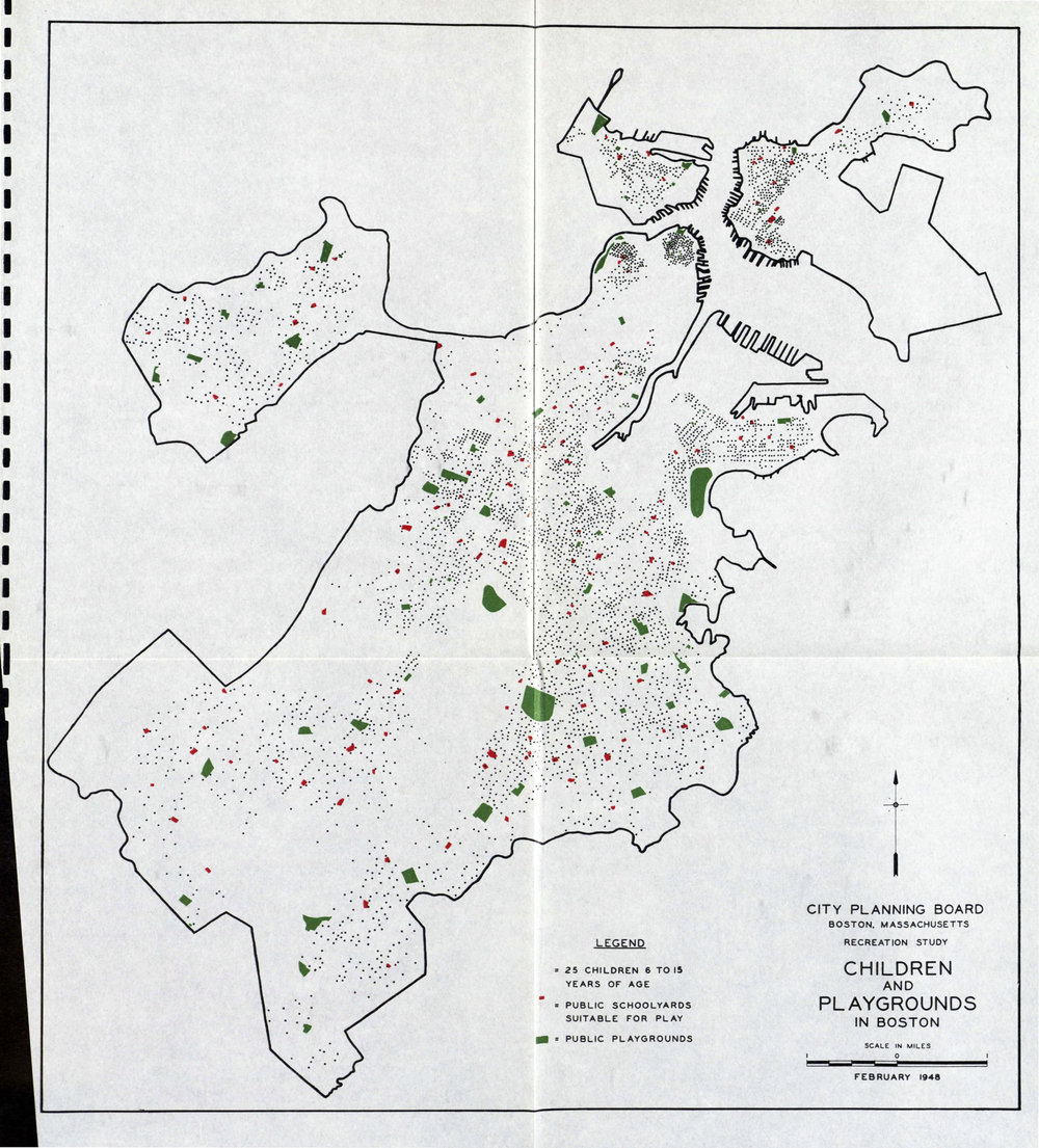
| Title | Children and Playgrounds in Boston, from Children's Playgrounds in Boston |
| Creator | Boston (Mass.). City Planning Board |
| Year | 1948 |
| Location | Northeastern University Library Special Collections |
This map is taken from a report created by Boston city planners. The report includes information about existing conditions and recommendations for the future. The map uses symbols, dots, and colors to show locations and amounts. These are aspects of a map’s symbology, or the way a cartographer creates a map-based picture of the information.
Look closely at the map’s title and legend.
What group of people is being explored on this map? What do the symbols and colors show us? What do you think is in the areas with no markings?
When was this map made? In what way might the map have been useful when it was made? What might its purpose have been? In what ways is the information on the map useful for us today?
All map makers have to decide what to show and what to leave out. For example, this mapmaker decided to include a scale that helps us measure distances and a compass to help us figure out directions, but it doesn’t have any labels written on the map to help us locate streets or neighborhoods.
What else doesn’t this map tell us? How might it not tell the whole story about kids in Boston?