Protest and Dissent
Most of the maps in this section were created by people and institutions with considerable power, like governments, military agents, big corporations, and high-circulation publications. Yet maps don't exclusively show the perspectives of those in dominant positions. They can also be potent persuasive instruments in service of protest and dissent, and can take a critical stance towards power and authority.
American Geographical Society Library, University of Wisconsin-Milwaukee Libraries
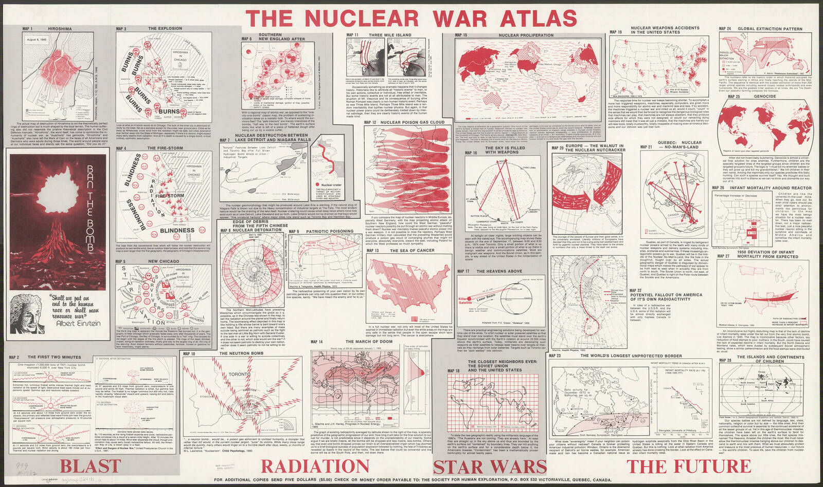
By the middle of the twentieth century, the world's superpowers had equipped themselves with enough nuclear weapons to annihilate humanity several times over. This set of maps was produced by the radical cartographer William Bunge to show just how destructive and horrifying a nuclear war would be. Using simple lines and symbols, Bunge demonstrated the effect of fallout and explosive fire on top of cities like Chicago and Toronto. He also used clever techniques to emphasize how traditional national borders no longer made sense in the atomic age.
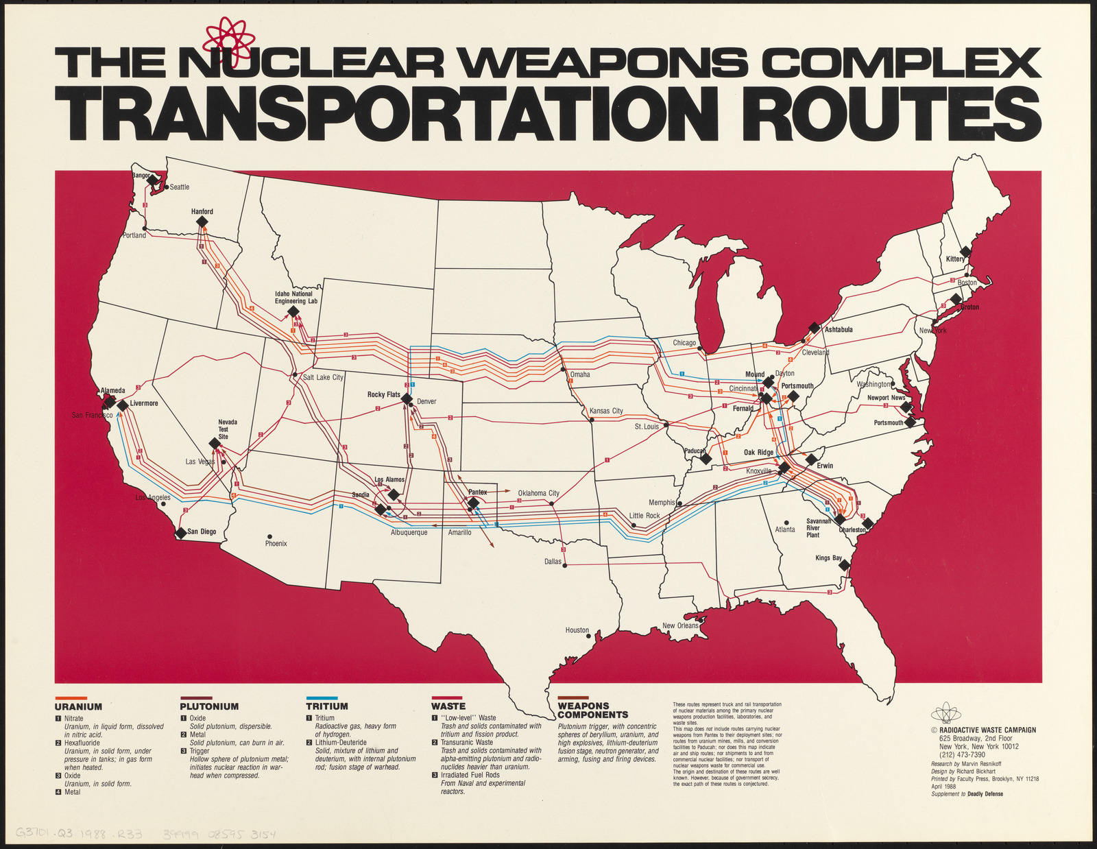
The Radioactive Waste Campaign had a similar goal to Bunge: to sound the alarm about the ever-present danger of nuclear weapons. This 1988 map, issued as part of a book on radioactive landfills, traces the routes by which nuclear materials were transported around the country. The generous extra spacing between the parallel lines borrows the visual technique of a flow map and gives the impression that vast swathes of the country are in the path of nuclear weaponry components.
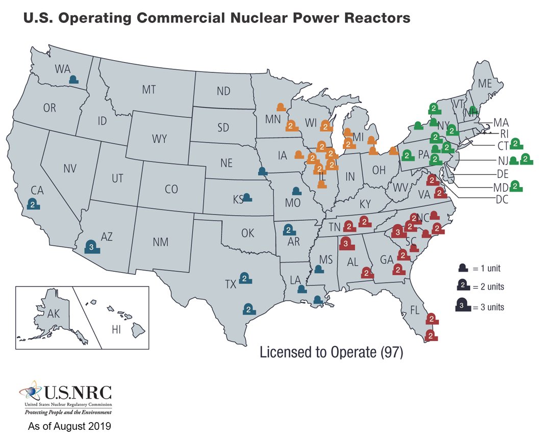
Compare these maps to the map below, produced by the government agency that regulates nuclear energy. Both take similar graphical approaches, but one is meant to raise alarm, while the other is meant to project cool, bureaucratic calm.