Ideological Battles
Some maps are born into a political movement, and they make an obvious, explicit argument about what the mapmaker thinks the map should lead the viewer to believe. Like the propaganda maps of wartime governments, these maps were carefully crafted to convince their viewers of something. In these cartographic battles, however, the conflict isn't between nations and armies, but between competing ideologies.
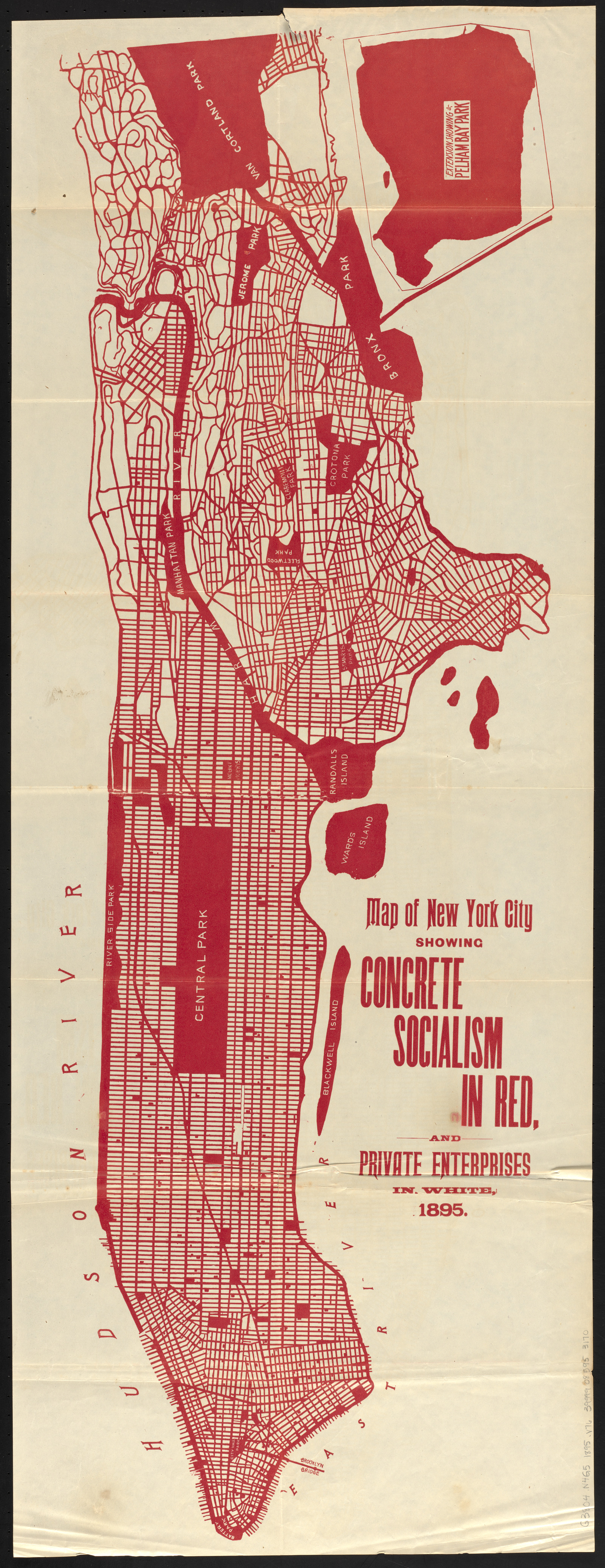
The striking single color on this 1895 map—red—gives a dramatic lesson in how much of New York City was already “socialist” by the end of the nineteenth century. By showing the “concrete socialism” of every street, park, school, public building, and public dock, the author of this map hoped that readers would draw the conclusion that it was time to paint the rest of the map red, as well. This map appeared in a book by the socialist activist Walter Vrooman, who was an advocate for public amenities like parks, playgrounds, and educational institutions. Private enterprises recede to the background, as the negative space around the extensive areas already owned and operated for the public benefit.
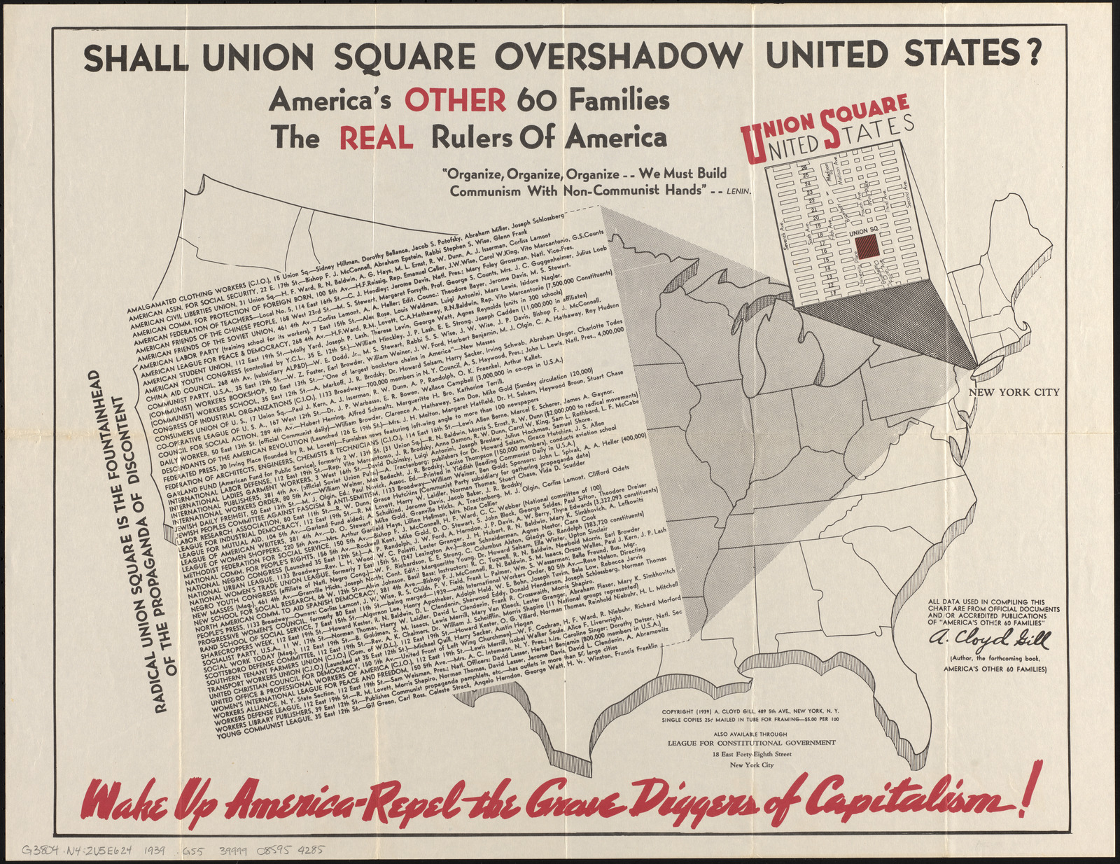
Half a century later, this right-wing broadside took a very different attitude towards socialism and New York. By blowing up Union Square in a looming pillar shadowing over the United States, the League for Constitutional Government urged Americans to “repel the grave diggers of capitalism,” in a subtitle written as if in blood. Published at a time when the New Deal was reshaping American politics and the Soviet Union was growing in influence, this map expressed a paranoia that labor unions, left-wing political clubs, and social reform organizations were plotting with foreign agents.