Inciting War
Sometimes maps help us to discover and learn things about people and places outside of our own community, region, and nation. At other times, though, maps are used to whip up fear and anger towards distant outsiders, and, in the most extreme cases, fan the flames of a smoldering case for war. These maps all appeared in the early days of international conflicts, and their goal in each case was to sound the alarm about a perceived danger.
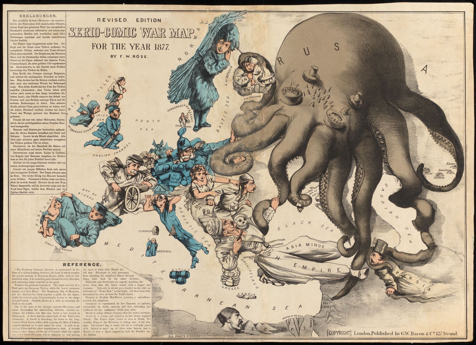
The visual motif of an octopus is one of the most recognizable examples of cartographic illustration used to exaggerate a threat. The tentacles of expansion have been used to portray real and imagined threats ranging from the sprawl of industrial cities to anti-Semitic delusions of Jewish world control. Here, in this map published at the beginning of the Russo-Turkish War, the octopus is Russia, shown reaching into Europe and Asia Minor, while the bellicose nations of Germany, France, and Britain ready their military powers.
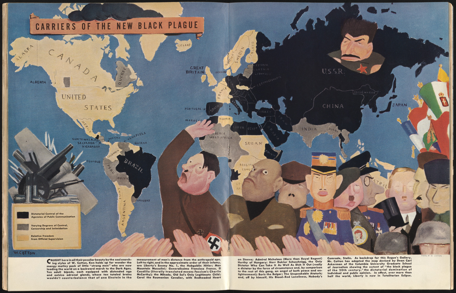
A different kind of threat appeared on this illustrated map in a 1938 issue of the magazine Ken. With totalitarian governments sweeping up global power while the United States maintained its neutrality, this cartoon of the “new Black Plague” sought to raise the alarm about “the mangy motley pack of little ‘strong men’ who are now leading the world on a backward march.” Black and gray territories mark out the parts of the world where dictatorial authority was taking root.
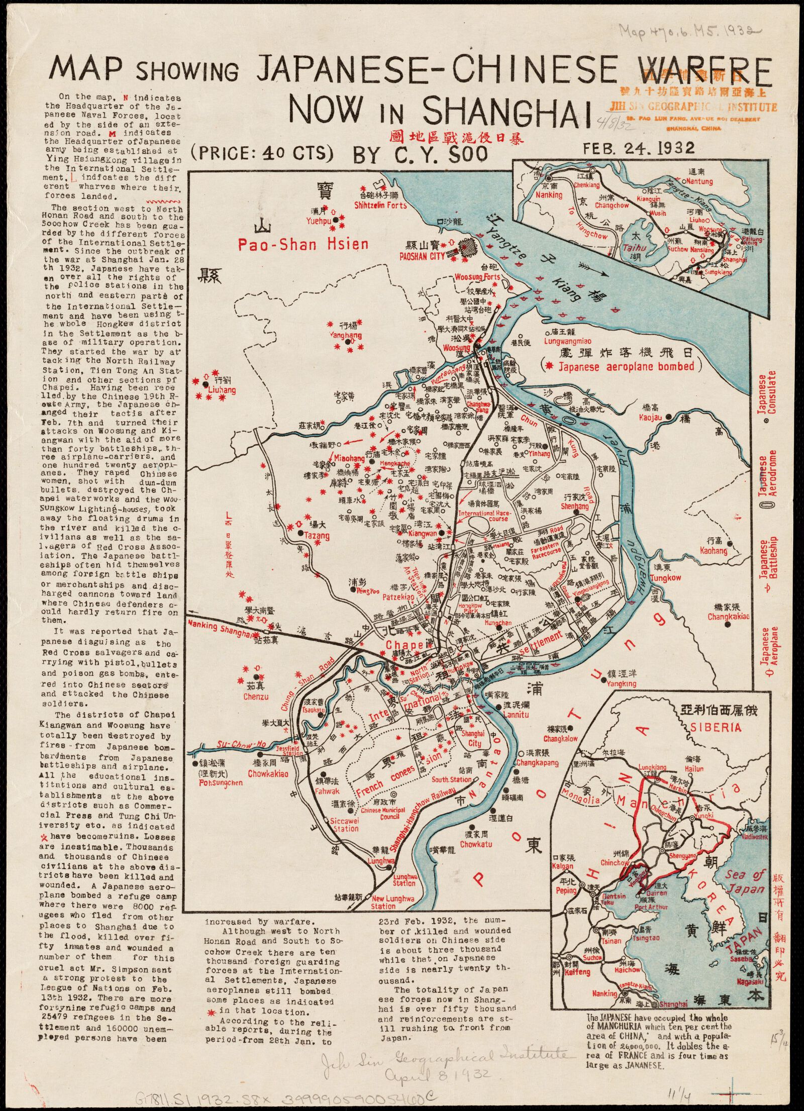
For the residents of Shanghai during the time of the Japanese siege in 1932, war was already a reality. This hand-printed map was a desperate attempt to convince outsiders to take up the embattled city's cause, and it was sent to correspondents in places like Boston with the hopes of arousing international aid—which is probably how it ended up in the library's map collections. By dramatizing the perilous situation of the Shanghai battle lines, the map serves as a visual exclamation mark to the narrative description of war atrocities.