Borders, Nations, and Territory
Before borders exist in reality, with passport inspection stations, customs houses, or perhaps fences and walls, they exist on maps. The ability to draw political lines and insist on their recognition and acceptance is the basis for the concept of sovereignty: the map shows where one jurisdiction begins and another one ends. This means that maps of borders—especially the ones separating nations from one another—have the potential to ignite wars or wipe entire political units out of existence. These fateful cartographic lines have been the source of endless disputes and confrontations through human history, because they cement the relationship between territory and power.
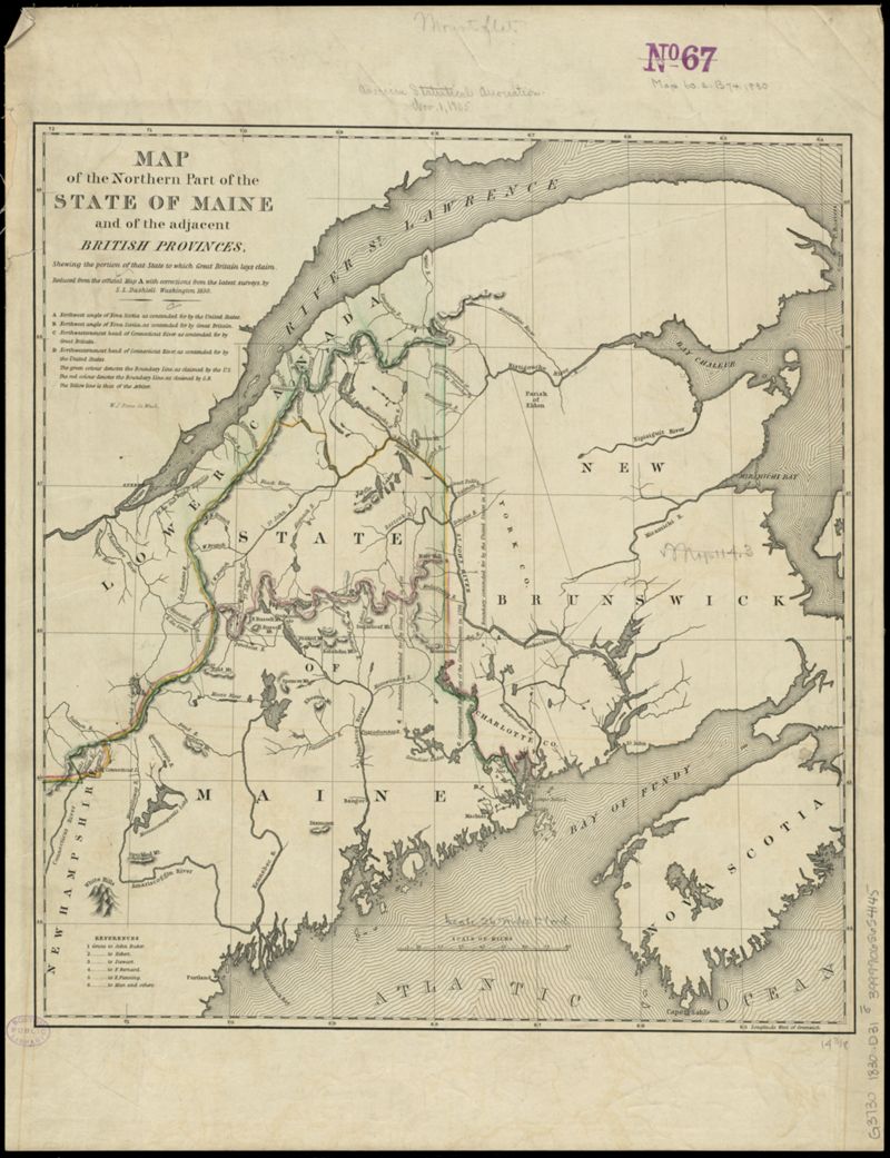
In 1838, the United States and the United Kingdom nearly went to war over the boundary line between the Maine and the British colonies of Lower Canada (Québec) and New Brunswick. The treaties which had ended the American Revolution and the War of 1812 weren't precise about where to draw the northern border, leaving local governments and settlers skirmishing about who lived on which side of the line. This 1839 map, which was part of the U.S. Senate's negotiating dossier, shows the British contention for the border in red, the American-claimed border in green, and the arbitrated line in yellow, which ultimately became the basis for the Webster-Ashburton Treaty in 1842. Though the “Aroostook War” never saw any bloodshed, both sides drew upon competing sources of cartographic evidence to promote their claims on the territory. Even today, the United States and Canada disagree on the status of a tiny island in the Bay of Fundy, with both sides insisting that the rocky outcropping belongs on their side of the international line.
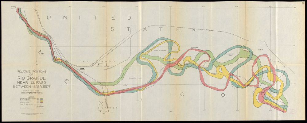
On the southern border, the Rio Grande seems like it ought to be a fairly easy geographic feature for determining where the U.S. and Mexico meet. But rivers move, and this 1911 map of the meandering Rio Grande shows how the river shifted its course between El Paso and Ciudad Juárez in the decades following the Treaty of Guadalupe, which had established the river as the border. The shifting river course left two sections of land—the “Chamizal Tract” and “Cordova Island”—which could possibly have been in both countries as once. Tensions over the claim to Chamizal ran so high that when the U.S. and Mexican presidents met at the border in 1909, they were both nearly assassinated. Two years after that incident, an international boundary commission created this map and a series of historical investigations about the river's changing lines in order to peacefully settle the dispute, but its recommendations were not ratified until 1964, after more than a century of acrimony.
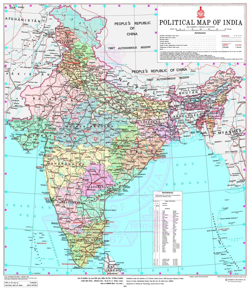
In 2016, the Indian Ministry of Home Affairs introduced a new bill in Parliament that would punish anyone distributing “wrong or false topographic information” with fines of up to 15 million USD or prison time of up to seven years. Though the bill didn't become law, it suggested just how seriously national governments treat their own versions of cartographic truth. In its official survey map of the country, the Indian government portrays the biggest version itself, including the fiercely disputed areas of Jammu and Kashmir in the northwest. It does so with a matter-of-fact solid line, which seemingly makes a straightforward claim that this really is the shape of India.
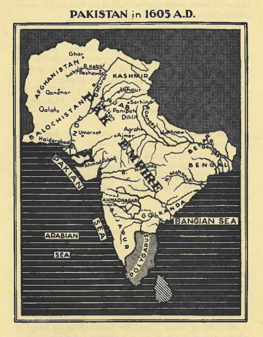
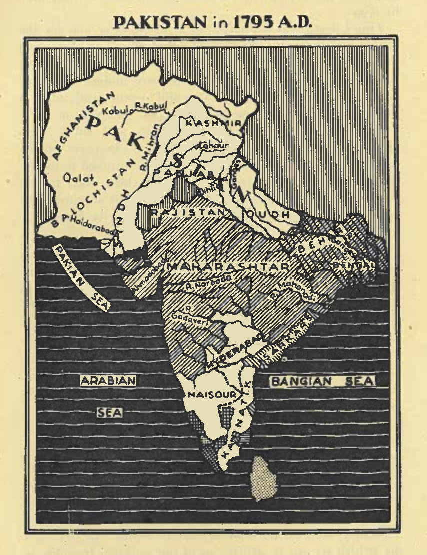
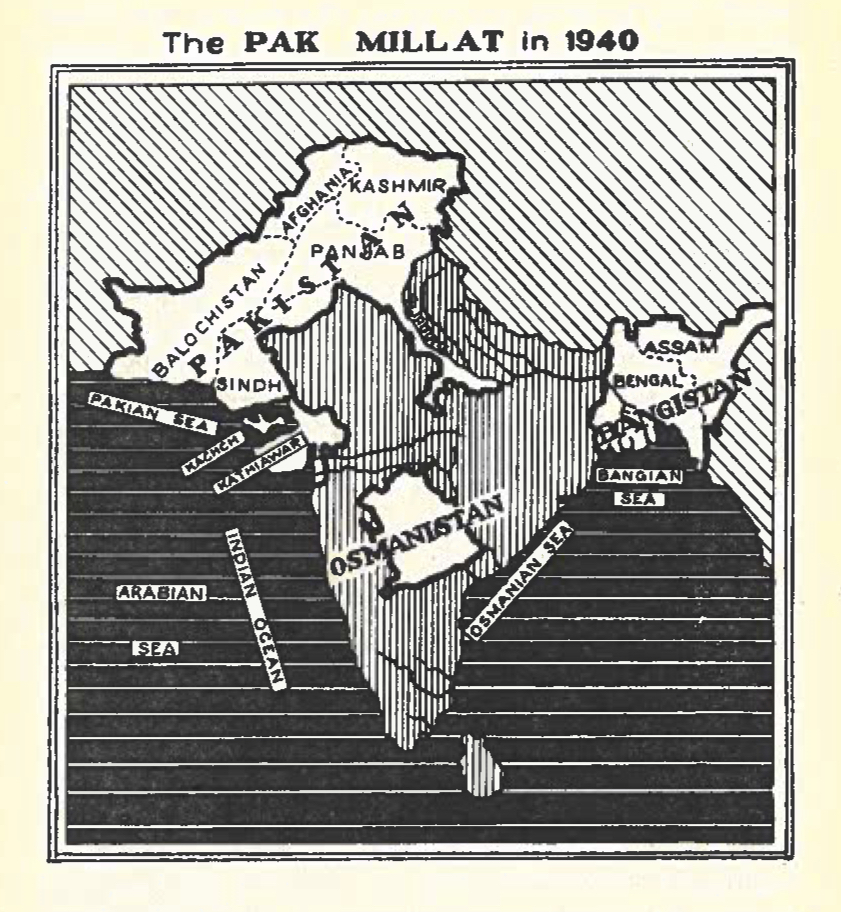
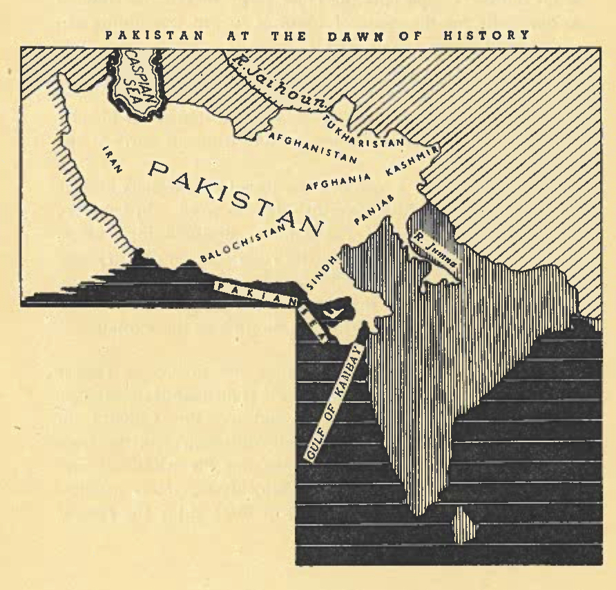
That border is so contentious because, in the legacy of colonial interventions and a diverse population consisting of many ethnicities, linguistic groups, and religious adherents, the question of who is on the side of what line is hardly easy to answer. These set of four maps appeared in a book printed by the Pakistani nationalist Choudhary Rahmat ‘Ali, who is credited with coining the name “Pakistan,” a portmanteau of several historic provinces stretching from Eastern Iran to the Indian Subcontinent. Although the name Pakistan was an invention of Ali's from the 1940s, he used maps like these to argue that the nation had a historic legitimacy, with borders that crested outward in the “Pak Empire” of the 17th century. In all of these maps, Kashmir is shown as integral part of historic Pakistan—a claim to which Pakistani nationalists still hold fast.

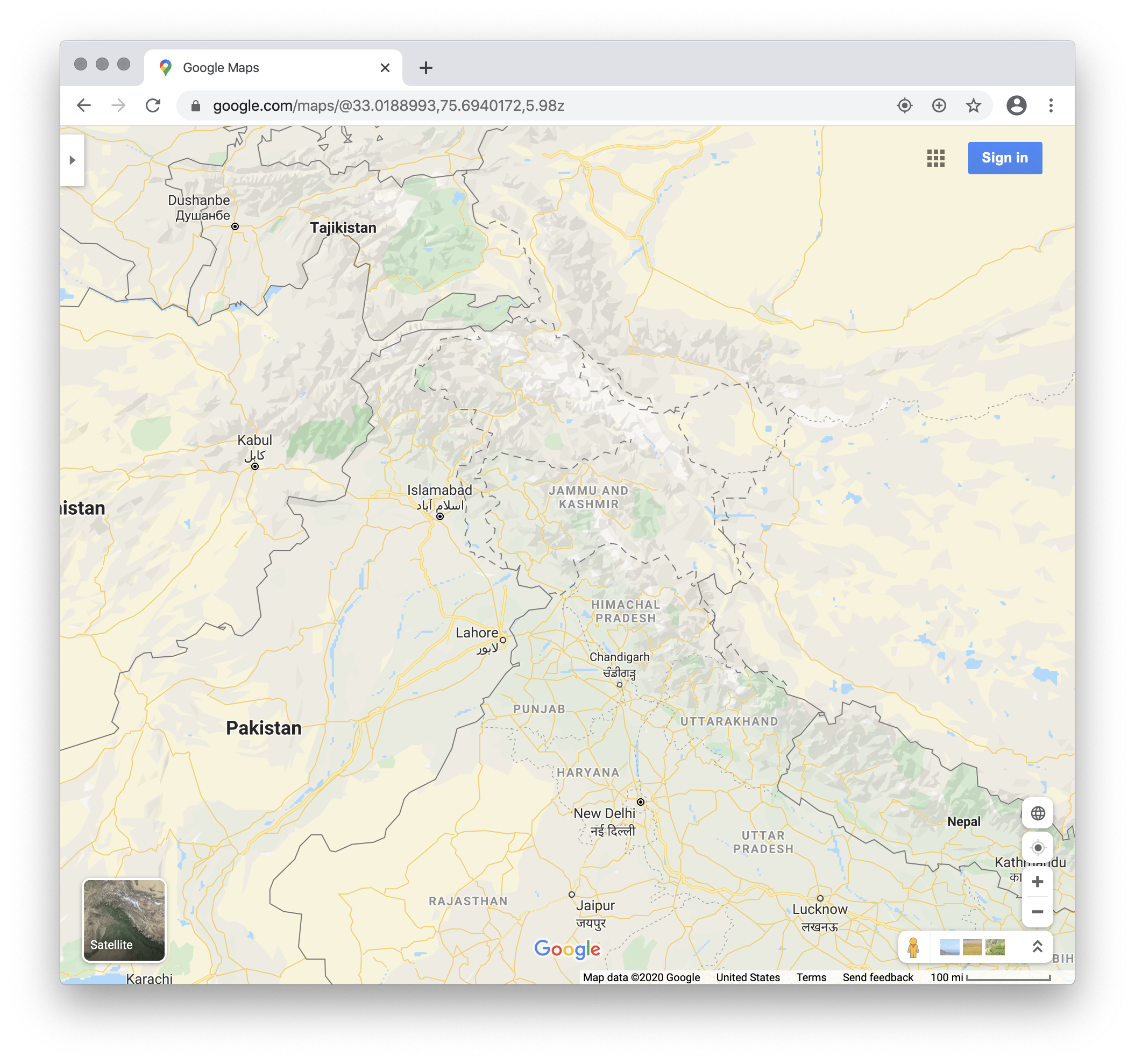
In an age of digital cartography, where a single map can be viewed all around the globe and on opposite sides of a competing border, there's a tricky conundrum when two countries have their own versions of the “correct” political geography—and threaten any dissenters with legal consequences. Google Maps, one of the most widely used digital mapping services, has split the difference. These two maps show the same area at the border of Pakistan, India, and China. On the left is what the map looks like when it's loaded from a computer in India: a solid line with all of the disputed area seemingly safely tucked inside of India's borders. But from outside of India, the area is shown as a welter of dotted, ambiguous lines, suggesting that the truth of the situation depends very much on where you are standing when you look.
In this section
words