Nationalism and Imperialism
Territory and nationhood are intimately linked to one another. Outline maps appear on national flags and in the political leaflets of independence campaigns. The cartography of imperial power can be used to whip up pride and patriotism, while nationalist arguments about sovereignty and ethnic community can be marshaled in support of movements that promote either splitting or unifying political geography.
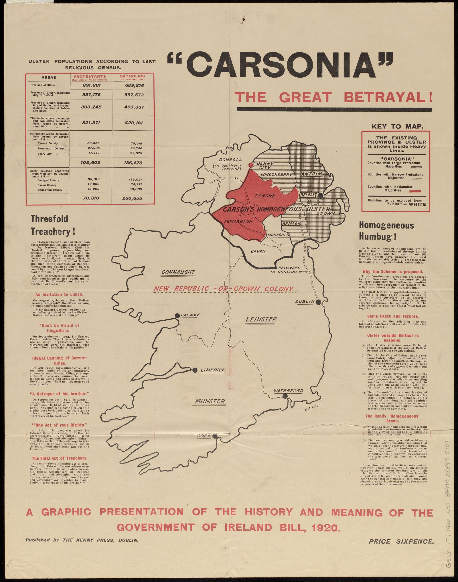
In this 1920 broadside, Irish nationalists scoffed at what they called a “homogeneous humbug”—a British proposal to partition the island into Protestant and Catholic sections. With dark red dramatizing the Catholic-majority areas that remained inside of Northern Ireland's proposed borders, and tables of statistics documenting the magnitude of the “threefold treachery,” this map registered a complaint that would echo through decades of bitter national struggles in Ireland.
P.J. Mode Collection, Cornell University
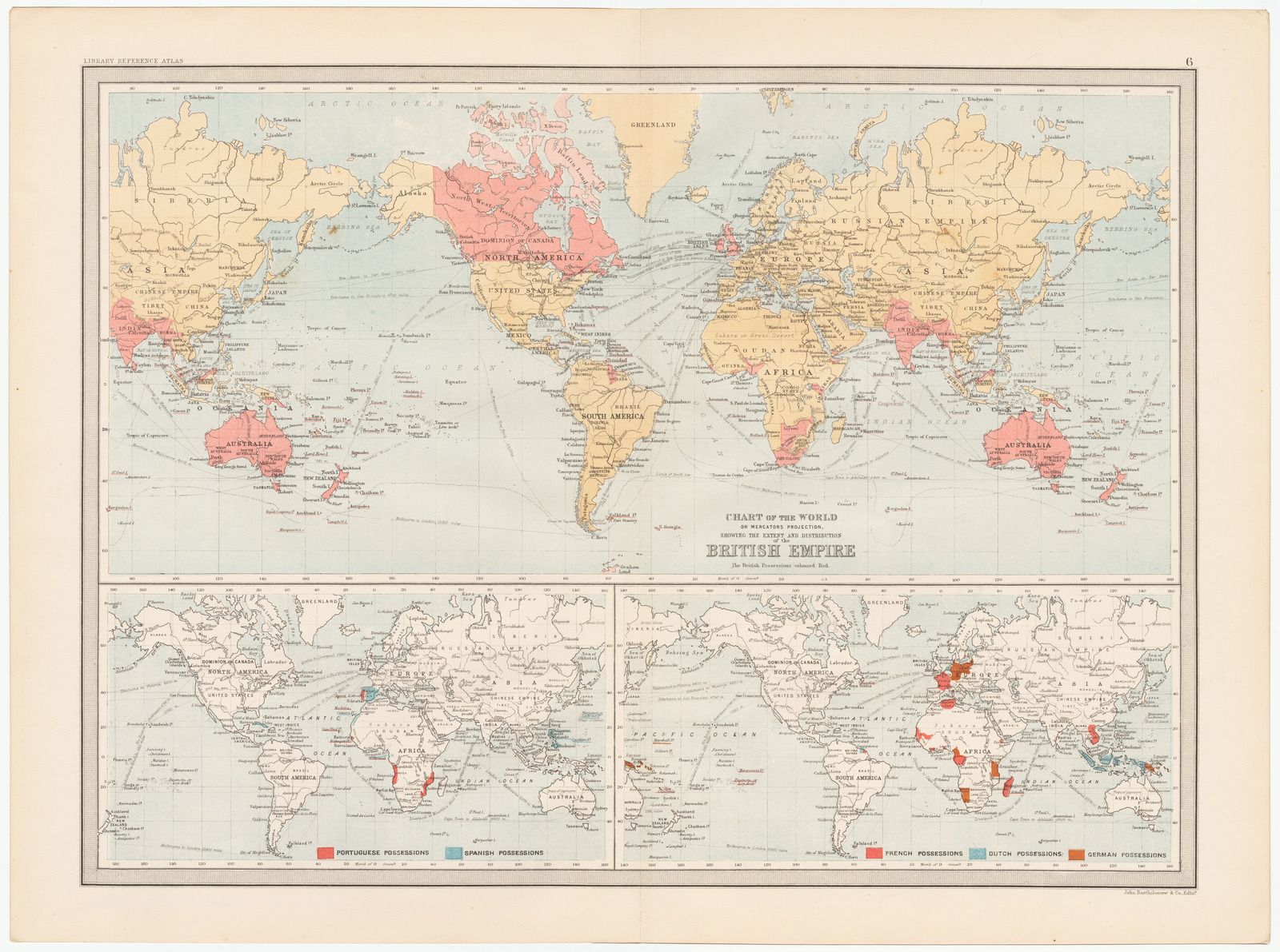
From the imperial perspective, however, the color red took on a different connotation. British schoolchildren were once taught to take pride in their country's imperial might by looking at world maps splashed in red ink, showing the territorial possessions of a global power on which “the sun never set.” On a map like this one, the sun would have had a difficult time setting indeed, since the projection wraps around the globe more than once. With two Indias, Australias, and New Zealands, the British Empire seems even more dramatically world-spanning.
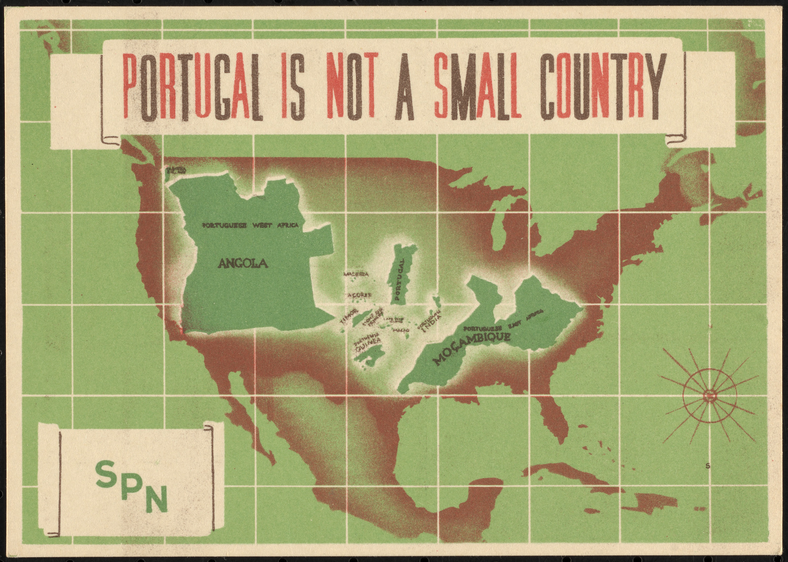
Another way of showing power and importance is to compare the territory of one country to another. This postcard of Portugal, produced by the Ministry of National Propaganda during the country's authoritarian regime, insists that the little European country, augmented by its imperial holdings and some artful cartographic liberties, could size up to the United States.
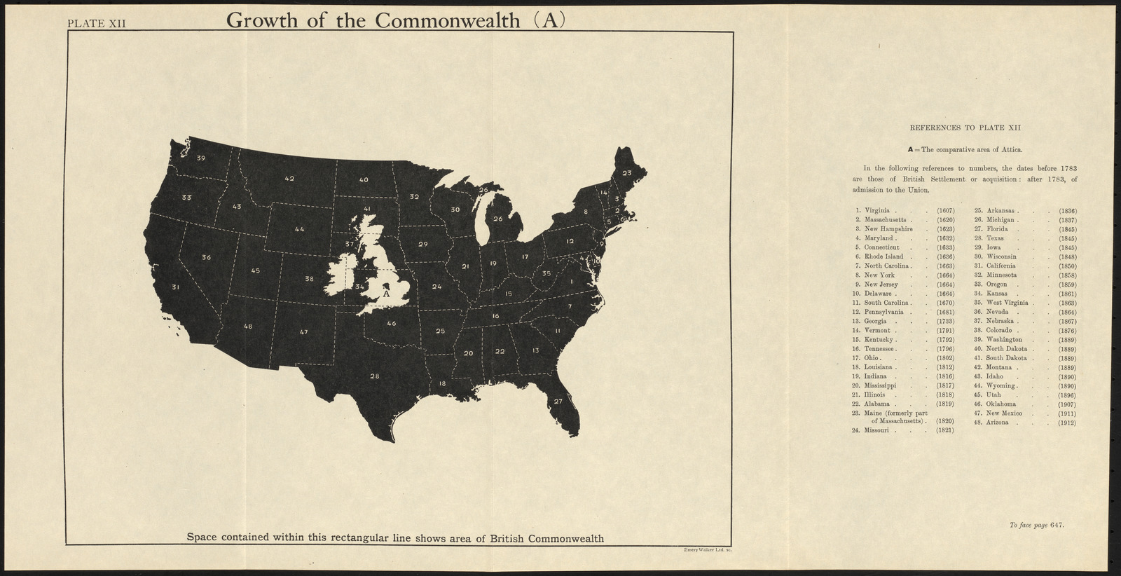
These kinds of superimposed overlays are a common visual technique for comparing nations, as in this map comparing the British Isles to the United States. Try out an interactive tool that lets you compare the sizes of many different countries to one another by dragging them around a digital map.