Selective inattention
| Title | Guide map for the Tourist - Republic of South Africa |
| Creator | South African Touist Corporation |
| Year | 1978 |
| Dimensions | 21 × 29 cm |
| Location | Leventhal Map & Education Center at the Boston Public Library |
As a map zooms farther and farther out, it has to leave out information about certain things. This process of simplification, called generalization in cartography, is a basic part of what makes a map useful as a communicative instrument. After all, if a map contained every piece of information about the world, it wouldn't be a map any more—it would just be the world itself.
Typically, cartographers try to follow rules about what to include and what to exclude. For instance, a map for car drivers will probably include highway exits, but not underground water mains. One of these rules of thumb is that cities with a larger population are treated as more “important” and will crowd out smaller cities when physical space is at a premium. For instance, try slowly zooming out on one of your computer or phone mapping apps from Boston. When you're zoomed in close, you'll see every municipality, and maybe even the names of neighborhoods. As you zoom out, you'll see only Massachusetts's large cities, and eventually only Boston. If you zoom far enough out, Boston itself will probably get crowded out by New York City.
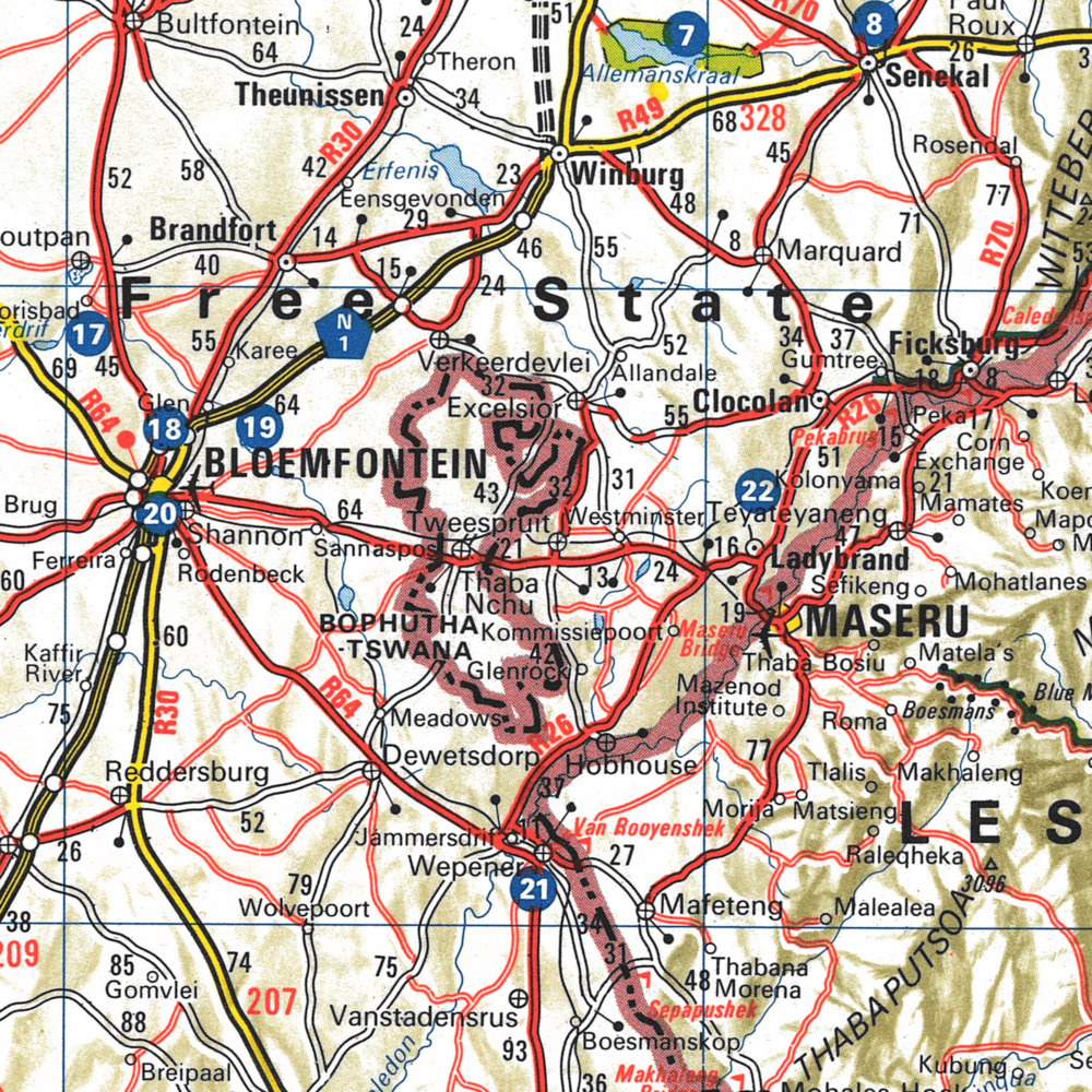
Even when there are rules to follow, though, it's possible, and even likely, that a cartographer will have to make judgment calls—and those judgment calls can easily reflect an underlying assumption about what is and is not important to map. This 1978 tourist guide to South Africa shows just how profoundly the nation's official apartheid policy affected even what could be seen on maps. () In this map, you can see an area outlined in black dots labeled Bophuthatswana, just east of the city of Bloemfontein. In 1977, the apartheid government had essentially declared several majority-Black areas of the country to be separate nations unto themselves. This section of Bophuthatswana was the site of a large Black population, which would eventually be recognized as the township of Botshabelo.
On this map, however, the area has been generalized out—even though the Botshabelo township had a larger total population than neighboring Bloemfontein. What Bloemfontein had was far more white South Africans, and the imprimatur of a European-style city, with infrastructure and urban institutions. Thus, Bloemfontein made it onto the map and Botshabelo did not—a generalization which reflected white supremacy, not cartographic rules.
Bibliography
- Kelso 1999
- Clare Kelso, “Ideology Of Mapping In Apartheid South Africa,” South African Geographical Journal 81 (1999): 15-21. doi:10.1080/03736245.1999.9713657