Twisted districts
| Title | The Shape of American Democracy |
| Creator | Alasdair Rae |
| Year | 2018 |
| Location | Alasdair Rae |
It's very difficult to pinpoint exactly what we mean by a “gerrymandered” district. Is it simply one that has a titled partisan skew? But there are many places where there are simply more voters from one party than another—so that doesn't necessarily mean that a district has been gerrymandered. Anti-gerrymandering activists have struggled in the court system to find a statistical test which conclusively shows that a district has been drawn in a manner that infringes on voters rights.
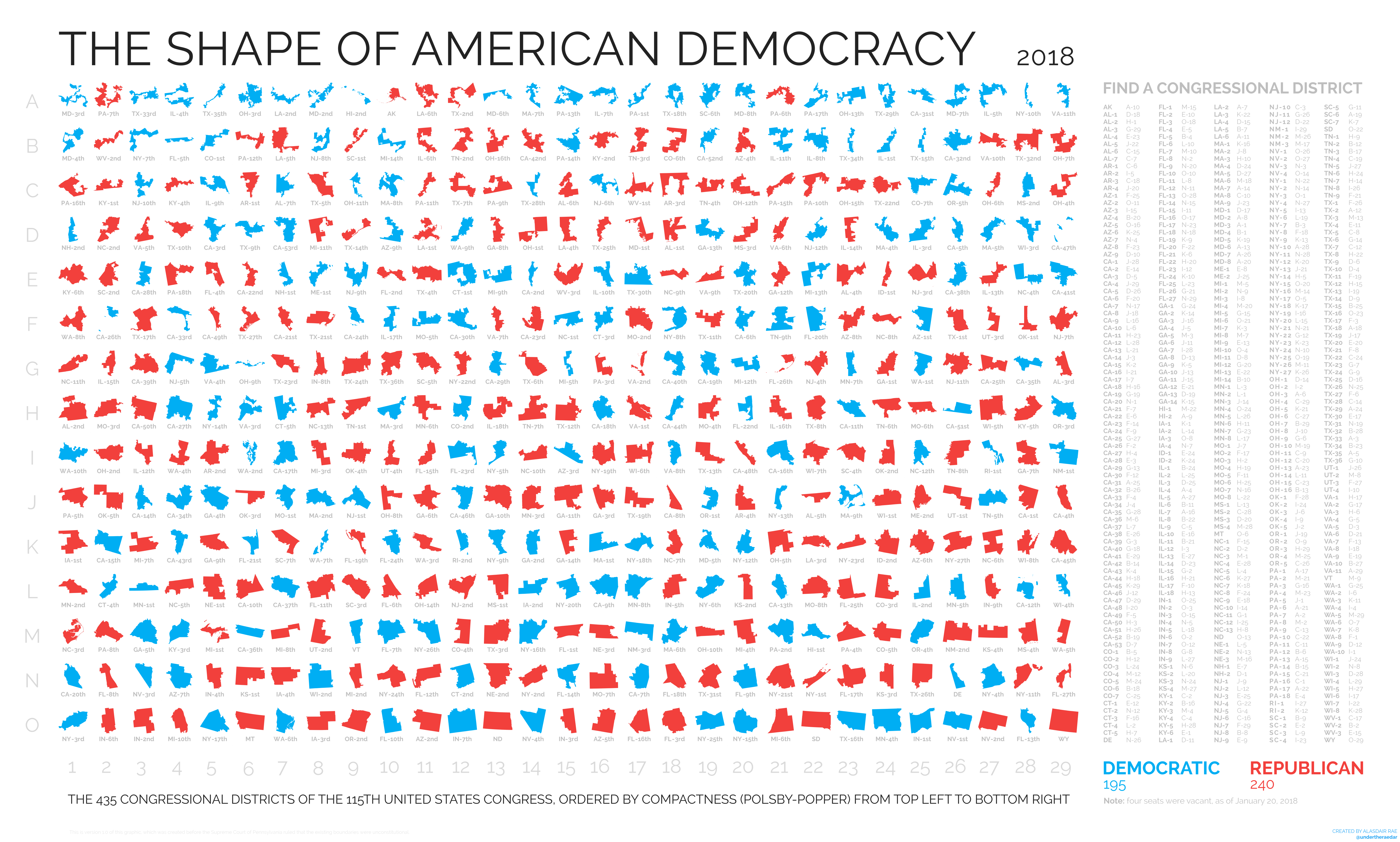
One way of trying to identify malformed districts is by looking at their actual shape, rather than the number of Republican and Democrats inside of them. A relatively simple measurement is called the Polsby-Popper score, which compares the perimeter of a district to its area to see how “compact” it is. The most compact possible district would be a perfect circle, while more intricately designed districts, with many twists and turns, score more poorly when dividing perimeter by area.
This cartographic chart shows the 435 Congressional districts of the United States ranked by their Polsby-Popper score, with the lowest-scoring district, Maryland's 3rd district, in the top left, and the best-scoring district, Wyoming's 29th district, in the lower right. Red and blue colors show the party holding control of each seat as of 2018.
Ranking districts in this way should raise questions about how effective the Polsby-Popper score is as a measure of gerrymandering. Hawaii's 2nd district and Alaska's at-large district rank amongst the worst, simply because they follow the complicated coastline borders of those two states. Meanwhile, Wyoming's at-large district earns the best score even though it is impossible to gerrymander: it's just the single district in this quadrilateral-shaped state.