Countering the names of the Confederacy
| Title | A Nation Divided, from Whose Heritage? Public Symbols of the Confederacy |
| Creator | Southern Poverty Law Center |
| Year | 2016 |
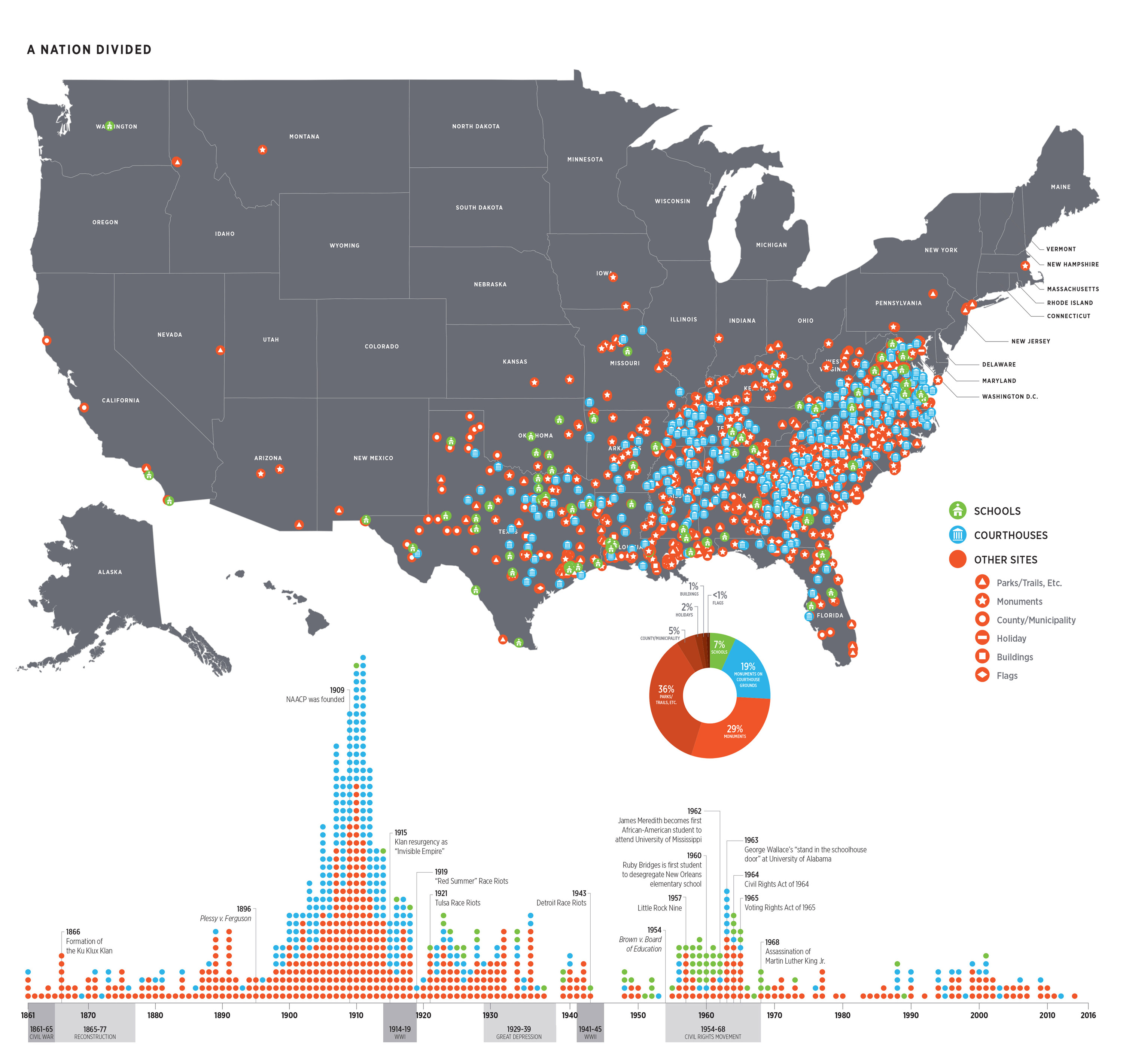
The Southern Poverty Law Center created this map as part of a 2016 report documenting the prevalence of Confederate names in the American landscape, especially in the South. Excluding cemeteries, museums, battlefields and other sites of a specifically historical nature, the SPLC counted 1,503 symbols of the Confederacy in public spaces, shown here on this map. The timeline shows when these names were created, with the vast majority falling during the period from 1890–1920, the height of the Jim Crow repression of black civil rights.
As the SPLC writes of the campaign to document and remove these names from public places, and thereby take them off the map:
The effort to remove [Confederate names] is about more than symbolism. It’s about starting a conversation about the values and beliefs shared by a community.
It’s about understanding our history as a nation.
And it’s about acknowledging the injustices of the past as we address those of today.
The Whose Heritage? project also highlights the power of digital data put in the hands of ordinary people. The SPLC has made the results of their survey available as a public data set for citizens to use in their own mapping projects.