Next-generation georeferencing
Allmaps is a next-generation software ecosystem that makes it easier and more fun to create, curate, and share goereferenced maps. Using the International Image Operability Framework (IIIF), Allmaps can warp and display scanned maps entirely in a web browser, without the need to download desktop GIS software like ArcGIS or QGIS.
In collaboration with the Allmaps development team and the American Geographical Society Library (AGSL) at the University of Wisconsin-Milwaukee, the Leventhal Center leads an ongoing project focused on helping other map-holding institutions improve accessibility to their digital collections. Our focus areas include:
- Internal feature development within the Allmaps software ecosystem, including building new tools that will allow Allmaps users to manage crowdsourced georeferencing workflows at scale.
- External feature development beyond the Allmaps software ecosystem, including the creation of plugins for major content management systems like GeoBlacklight and CONTENTdm that will allow collections managers to easily include Allmaps in their digital discovery portals.
- Social infrastructure development that will support the maintenance and further development of Allmaps—and other tools like it that land at the intersection of geography and digital humanities—in perpetuity.
This work is supported by a Digital Humanities Advancement Grant from the National Endowment for the Humanities (Award HAA-293491-23). Please reach out to Ian Spangler—or complete the form below—if you want to learn more about Allmaps or get involved in the project.
Get involved with the Allmaps Project!
Allmaps applications
| Go to application | Description |
|---|---|
 |
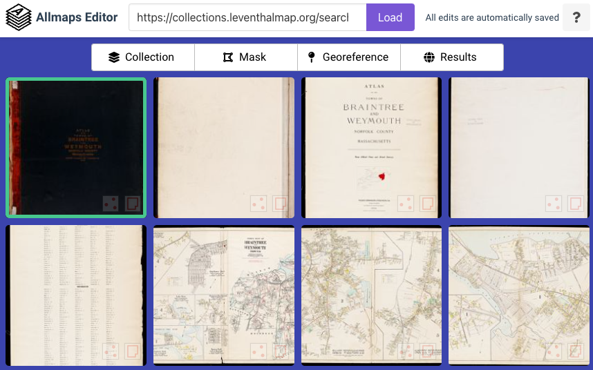
Allmaps Editor. Georeference any IIIF-compliant map, entirely in a web browser. Open Allmaps Editor directly from any object in LMEC collections. You can also load a map via its IIIF manifest from any IIIF-compliant digital map collection. |
 |
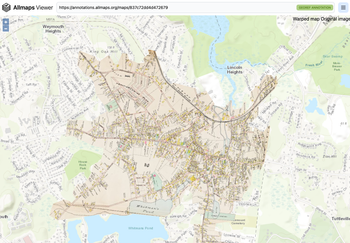
Allmaps Viewer. View any map that was georeferenced using Allmaps overlaid on a modern web map. Load the map by pasting its IIIF manifest or georeference annotation. Toggle transparency and even remove certain colors from the overlay map to compare how places have changed over time. |
 |
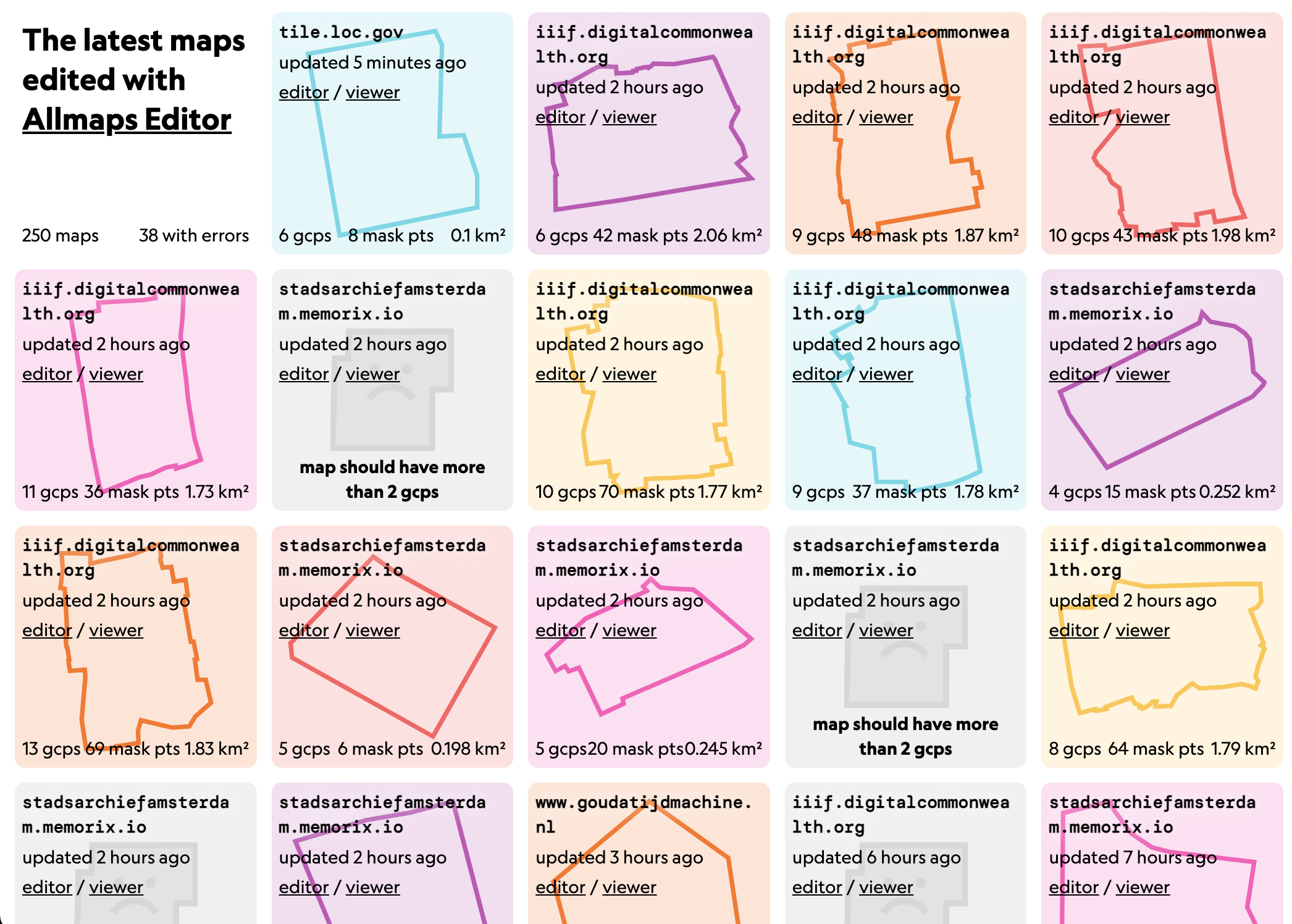
Allmaps Latest. View a live feed of the latest maps georeferenced using Allmaps. Improve maps that need better masks or more control points. See which collections are georeferencing the most maps. |
Allmaps Research Fellowships
Are you a researcher, scholar, cartographer, or essayist with interests at the intersection of digital humanities and public geography? Would your work benefit from creative visualization of georeferenced maps? Do you have an idea for a project or publication? If so, consider inquiring about our Allmaps Research Fellowships.
LMEC and AGSL are actively seeking applicants to our Allmaps Research Fellowship program. We’re looking for compelling stories that not only bridge the divide between academic scholarship and public education, but use georeferenced maps to bring those stories to life.
The Fellowship consists of a $1,200 honorarium to support research and development time. LMEC and AGSL staff will also provide research and technical support through all stages of the digital publication process. Any topic is eligible for an Allmaps Research Fellowship, provided that the proposed project uses Allmaps, but you must have a U.S. bank account in order to receive the stipend. If you don’t have a U.S. bank account but are interested in applying, please contact us.
Fellows are expected to create a digital publication. Digital publications produced through the Allmaps Research Fellowship program will be published and hosted by LMEC on one or more of its digital portals, though projects will be licensed on a Creative Commons license and further publication, in digital or print formats, is not precluded by receipt of an award. Projects may be conducted remotely, and award recipients are not required to plan any in-person project time in Boston.
We hope to see applicants engage with Allmaps in a variety of ways, from indivdiual researchers to big research teams (though the fellowship honorarium remains the same, regardless of the number of authors involved). By way of example, we’d be excited to see proposals on the following topics:
- Reflections and outcomes from georeferencing with Allmaps in a educational or community contexts
- Interpretive textual essays of 1,200-2,000 words using Allmaps as a research and visualization method
- Digital cartographic projects that use one of Allmaps plugins for web mapping libraries
- Experiments with automatic georeferencing of standardized atlases or “machines reading maps” using the Allmaps software ecosystem
- And much more… this is by no means an exhaustive list of the possibilities!
Please contact Ian Spangler and Marcy Bidney if you have any questions.