We regularly mount exhibitions in our gallery, located in the historic McKim Building the Boston Public Library in Copley Square. Exhibitions topics range from collections-centered shows on Boston bird's eye views and women mapmakers to theme-centered shows on the American Revolution, Boston immigration, and public landscapes. All of our exhibitions feature scholarly research as well as activities for families, children, and educators.
Current Exhibition
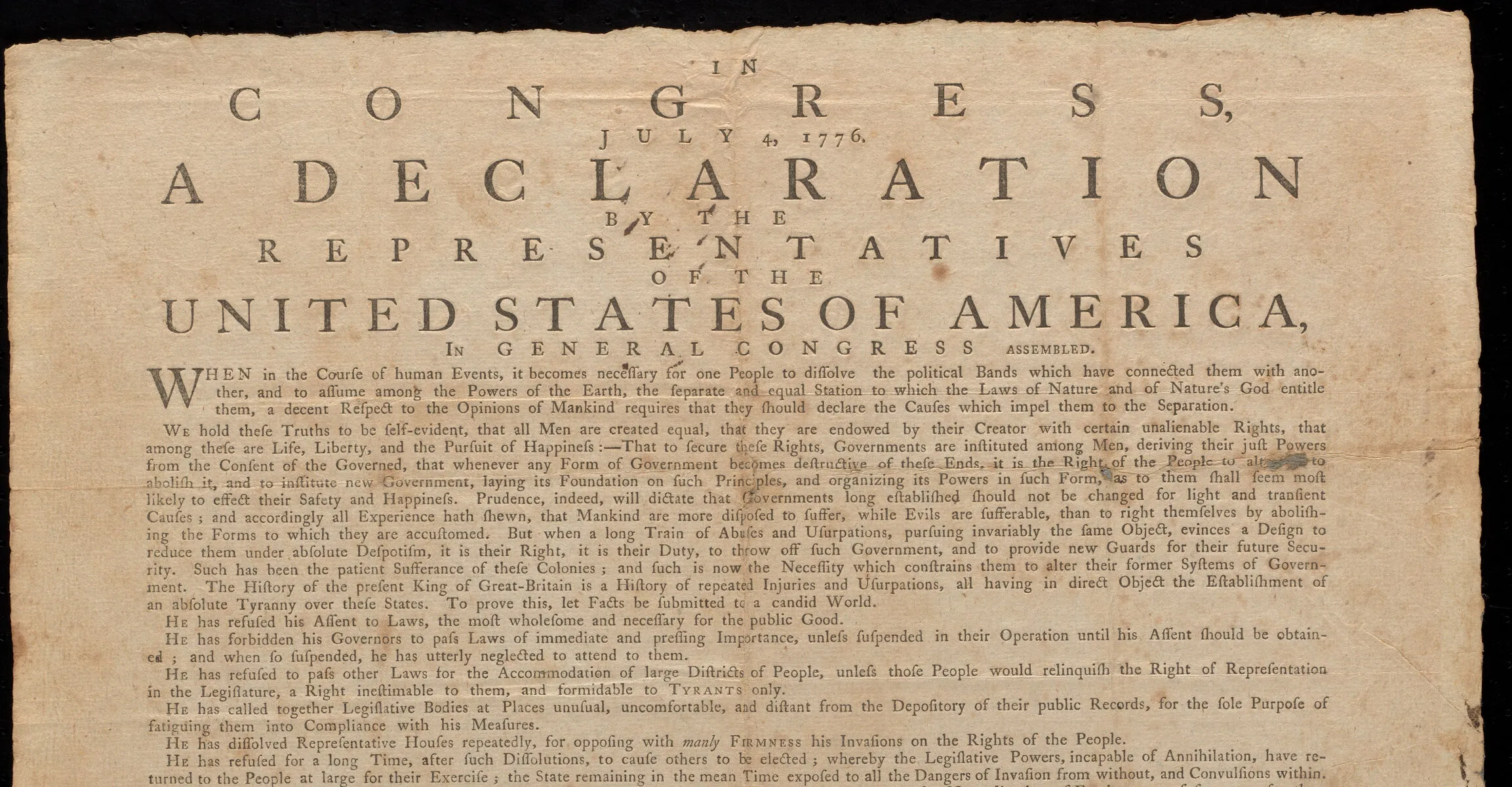
Declarations: Printing a New Nation
April 11, 2026 – September 13, 2026
On July 4, 1776, the Continental Congress ratified the Declaration of Independence in Philadelphia, Pennsylvania. The next day, the first printed copies were sent off and began to circulate through the thirteen colonies, which were now, on paper, independent states.
Throughout July and August of 1776, the Declaration was reprinted in major American cities and small towns alike. Some of these new printings appeared in newspapers. Others were issued as large, single-sheet publications known as broadsides. Many versions, in both formats, were printed before the delegates to the Continental Congress began to sign the official handwritten Declaration in early August.
These early printings of the Declaration were created at a time when the independence of the future United States was anything but certain. From the perspective of those who read it in the summer of 1776, we can see the Declaration of Independence in its original form: not yet a famous founding document, but breaking news.
For more information about the exhibition, see the BPL press release.
Curated by Jay Moschella and Garrett Dash Nelson
Permanent Exhibition
Becoming Boston: Eight Moments in the Geography of a Changing City
Maps trace out the complicated history of places, and we can use them to document geography in much the same way that we can use diaries and letters to document biography. In the eight cases of this exhibition, we follow the changing spatial forms of the place we now call Boston—from before the landscape carried that name all the way through the struggles, clashes, and dreams that continue to reshape the city today. These maps don’t merely depict facts about how the city looked at different moments in its history. Instead, they invite us to contemplate how geographic forces, both natural and human, have constructed the physical and social world around us, through large and small transformations that have transpired over many centuries.
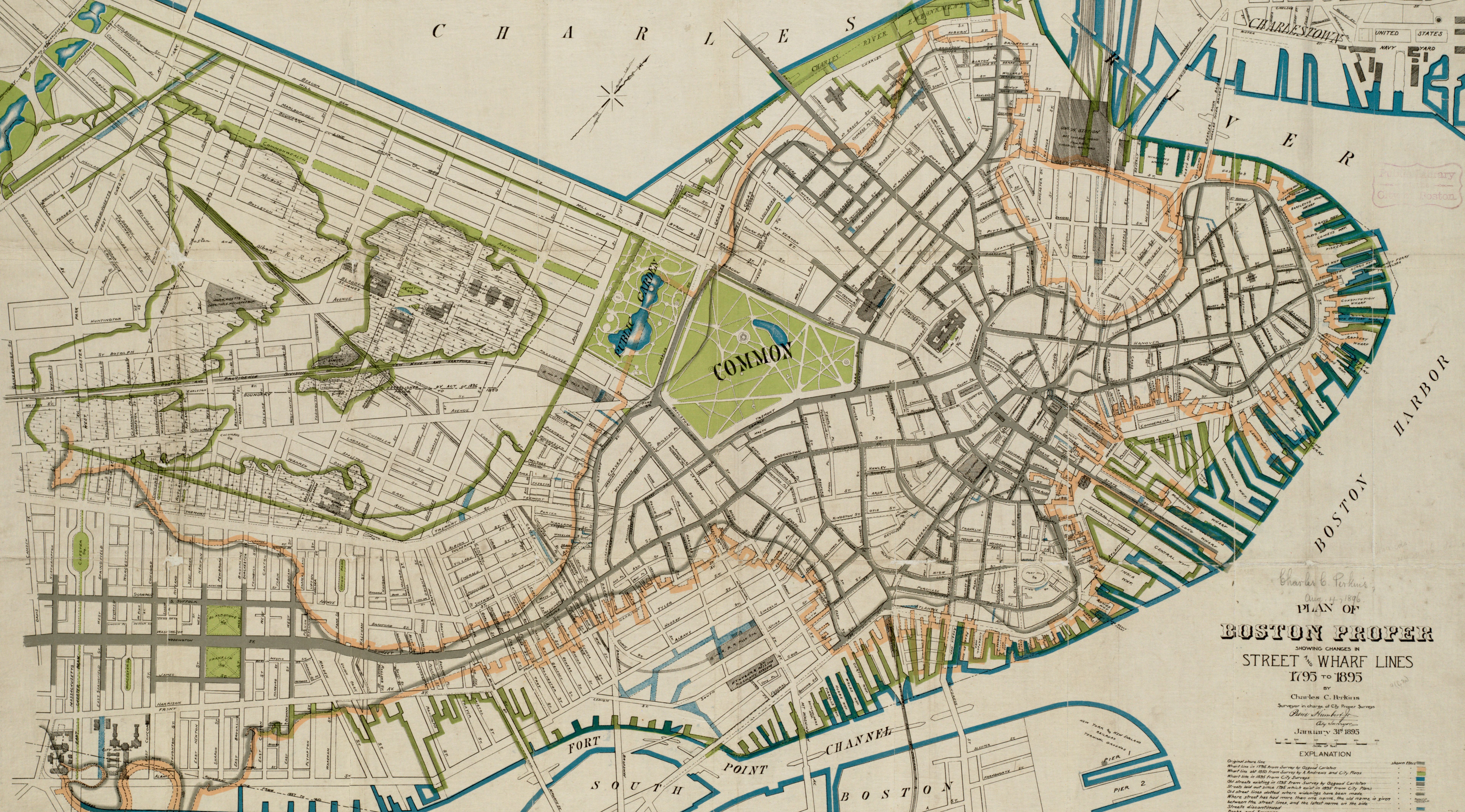
As one of the most important centers of a newly independent nation, Boston spent the first half of the nineteenth century reimagining its urban form and building neighborhoods from scratch, as seen in this 1895 map.