“Do you have any pirate maps here?”
This is a commonly asked question by young visitors to the Leventhal Map & Education Center (as well as more than a few adults). The idea of the so-called pirate map is one born out of the fiction of Robert Louis Stevenson’s Treasure Island and conjures up images of “X marks the spot” and chests of gold hidden in caves. While our answer to this question is mostly no, it’s also a little bit yes if you consider the story of cartographer Captain Cyprian Southack and his mandate to recover the wreck of the pirate ship Whydah in 1717 off Cape Cod.
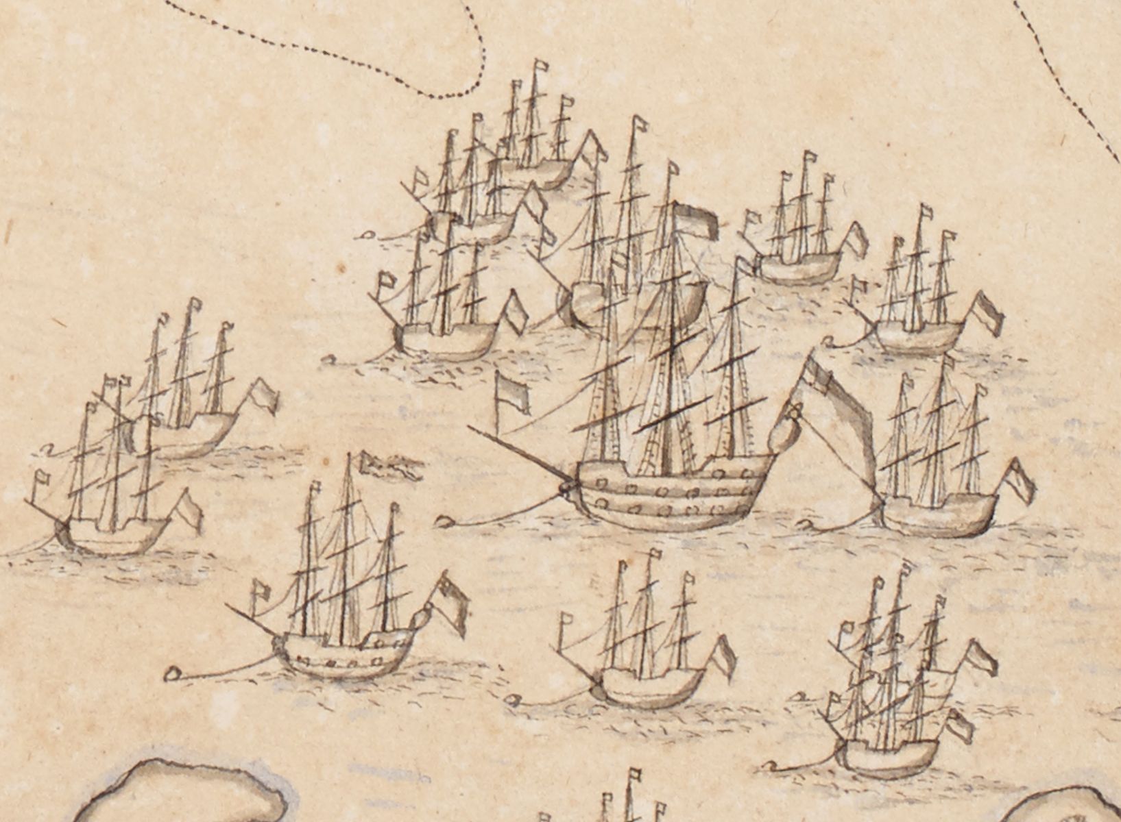
Detail from "An Exact Draught of Bostone harbour, with a Survey of most of the Islands about it." (1711)
On April 26, 1717 the Whydah ran aground on a sandbar and capsized during a fierce Nor’easter near Wellfleet, Massachusetts. The ship had previously been a slave ship and had just completed her maiden voyage delivering 312 enslaved people from the West Coast of Africa to Jamaica. Her name comes from the slave port Ouidah in Benin. The Whydah delivered her enslaved human cargo to the Caribbean and was sailing back to England bearing enormous profits from the trade. Near the Bahamas, Sam Bellamy (known as “Black Bellamy”), an infamous pirate captain, and his crew captured the ship and took possession of the state-of-the-art vessel and her treasure. Legend has it that Bellamy headed to Cape Cod after to continue a budding romance with a woman named Maria Hallett.
Like other pirate ships of the time, Bellamy’s crew was a mix of sailors from Europe and North America as well as Africans, Native people and men of African descent. There was even a young boy around 9 years old aboard named John King who had joined the crew. The pirate life offered an alternative to the drudgery of working on commercial ships as well as freedom from enslavement for Native and African crew. In addition, the capture of loot from other ships was shared amongst the crew.
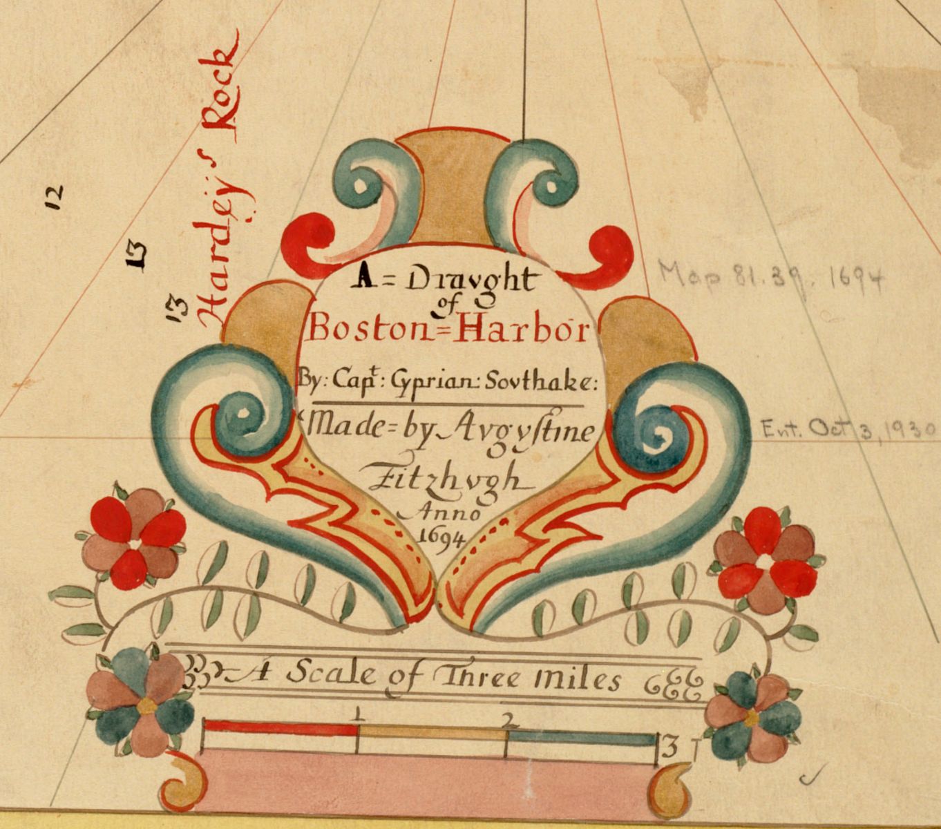
Detail of a cartouche from Southack’s map of Boston Harbor.
After the April 26 wreck, colonial governor Samuel Shute received word that a ship had gone down “man’d with about 130 men, 28 guns, who had not any commission from any Prince or Potentate.” Shute sent Captain and cartographer Cyprian Southack (1662-1745) to recover what he could. Southack, London born, lived in Boston after 1685. He is recognized as America's first chartmaker and served as commander of several vessels responsible for guarding the Massachusetts coast and shipping against the French, as well as dealing with the so-called “Indian affairs” of the colony further North in Maine.
Southack hired a whaleboat and crew near Provincetown to make the journey out to where the wreck lay. They passed through a spot called “Jeremiah’s Gutter” that would be along the Eastham/Orleans border today. This passage no longer exists due to the shifting sands of Cape Cod, but it’s marked on Southack’s map. While they could see the wreck being battered by the waves, the strong currents made it too dangerous to reach. The whaleboat crew collected whatever they could from the beach (which amounted to very little). Southack also came to discover that the locals had beat him to the beach days earlier and had likely collected whatever valuables washed up on their own or on the bodies of the pirates who washed ashore. Despite orders for the locals to turn over any valuables to the Crown, as well as turn in their neighbors who had scavenged, unsurprisingly very few stepped forward.
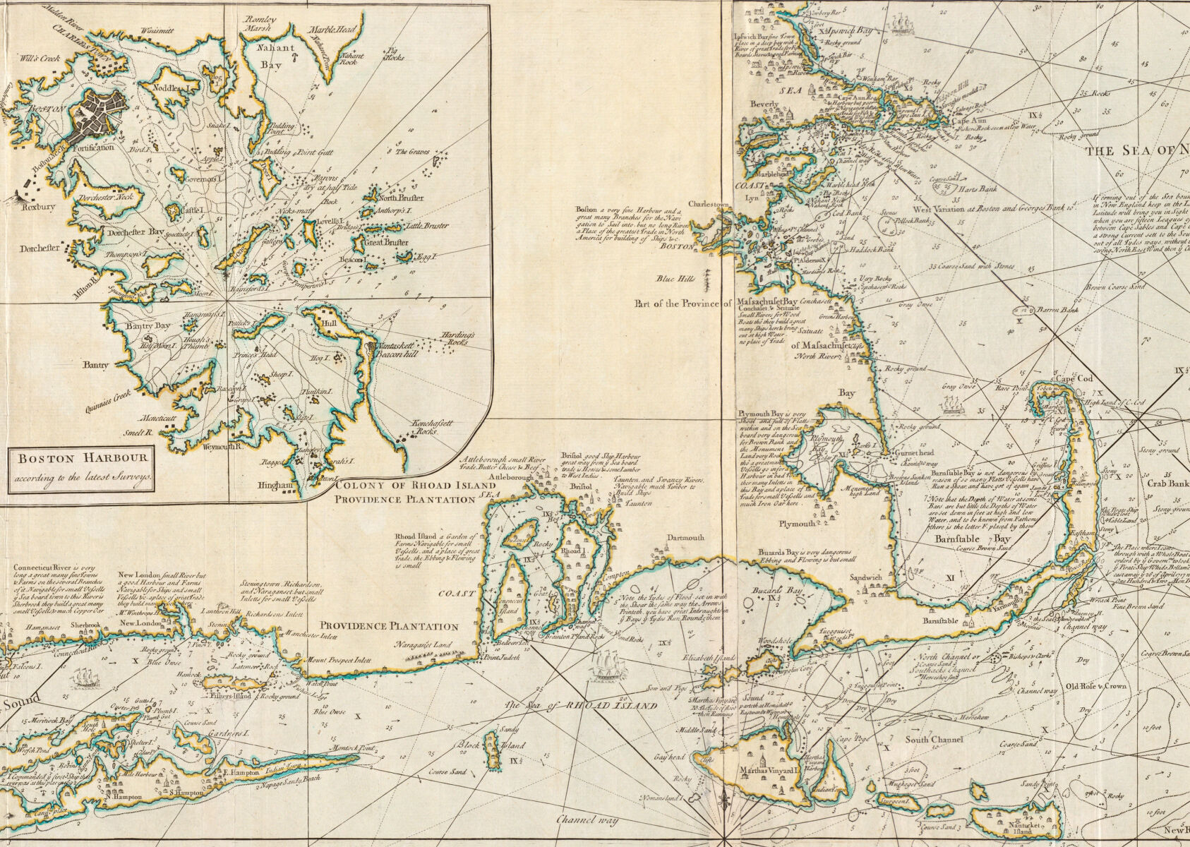
Detail from Southack’s survey of the coast extending “from New York to Cape Briton”
Of the crew, two did survive and managed to make it ashore. Of those who perished and washed ashore, the town of Eastham buried them in a pit and then billed Southack for the expense. Between the scant booty found on the beach and the bill for burial, Southack brought nothing back for the Crown.
Southack extensively documented his expedition in letters and maps to the governor (now in the Massachusetts State Archives). Southack's map was published in book form as “The New England Coasting Pilot” between 1729 and 1734. This later version features more detailed views of various harbors and annotations, including Southack’s own account of the Whydah expedition and the point where the ship went down (spelled Whido here):
The Place where I came
through with a Whale Boat
being ordered by ye Governmt
to look after ye Pirate Ship
Whido Bellame Commandr
castaway ye 26 of April 1717
where I buried One Hundred
& Two Men Drowned
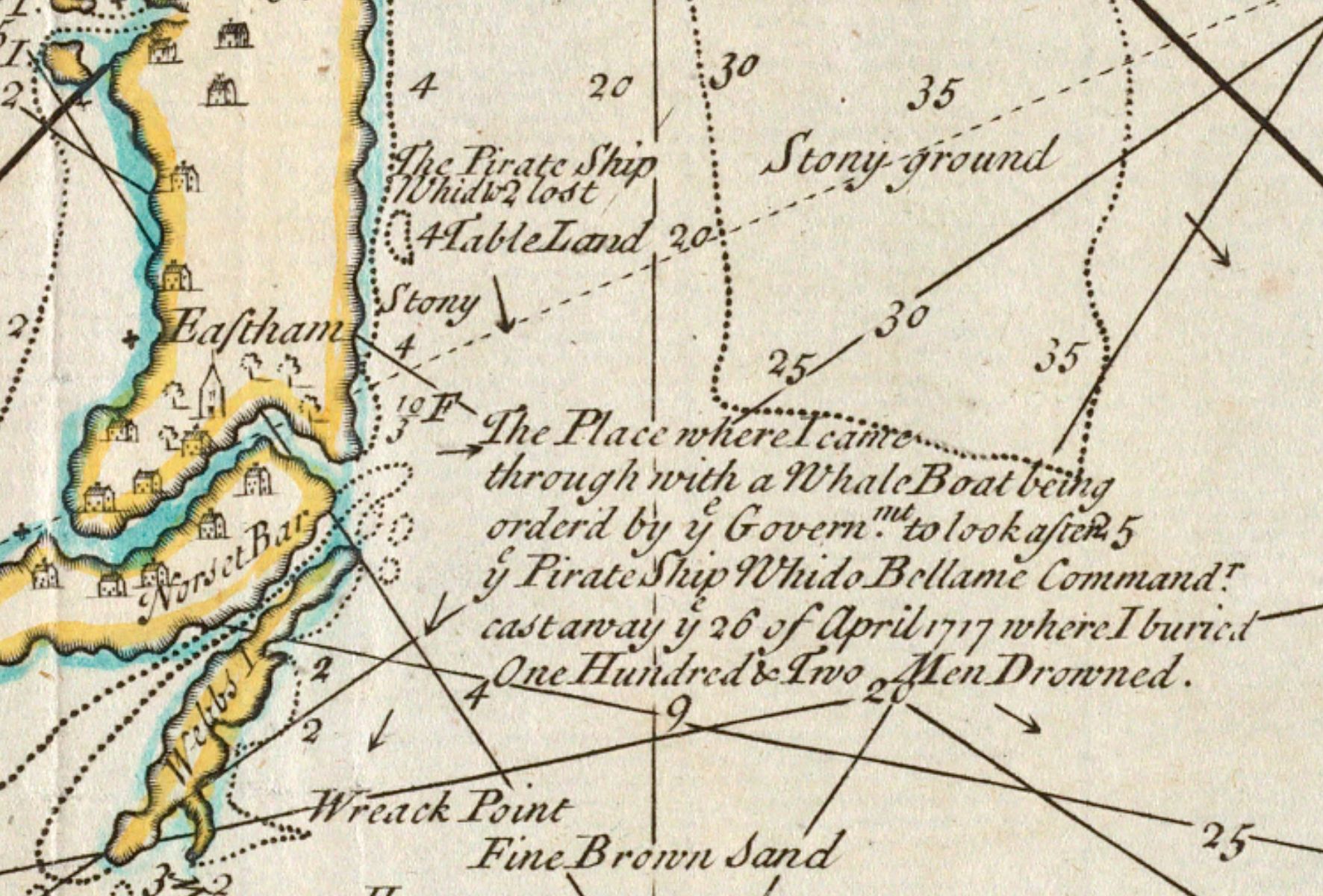
In this this detail Southack denoted where the pirate ship Whydah went down as well as where the whale boat he hired traveled from Provincetown to Eastham through a natural canal called Jeremiah’s Gutter. The canal no longer exists due to shifting sands and erosion.
In 1984, underwater archeological explorer Barry Clifford and his team located the Whydah using Southack’s maps and notes after years of searching (and having to account for erosion over the course of hundreds of years.) The discovery of the ship amounts today to the largest collection of pirate artifacts from any shipwreck in the world. If you visit the Whydah Pirate Museum in West Yarmouth you can see pistols, cannons, gold and silver coins and jewels amongst a wide range of objects that give life to not only the pirate crew but also the Whydah’s role in the slave trade and the empires vying for control of the Americas.
Sometimes maps can unearth treasure.
Want to learn more?
Check out all available digitized maps by Cyprian Southack on our collections page.
Learn more about the Whydah from this South Wellfleet blog post or from the "Real Pirates" Exhibition at the Field Museum.
Our articles are always free
You’ll never hit a paywall or be asked to subscribe to read our free articles. No matter who you are, our articles are free to read—in class, at home, on the train, or wherever you like. In fact, you can even reuse them under a Creative Commons CC BY-ND 2.0 license.