This digital publication was supported by the Leventhal Map & Education Center's Small Grants for Early Career Digital Publications program.
Digital applications for connecting collections
The New Bedford Whaling Museum’s special exhibition, Up From the Depths: Natural Selections from Our Collections (2024-2025) included 71 seashells displayed under a glass case. Numerical markers associated each one to a physical location on an accompanying world map display. Photographs of some items on exhibit, including a sample of these seashells, were included on the exhibition webpage.
While touring the exhibit with Robert Rocha, Associate Curator of Science and Research, I wanted to hold the seashells and experience them out of their resting place. I wanted to know more about how the seashells were acquired from some far-flung reaches of the world, and how they came to live at the Whaling Museum, and why these seashells were important here, to this place—both at the time of their acquisition, and as they are now, resting in the collections. Finally, I wondered what was happening at the places these shells were obtained.
Because the seashell collection is lacking provenance, a lot of these questions must be left to imagination. However, museums are places that encourage our curiosity as well as provide information. I started to imagine: could I use maps, charts, and other historical documents to contextualize these seashells in space, and within the maritime culture of industry and exploration for which New Bedford has been regarded over the centuries?
Creating a digital seashell exhibit
Using Smithsonian Voyager, I built a digital experience to creatively investigate the above question. First, I used my phone to scan specimens with a photogrammetry application. Photogrammetry is a process of creating 3D models by means of triangulation using 2D photographs in a series of overlapping images. Then, I conducted background research on historical whaling maps to provide a backdrop for the shells. Using Blender, I modeled a map of ocean currents and whaling grounds from the David Rumsey Map Collection.
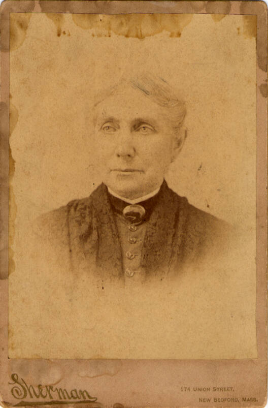
A portrait of Charlotte Sherman DeHart, Courtesy of the New Bedford Whaling Museum
Placing the seashell models and the map model together in the same scene required a story to relate the two. Thankfully, Charlotte Sherman DeHart’s logbook of her voyage aboard the ship Roman 2nd of New Bedford provides an excellent narrative for viewers to follow the seashell models in sequential order across the map. The whaling expedition took place only a few years after the publication of the "Map of the Currents and Whaling Grounds." Charlotte's account gives insight to the activities taking place at the surface—hunting, exploring, and entertaining on the high seas—as they sailed around the world. The seashells become spatial representations of those activities.
This digital exhibit therefore highlights two parallel hidden histories. First, it asserts Charlotte's story against the backdrop of well-known narratives of nineteenth-century whaling industry, which was dominated by popular tropes such as man versus the leviathan. Second, the exhibit uncovers the story of this seashell collection—a small but intriguing account of human experience with the natural world that helps reveal how distant places were intimately connected to one another through networks of trade, culture, and ecology.
How to explore the exhibition
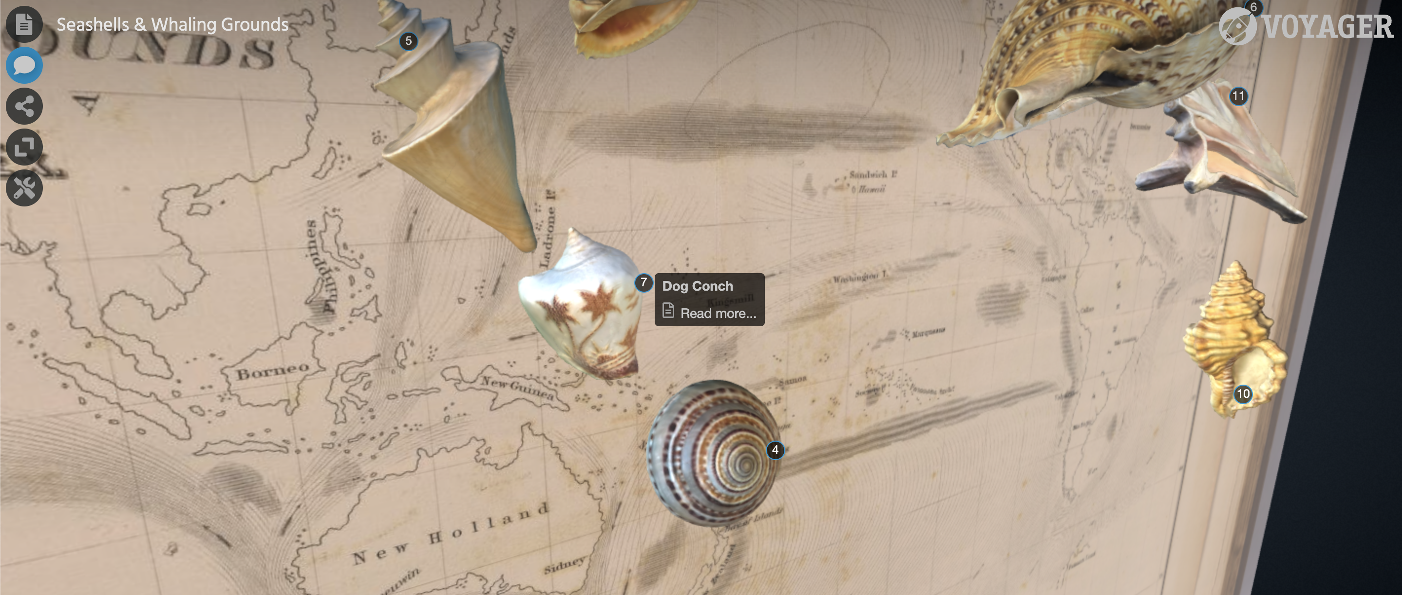
A screenshot from the digital exhibition Seashells & Whaling Grounds
This exhibit, entitled Seashells & Whaling Grounds, contains a number of models, articles, and associated annotations. The New Bedford Whaling Museum provided the seashells for 3D digitization and modeling. The map is provided by the David Rumsey Map Collection.
To get started, enable Articles and Annotations by clicking the top two icons in the upper left corner of the viewer. The Articles are listed in order at the right of the viewer. The Annotations bar appears at the bottom of the viewer. There is an icon to enable full screen viewing as well.
Enabling an Annotation by clicking on the name of the model in the annotation bar displays the associated model. Disable the annotation to hide the model from view. Each annotation corresponds to its model in numerical sequence according to the historic events of Charlotte Sherman DeHart’s voyage aboard the whaling ship Roman 2nd of New Bedford. Associated articles are also listed in chronological order.
Articles contain more information about Charlotte’s voyage and the seashells. Her digitized logbook is referenced throughout the articles. Each reference links to an associated entry available for viewing on the Archive.org site. A map detail showing the distribution of species belonging to these seashells is displayed in each article. Links to the OBIS Mapper and iNaturalist provide more information for each species.
Expanding digital collections to reach a broader audience
Through remote participation, the Seashells & Whaling Grounds digital exhibit may encourage in-person attendance as well. Digitization serves as an important tool for conservation of collections, and my engagement in this project demonstrates the influential role of participatory experiences as explained by Nina Simon in her work, The Participatory Museum. Proactive undertaking can engage researchers and early career professionals in digitization work over time as creative funding opportunities arise.
This project also demonstrates the effective use of open source software and inexpensive, accessible tools to generate immersive visitor experiences through interactive technology. Museums’ purposeful orientation toward collaboration via free and common use rights is foundational to the efficacy of these tools. Combining grant funding with open source tools and accessible information allowed me, as a researcher, to fruitfully connect historical resources across the Whaling Museum, David Rumsey Map Collection, and the Leventhal Map & Education Center.
Rae uses maps to help people explore how culture, memory, and discourse inform our future spatial relationships with each other and the living world around us. She is an urban planner in New Bedford, Massachusetts. She earned her B.S. in Anthropology, conc. Public Archaeology, and GCert in GIS from Bridgewater State University.
Our articles are always free
You’ll never hit a paywall or be asked to subscribe to read our free articles. No matter who you are, our articles are free to read—in class, at home, on the train, or wherever you like. In fact, you can even reuse them under a Creative Commons CC BY-ND 2.0 license.