The Leventhal Center is soliciting donations in the area of early computer cartography, including maps, datasets (physical or born-digital), papers, and other cartographic objects produced between 1960 and 2000. In this post, we introduce two new collections that exemplify this interest.
Here at the Leventhal Center, we're thrilled to welcome two new archival collections which help narrate the history of computer cartography: the Applied Geographics, Inc. Records and the David J. Weaver Collection.
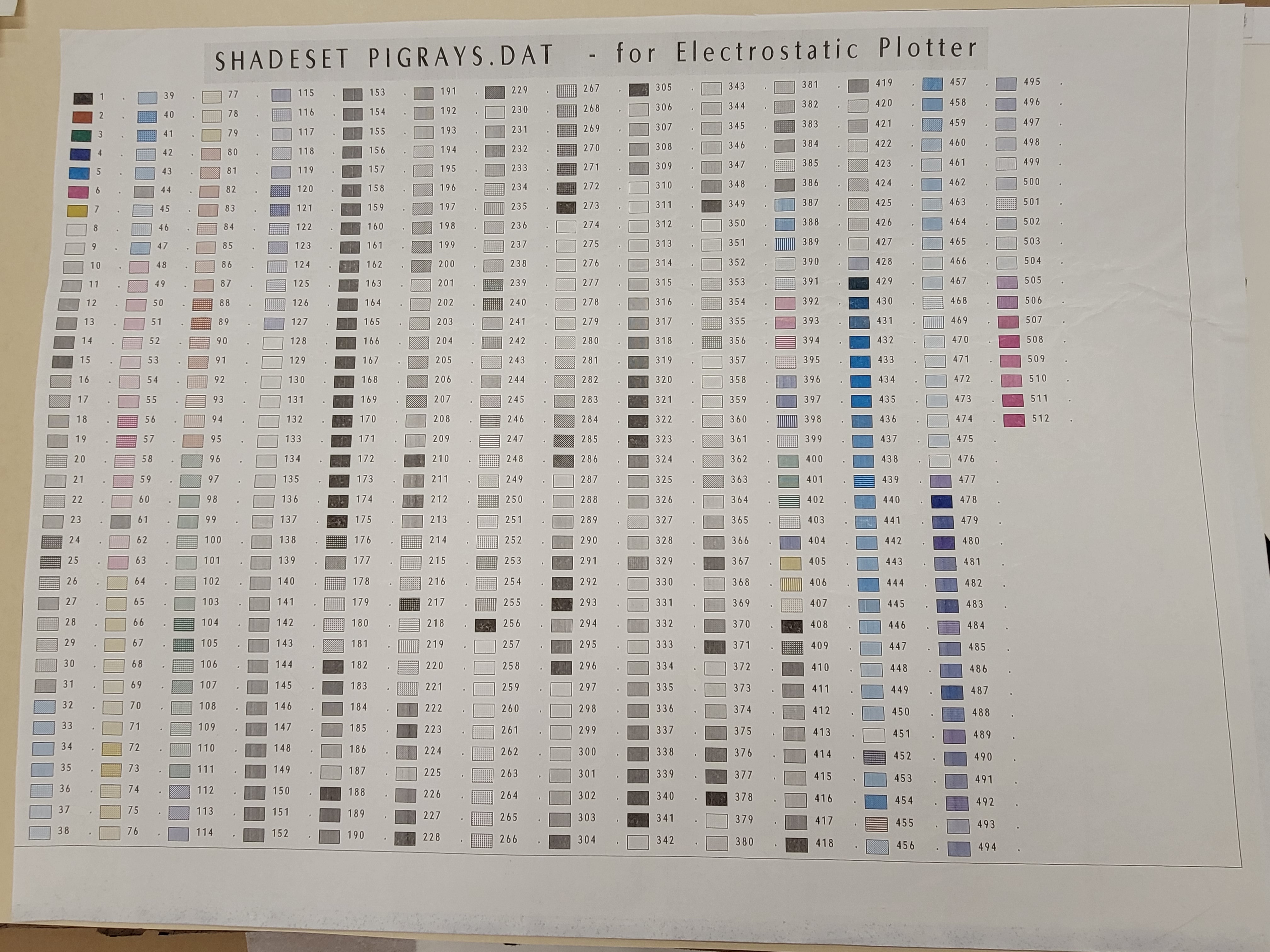
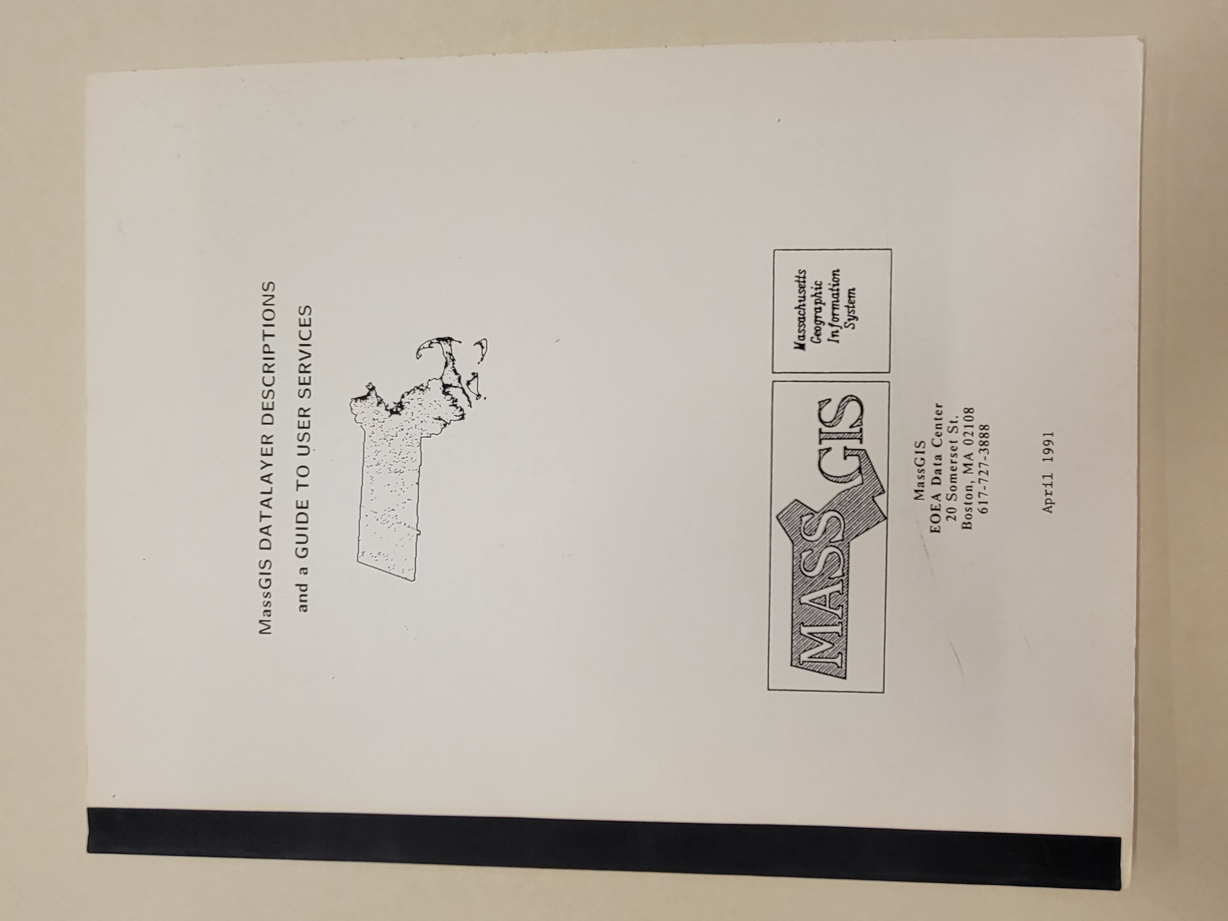
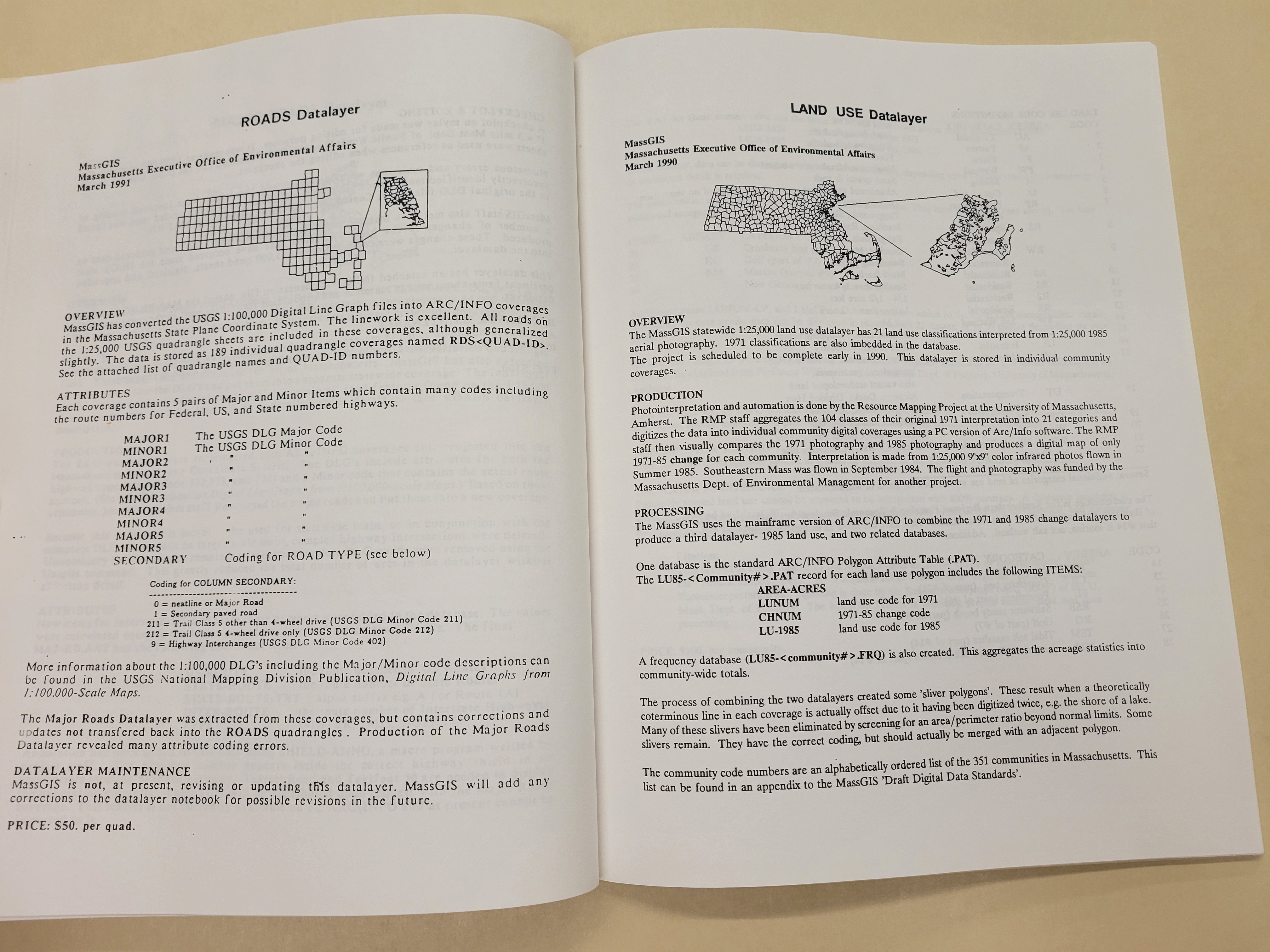
Donated by David Weaver, co-founder and former Vice President of Applied Geographics (AppGeo), these collections encompass hundreds of cartographic objects including maps, data creation tools, software manuals, and more. See below for some photos taken during our time processing the archival collections.
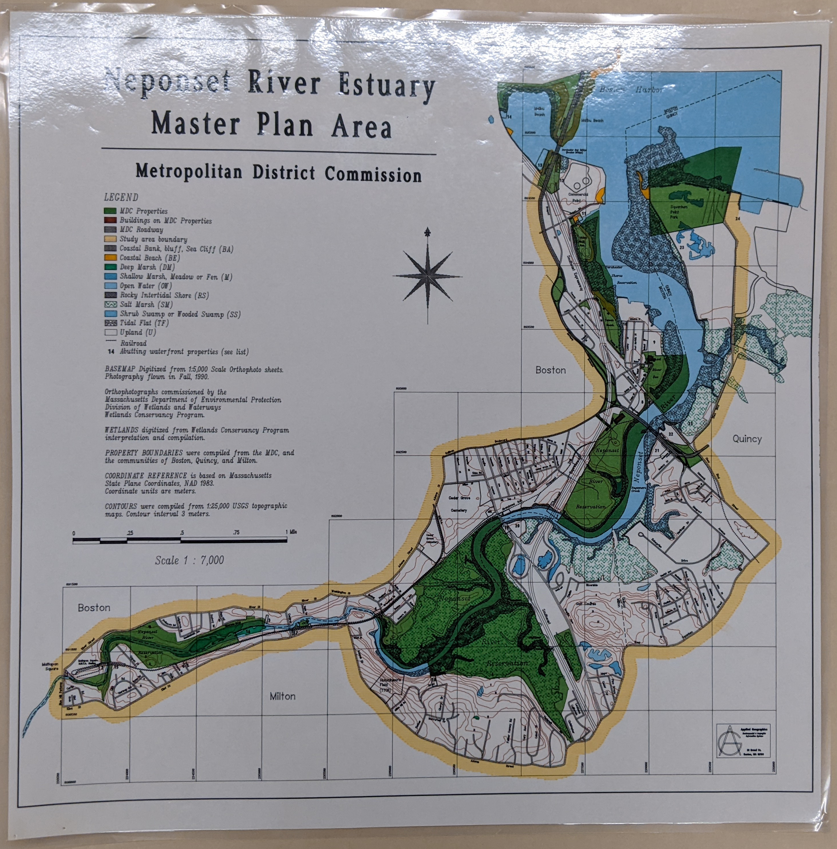
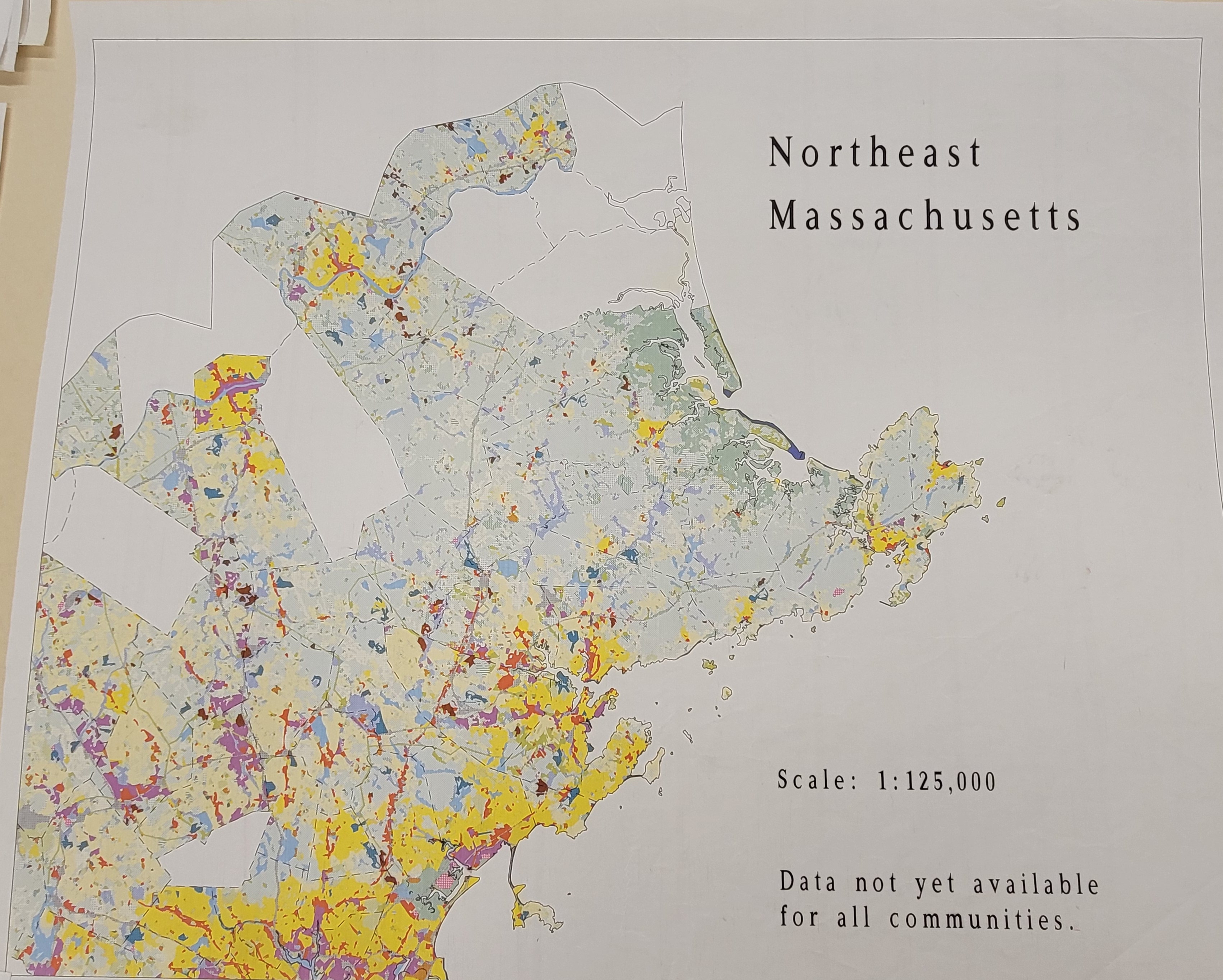
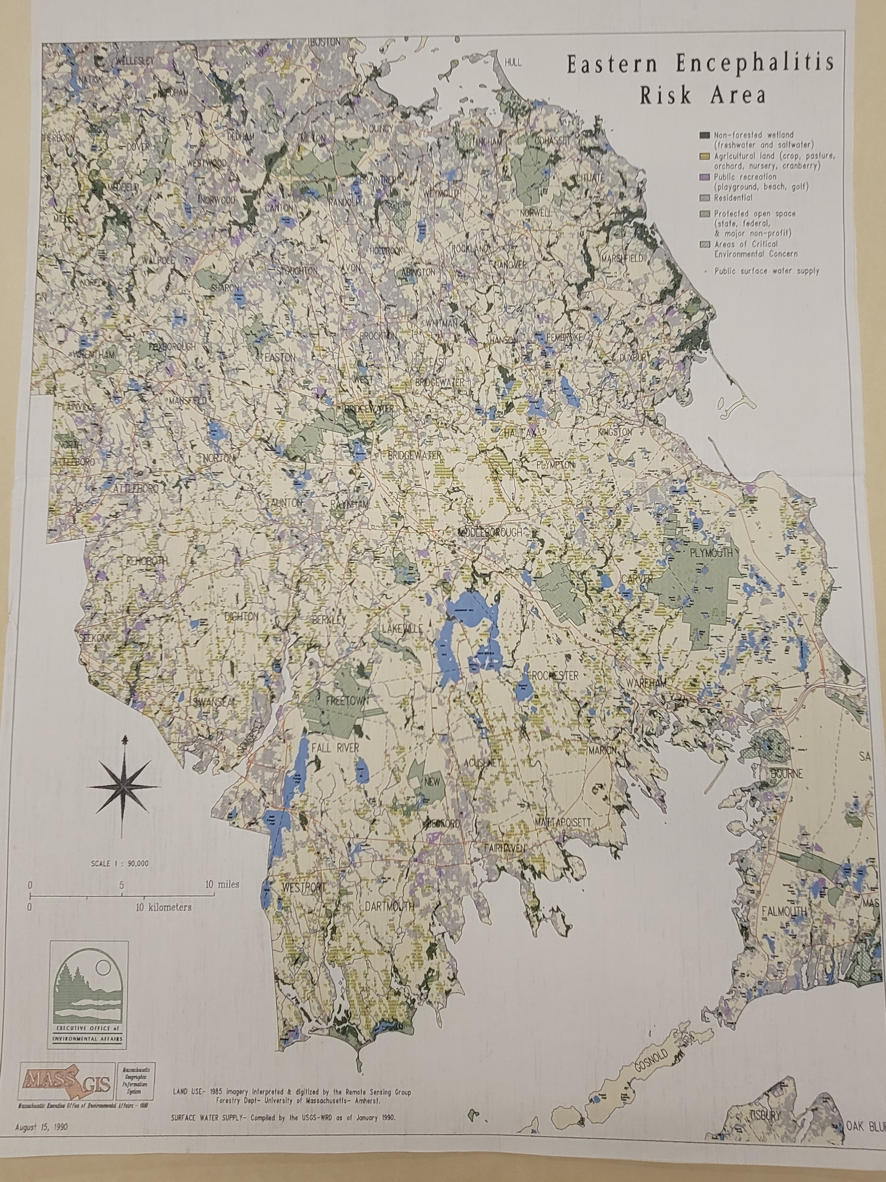
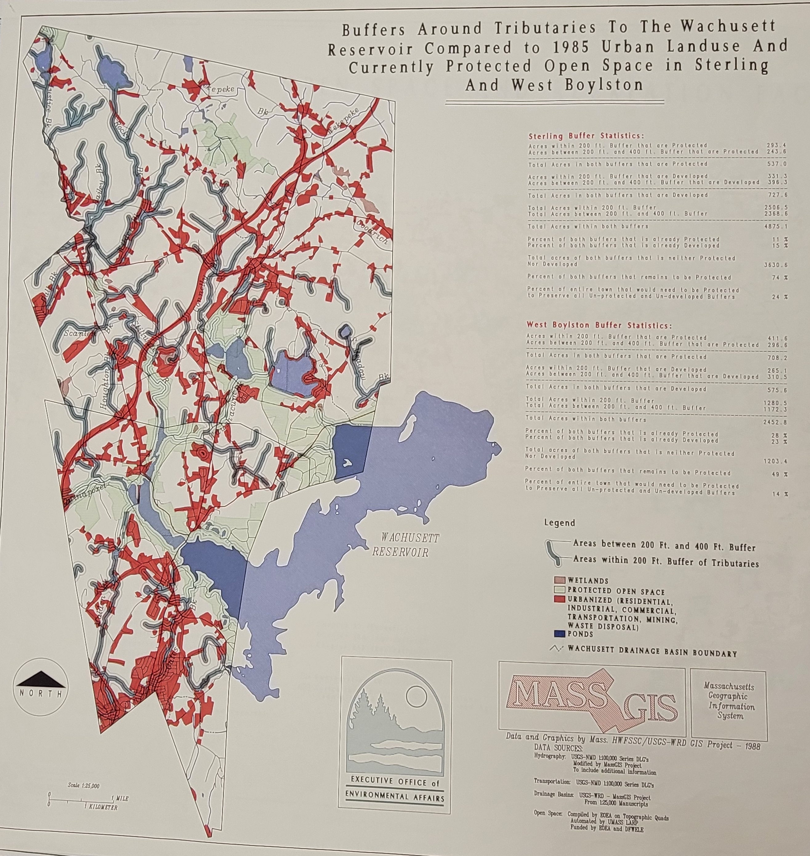
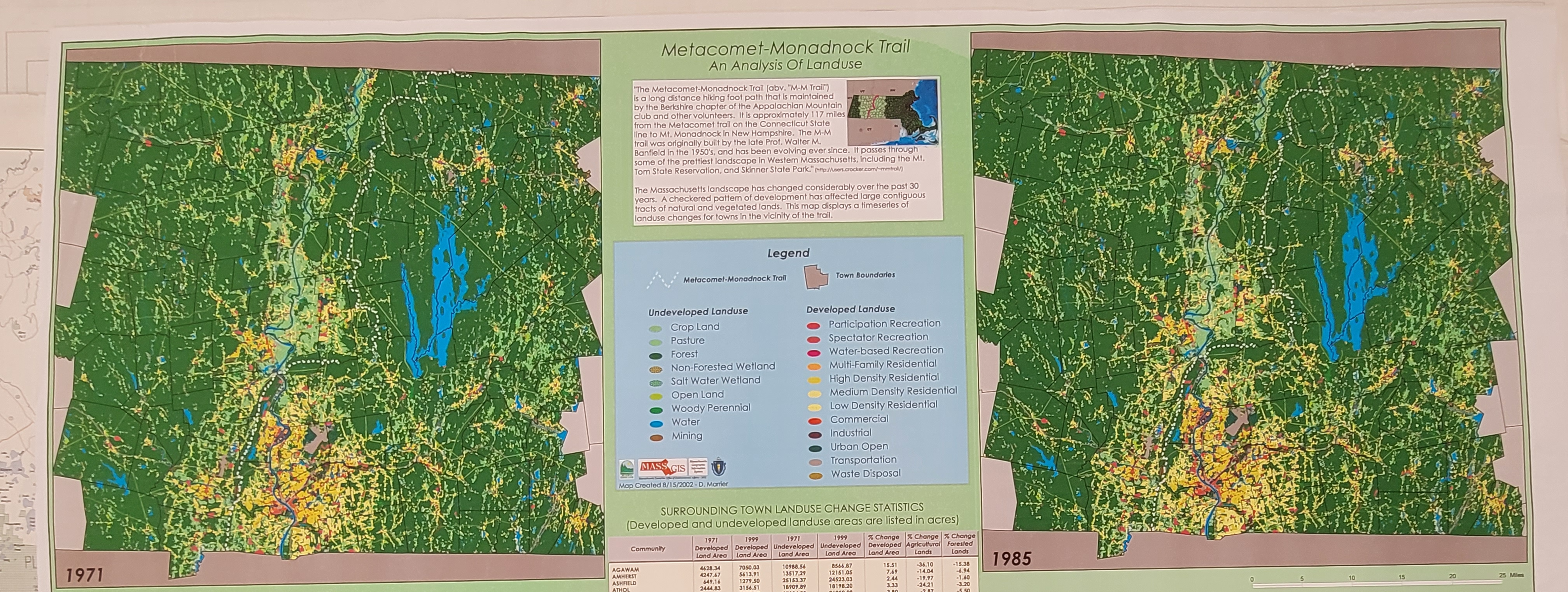
While the collections have a special focus on maps made by AppGeo, many other authors including Esselte Map Service, Intergraph, and various Massachusetts state agencies are also represented. Taken together, these collections provide a unique glimpse into major changes in cartographic design, process, and philosophy between the late 1970s and 2012.
Since dedicated collections of maps produced during the early days of computer cartography still remain rare, we're eager to collect maps---especially ones created between 1960 and 2000---that reflect:
Changes in cartographic practice. How did advances in computation affect the look of maps? What conventions and standards were introduced (or erased) as the mapmaking process was increasingly computerized?
Methodological changes in spatial analysis. How did computer cartography and geographic information systems (GIS) transform the kinds of questions we could ask (and answer) with maps? To what extent did this change the relationship between the map, the mapmaker, and the audience?
Early technical workflows or data creation techniques. What novel data creation techniques did advances in computation allow? How was this data analyzed in the form of maps?
In short: we're interested in maps that bring the process of early computer cartography to life. If you want to learn more about this initiative---or if you think you have some maps that fit the above criteria---don't hesitate to reach out to us.
Our articles are always free
You’ll never hit a paywall or be asked to subscribe to read our free articles. No matter who you are, our articles are free to read—in class, at home, on the train, or wherever you like. In fact, you can even reuse them under a Creative Commons CC BY-ND 2.0 license.