An archival collection is a group of related materials that documents the activities of an individual, family, or organization. The Leventhal Map & Education Center's archival collections include personal papers of cartographers, records of mapping or surveying firms, and subject-based collections. Archives at LMEC are described in finding aids, which include essential information about the creation, content, arrangement, and context of these collections.
Archival collections at the LMEC are listed below. We are currently processing these materials so only some collections are described at this time. Contact us for more information about these collections.
Applied Geographics, Inc. Records
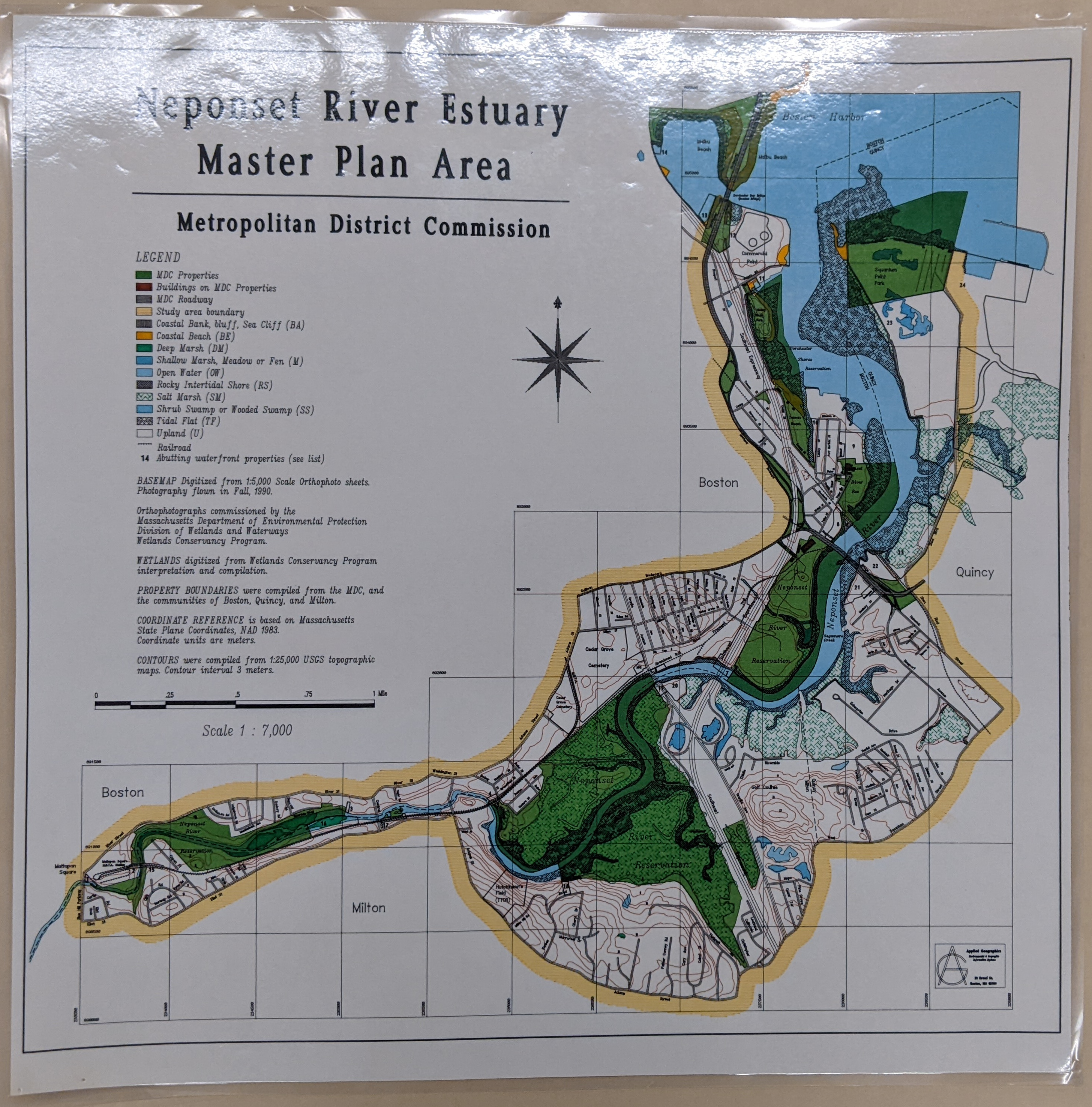
Pen plot map of the Neponset River Estuary by Applied Geographics Inc. for the Metropolitan District Commission
The Applied Geographics, Inc. records consist of maps dated 1982-2012 that were created by or held by Applied Geographics, Inc., a GIS consulting firm in Boston, Massachusetts. A large portion of the collection consists of maps created for government agencies. The collection also includes maps produced by AppGeo staff while employed at MassGIS before the establishment of AppGeo, maps produced by other GIS firms, and published maps that were used for reference by the company.
Auctioneer Plans Collection
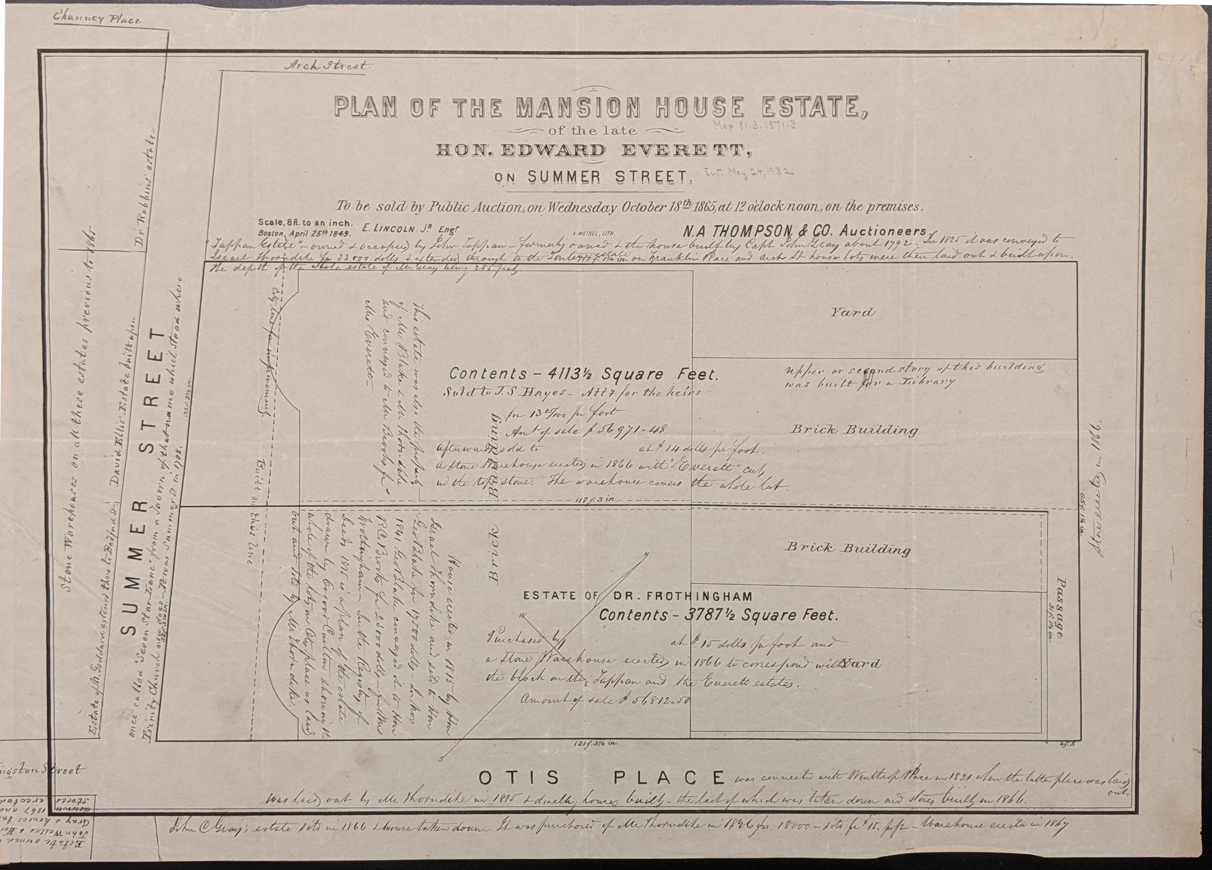
Auctioneer Plan of the Mansion House Estate
Auctioneer plans advertise lots to be auctioned for sale, usually by cities or real estate companies. Some auctioneer plans are annotated with sale information.
Robert Bayard Bellamy Surveying Papers
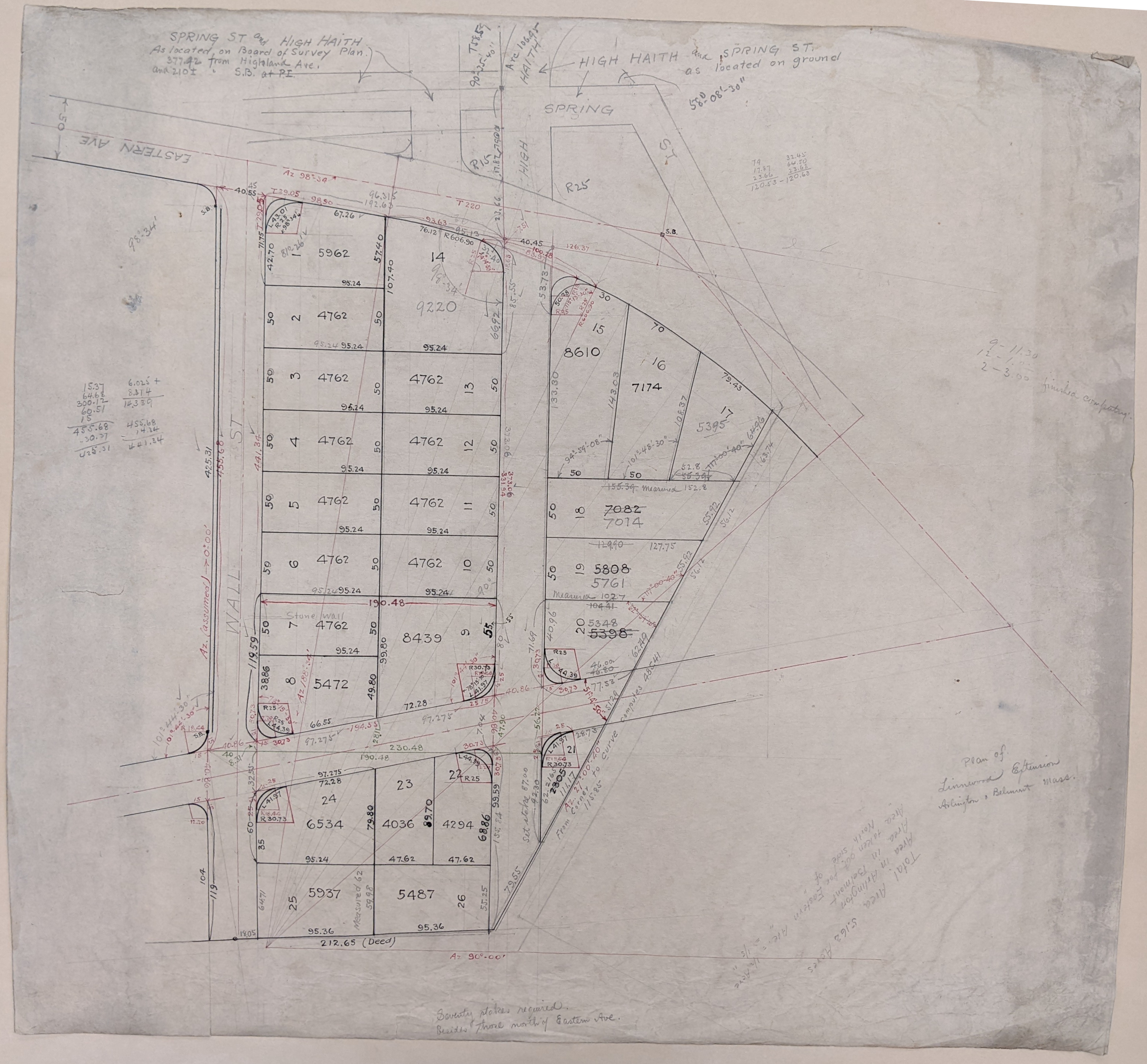
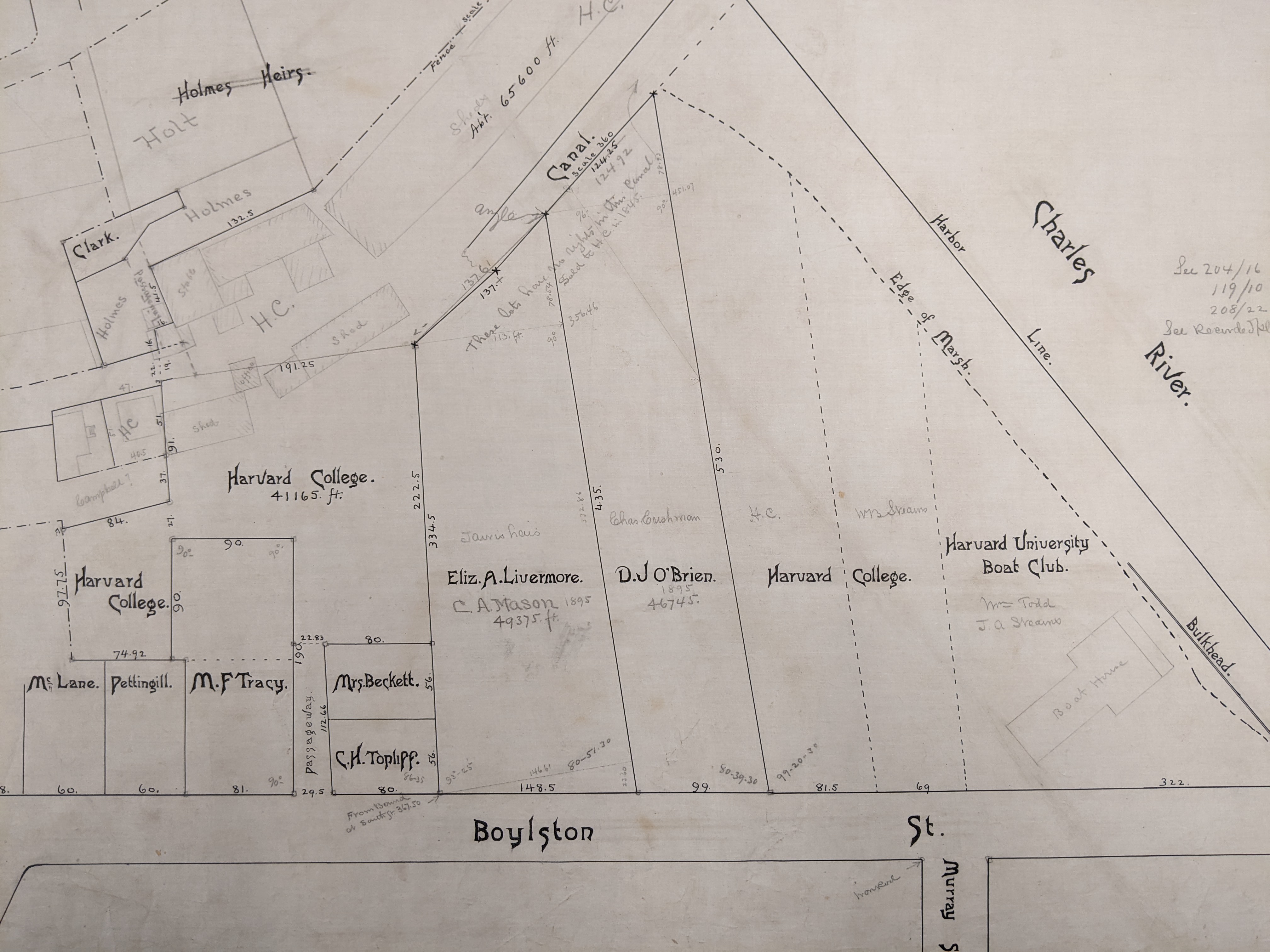
Manuscript property survey from the Robert Bayard Bellamy Surveying Papers
The Robert Bayard Bellamy surveying papers consist primarily of surveys of properties in eastern Massachusetts circa 1860-1950, with the bulk of surveys done approximately 1890-1930. The majority of surveys are by Robert Bayard Bellamy (1879-1962). Other heavily represented surveyors are his predecessor Frederic Endicott (1839-1918), his brother Arthur Muirson Bellamy (1881-1968), and his father-in-law John Norris McClintock (1846-1914). Surveys show property boundaries, structures, owners, planning, and infrastructure such as public transit and utilities. The Papers include topographical maps, engineering and architectural drawings, and other materials presumably used in the creation of the surveys, as well as miscellaneous documents of professional credentials.
C.L. Berger & Sons Records
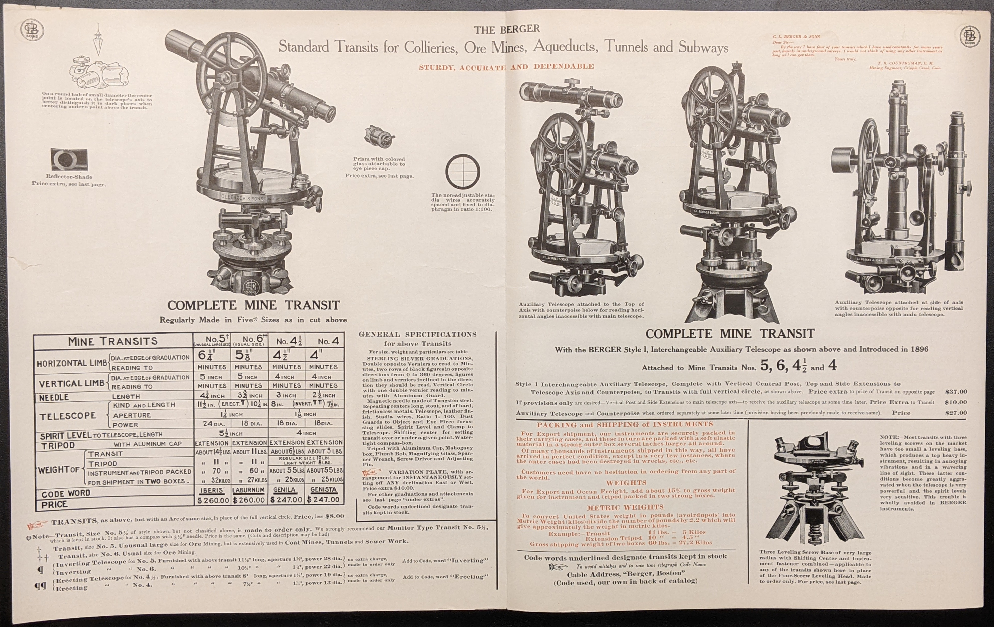
C.L. Berger & Sons mine transit product catalog
The C.L. Berger & Sons records consists of documents and objects produced by the surveying instrument manufacturing company from 1919-1948. The collection includes product catalogs, product manuals, field manuals, instructional manuals, technical manuals, photographs, pamphlets, company stationary, and three small models of instruments. Also included are texts of speeches by co-owner Louis H. Berger and other materials related to trade conferences.
Dana F. Perkins, Inc. Surveying Records
Manuscript property survey by W.A. Mason & Sons, acquired by Dana F. Perkins, Inc.
The Dana F. Perkins, Inc. surveying records consists of surveys, notebooks, and ancillary surveying documents from firms and individual surveyors acquired by the company, as well as some surveys created by Dana F. Perkins, Inc. The majority of items were created by W.A. Mason & Son, with the next largest group of items created by Fuller & Whitney (later William H. Whitney). Other surveyors with a significant number of materials are Charles D. Elliot, Dana E. Perkins, and Dana F. Perkins. The bulk of surveys date from the mid-nineteenth to early twentieth centuries and show property boundaries, structures, owners, planning, and infrastructure such as public transit and utilities. Most surveys are for towns in eastern Massachusetts, with Cambridge, Boston, and Somerville being the most heavily represented.
Richard K. Grady Papers
The Richard K. Grady papers consist primarily of work notes and maps produced by the American geographic information systems professional and cartographer Richard K. Grady (1955-) or by the companies for which he worked. The work notes exemplify map design and production in the late 20th century during the development and implementation of computer-assisted mapmaking technologies. The Papers also contains materials about printing, traditional cartography, and computerized map production. The collection includes manuscript notes; administrative documents; maps and atlases; books; drafts and overlay films for creating offset printing plates; newspaper clippings; and 35 mm slides. Work materials comprise work at Cities, Inc., Esselte Map Service USA, Intergraph Corporation, and design of a map of Killington Ski Area, Vermont.
Annie Olmstead Peet Papers
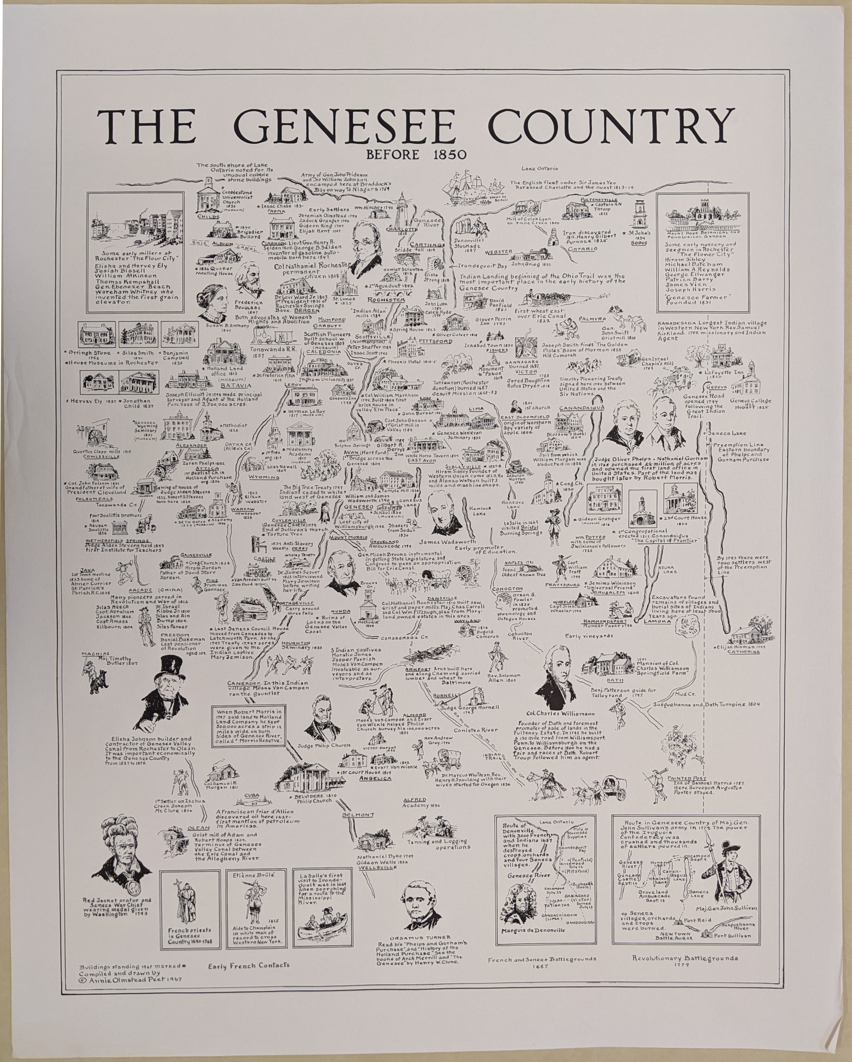
Pictorial map of the Genesee Country before 1850 drawn by Annie Olmstead Peet
The Annie Olmstead Peet papers consists of manuscript, pre-production and published pictorial maps produced from 1926-1969 by cartographer Annie Olmstead Peet (1888-1973) of Rochester, New York. The maps illustrate subjects such as family migrations and county, city, and town histories of New York and New England areas. It also includes miscellaneous photostats of published maps likely used as references, and three aerial photographs by Peet’s son, Olmstead Peet (1912-2003).
John Roman Papers
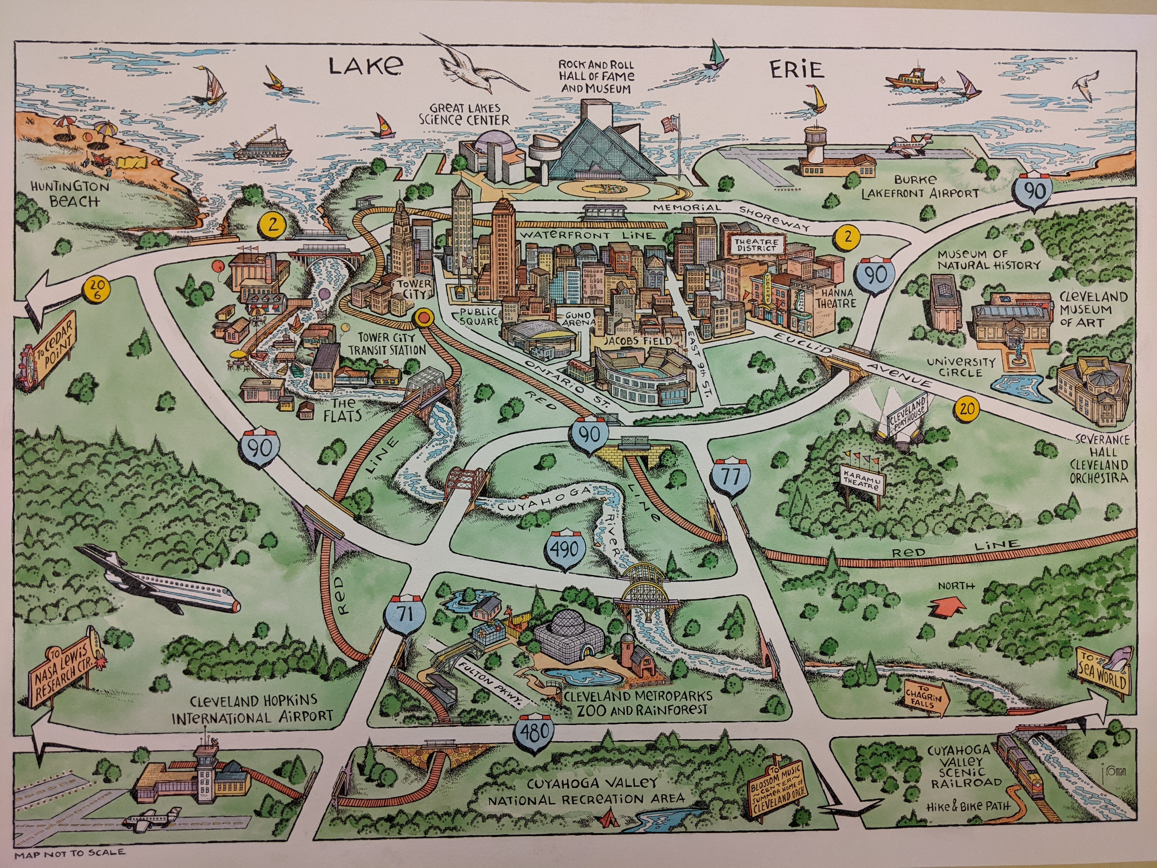
Manuscript pictorial map of Cleveland, Ohio in ink and watercolor
The John Roman papers consist of pictorial maps produced from 1984-2012 by John Roman (1950-), an American map illustrator, author, and college art professor. The collection comprises 54 items representing 30 pictorial map commissions of Roman’s illustration studio in Scituate, Massachusetts. It includes original hand-drawn ink illustrations colored with watercolor, either directly on the illustration or incorporated into the black and white map digitally; sketches; published maps; photos of installations; and magazines, booklets, posters and brochures in which the maps were published. Maps were commissioned for education, advertisements, and to illustrate articles, and depict nature trails, college campuses, tourist destinations, and cities.
David Judkins Weaver Papers
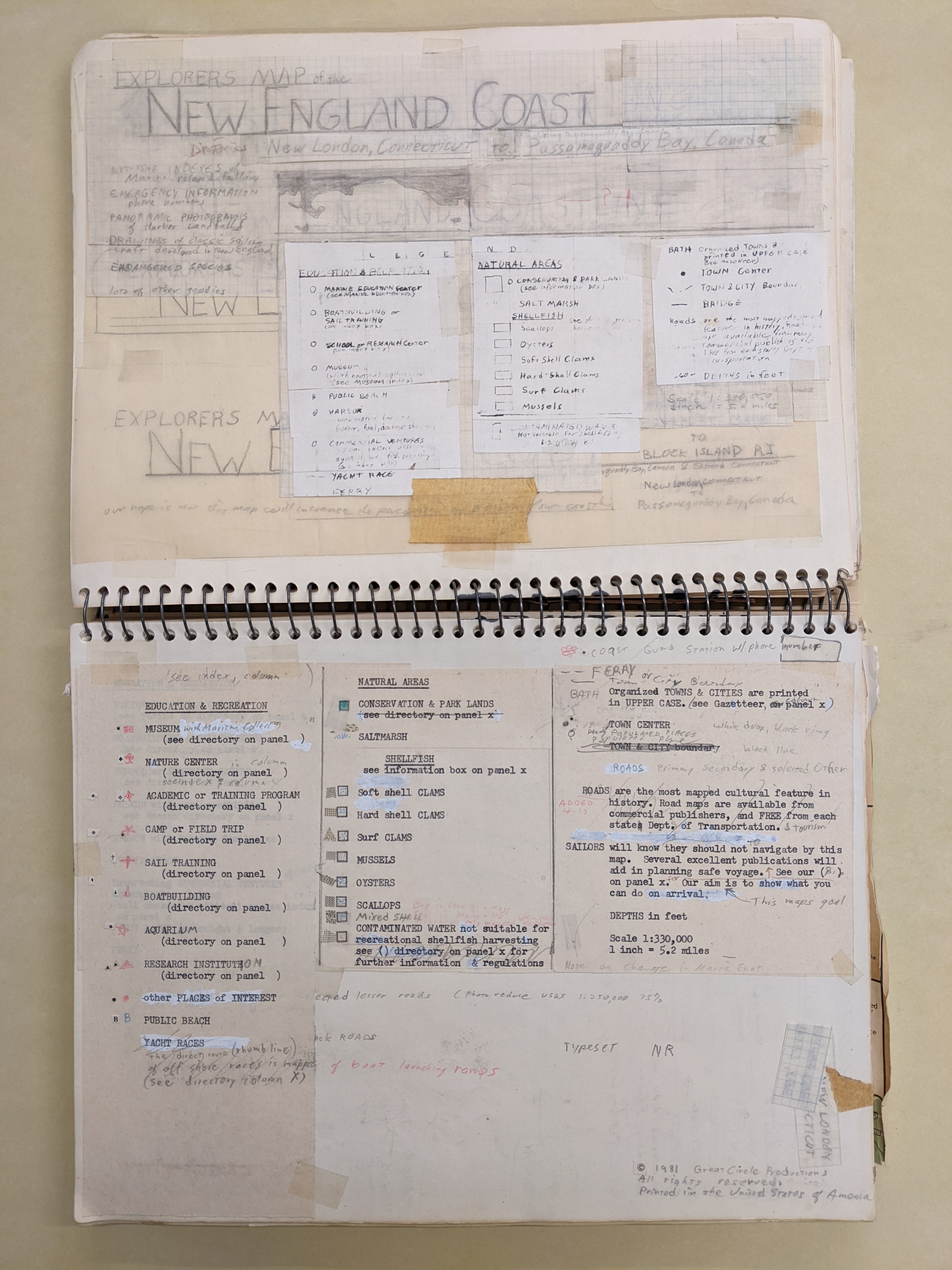
Design notes for Weaver's 'Explorer's map of the New England Coast
The David Judkins Weaver Papers consist primarily of maps dated 1799-2019, bulk 1970-2019, that were created or collected by David Judkins Weaver (1951-2024), a cartographer and geographer in Boston, Massachusetts, who worked at various companies and Massachusetts agencies from the early use of computer cartography in the 1970s through its development and increasing adoption to prevalent method of cartography in the 2010s. The collection contains manuscript and printed maps, notebooks, books, pamphlets, documents, photographic prints, 35mm slides, and tools. It includes his professional portfolio, notes, and independently published maps; maps from organizations at which he was employed, mainly MassGIS and Applied Geographics, Inc.; his collection of traditionally published maps and computer-assisted maps; cartography reference materials; and cartography tools. A large portion of maps are of Massachusetts and New England or show coastal and environmental information.