Overview of the collections
The Leventhal Map & Education Center cares for more than a quarter million cartographic and geographic objects, including maps, atlases, charts, globes, gazetteers, ephemera, research texts, and data sets. Most, though not all, of our physical objects are housed on location at our gallery and research center at the Central Library in Copley Square. All of our collections holdings are available for access to researchers by appointment, and many are available as digital collections.
Collection strengths
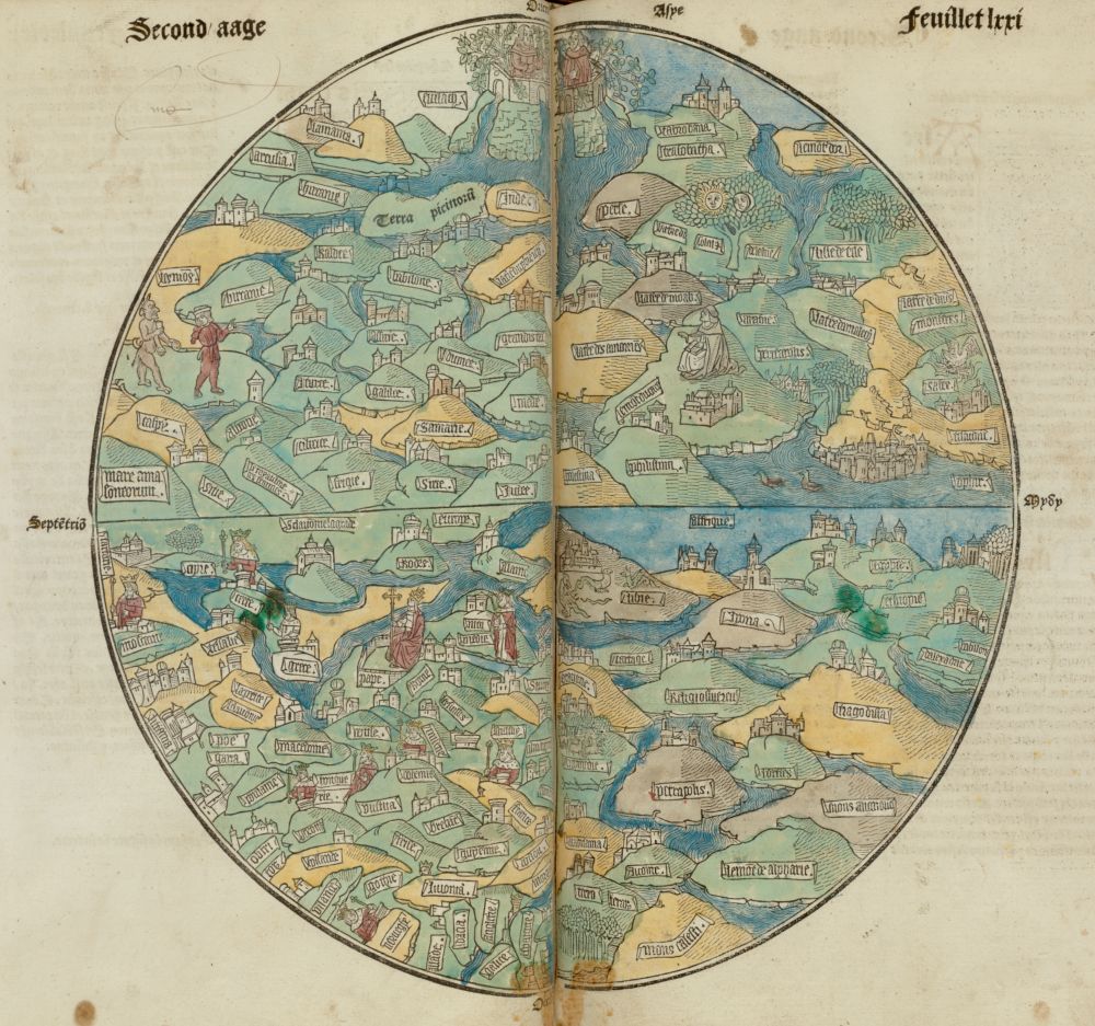
One of the oldest objects in the collection, a circular world map from the 1475 Latin edition of Rudimentum Novitorium
Chronologically, the Center's collections span from the fifteenth century to the present day, and geographically cover all world regions. The strongest areas of the collections are objects whose geographic extent includes Boston, Massachusetts, and New England. Many of the Leventhal Center's most significant collections from the early modern period were previously held in the Rare Books department, while many of our nineteenth century materials were formerly held in the Prints department. As a federal depository library, the Leventhal Center, together with the Government Documents section of the BPL, holds many thousands of maps produced by federal, state, and local governments, as well as from agencies related to defense, environmental management, and urban and regional planning.
Collections of Distinction
Our collections include four named Collections of Distinction, selected for their uniquely comprehensive coverage of these subject areas.
American Revolutionary War-Era Maps. This collection encompasses approximately 900 maps covering Boston and New England, as well as the remainder of eastern North America and the West Indies during the period 1750–1800. The Digital Collection also includes many significant maps from digital partner collections.
Boston and New England. The collection includes a number of unique or very rare items, including the fourth impression of John Bonner's map of Boston (dated between 1723 and 1730), Charles Bulfinch's 1813 manuscript plans for filling in the Mill Pond, Charles Pinney's 1861 fire insurance atlas of Boston, the Sanborn Company's first fire insurance atlas of the city (1867), and numerous manuscript cadastral survey plats.
Urban Maps. This collection, primarily earlier than the 20th century, consists of approximately 2,000 urban-related maps, with a special focus on maps and atlases depicting Boston and other Massachusetts cities and towns. Included are examples of the major types of urban mapping that were common in Europe and the United States from the end of the 16th century until the early 20th century.
Maritime Charts and Atlases. The core of this collection consists of 25 atlases dating from the 17th and 18th centuries and approximately 1,500 charts, most of which were published during the 19th century. Although the geographic coverage is worldwide, the primary focus is the coastal waters of the United States, especially the northeastern coast.
The Mapping Boston Collection
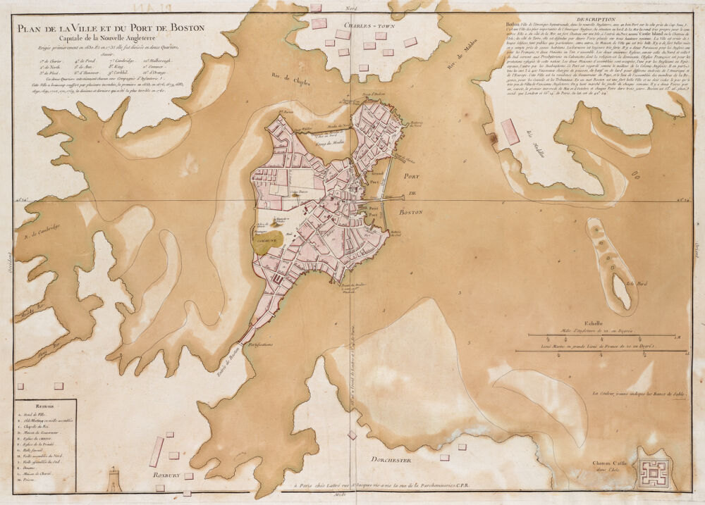
Jean Lattré's ca. 1764 map of Boston, in the Mapping Boston Collection.
The Mapping Boston Collection consists of the rare maps collected by Norman B. Leventhal during his lifetime. The maps in this collection range from fifteenth century world maps produced during the Age of Exploration to many of the most important maps of Boston and New England in the colonial period and early republic. In-person access to items in the Mapping Boston Collection is available only by advance appointment and online. Many of the Mapping Boston Collection objects are described in the 1999 book Mapping Boston (MIT Press), available in the library and for purchase.
Data Collections
In addition to printed and physical objects, the LMEC also collects data sets and geospatial information pertaining to both present-day and historical geography. We also collect geographic information that is derived from physical objects, including both identifying data such as bounding boxes as well as inferred data such as names, boundaries, and characteristics.
Our online public access data portal is currently under development. For more information, see our Geospatial Information Services research page.
Other geographic resources at the BPL
The BPL's research collections include many geographic resources not housed at the Leventhal Center. The research library collections contain many 20th century atlases, guides, and scholarly monographs. The Special Collections departments, including Rare Books, Prints & Photographs, Architectural Plans & Drawings, and Manuscripts & Archives, and Fine Arts, contain geographic material as well as material that is useful in connection with Leventhal Center objects.
Learning from the collections
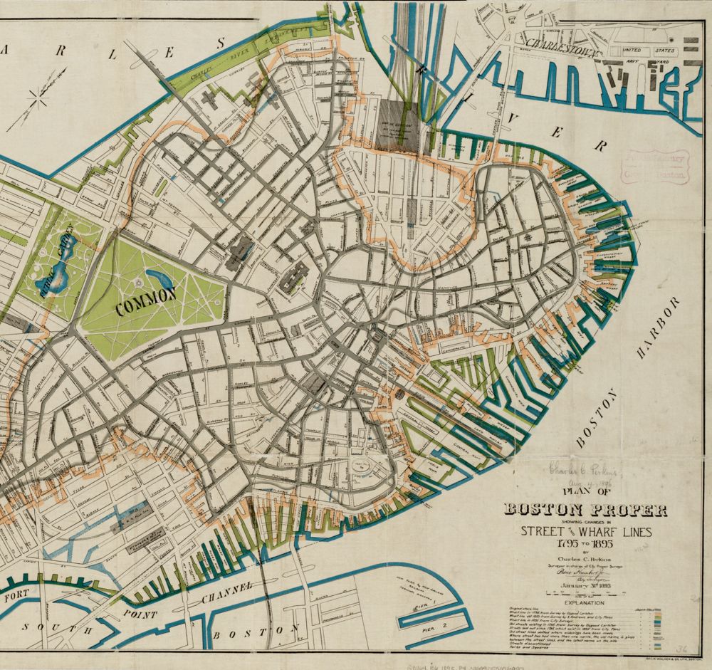
This 1895 map commemorated a hundred years of shoreline change by showing how Boston's waterfront had been altered over time
The hundreds of thousands of objects in our collections open up many different lines of inquiry about both the past and present. They document not only the changing practices of cartography itself, but also the history of different perspectives on the world, as well as the changing relationship between people and places over time.
There are many different ways to learn about history and geography through our collections. Our exhibitions cover topics ranging from the Civil War to the history of women in cartography. We post several times a week on Instagram, Twitter, and Facebook with stories about collections objects. For educators and students at both the K-12 and university level, we offer education programs that explore maps and geography. And our events include seminars and talks about special features of the collections.