Sponsor an Atlas
The Leventhal Center has an extraordinary collection of urban atlases dating from the late nineteenth to early twentieth centuries. These maps are some of the most important documents for depicting how our city and region have changed over time.
In our Atlascope tool, we’ve geotransformed over 145 of these atlases into a web interface that makes it easier than ever to explore change over time in historical geography. It’s used by researchers, genealogists, local historians, archaeologists, educators, and anyone who’s interested in learning more about history and geography in Massachusetts.
We are actively expanding Atlascope’s coverage to locations across the state of Massachusetts. With your help, Atlascope can be used as a tool for historical research and discovery in your town or city, too—and across our whole state.
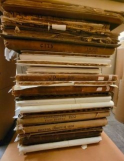
Physical urban atlases, while fascinating, are large, bulky, and can be difficult to parse through to find the information you're looking for.
What is Atlascope?
Designed for use on a computer or mobile device, Atlascope makes it easy to compare properties, buildings, and owners, and to tell stories about how places have changed over time. With new features to empower storytelling, annotation, and discovery, as well as connections into other Massachusetts digital collections, Atlascope is a great tool to answer questions about property ownership, genealogy, urban transformation, and broad questions about historic and geographic change. As Boston Globe columnist Mark Feeney wrote, Atlascope is "a reminder of the extent to which these renderings of the past that are on display, the city as was, directly relate to visitors’ present, the city as is."
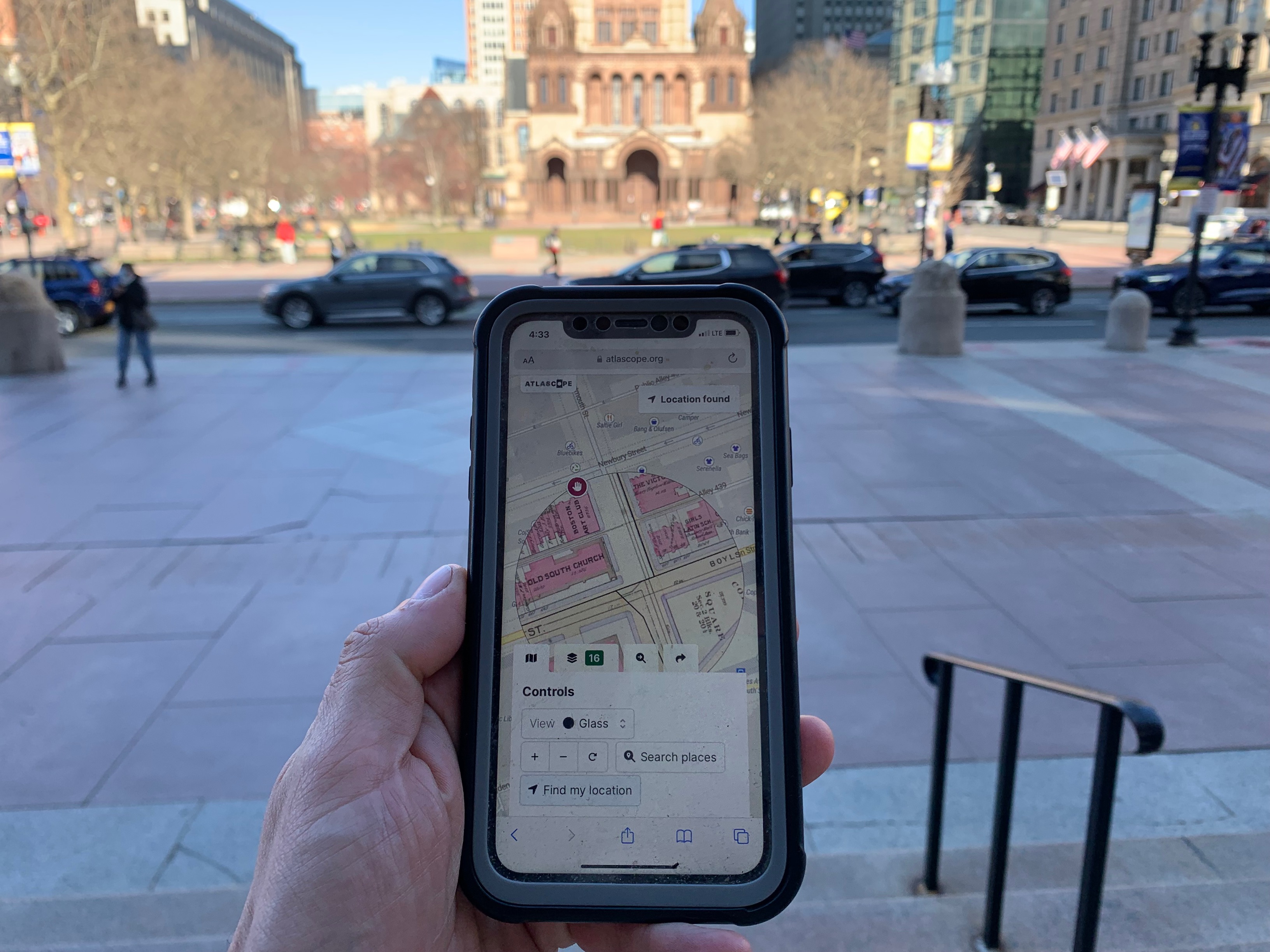
Atlascope can easily be used on a tablet or your phone to discover local history as you wander around the City of Boston.
Who uses Atlascope?
Boston City Archaeologist Joe Bagley uses Atlascope frequently in his work, describing it as an invaluable tool for his historic research. In 2020, Atlascope helped Bagley and his team uncover the origins of a mysterious sinkhole that appeared in Ronan Park in Dorchester and the subsequent discovery of a nineteenth century well.
Students and individuals of all ages also use Atlascope to open up historic inquiries. Last summer, the Boston Preservation Alliance worked with Boston Public School students from the Lilla G. Frederick Pilot Middle School, who used Atlascope in combination with other primary sources and first-hand accounts from residents to explore Grove Hall, Upham’s Corner, and Fields Corner to tell stories about these Dorchester neighborhoods.
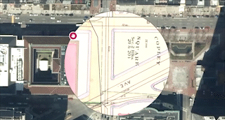
The overlay of a 1902 Bromley Atlas on top of present day Boston in Atlascope.
Scholarly researchers, teachers, and university classes have used Atlascope for in-depth research projects around urban change and local history. For example, students at College of the Holy Cross recently completed a semester-long research project about the buildings and landscapes of Boston that were destroyed by the Central Artery. Two scholars (and recent recipients of the Leventhal Center's Small Grants program) are using Atlascope to research Boston’s Little Syria, which thrived between the 1880s and 1950s.
Finally, Boston Public Library users and Leventhal Map & Education Center patrons from all over the city and surrounding areas use Atlascope as a tool to research their family histories, nurture curiosities about historical change over time, and discover new stories that emerge from the woodwork when examining these fascinating cartographic items.
Expanding Atlascope
We began Atlascope with atlases of historic Boston and its surrounding areas, but these atlases exist in towns across the state. Our goal is to expand Atlascope to cover even more of Massachusetts. It can take up to 60 hours of skilled staff labor to transform a single atlas from printed pages into a modern web layer, a time-consuming process, so this is no small task—and we need your help to do it.
Are there atlases of other Massachusetts towns you would like to see represented in Atlascope? We are currently seeking sponsorship for atlas layers. If you would like to help support this project, please contact us at frontdesk@leventhalmap.org with the subject line “Atlascope sponsorship in my town,” and a member our staff will be in touch with you.
Atlascope Credits: Digitization and preparation of atlas layers currently in Atlascope was made possible with funding from the Council on Library and Information Resources and the Associates of the Boston Public Library.