For the second time in two years, the Leventhal Center's historic maps and Atlascope tool provided the backbone for a semester-long research project for my urban history students at College of the Holy Cross. In the Spring 2021 and Fall 2022 semesters, students researched the history of parcels of land along the corridor currently filled by Boston's Rose Kennedy Greenway. Before this land was the Greenway, it hosted an elevated highway (the Central Artery); and before that, it was filled with buildings and streets. What could we learn about the physical, architectural, and social histories that filled this land before the highway?
Students began their research using Atlascope, poring over historic maps to gather information about the buildings, businesses, and landowners on their parcels. They then used these findings to fuel further research in historic newspapers, census records, city directories, and archival collections. They followed the evidence they found to paint detailed profiles of the people and places that formerly occupied this land. The short student research profiles below introduce some of the Fall 2022 class's rich findings.
Read on for more, and then explore the full website, featuring two semesters of student projects and an interactive map of parcels.
---Amy D. Finstein
Windows, Doors and Blinds, Oh My!
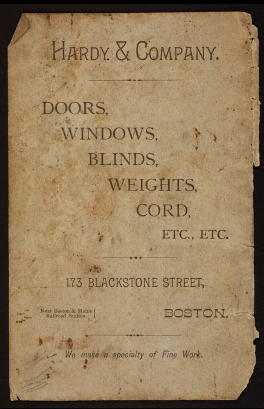
Advertisement from Historic New England
In a digitized 1882 Sanborn atlas a vague reference to an unidentified "Sash & Blind Storage, Glazing" business between 173 and 175 Blackstone Street exposed a plethora of otherwise inaccessible information about Hardy & Company, a successful retail and wholesale door, window, and blind firm. This map was a valuable resource for obtaining and identifying specific addresses and industries within my parcel. Through use of the map, I uncovered an advertisement and business card, revealing a company move and expansion, which I later confirmed through a published business review. A subtle company description written on an 1882 map document was a foundational aspect of my research and aided in uncovering related sources.
---Emily Marino
Generational Wealth on India Square
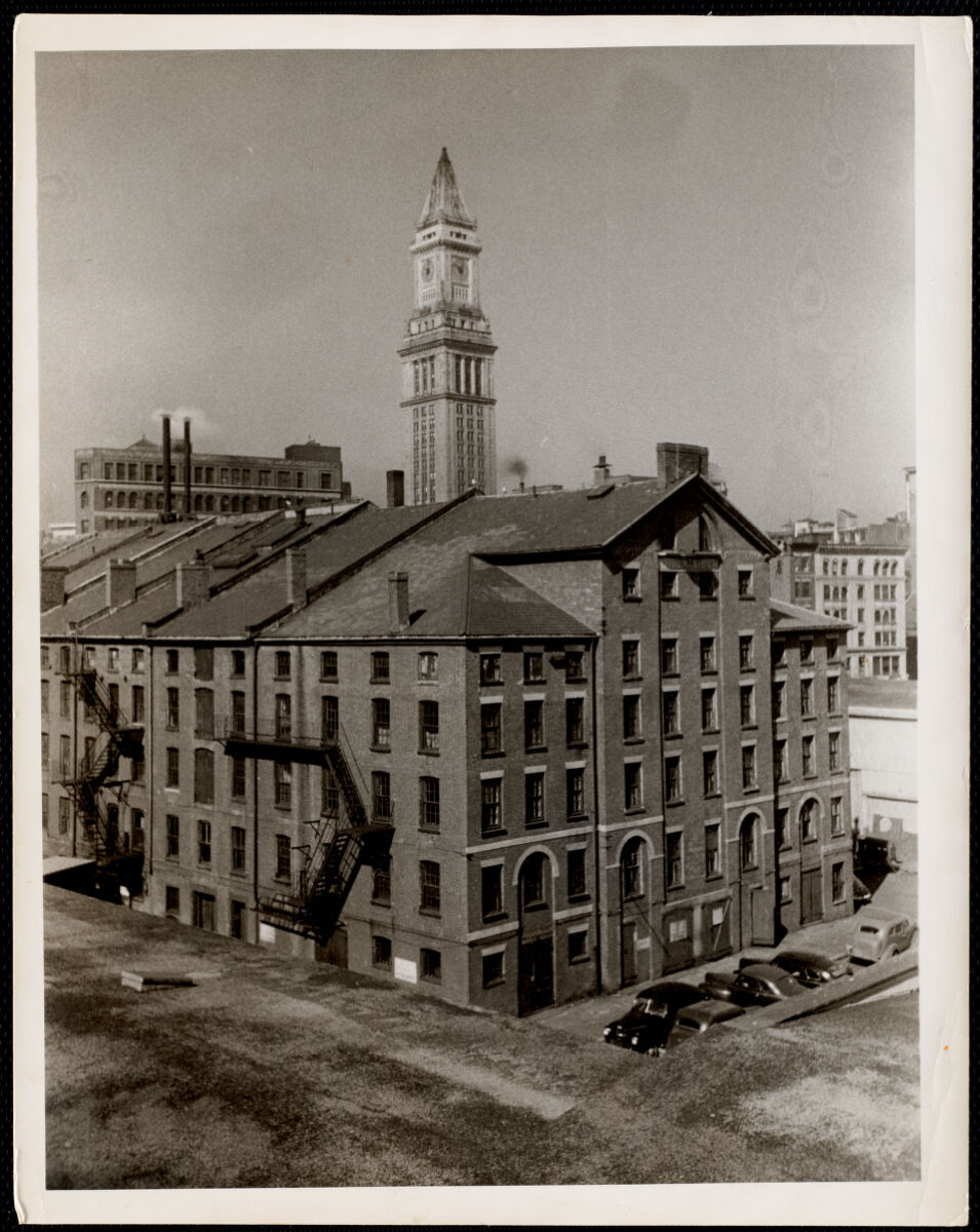
Arthur Griffin, "Old India Wharf" (ca. 1935–1955). Griffin Museum of Photography
India Square was located across from India Wharf, at the center of Boston's shipping and trade activities. The waterfront was home to warehouses, businesses and international ports that supported the region's growing economy. The 1902 Bromley atlas provided important insights into the history of property ownership on India Square. Additional research into newspaper archives and tax records revealed an interesting pattern: many prominent Boston families owned businesses located near the wharfs and often rented rooms to longshoremen working nearby. These property holdings were often passed on from one generation to the next through family trusts. The India Wharf Rats, a members-only social club for business owners, politicians, and other noted local professionals, was a prime example of such families' wealth and stature. This photograph shows the club's meeting place in the India Wharf building, where the Wharf Rats would meet to discuss business, eat, and host events.
---Kathleen McCarthy
Bustling Business in the North End
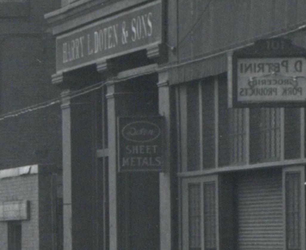
Excerpt from "Cross Street widening from North Street to Commercial Street" (November 30, 1933). City of Boston Archives
The North End historically functioned as a business hub that boosted Boston's economy and fulfilled local Bostonians' needs. Between the years of 1928 to 1938, Harry L. Doten & Sons, a metal sheet manufacturing business, functioned out of the parcel of land on 107-113 Cross Street. The owner, Harry L. Doten, even earned the title of "The Father of the Boston Steel Industry" from the Boston Globe after his 50+ years of success in the field. With the help of Atlascope and historical newspapers, I was able to piece together the success story of this business and its owner to help to re-establish the company's legacy in the North End and Boston.
---Julia Clarke
Industry on Blackstone
The parcel of land that existed on 1-22 Blackstone Street revealed itself to be a hub of various industries within the city of Boston. Companies such as Dean & Foster glassware and B.S Thompson & Co coffee producers were large companies that existed within this block. Looking at this 1882 Sanborn map one can see the presence of glass production and coffee roasting as well as other industries such as cork cutting and a canned goods factory that all existed on this parcel.
---Maggie Hartnett
Research, Impassioned
By using Atlascope to research my parcel, I was able to engage with the history of this space very directly. As I examined these maps in sequence, I not only gathered a wealth of information but also felt deeply the passage of time. Every time the parcel's structure changed drastically, I was immediately enthralled. I wanted to know what caused that change, and when it occurred. I think that research should be an exciting process, a process of discovery. Atlascope enables this passion wonderfully.
---Owen Kenney
Visit the Before Displacement project site to discover more historical investigations about the landscapes which were destroyed to make room for the Central Artery. The urban atlases featured in Atlascope also form the basis of Building Blocks: Boston Stories From Urban Atlases currently on display at the Leventhal Center's free public gallery at the Central Library in Copley Square. Building Blocks runs through August 2023.
Our articles are always free
You’ll never hit a paywall or be asked to subscribe to read our free articles. No matter who you are, our articles are free to read—in class, at home, on the train, or wherever you like. In fact, you can even reuse them under a Creative Commons CC BY-ND 2.0 license.