We recently digitized our Boston Redevelopment Authority Collection and are diving deep into one of its maps today! This map of the city of Boston and the Freedom Trail focuses on tourism and getting visitors into and around the city to see the sights. It’s a two-sided brochure with a variety of maps and other images on it that show different ways of visualizing Boston from a tourist perspective.
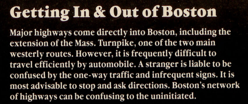
The first section of the inside is a map of Greater Boston with advice on getting in and out of the city from different directions, assuming an audience of car owners. “It is most advisable to stop and ask directions,” the creators of this map suggest. Indeed, Boston is a difficult city to navigate, and for many of us it’s hard to imagine learning how for the first time without a GPS! This map was created in 1982, though, a time when oral, pre-written, and physical map directions would have to suffice without real-time adjustments or reminders of when to turn.
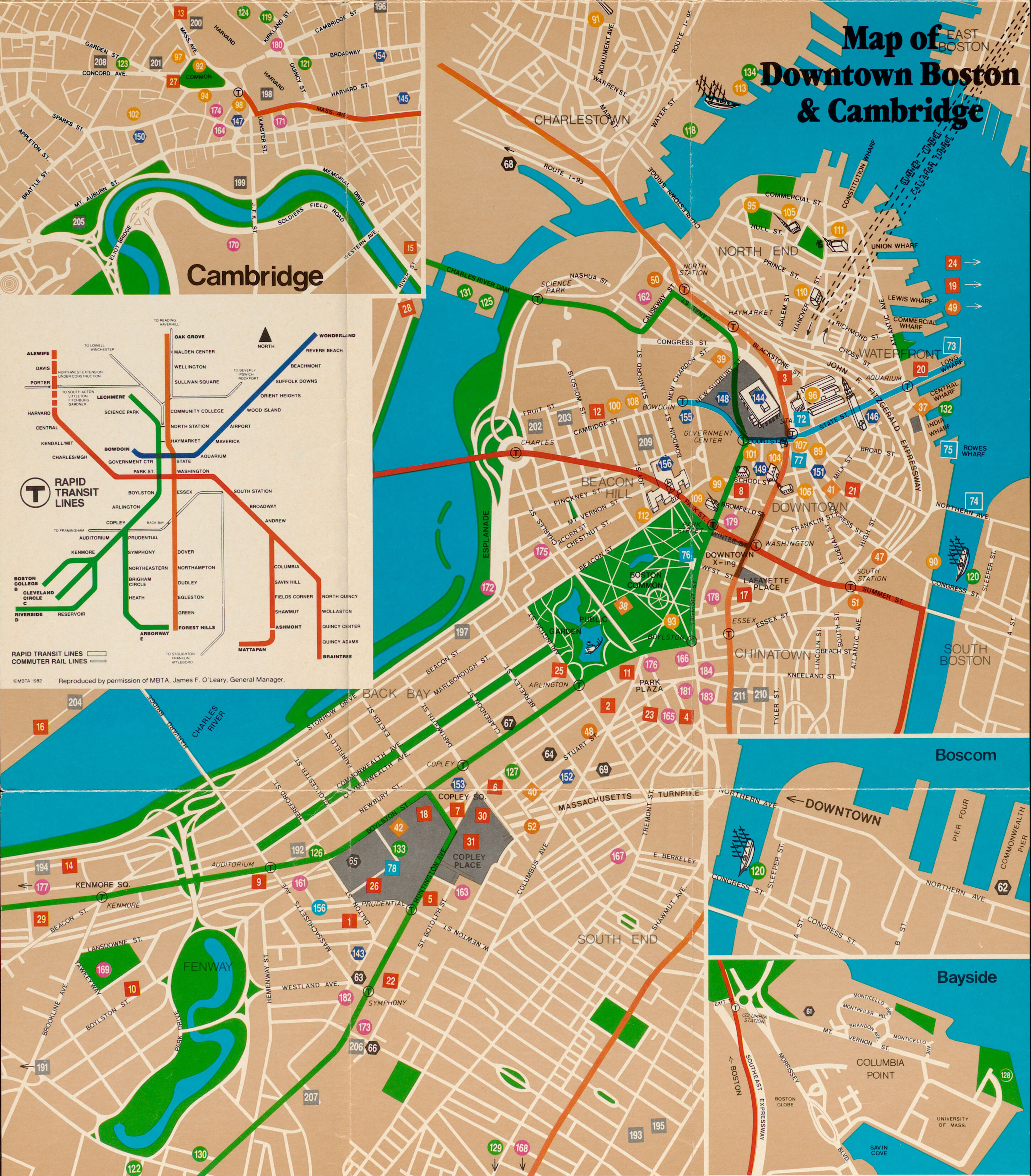
Once you arrive in Boston, the map provided for you by the creators of this brochure is a city map. There are two ways to look at the map of the public transit system. One is the larger map traced directly on top of the street map, which shows the approximate layout of the actual train tunnels and tracks through the city. The other way to visualize the T is the more abstracted map we see in the inset, which is very similar to today’s T map.
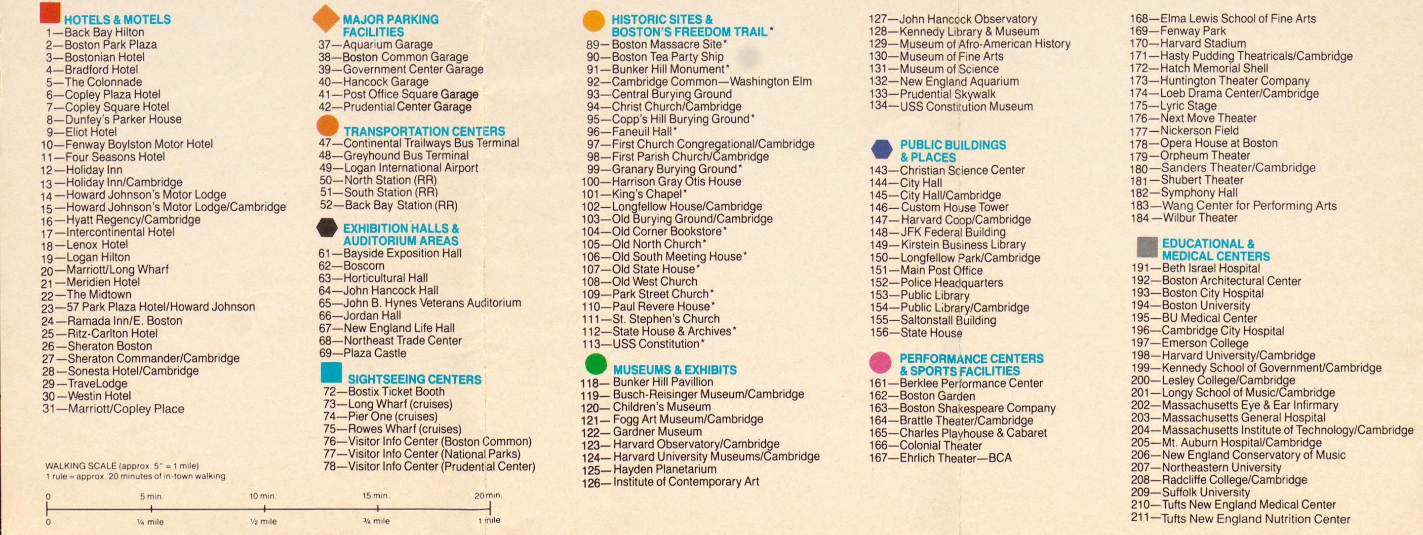
Another clue that this map would have been primarily used for tourists and visitors is the presence of numbered landmarks scattered across the landscape. These represent a variety of amenities, notably including parking, as well as historic sites, hotels, sports and performance locations, and more.
The other side of the brochure is actually the outside, which the intended user of this map would have seen first. It’s got a photo and title on the front, a list of several “off the Freedom Trail” sites on the back, and a map of the trail as the first page when someone opened it up.
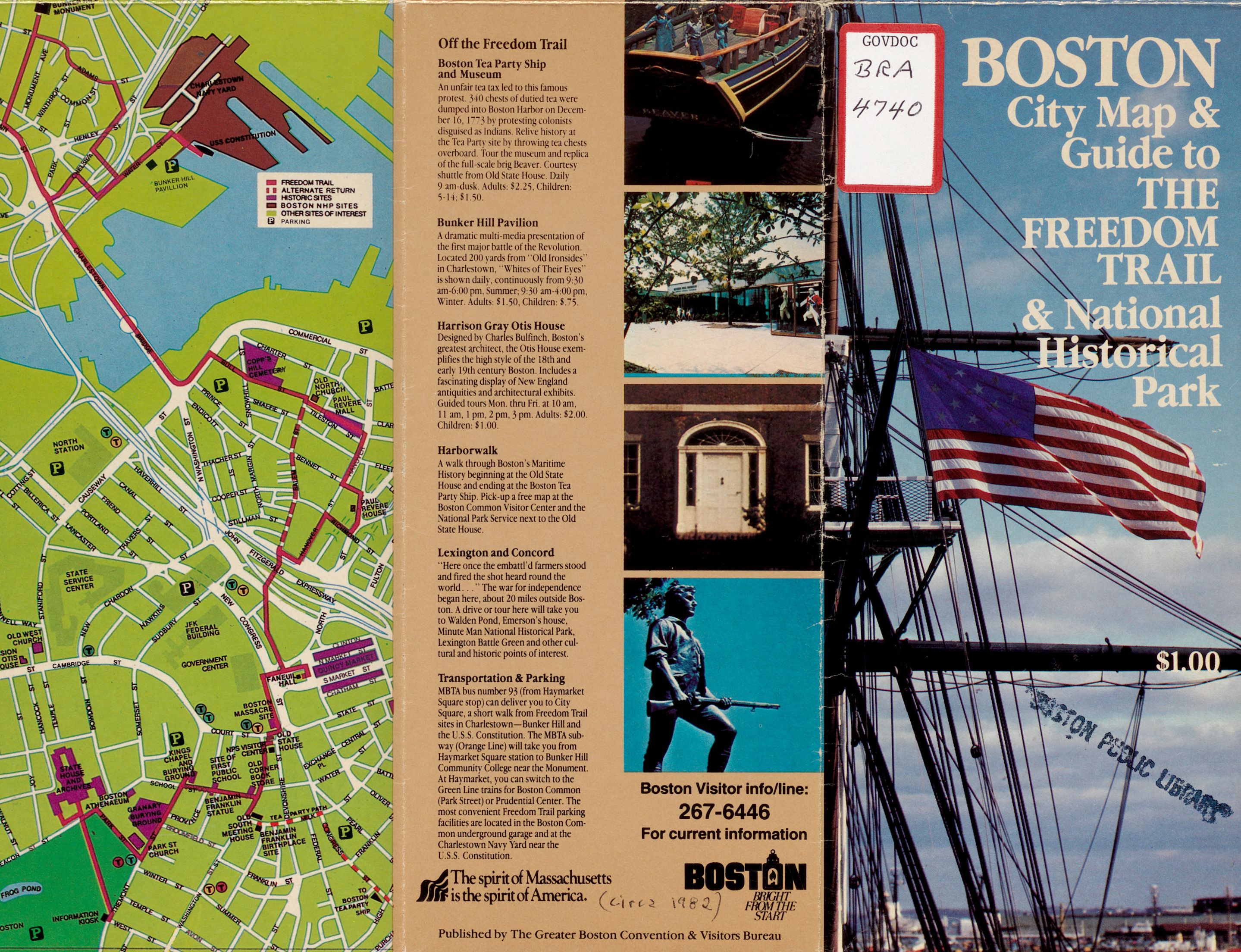
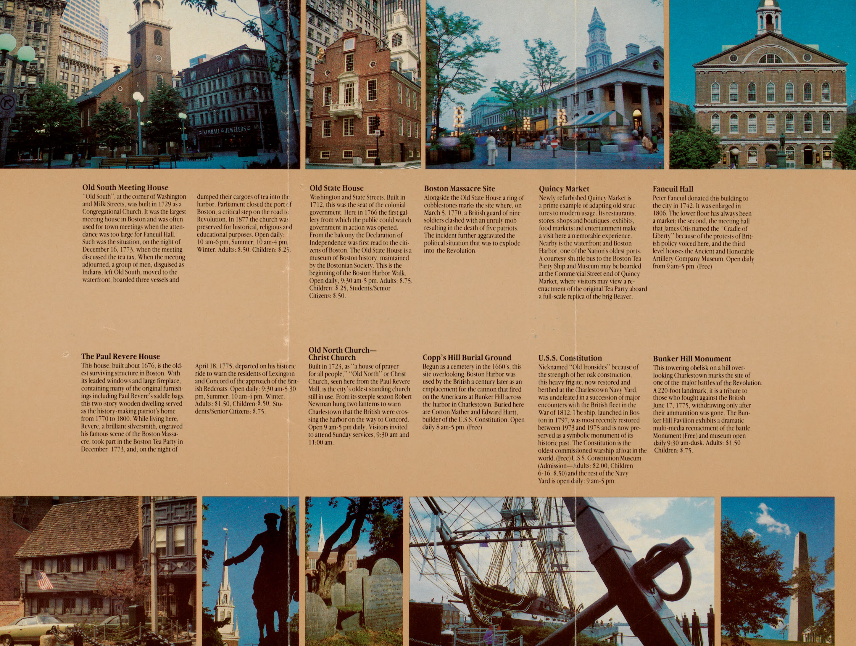
Once it opens up all the way horizontally, there are photographs and descriptions of the sites on the trail, in the order that they appear along the trail in real life.
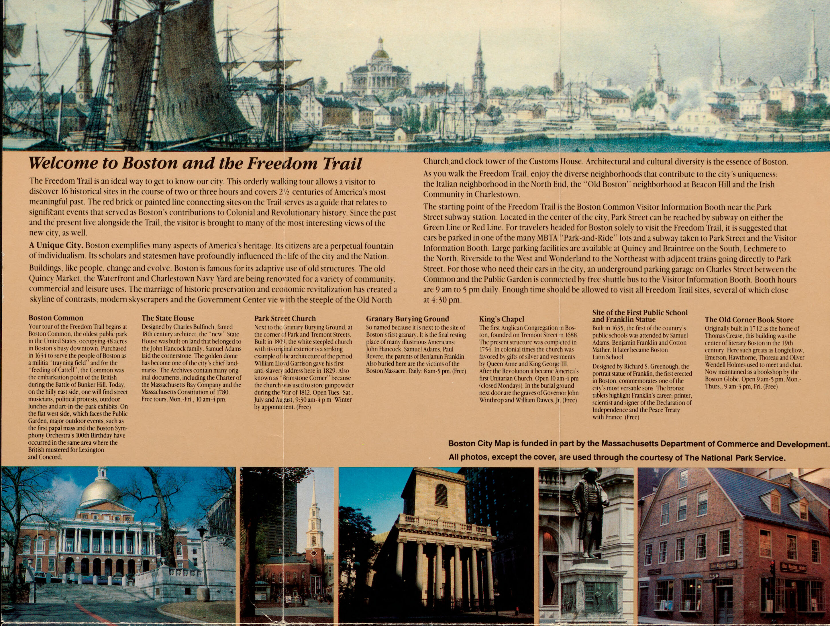
This text listing of stops is just a different way of mapping the Freedom Trail from a standard street map!
If you like exploring the history of Boston and maps, we have a couple of events coming up just for you. One is a special interactive event we’re holding next week, Wednesday, March 10 at 7 PM, where we are inviting you to select your own favorite maps from the BRA Collection and bring them to a Map Show & Tell! At this informal gathering, you can tell us what piques your interest in a map you’ve selected, or ask us what we know about it. Register now to join the event, which is cosponsored by Maptime Boston and the Boston Map Society.
The other event we have is a book talk by Stephen Beaucher on Tuesday, March 30 at noon (also cosponsored by the Boston Map Society). Beaucher’s new book Boston in Transit tells the story of Boston’s public transit history, from ferries, through the arrival of steam trains and fleets of electric streetcars and buses, to the creation and evolution of the MBTA.
To keep learning, join us at both events! Or, as always, get in touch for more information!
Our articles are always free
You’ll never hit a paywall or be asked to subscribe to read our free articles. No matter who you are, our articles are free to read—in class, at home, on the train, or wherever you like. In fact, you can even reuse them under a Creative Commons CC BY-ND 2.0 license.