With Atlascope—the Leventhal Center’s tool for navigating historic urban atlases—you can explore historical geography in a dynamic and interactive fashion. If you haven’t already used it, there’s no better time than now to get started:
We’re excited to share a few updates to Atlascope that will make it easier to connect the past and the present.
A new map layer for 1798, and more soon
Recently, we wrote about the process of bringing Samuel Chester Clough’s 1798 tax atlas of Boston into Atlascope. This unique research document reconstructs Boston’s cadastral geography at the time just after the American Revolution.
In collaboration with our friends at the Massachusetts Historical Society, we hope to add Clough’s maps depicting Boston in 1648 and 1676 to Atlascope next. Keep an eye out for those additions, which will launch Atlascope back in time to the seventeenth century!
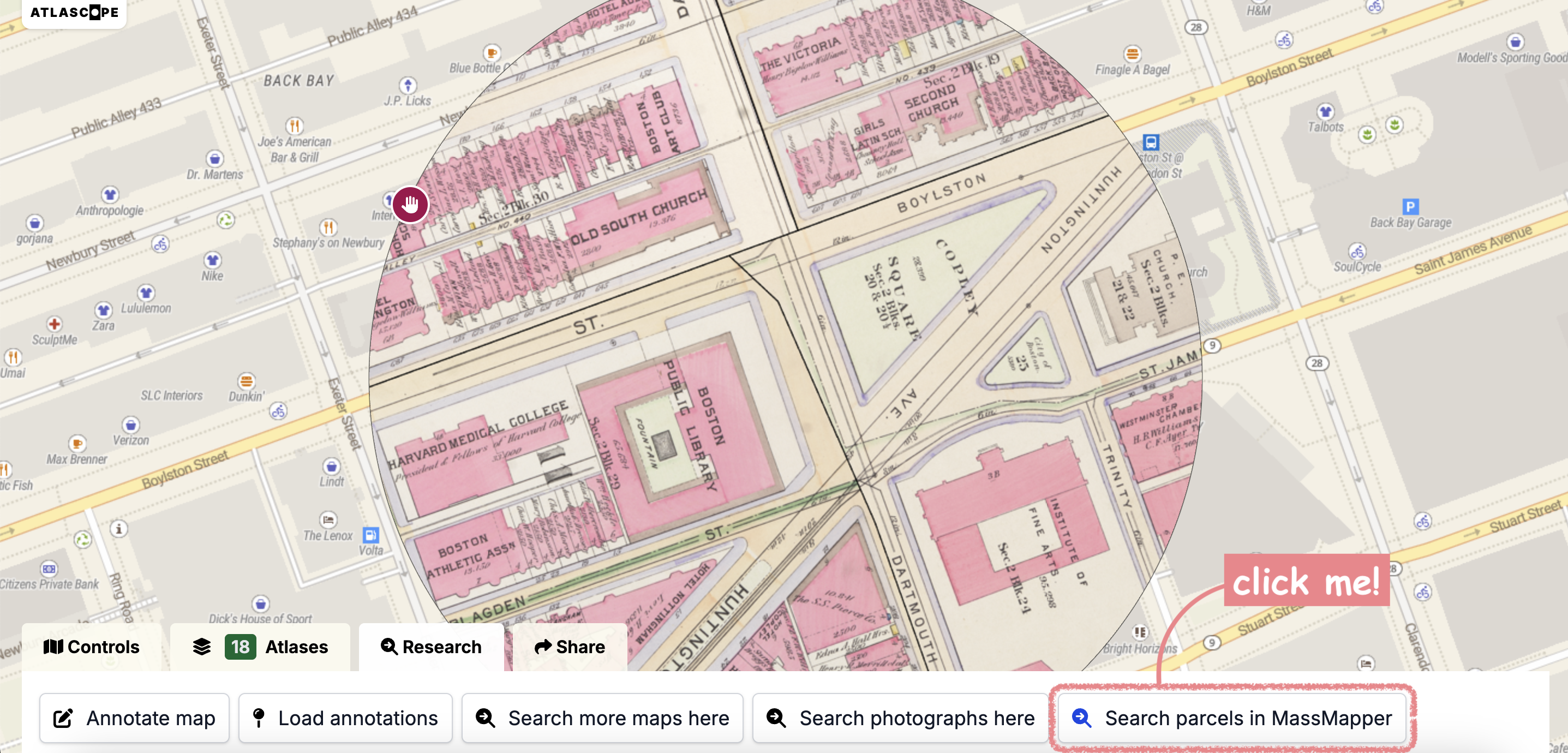
Tax parcels and aerial photos from MassGIS
Whether you’re a seasoned genealogist, a scholarly researcher, or just a Massachusetts resident who wants to learn who owned your house or apartment a hundred years ago, you can use Atlascope to connect the past with the present.
With the help of MassMapper—the flagship interactive map of Massachusetts created by MassGIS—we’ve added a new research connection in Atlascope that extends research opportunities into modern geospatial data. Now, if you select the “Research” tab on Atlascope, you can choose to “Search parcels in MassMapper” to automatically open a modern map containing detailed information on every tax parcel in Massachusetts.
MassGIS also publishes and maintains a variety of aerial imagery layers collected between 1992 and 2023. We’ve had data for 2021 and 2023 for a long time, but with our latest additions, you can compare aerial imagery throughout the entire state for the following time periods: the 1990s, 2001/2003, 2005, 2008/2009, 2015, 2021, and 2023.
We haven’t added every aerial imagery layer, but you can see the full list of MassGIS’s aerial and satellite imagery on their data layers page. If there’s a certain year that you’d really like to see listed, reach out to us.
Stay in touch
If you want to stay updated with the latest features and changes to Atlascope, don’t forget to subscribe to our newsletter. We’re also working to expand Atlascope’s coverage to more locations across the state of Massachusetts, so if you want to see a town or city that isn’t yet included in Atlascope, please drop us a line—we would love to work with you to prioritize that atlas layer’s processing and publication.
Our articles are always free
You’ll never hit a paywall or be asked to subscribe to read our free articles. No matter who you are, our articles are free to read—in class, at home, on the train, or wherever you like. In fact, you can even reuse them under a Creative Commons CC BY-ND 2.0 license.