We’re excited to welcome Julia Williams to the team as our new Communications & Gallery Coordinator. Julia is a researcher and an educator with an MA in Museum Education from Tufts University. We sat down with Julia to learn more about her interests and future work at the Center.

Julia Williams
Julia, we’re so excited to have you on board here at the Leventhal Map & Education Center. Tell us a little bit about your background—what led up to your new role with us?
Of course, I’m really excited to start! I didn’t always know that I would be working in a library or archives space, but I’ve always been interested in education.
For my undergraduate degree, I double majored in education and human development and I was particularly interested in the way education can be used to shape, inform, and uplift people at every stage of life. Libraries, museums, and gallery spaces have always been interesting to me and I realized that I wanted to work in a space where visitors had the implicit drive to learn and experience something new.
In the process of completing my graduate degree in museum education, I found myself drawn to local and natural history and how much power and connection comes from knowing more about the world and communities we inhabit. Historic cartography was rarely subjective and it reflects the individual map makers, the communities they came from, and the broader understanding people had of the world at large. I feel the LMEC embodies this connection between the natural world and the people who shape and inhabit it. What really drew me to this role was the LMEC’s commitment to inspire curiosity and learning and encourage visitors to think about their own geographic perspective on the relationship between people and places.
What is your earliest memory of maps?
My earliest memory of maps is a bit niche–it was a map of the United States made of thick cardboard that had spaces for the corresponding state edition quarter. The map was a part of this huge initiative by the U.S. Mint that introduced 5 quarters each year (from 1999 to 2008) depicting the states in the order of first to ratify the Constitution or were admitted into the Union. My two sisters and I spent years finding each state’s quarter and learning about the featured state elements, like New Hampshire’s Old Man of the Mountain or Missouri’s depiction of Lewis and Clark’s journey down the Missouri river.
I learned recently that the LMEC actually has the map that Lewis and Clark used to navigate the Missouri river during their expedition! My sisters and I were eventually able to complete the map and it exposed us to the amazing culture and significance of each state. I look to it now as an example of a great way to integrate what could be stagnant learning into something much more interactive and engaging.
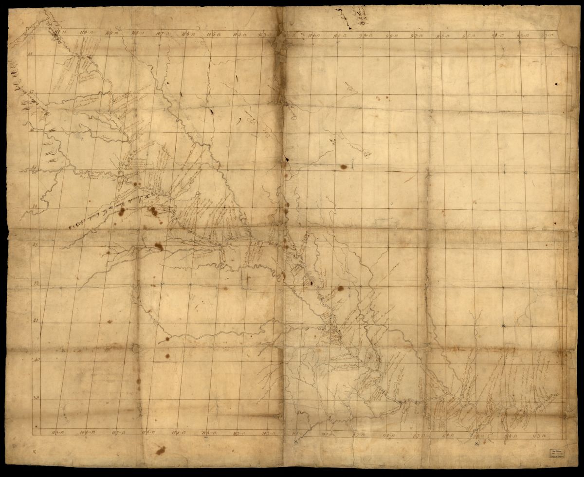
Map of Missouri River and vicinity from Saint Charles, Missouri, to Mandan villages of North Dakota (1798)
You’ll be spending lots of your day thinking about our public gallery. Right now, Getting Around Town is entering its sixth month in our gallery. Do you have any favorite parts of that exhibition so far?
Ooo, that’s a hard one! I’d have to say my favorite part of the exhibition is the large, center table display. I love how it focuses on the user-experience of public transit and what would have been involved in trying to navigate those systems. From private transportation companies to wallet-sized maps of the T, I think it’s a very insightful look into how Boston was presented to and understood by the public. I think it also shows a bit of the potential clash between cartographic professionals and the general public. It was one of our gallery attendants that pointed out to me how transit maps that included time tables may have been a good idea, but were actually impractical for daily use unless everything is running according to schedule - which we know is rarely the case.
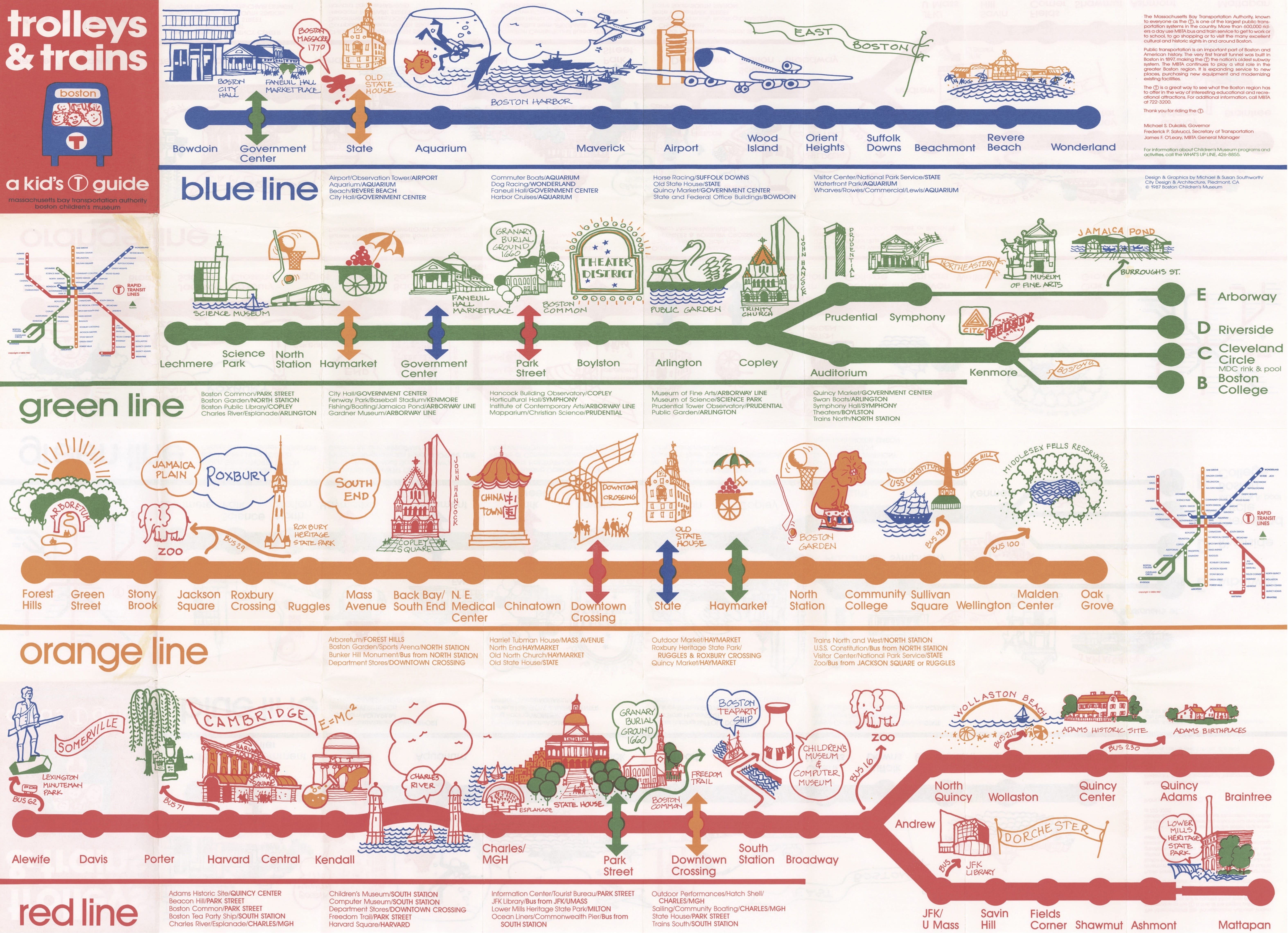
I also like the Trolleys & Trains map designed specifically for children and young users of the MBTA. I think it strikes the perfect balance between being informative and being fun. The map shows the different stops across all of the subway lines with accompanying images of standout landmarks, neighborhoods, bus and subway connections. For being so simplified, the map is super informative and easy to use - I wish they would create a modernized version for use now!
What work at the Center are you looking forward to?
I’m very excited to start working in the gallery and interacting with visitors. I formerly worked as a visitor service representative at a local natural history museum and my favorite part was interacting with all of the different visitor groups and helping people find what interested them most in the collection. I look forward to applying these past experiences to the LMEC and interacting with all of the patrons!
Do you have a favorite map that you’ve found in the collections yet?
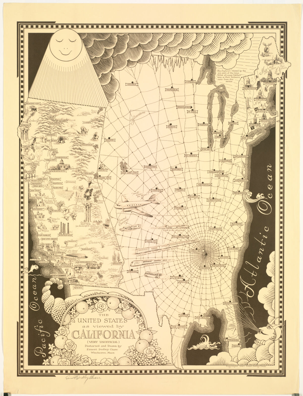
While I protest its depiction of the rest of the states a bit, I get a lot of joy from looking at the map “The United States as viewed by California (very unofficial)”. My mother grew up in California and I’ve spent a good amount of time there and I can totally see how easy it is to get lost in the beauty and allure of the state. I just think this map is so funny - the country is covered in cobwebs and clouds, the coasts to the east and south full of powerful winds and map monsters, all the while California is bathed in sunlight with happy little fish in the sea and beautiful depictions of its most important cities. I also have to give the mapmaker some credit for keeping New England intact and even allowing us some sun for half of the year! To me, this map shows that it’s ok to poke fun at a group or community’s perception of the world, especially when it’s created to clue everyone in on the joke.
Our articles are always free
You’ll never hit a paywall or be asked to subscribe to read our free articles. No matter who you are, our articles are free to read—in class, at home, on the train, or wherever you like. In fact, you can even reuse them under a Creative Commons CC BY-ND 2.0 license.