Because we’re a historical map collection, it’s easy to assume that what you’ll find in our holdings are all maps of the past—maps that document how things used to be. But maps aren't always backwards-looking. In the form of plans, maps can show how the world as it may someday become, rather than how it is or was. For instance, we sometimes ask students to figure out where the “Silver Lake” shown in this 1852 map can be found in modern Boston. It’s a trick question, because the Boston shown in this map never existed; the 1852 document is a speculative plan for Back Bay that wasn’t executed. The history of plans is therefore history of futures past—some of which became real futures, and others of which never came to pass.
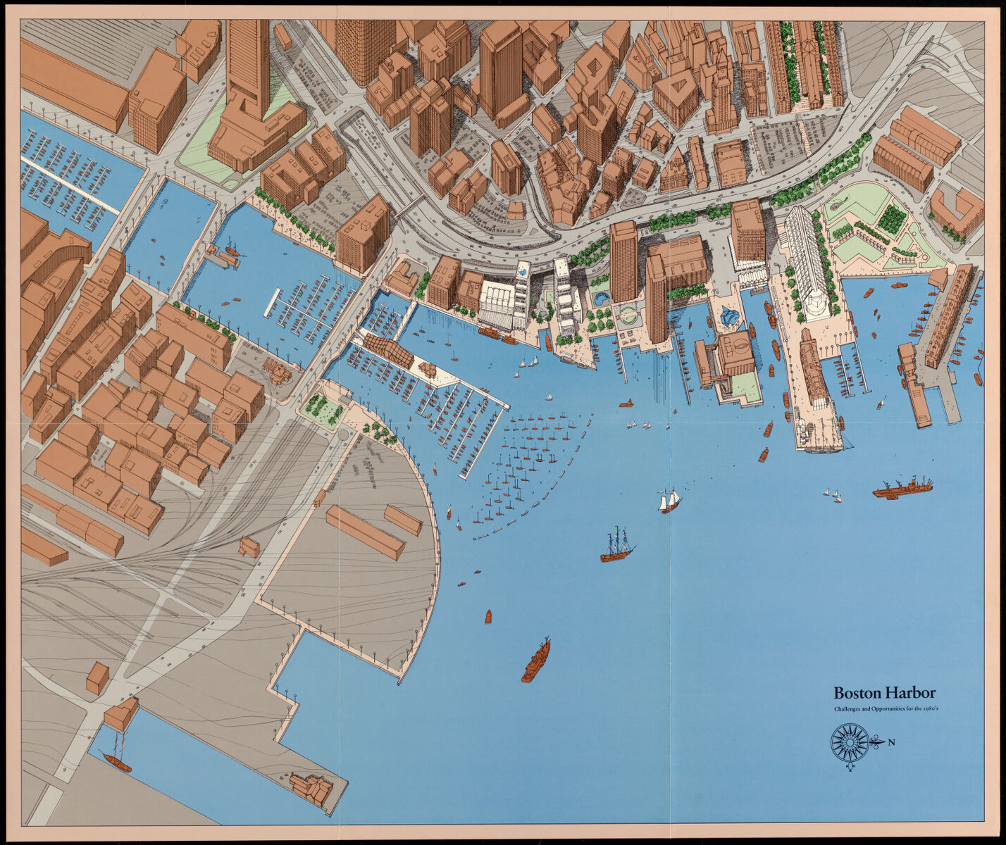
A 1979 plan of the waterfront produced by the BRA shows "challenges and opportunities"
Probably no single organization in Boston's history is responsible for producing more plans that forecast the city's future than the Boston Redevelopment Authority. Founded in 1957 at the height of the postwar boom in urban renewal, the BRA became the city's chief planning authority in 1960, and oversaw projects ranging from the mass clearance of entire neighborhoods to studies of individual buildings. Renamed the Boston Planning & Development Agency in 2016, the former BRA remains a hugely important institution in mapping Boston in the present day.
For all of those reasons and more, we’re very excited to announce the availability of 124 newly-digitized historic maps and plans from the Boston Redevelopment Authority Collection. These materials, spanning from the 1920s to the early 1990s, offer an extraordinary look into the way that municipal planners shaped not only the physical form of the City of Boston, but also its social life, economic patterns, and community characteristics as well. As examples of the history of cartography, these maps document the emergence of social-scientific methods for mapping human geography in the middle twentieth century. As records of Boston's urban history, they show how some of the most influential projects in the city's modern development, like the construction of Government Center, came to be.
<a class="btn btn-outline-primary btn-block" href="https://collections.leventhalmap.org/collections/commonwealth:7h14cv132"><i class="fas fa-eye me-2"></i> Visit the BRA Collection</a>
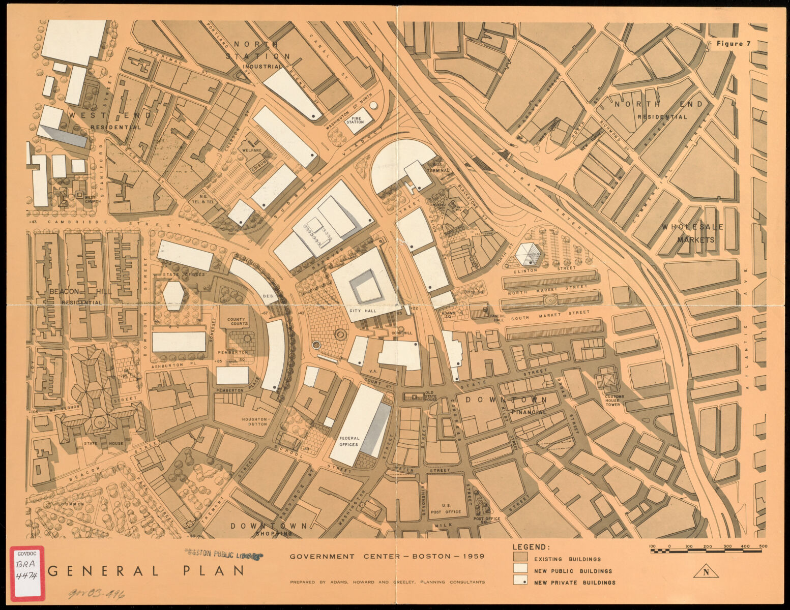
A 1959 plan showing a vision for Government Center, which would become one of the most influential BRA-led projects and symbolized the height of urban renewal in Boston
The maps in the BRA Collection also encourage us to reflect on the role of government power in the production of urban space; after all, the term authority is right there in the BRA's title. In our current exhibition Bending Lines, we show how maps exert a powerful kind of narrative authority. In fact, the BRA's ability manage how and where people lived, worked, and went about their lives was (and is) intimately related to its ability to produce maps—both the official maps which informed the planners' own work, as well as maps that circulated amongst the public, advertising and promoting the goals of redevelopment projects. That cartographic power, the symbolic representation of "top-down" authority, was part of what led the BRA into political conflict when activists and organizers felt like its perspective on the city was too distant, a story we heard more about from the historian Lizabeth Cohen in a lecture last fall.
Digitizing the collection
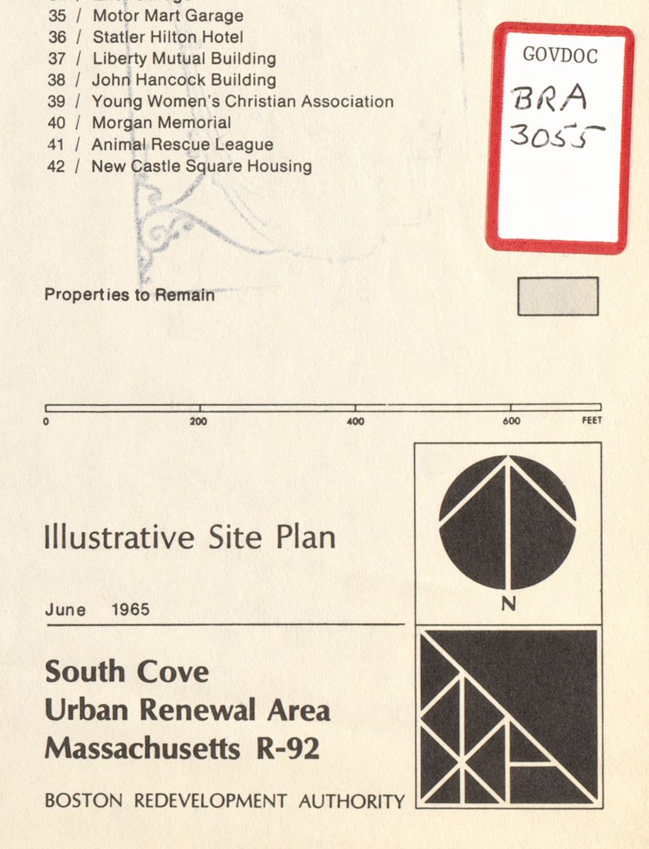
The BRA logo appears next to a Government Documents label on this excerpt from a 1965 site plan of the South Cove
The maps in this collection come from the former Boston Redevelopment Authority Library, which was obtained by Boston Public Library in the early 1990s when the BRA Library closed. The collection consists mainly of BRA publications, documents created for redevelopment projects, and items submitted to the BRA for approval. During its time at the BRA, this collection of materials covered "the many aspects of urban planning, housing, and related topics" that was useful to BRA planners and other government agencies; it also provided reference services to an international audience of institutional researchers.
Many of the BRA Library's documents and reports, which are now part of the BPL's Government Documents library, have been digitized by Internet Archive. However, the collection includes many large sheet maps that were not digitized by Internet Archive, which is optimized for digitizing bound materials and which typically photographs maps and images inside of books at a lower resolution than the imagery in our Digital Collections repository.
In an effort to expand our twentieth century and urban planning materials, LMEC is sending sheet maps from the BRA Collection to the BPL Digital Imaging Lab, which has a digitization setup for maps measuring up to 8’ x 4’. The Lab digitizes objects for the BPL well as for other Massachusetts institutions as part of the Library for the Commonwealth program. As of today, 124 objects (some of which consist of more than one map) are newly available in our Digital Collections, with more to come in the following months as we continue our digitization efforts. As with all of our Digital Collections materials, you can run filtered searches by locations, topics, and dates of creation.
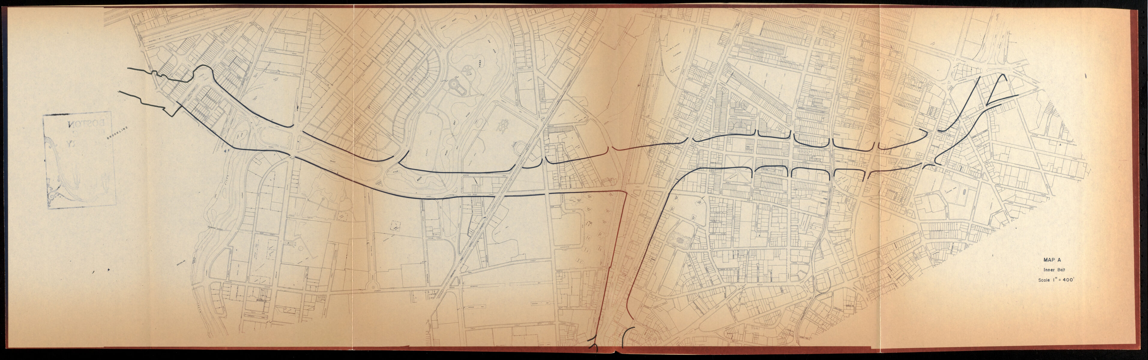
The proposed Southwest Expressway became one of the BRA's most controversial plans; this 1967 study examines the amount of displacement and property clearance that the proposed highway would have required
Urban history at LMEC
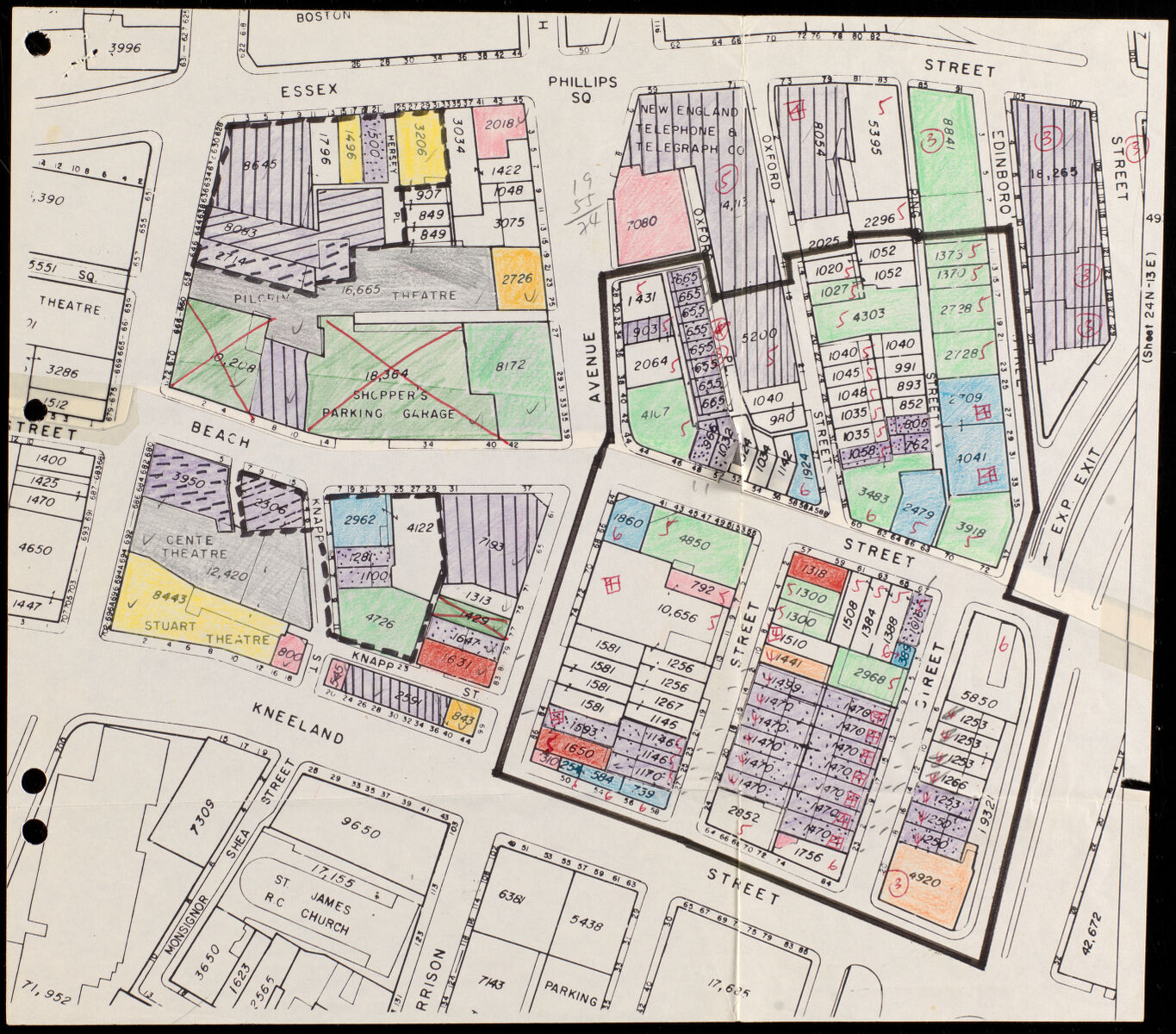
The collection includes not only published plans intended for public audiences, but also the kinds of materials that were used in the BRA's daily operations, like this study map of architectural styles in Chinatown
Urban, regional, and neighborhood history is one of the topics that is most closely connected with maps and historical geography, and it's a theme that weaves through many of our programs at the LMEC. In the past year, we’ve welcomed Lizabeth Cohen of Harvard University to talk about the career of Ed Logue, head of the BRA in the 1960s; and Amy Finstein of Holy Cross to talk about the construction (and demolition) of elevated highways in the twentieth century. In the past, we've hosted exhibitions on urban history themes like neighborhoods and parks. Our Atlascope tool offers easy access to some of the most important fine-scaled atlases for studying urban change from 1860 to 1930, and our broader Urban Maps Collection of Distinction contains thousands of maps, views, and plans of cities around the world. We showed off some of these recently in Mapping a World of Cities, a partnership with nine other digital map libraries. Our research services offer many opportunities for people interested in the history of cities, from scholars working on book manuscripts to residents of the Boston area seeking information about their own houses and neighborhoods.
What's especially exciting about the inclusion of the BRA Collection in our digital materials is that it gives us many new historic objects that relate to issues which are still very much ongoing in the present day—issues like racially-restrictive housing patterns, the financial crises that hit industrial cities during the era of suburbanization, and the struggle to provide equitable access to urban rights like a healthy environment or reliable, affordable transportation. These issues, of course, have roots in historical timelines that run far earlier than the 1920s. But they are most obviously related to the interrelated crises and opportunities that confronted deindustrializing cities from the 1950s onwards. Unfortunately, most commercially-published maps dated later than 1925 are still under copyright, meaning that we can't make them available digitally until their copyright eventually expires. But government publications generally aren't subject to the same copyright restrictions. Therefore, the BRA materials are crucial elements in representing the story of twentieth century Boston in our digital offerings.
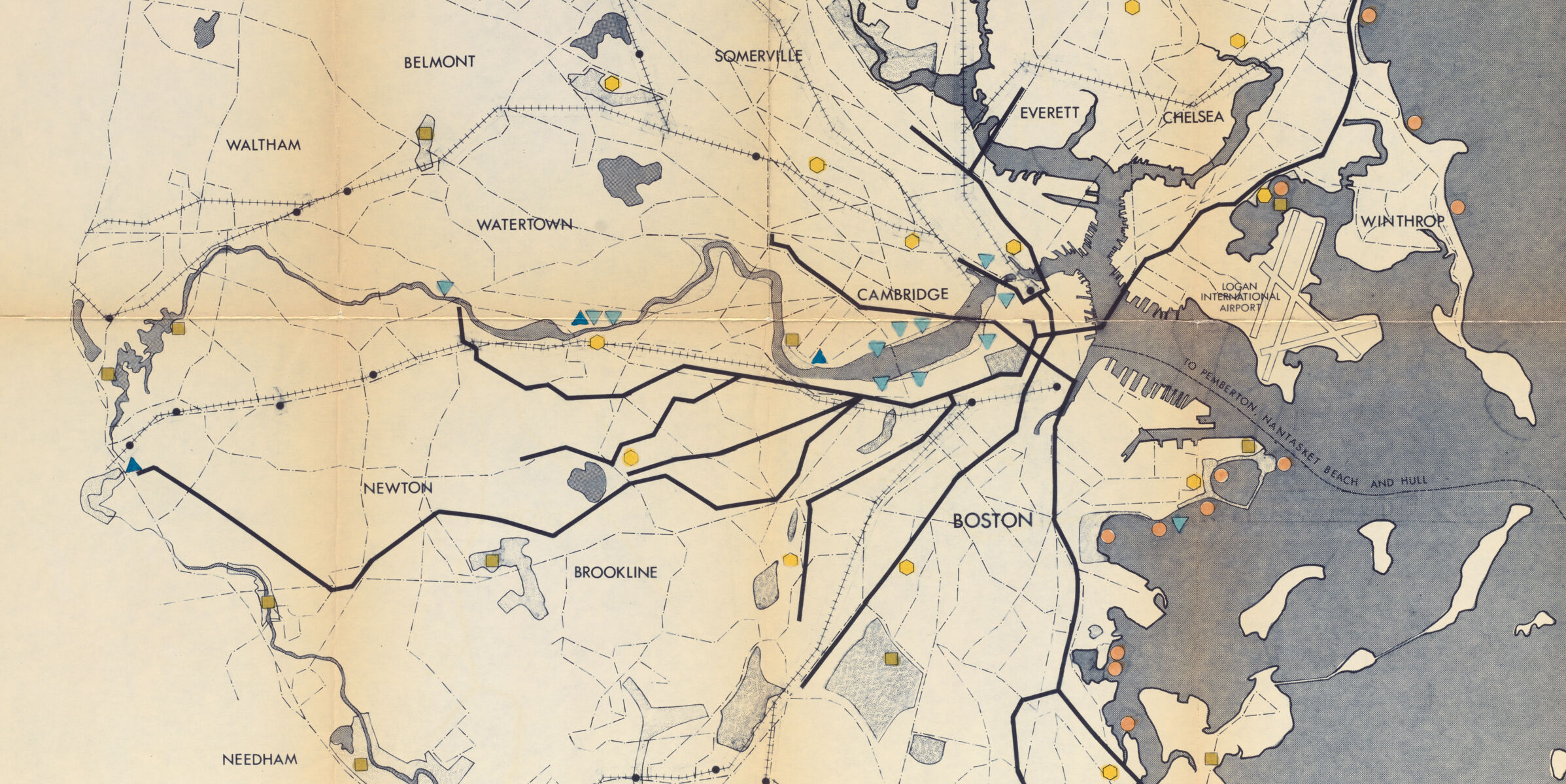
Not all of the maps in the collection were produced by the BRA itself; this 1972 study of public transit lines and recreational amenities was produced by the Department of Natural Resources
Where to find more on twentieth century Boston
Don't forget: what you can find in a digital repository almost never matches the full extent of resources which a library has in its collections! We have many thousands more materials about twentieth century Boston; you can find out more by searching our catalog or making an appointment with a research librarian. As we mentioned earlier, the BPL's collections on the Internet Archive include many scanned reports and pamphlets from the Government Documents collection, and quite a few of these include maps.
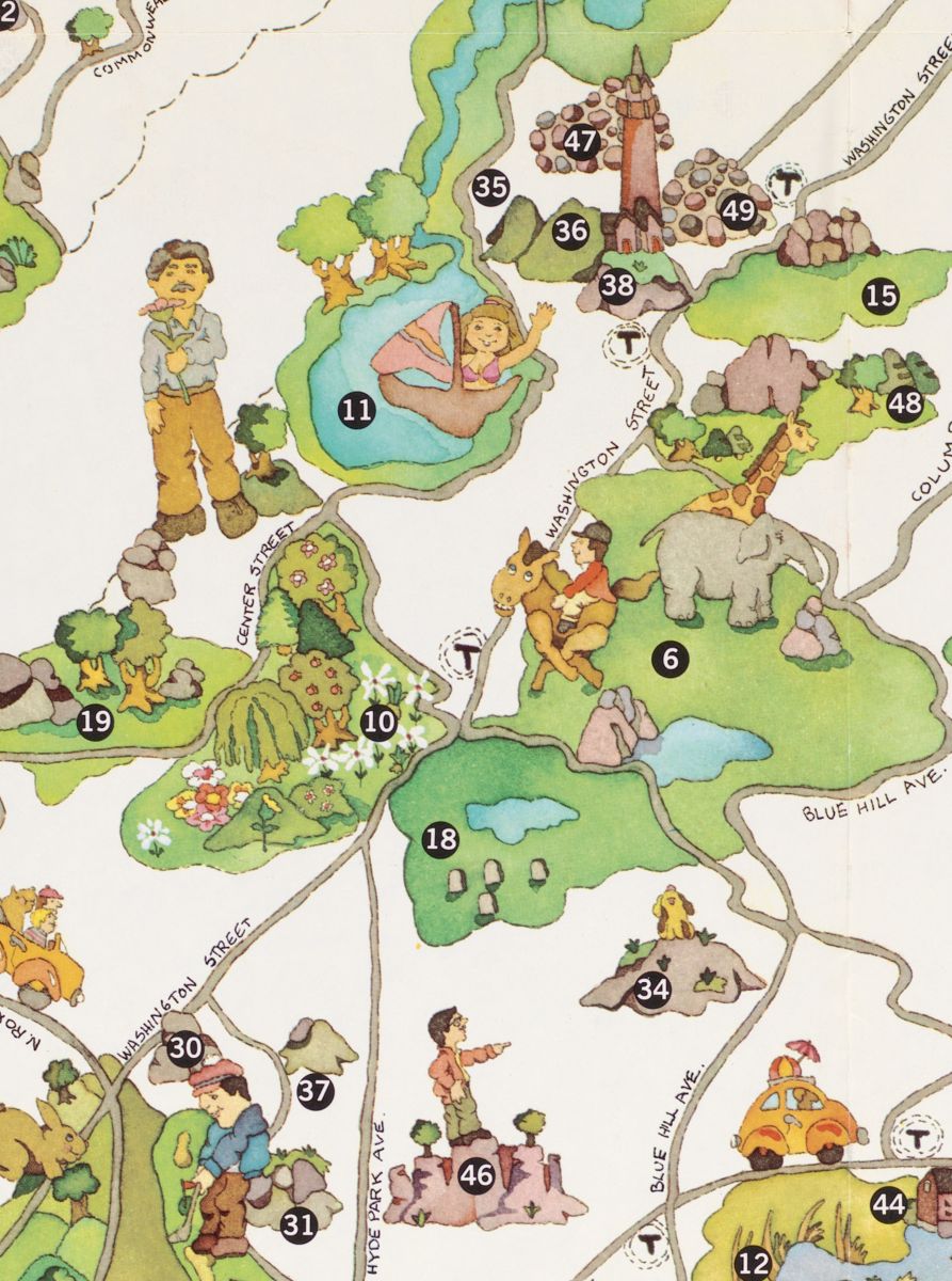
This playful pictorial map from 1976 shows Boston's "urban wilds"
Elsewhere on the web, you can also find digital collections related to twentieth century Boston at some of the following institutions:
Kevin Lynch's Perceptual Form of the City collections at MIT Libraries
Historic maps at the BPDA (the BRA's successor agency)
As we add new material into the BRA Collection, we'll be spotlighting items on our website and social media. Meanwhile, let us know what you find interesting! We make high-resolution images from our collections available on a permissive license, so we welcome you to republish them in your own blog posts, presentation slides, or research reports (don't forget to include a link back to our collections page).
Our articles are always free
You’ll never hit a paywall or be asked to subscribe to read our free articles. No matter who you are, our articles are free to read—in class, at home, on the train, or wherever you like. In fact, you can even reuse them under a Creative Commons CC BY-ND 2.0 license.