We regularly mount exhibitions in our gallery, located in the historic McKim Building the Boston Public Library in Copley Square. Exhibitions topics range from collections-centered shows on Boston bird’s eye views and women mapmakers to theme-centered shows on the American Revolution, Boston immigration, and public landscapes. All of our exhibitions feature scholarly research as well as activities for families, children, and educators.
Rotating Exhibition
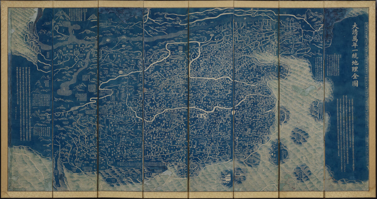
Heaven and Earth: The Blue Maps of China
May 11 – August 31, 2024
In the early decades of nineteenth-century China, two series of large-format maps, one terrestrial and one celestial, were printed in the city of Suzhou. They were printed as eight loose sheets using Prussian blue, the first large scale use of this pigment in East Asia, in the unusual manner of a rubbing from a stone-stele, resulting in most of the paper appearing in bright blue. The terrestrial maps present the realm of the Qing Empire (1644–1911) and selected surrounding regions. The four extant editions of the celestial maps, dated to 1822 and 1826, present a planisphere of all the known stars and extensive descriptions of known celestial bodies and their related celestial mechanics. This exhibition considers these two maps in the contexts of their production, consumption, and functions revealing them as unique in the global history of mapmaking.
Guest curated by Dr. Richard Pegg, Director and Curator of the MacLean Collection.
Permanent Exhibition
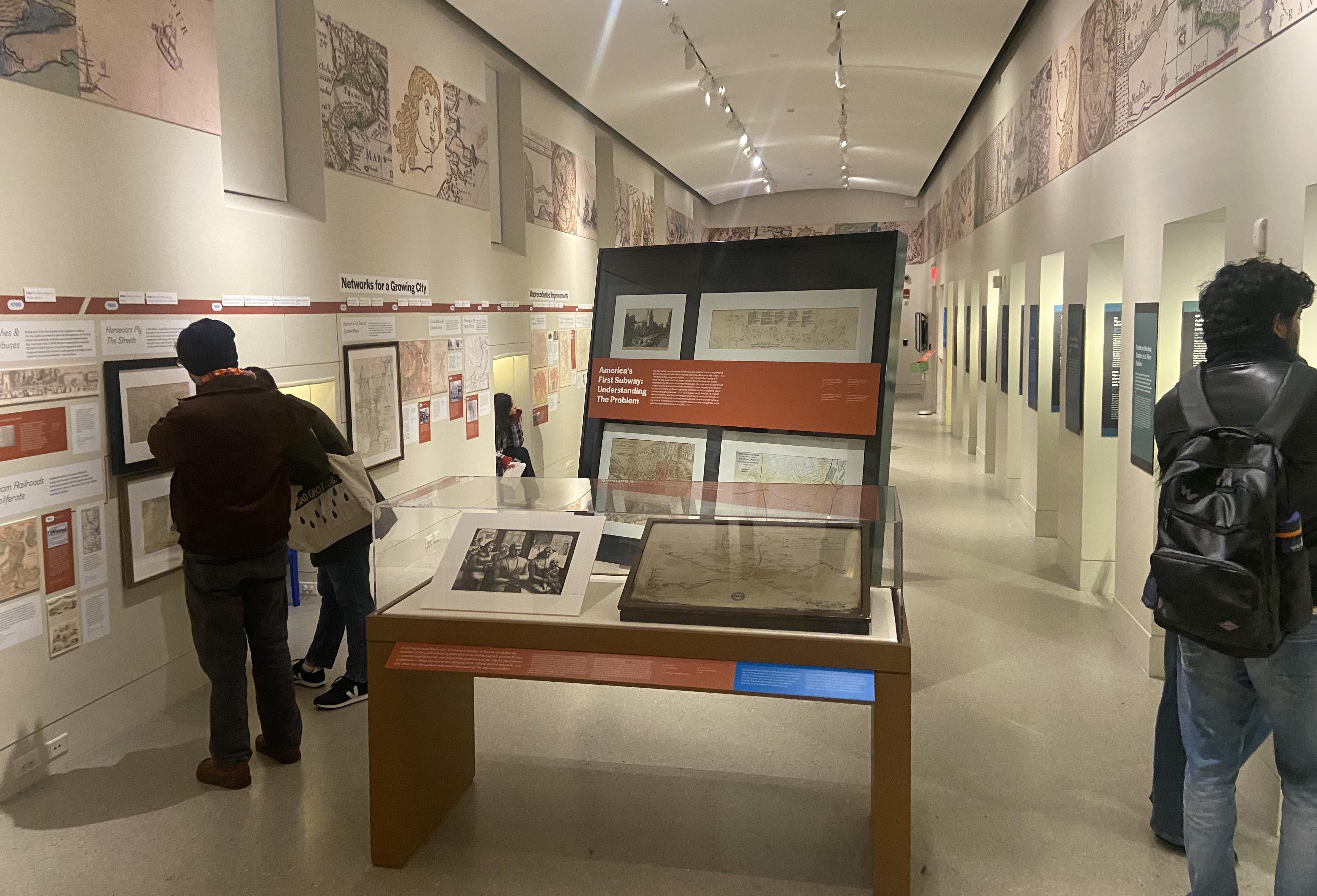
Becoming Boston: Eight Moments in the Geography of a Changing City
Enter the digital exhibition for Becoming Boston
Maps trace out the complicated history of places, and we can use them to document geography in much the same way that we can use diaries and letters to document biography. In the eight cases of this exhibition, we follow the changing spatial forms of the place we now call Boston—from before the landscape carried that name all the way through the struggles, clashes, and dreams that continue to reshape the city today. These maps don’t merely depict facts about how the city looked at different moments in its history. Instead, they invite us to contemplate how geographic forces, both natural and human, have constructed the physical and social world around us, through large and small transformations that have transpired over many centuries.
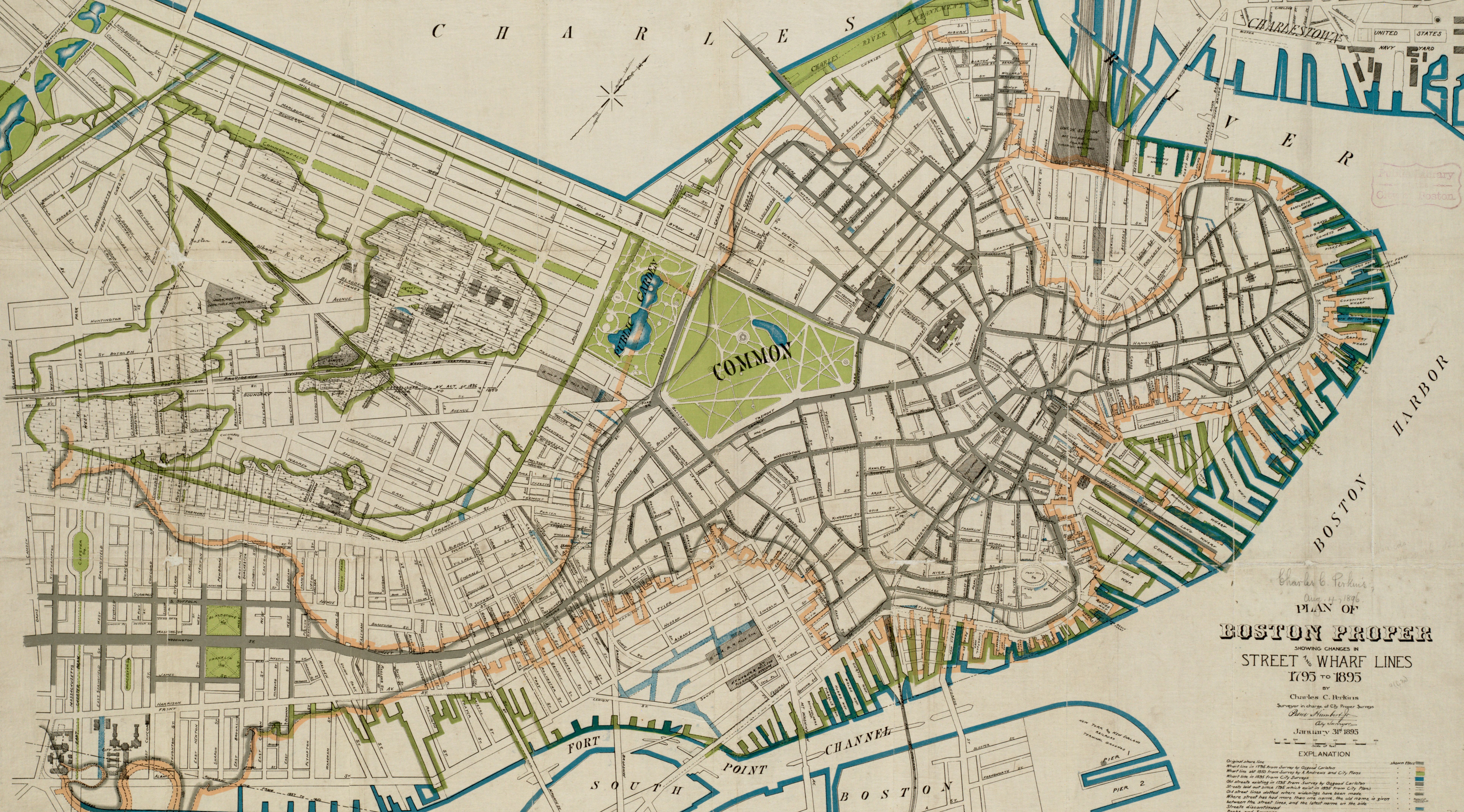
As one of the most important centers of a newly independent nation, Boston spent the first half of the nineteenth century reimagining its urban form and building neighborhoods from scratch, as seen in this 1895 map.
Upcoming Exhibitions
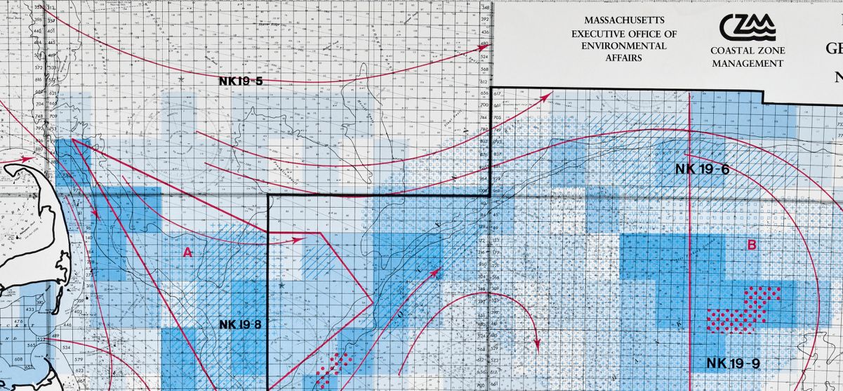
Processing Place: How Computers and Cartographers Redrew our World
September 13, 2024 – March 2025
In the long history of mapmaking, computers are a relatively new development. In some ways, computers have fundamentally changed how cartographers create, interpret, and share spatial data; in others, they simply mark a new chapter in how people have always processed the world. This exhibition features objects from the Leventhal Center’s unique collections in the history of digital mapping to explore how computers and cartographers changed one another, particularly since the 1960s. By comparing maps made with computers to those made before and without them, the exhibition invites us to recognize the impacts of digital mapping for environmental management, law and policy, navigation, national defense, social change, and much more. Visitors will be encouraged to consider how their own understanding of geography might be translated into the encodings and digital representations that are essential to processing place with a computer.
Curated by LMEC Staff Ian Spangler and Emily Bowe
Terrains of Independence
March 2025 – January 2026
In 1775, a collision of word-historical forces, driven by ocean-spanning empires, conflicts over trade and settlement, and new ideas about society and government, came together in the spark of the American Revolution. Yet although both the causes and the consequences of the Revolution were grand in scale, the war ignited in the tinderbox of a very specific local geography: Boston and the surrounding towns of Massachusetts. Why did it happen here? The revolutionary moment was as much about places as it was about people or ideas. In and around Boston, the tensions of Britain’s colonial empire had been rising for decades before the 1770s. The commercial geography of the city and its region, zones of friction between classes and communities, and contestations over the environment all helped to create the conditions that led to an era of revolutionary upheaval in Massachusetts. In the Leventhal Map & Education Center’s exhibition Terrains of Independence, maps will offer the entrypoint to a reconsideration of the Revolutionary War through the lens of locality and place.
Curated by LMEC Head Curator Garrett Dash Nelson