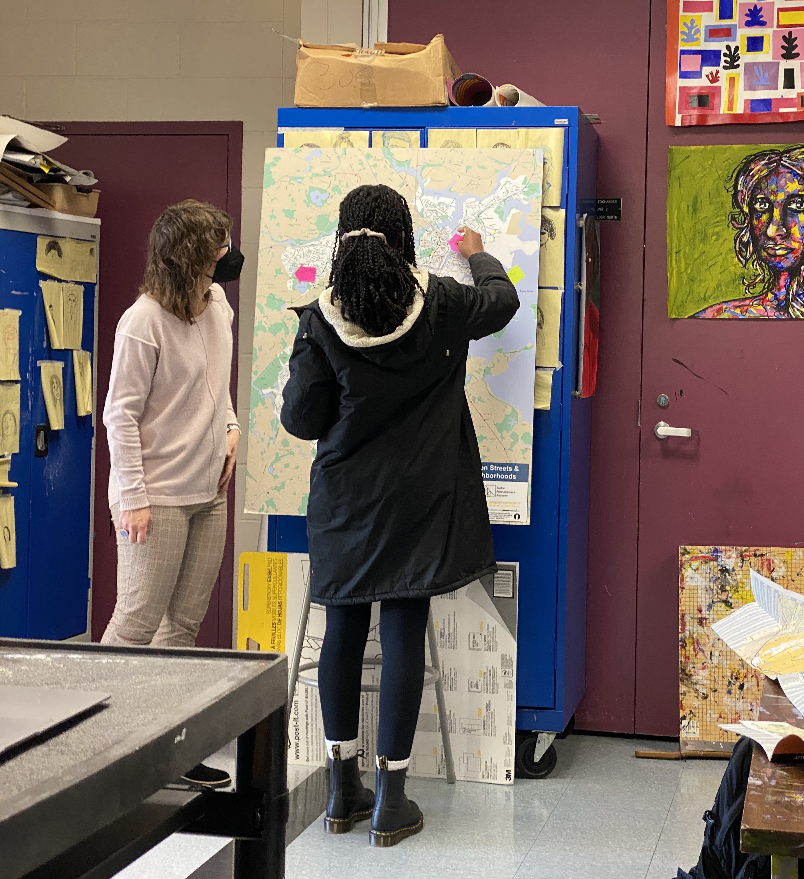
LMEC Director of Education Michelle LeBlanc stands with Margarita Muñiz Academy student while labeling a blank map of Boston.
During the first two weeks of January, the Map Center education team led a special intersession class for a small group of seniors at the Margarita Muñiz Academy, Boston’s first dual language (Spanish/English) high school. Part of our Boston Maptivisits Initiative, this class introduced students to critical map literacy as well as taught essential skills to create data maps using ArcGIS online.
Students began by mapping their city, from labeling the different neighborhoods of Boston on a blank map to creating a collaborative Google My Map showing a variety of places they go (or don’t go) in their daily lives. Students explored ideas of boundaries in Boston and created maps where they divided up the city in new ways based on their own experiences or other criteria. They also learned about the petition and successful removal of “The Emancipation Group” statue and discussed how we memorialize people and events in Boston and around the country, including the naming of their own school after educational leader Margarita Muñiz.
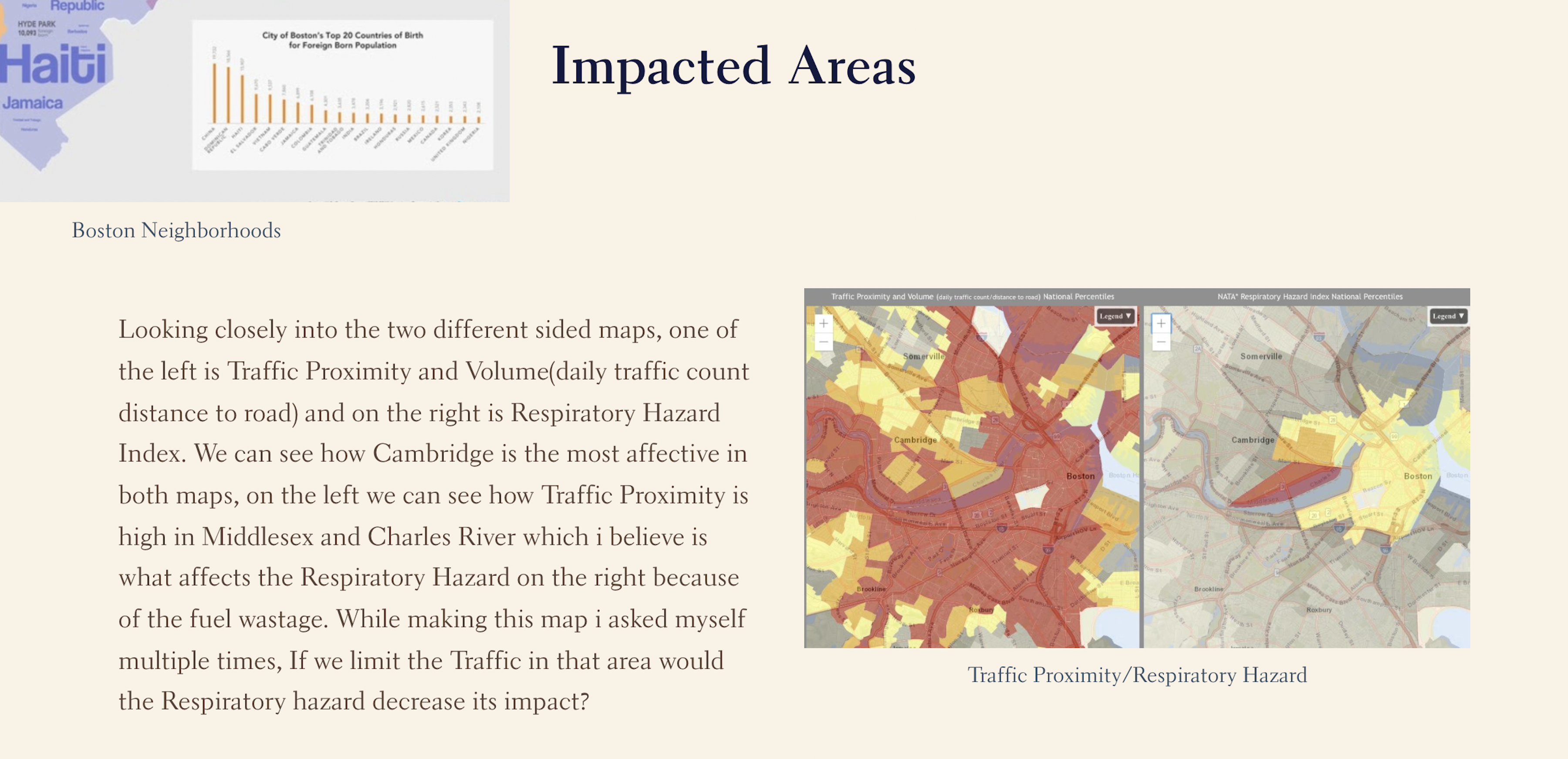
Snapshot of a student’s final Storymap exploring the relationship between Traffic Proximity and Respiratory Hazard.
For senior research projects, students are exploring concepts of nature and accessibility. The remainder of our course was dedicated to mapping demographic environmental data, using both the EPA’s EJScreen mapping tool as well as ArcGIS online. Students learned basic data visualization and created maps to add to their final Storymaps that outlined what they had explored in the class. Their work in the intersession will hopefully inform aspects of their final projects to be completed later in the spring semester.
If you want to learn more about our Maptivists initiative as well as access the Mapping our Boston lessons, check out our Maptivists page.
Our articles are always free
You’ll never hit a paywall or be asked to subscribe to read our free articles. No matter who you are, our articles are free to read—in class, at home, on the train, or wherever you like. In fact, you can even reuse them under a Creative Commons CC BY-ND 2.0 license.