Every month, I take a close look at the maps that pop up in a search of that month’s name. For May, that search brings up an intriguing selection of historical maps from several centuries. Here’s a look at a few favorites.
Beyond the Blew-hills
![James Blake and Frederic Endicott, A map or plot of the twenty-five divisions of land… (1895 [1730])](https://iiif.digitalcommonwealth.org/iiif/2/commonwealth:js956j089/full/,1200/0/default.jpg)
James Blake and Frederic Endicott, A map or plot of the twenty-five divisions of land… (1895 [1730])
This map is of a portion of Stoughton that was formerly Dorchester. It’s an 1895 copy of a much earlier, May 8th, 1730 map originally by James Blake (no, not that James Blake). The plot has a lot of text on it explaining how the lots on it are numbered and how to use it. It’s also littered with compass roses showing that the map is oriented with south at the top.
We Love May
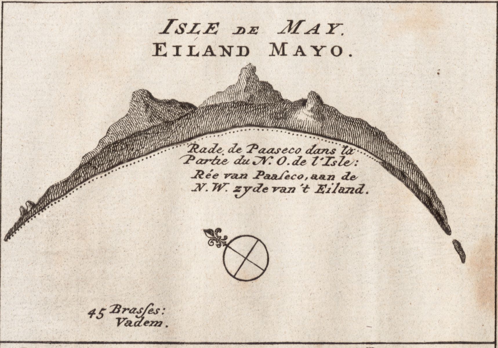
Jacobus van der Schley, abbé Prévost, and Peter Abraham De Hondt, Isle de May… (1747)
Here’s a quarter of a map we have of the Cape Verdean Islands from 1747. This view shows Maio, one of the Sotavento Islands. The map is oriented to show a harbor on the northwest side of the island rather than a top-down view of the island. Maio is actually a roughly oval-shaped, not crescent-shaped.
Lost Lands
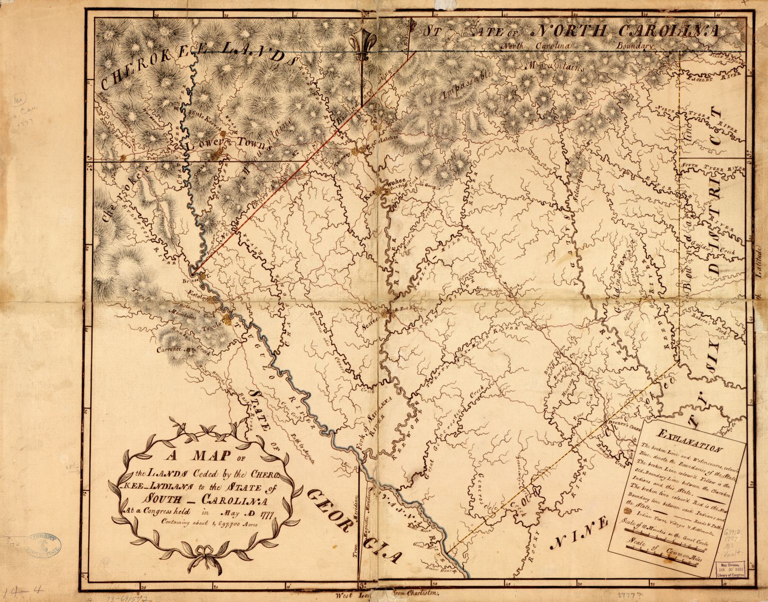
A Map of the lands ceded by the Cherokee Indians to the State of South-Carolina (1777)
This is a manuscript map of lands “ceded” by the Cherokee to South Carolina in May of 1777. Cession is a loaded term in American history. From our America Transformed exhibit:
“Cede” is a very gentle term to describe a deeply violent, forced, and uneasy process. As Native groups suffered losses from epidemics and the destruction of their food sources, they relinquished their lands to the U.S. government, often as a final resort. Native groups were forced to relocate from their homelands, either by treaty or executive orders promising them abundant resources in exchange for territory – none of which were fully realized.
Chris Newell (Passamaquoddy); endawnis Spears (Navajo, Ojibwe, Chickasaw, Choctaw); Dr. Jason Mancini Ph.D. Akomawt Educational Initiative
Great Fires
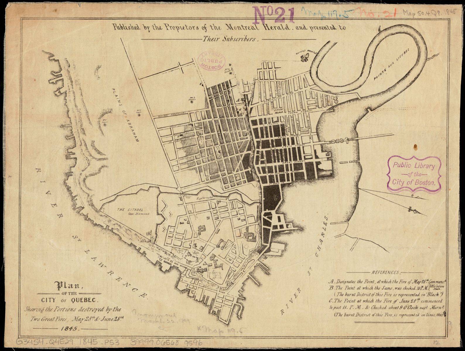
Plan of the city of Quebec (1845)
Two fires took place in Quebec City a month apart from each other in 1845: one on May 28th, and the next on June 28th. The black area on this map shows the burned district from May, and the lighter shading is what burned in June. These fires killed at least 23 people and left at least 15,000 homeless. Like several other of the maps in this set, north is not oriented towards the top of the map. Instead, it is in the lower right corner.
May Celebrations
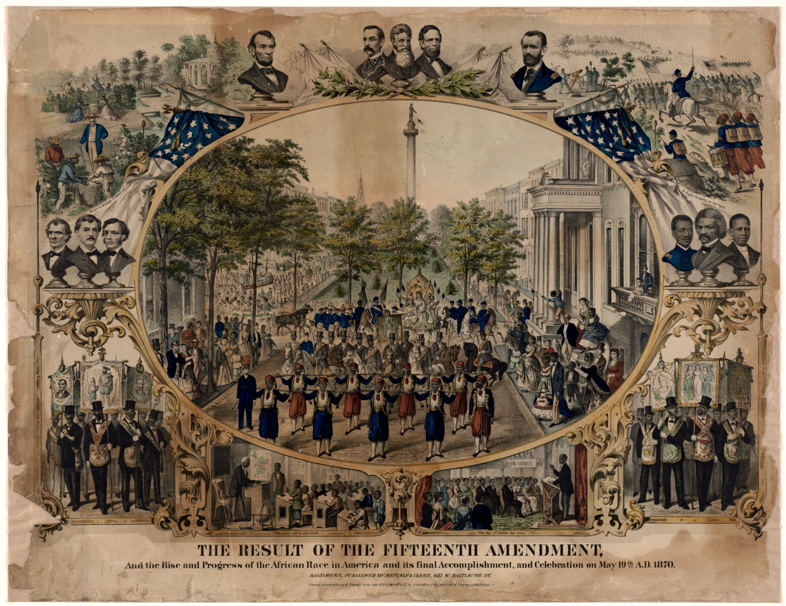
Metcalf & Clark, The result of the Fifteenth Amendment… (1870)
This 1870 lithograph depicts a celebration of the Fifteenth Amendment on May 19th of that year. The parade in the middle is surrounded by vignettes of famous figures of the time and important events in American history. While the tone of this image is celebratory, the amendment did little to practically extend voting rights to Black Americans.
An American Expo
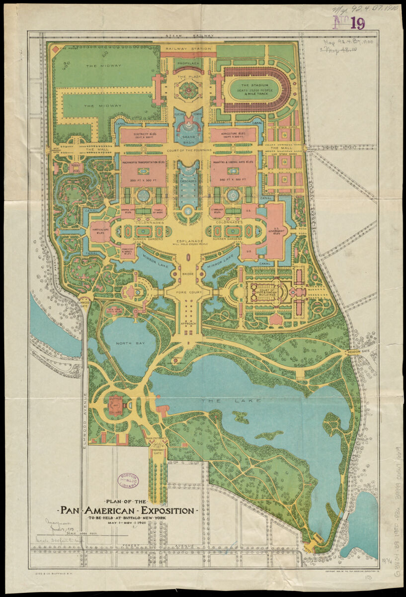
Gies & Co., Plan of the Pan-American Exposition… (1900)
Finally, here’s a beautiful map of the fairgrounds for the Pan-American Expo held in Buffalo, NY starting in May 1901. Most of the buildings on the map no longer exist, including the Temple of Music where President William McKinley was assassinated in September of that year. I recommend clicking through the link to this map and checking out the beautiful scenery! All the maps here are digitized in our collections at high resolution, and you can click any of the links to them to go to their collections page. There, you can zoom and pan as well as learn more about the items, download the images, or request to purchase reproductions.
Our articles are always free
You’ll never hit a paywall or be asked to subscribe to read our free articles. No matter who you are, our articles are free to read—in class, at home, on the train, or wherever you like. In fact, you can even reuse them under a Creative Commons CC BY-ND 2.0 license.