On June 9, we hosted From The Vault: Commodities! From The Vault is a biweekly event series showing collections objects selected by Leventhal Center staff. For this edition the series, we looked at objects that were created for or within a school environment.
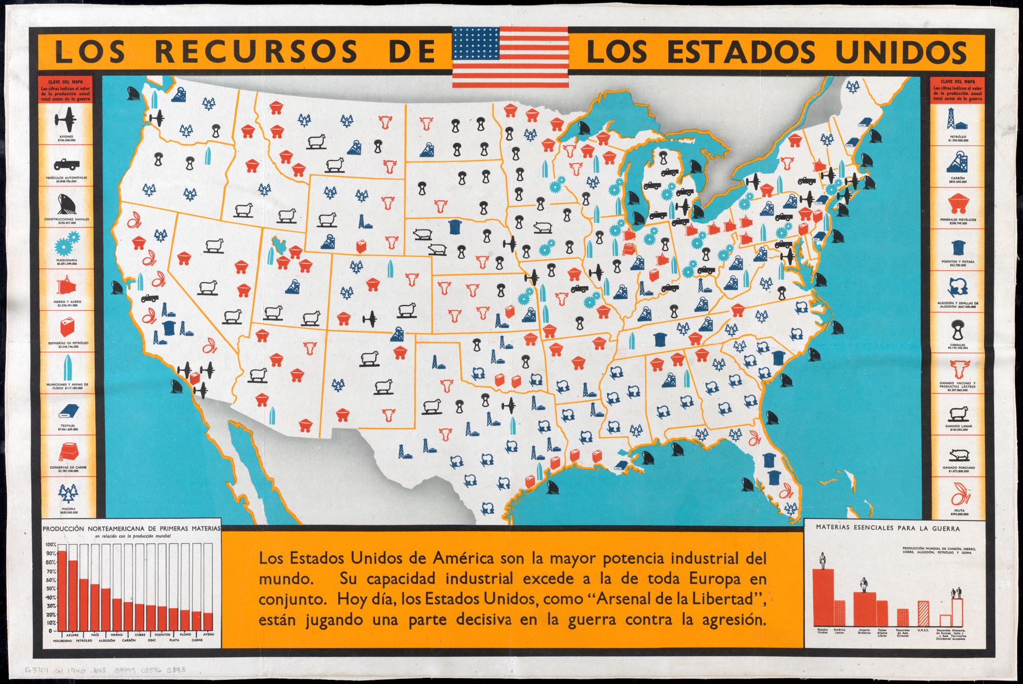
Los Recursos de los Estados Unidos (1940-1945)
This WW2-era poster depicts “The Resources of the United States” in a simple pictographic style which emphasizes the nation’s natural and industrial wealth, noticeably, entirely in Spanish. The information of the poster has a strong propaganda aspect in described the importance of the United States’ industrial wealth to the allied war effort. The text at the bottom states: “The United States of America is the greatest industrial power in the world…Today, the US, as the ‘Arsenal of Liberty’ is playing a decisive part in the war against aggression.” The resources listed range from primary commodities like coal and cotton, to manufactured commodities like textiles and airplanes. The two graphs along the bottom show the global significance of the US economy, in extent of war effort production on the right, and in the percentage of US contribution to the world’s production of key raw materials on the left.
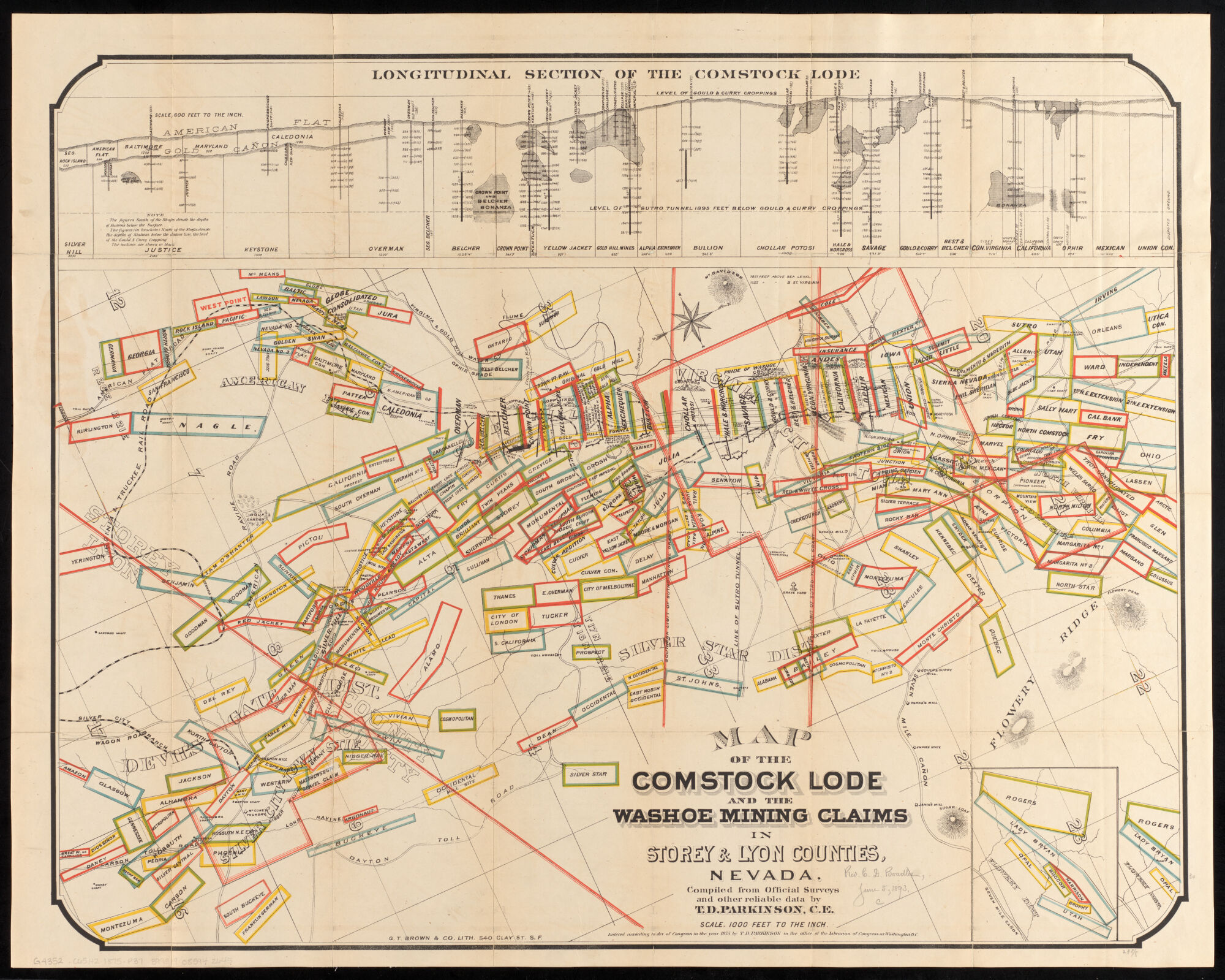
T.D. Parkinson, Map of the Comstock Lode and the Washoe Mining Claims in Storey & Lyon Counties, Nevada (1875)
The significance of the silver deposits of the Comstock Lode are visible here in the extensive mine shafts and tunnels depicted across the top of the map, as well as in the legal mining claims colorfully mapped across this portion of Nevada. The discovery of the Comstock lode, the first major deposit of silver ore in America in 1859, set off a rush of development and extraction which was a key aspect of Nevada’s quick path to statehood in 1863. A vibrant example of the close relationship between the allure and demand for resource extraction and America’s westward expansion.
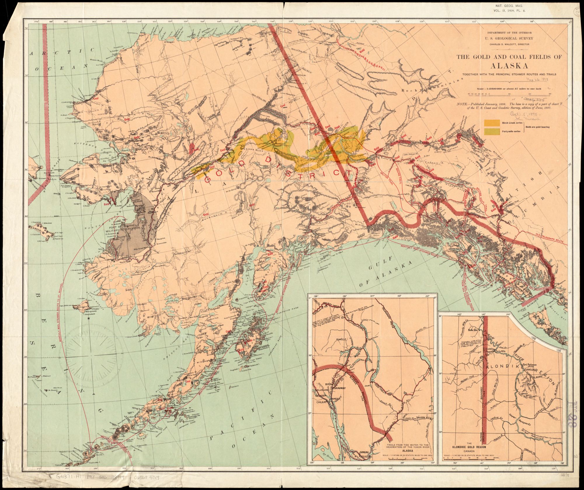
U.S. Geological Survey, The Gold and Coal Fields of Alaska: Together with the Principal Steamer Routes and Trails (1898)
This map, produced by the U.S. Geological Survey, depicts a pivotal moment in the history of resource extraction in Alaska and Canada’s Yukon Region. The well-known Klondike Gold Rush, which began in 1896, involved the frenzied migration of nearly 100,000 prospectors in search of fortune to the Klondike region close to the Alaska-Canada border. The main routes taken by prospectors are both visible in this map: the all-water route traveling east along the Yukon river and across almost all of Alaska, and the primarily land-based trails sprawling up from the Alaskan Panhandle. The excitement of the Klondike Gold Rush was in decline by 1898, but the infrastructure and interest which it spawned are represented here by the US Department of the Interior’s desire to chart Alaska’s resource wealth. Notably, an equal focus is placed on Alaska’s considerable coal reserves, a commodity of strategic importance for a rapidly industrializing nation, which as of the present has yet to be extensively exploited (perhaps overshadowed by the later discovery of Alaska’s significant oil and natural gas reserves).
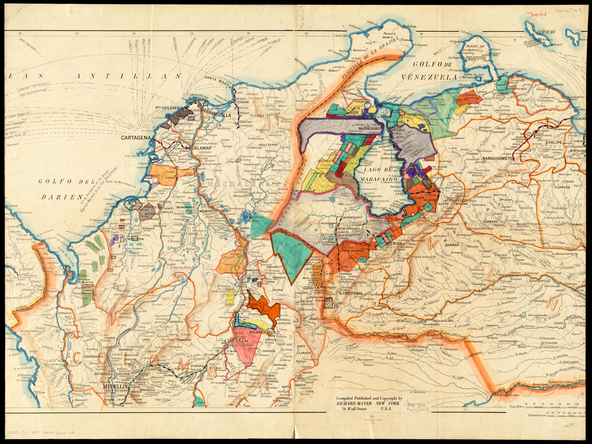
Richard Mayer (Firm), Map of Parts of Venezuela and Colombia (1910-1923)
The many multicolored demarcations which cover this map of Venezuela and Colombia give a visually striking appearance to what is an equally striking illustration of a defining moment in the history of the global petrochemical industry. Each shaded area corresponds to one of the countless companies rushing to benefit from the recent discoveries of oil in the region. The first major oil well on Lake Maracaibo [Lago de Maracaibo on the map] was drilled in 1917. By 1928 Venezuela would be the world’s largest oil producing nation. The environmental impact on the region and the local population, in addition to the critical political significance of oil dependency on the history of the Venezuelan state, both stem in part from the frenzied rush of foreign capital captured here, which initiated oil extraction in the region. In the key, listing implicated companies by country, some familiar names are visible operating in Venezuela, such as subsidiaries of John D. Rockefeller’s Standard Oil Company (in cyan), as well as the Sun Oil Co. (in orange) which co-owned and operated the Beacon Oil Refinery in Everett, MA, famous for its almost perennial industrial accidents throughout the 1920s.
Our articles are always free
You’ll never hit a paywall or be asked to subscribe to read our free articles. No matter who you are, our articles are free to read—in class, at home, on the train, or wherever you like. In fact, you can even reuse them under a Creative Commons CC BY-ND 2.0 license.