On August 4, we hosted From The Vault: New Acquisitions! From The Vault is a biweekly event series showing collections objects selected by Map Center staff. For this edition of the series, we looked at a handful of new additions to our digital collections!
Erwin Raisz, A canoeist’s guide to New England’s rivers (1935)
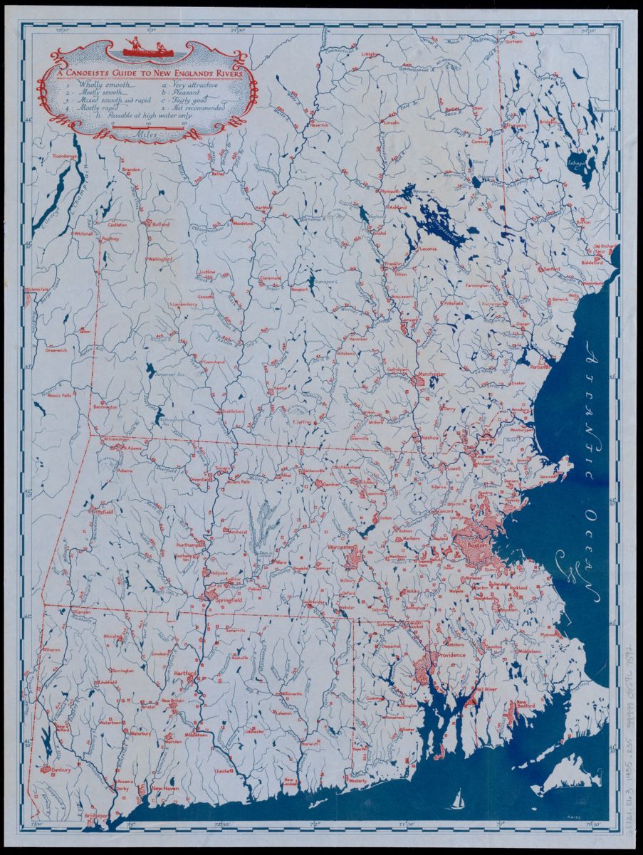
Care for a canoe ride? This 1935 map details 164 rivers and streams across New England and ranks each on a scale from smooth to rapid. (Boston’s Charles River is deemed “wholly smooth” and “pleasant.”) The first ever published guide to New England whitewater, it includes sections on history, gear, technique, river descriptions and was considered “the bible for New England boaters” for over thirty years.
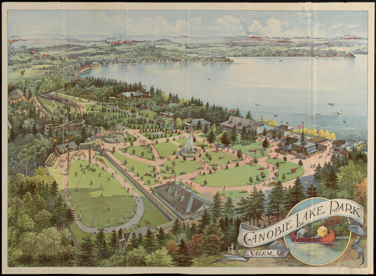
Walker Lith. & Pub. Co. and Massachusetts Northeastern Street Railway Company, Canobie Lake Park, Salem N.H. (1912)
In 1902, the Hudson, Pelham & Salem Railways (HP&S) opened Canobie Lake Park as a pleasure resort to generate more business for its new trolley line to Salem. In its early years, the park was known for its flower gardens, promenades and gentle attractions like canoeing, sporting events, the Circle Swing, picnics, and the Penny Arcade. In the 1920s, however, trolley ridership declined significantly, the Salem line was forced to close in 1929, and the park went out of business soon after. It didn’t stay closed for long, though! The park reopened in 1932 with new attractions and modern electricity. Today, Canobie Lake Park has over 85 rides, games, and attractions.
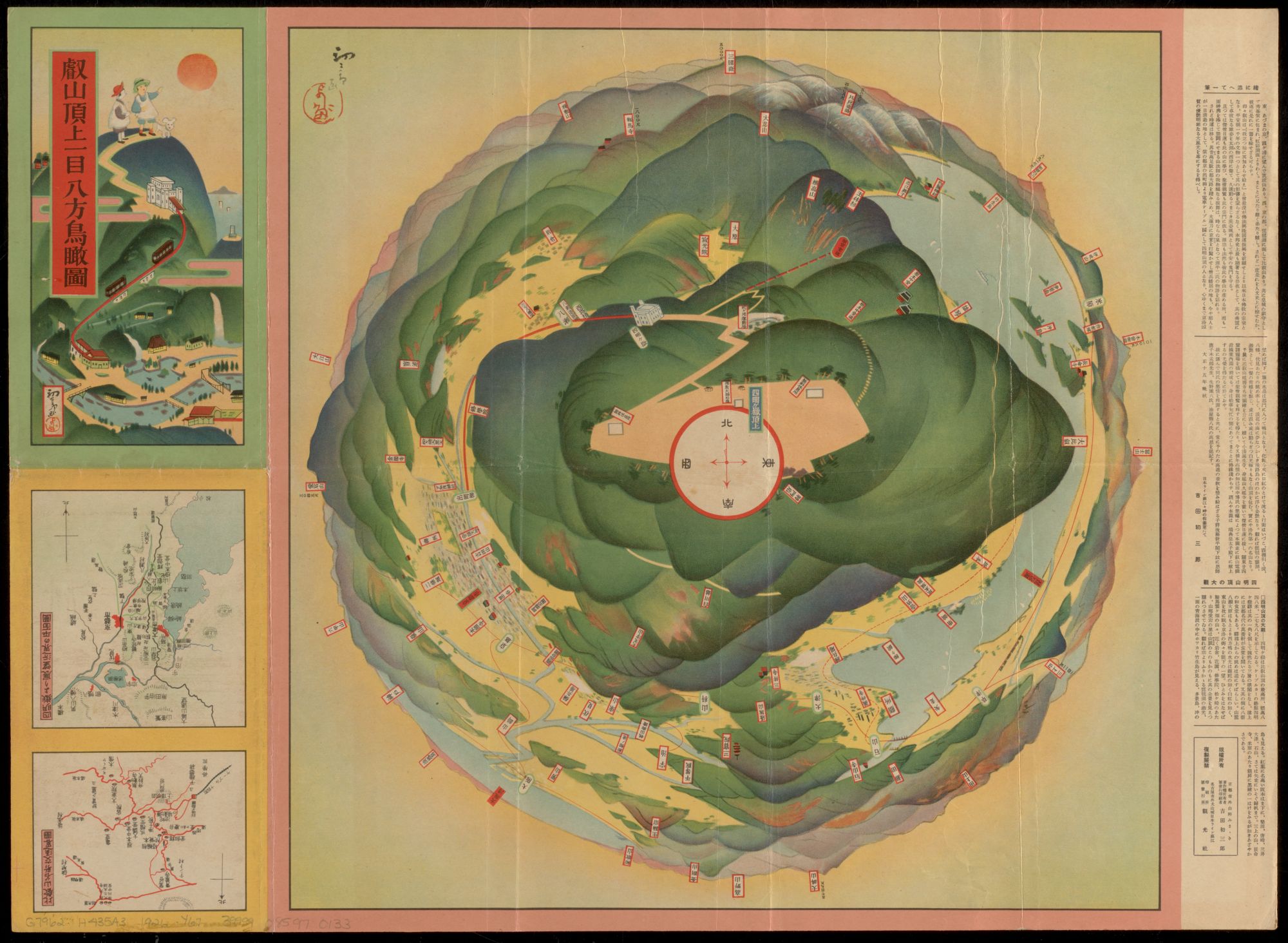
Hatsusaburō Yoshida, 叡山頂上一目八方鳥瞰圖 (1926)
This map depicts a 360-degree view from the summit of Mount Hiei in Japan, showing mountains, lakes, train lines, and cities with additional indications for temples, castles, and other points of interest.
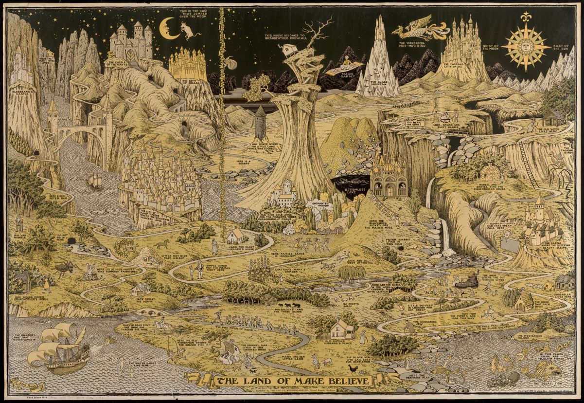
Jaro Hess, The land of make believe (1935)
Where would you choose to visit in the Land of Make Believe? This fantasy map takes inspiration from over 60 nursery rhymes, fairytales and children’s stories. We see familiar figures like the cow jumping over the moon, Jack climbing the Bean Stalk, the Emerald City of Oz, the house that belongs to Grandfather Know-All, Hansel and Gretel and the Gingerbread House, to name just a few.
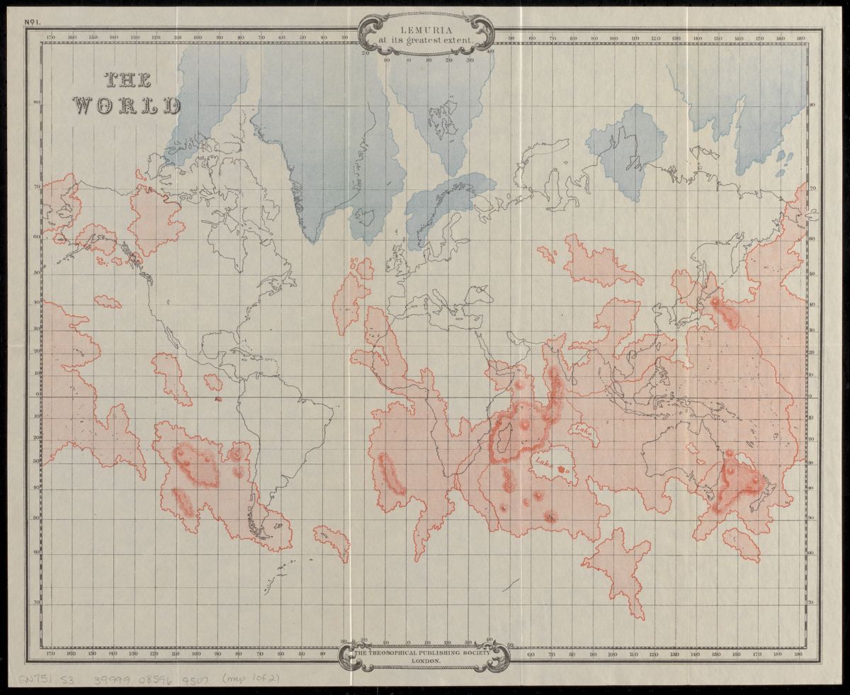
W. Scott-Eliott, Lemuria at its greatest extent (1904)
Have you heard about the lost continent of Lemuria? In the mid-1800s, a handful of scientists theorized about a lost landmass that once stretched across the southern Indian Ocean. Shaped like a triangle, Lemuria was said to have touched India’s southern point, southern Africa, and western Australia, and was home to enormous “Lemurians” with four legs.
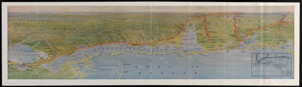
Louisville and Nashville Railroad Company, The Gulf Coast (1925)
This long map of the Gulf Coast promotes the “historical” and “romantic” route from New Orleans, Louisiana to Mobile, Alabama to Pensacola, Florida via the Louisville and Nashville Railroad. It includes a chart of hotel and boarding house locations, as well as their rates per day and per week.
Our articles are always free
You’ll never hit a paywall or be asked to subscribe to read our free articles. No matter who you are, our articles are free to read—in class, at home, on the train, or wherever you like. In fact, you can even reuse them under a Creative Commons CC BY-ND 2.0 license.