As we move into the new year, we are eager to unveil not one, but two, new exhibitions. In past years, our gallery has housed one rotating exhibition at a time; Most recently, we exhibited More or Less in Common: Environment and Justice in the Human Landscape in 2022, Bending Lines: Maps and Data from Distortion to Deception in 2021-2022, and America Transformed: Mapping the 19th Century in 2019-2020. For the 2023 year, we're experimenting with a new split gallery model: a featured exhibition on one side and a permanent exhibition on the other.
Building Blocks: Boston Stories from Urban Atlases
Featured exhibition
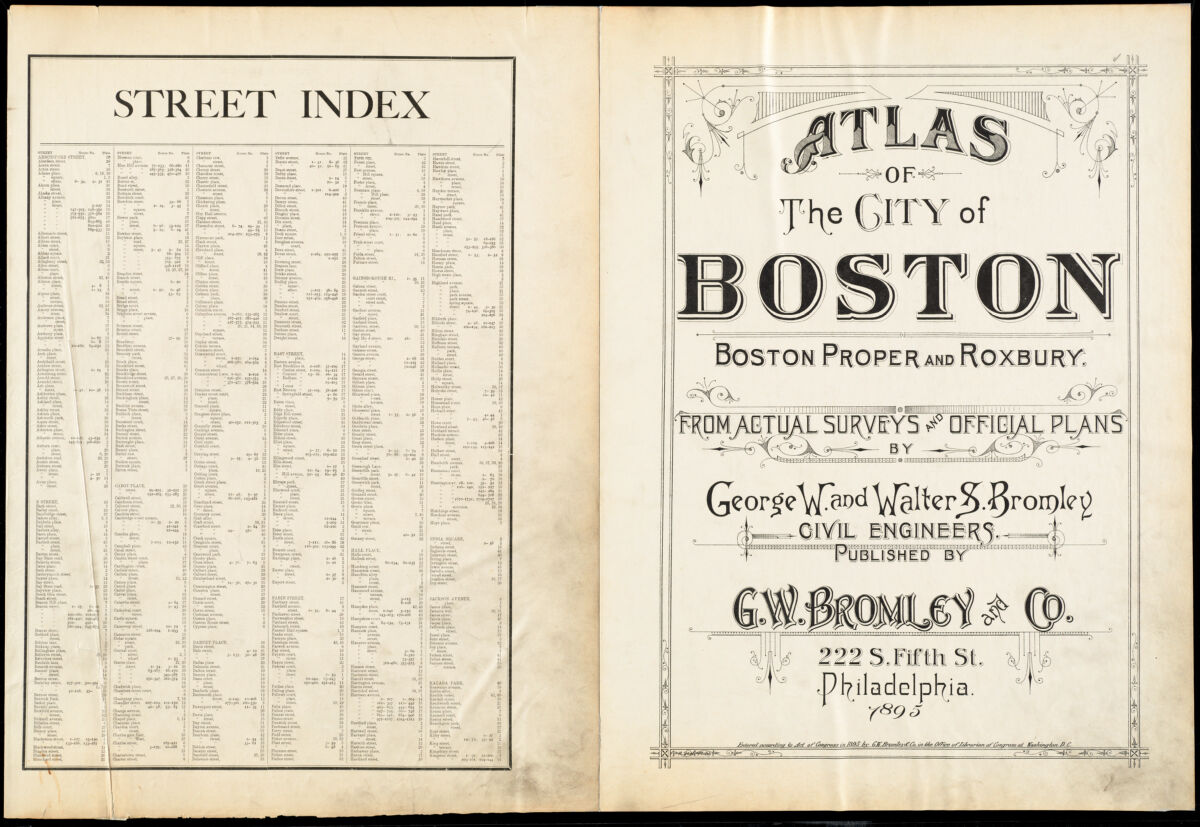
The cover page of this 1895 Atlas of the City of Boston includes an index for hundreds of streets.
In the period spanning the Civil War to World War II, Boston’s urban fabric experienced profound changes. The city filled in new neighborhoods, annexed suburbs serviced by streetcars, and ventured on ambitious infrastructure to stake its claim as a metropolis worthy of the name.
With each development, opportunities for new types of social interactions emerged in tandem. As communities and individuals responded to a shifting urban landscape, countless stories unfurled and brought life into the folds of a complex city. Building Blocks explores this extraordinary moment of transformation through the lens of the Center's urban atlases, a collection of maps that display property, street, utility, and building information, and are especially well-suited for discovering change by tracking small-scale interventions in the built environment.
Small-scale stories of urban change
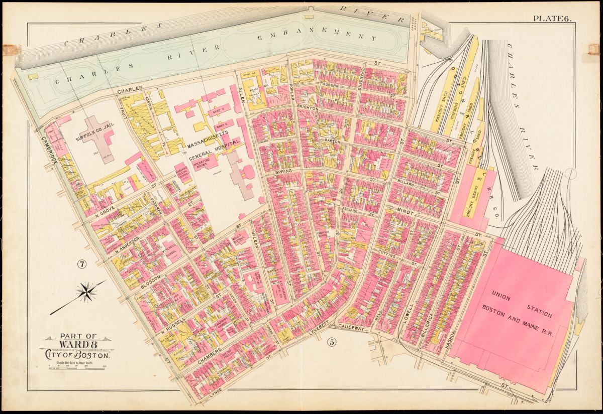
This atlas plate from 1895 uses the color pink to indicate brick buildings and the color yellow to indicate wood frame buildings.
Visitors will discover how the atlas collection opens up a world of fascinating stories, with vignettes including the city's first African Meeting House in the heart of Beacon Hill, landmarks of leisure like the Derby Racer and Giant Safety Thriller amusement rides in Revere, and public health infrastructure on Gallops Island in Boston Harbor.
Among these vignettes are a collection of local histories uncovered and reconstructed by a team of teen curators from Boston Public Schools. Over the course of eight weeks, the students chose their locations and dug into their research using maps, historical documents, interviews with scholars, and trips to the sites to photograph and observe. Their selected histories include the origins of Ronan Park in Dorchester, the Kelleher Rose Garden in Back Bay Fens, the once-bustling cattle industry of Brighton.
The maps in this exhibition tell stories that are ultimately about people, but the stories of some people are harder to find than others. In the case of Boston’s Black community, the urban atlases don’t always tell us as much as we might want to know. To illuminate the lives and stories that sometimes run hidden through these maps, Building Blocks follows the biography of an important Black Bostonian, Florida Ruffin Ridley, who worked, studied, played, and created within the landscapes on display. As visitors move through the exhibition, look for Florida's photo to follow her story and see how her life intersected with many other people and places in Boston and beyond.
Beyond these narrated stories, the rich details of the atlases hint at thousands, or even millions, of others, and we invite visitors to discover stories of their own.
Becoming Boston: Eight Moments in the Geography of a Changing City
Permanent exhibition
Maps trace out the complicated history of places, and we can use them to document geography in the same way that we can use diaries and letters to document biography. In the eight cases of this exhibition, we follow the changing spatial forms of the place we now call Boston—from before the landscape carried that name all the way through the struggles, clashes, and dreams that continue to reshape the city today.
For this exhibition, the themes we explore will remain consistent, but the maps on display will change throughout the year to allow visitors a chance to continuously explore our collections of objects related to the history of greater Boston.
From colonial contact to Boston today
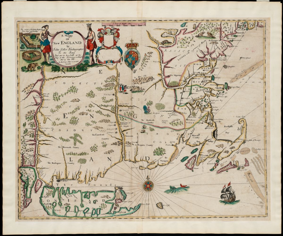
Note colonial place names on this ~1675 map of New England.
We begin in the seventeenth century at a point of colonial contact. For thousands of years, Native peoples have built their homes and nations around Massachusetts Bay, and today the region is still home to members of the Massachusett tribe as well as Indigenous people from across the Americas. Maps of this period show New England as the Europeans wanted it to appear, with Native peoples receding into the hinterland and new territories forming the outlines of a colonial geography.
Boston quickly developed into an important regional city at the intersection of networks in trade, power, and ideas. And as resentment grew toward an increasingly-centralized British imperial administration, Boston soon became the flashpoint for the American Revolution, with its urban spaces hosting some of the first engagements that would eventually lead to all-out warfare.
After the revolutionary era, Boston entered into a moment of transition and expansion, reimagining its urban form and building neighborhoods from scratch. The city's surrounding tidelands were put to work as mill ponds and later as new districts constructed on landfill. Industries, railroads, and rapid transit were soon to follow. To many people living in Boston during its industrial boom years, the growth of the modern city seemed constantly at risk of spiraling out of control. Urban development led to issues ranging from catastrophic fires and tangled streetcar traffic, to waves of epidemics and environmental health concerns.
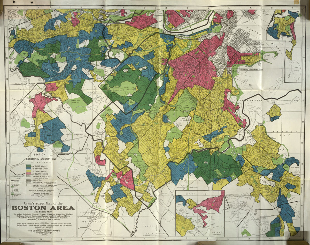
Starting in the 1930s, the Home Owners’ Loan Corporation (HOLC) assigned thousands of neighborhoods with rankings on a graded scale, from A to D, based on statistics about race, ethnicity, mortgage rates, and housing conditions.
As the physical landscape expanded and diversified, so did the city's population. Sometimes the city welcomed new arrivals, while during other periods formal and informal barriers constrained who could come to Boston and where they could live. The “color line,” which the Black scholar W. E. B. Du Bois described as “the problem of the twentieth century,” was not just a conceptual line between groups of people but very often a cartographic line, a space of both racist confrontation and demands for liberation.
With the twenty-first century on the horizon, the city saw a shift in the politics of design, planning, participation, and democracy. Both politicians and community groups were demanding more opportunities to draw maps in a more democratic fashion, bringing people from all walks of life into the decision-making processes that determine how the city’s geographies look today and in the future. As Boston continues to evolve, how will maps document and determine the future of this ever-changing city?
The maps in this exhibition don’t merely depict facts about how the city looked at different moments in its history, but invite us to contemplate how geographic forces, both natural and human, have constructed the physical and social world around us.
Mark your calendar for the January 13 openings of Building Blocks and Becoming Boston! Follow us on social media or join our mailing list to keep in touch with what we’re planning for the spring.
Our articles are always free
You’ll never hit a paywall or be asked to subscribe to read our free articles. No matter who you are, our articles are free to read—in class, at home, on the train, or wherever you like. In fact, you can even reuse them under a Creative Commons CC BY-ND 2.0 license.