- March 17, 2023
- Garrett Dash Nelson
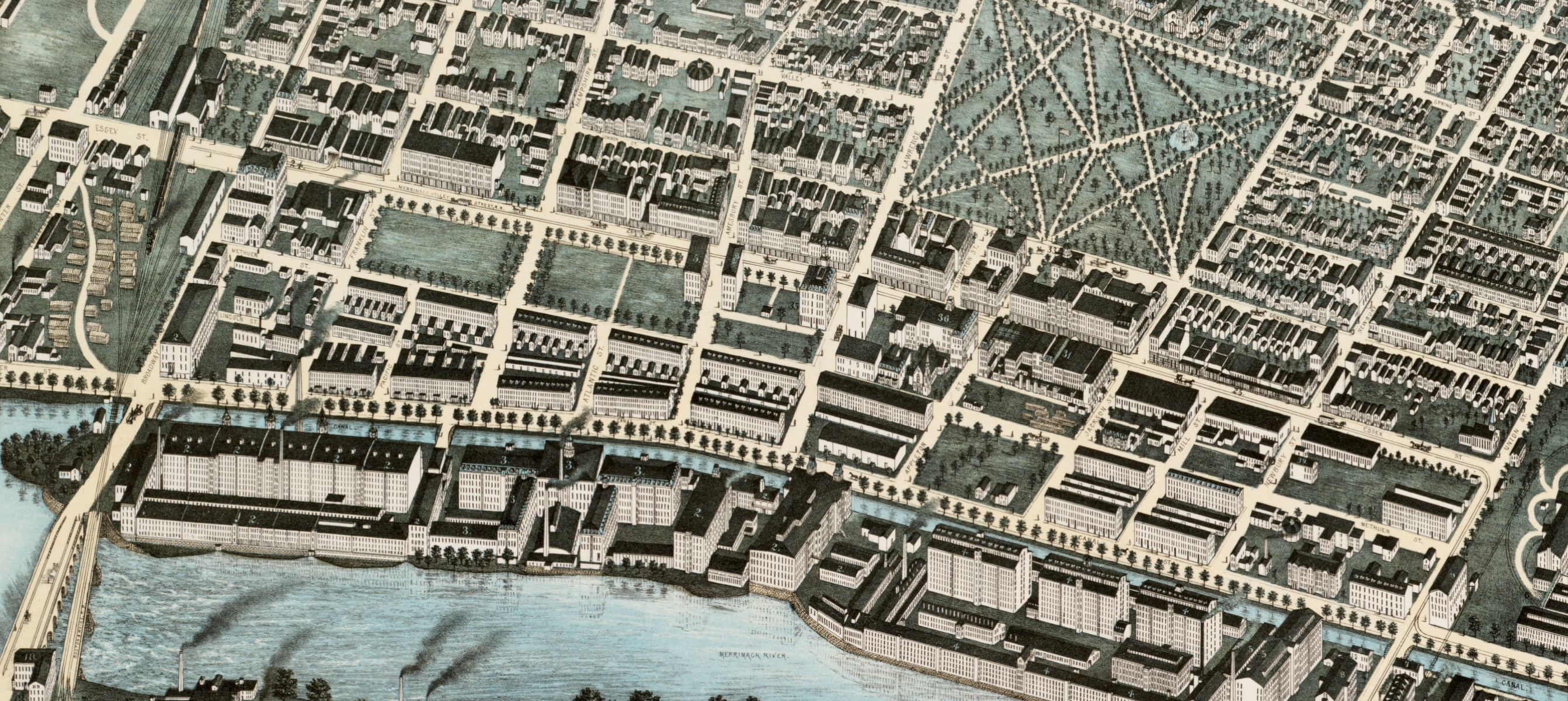
Growing New England’s Cities
What can a visualization of population growth in cities and towns in the Northeast tell us about different moments in the region’s economic geography?
Read more What can a visualization of population growth in cities and towns in the Northeast tell us about different moments in the region’s economic geography?
Read more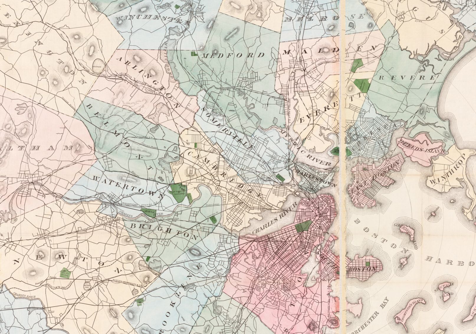
Meet the team of wonderful student interns who have been hard at work this semester on various LMEC projects
Read more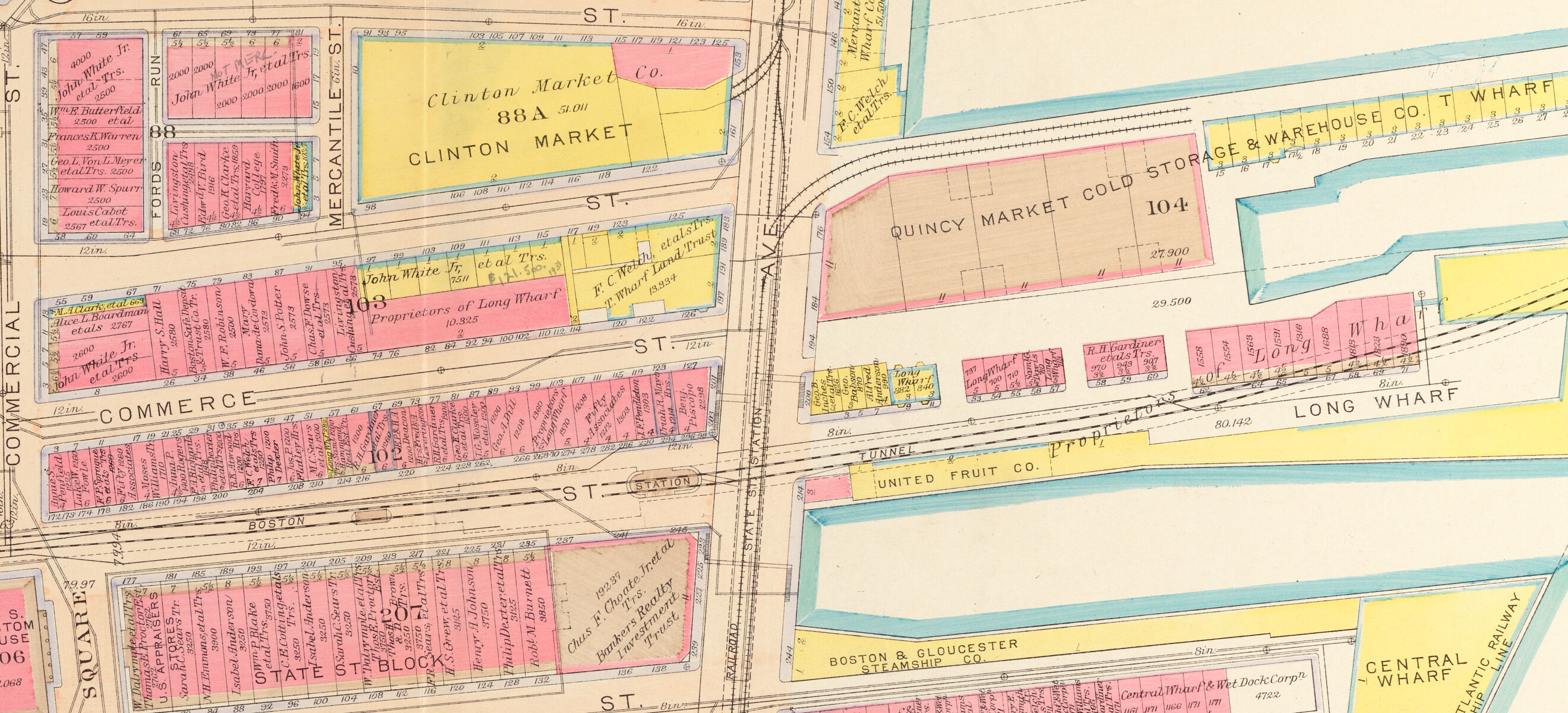
Undergraduates at the College of the Holy Cross used Atlascope to research the buildings and landscapes of Boston that were destroyed by the Central Artery
Read more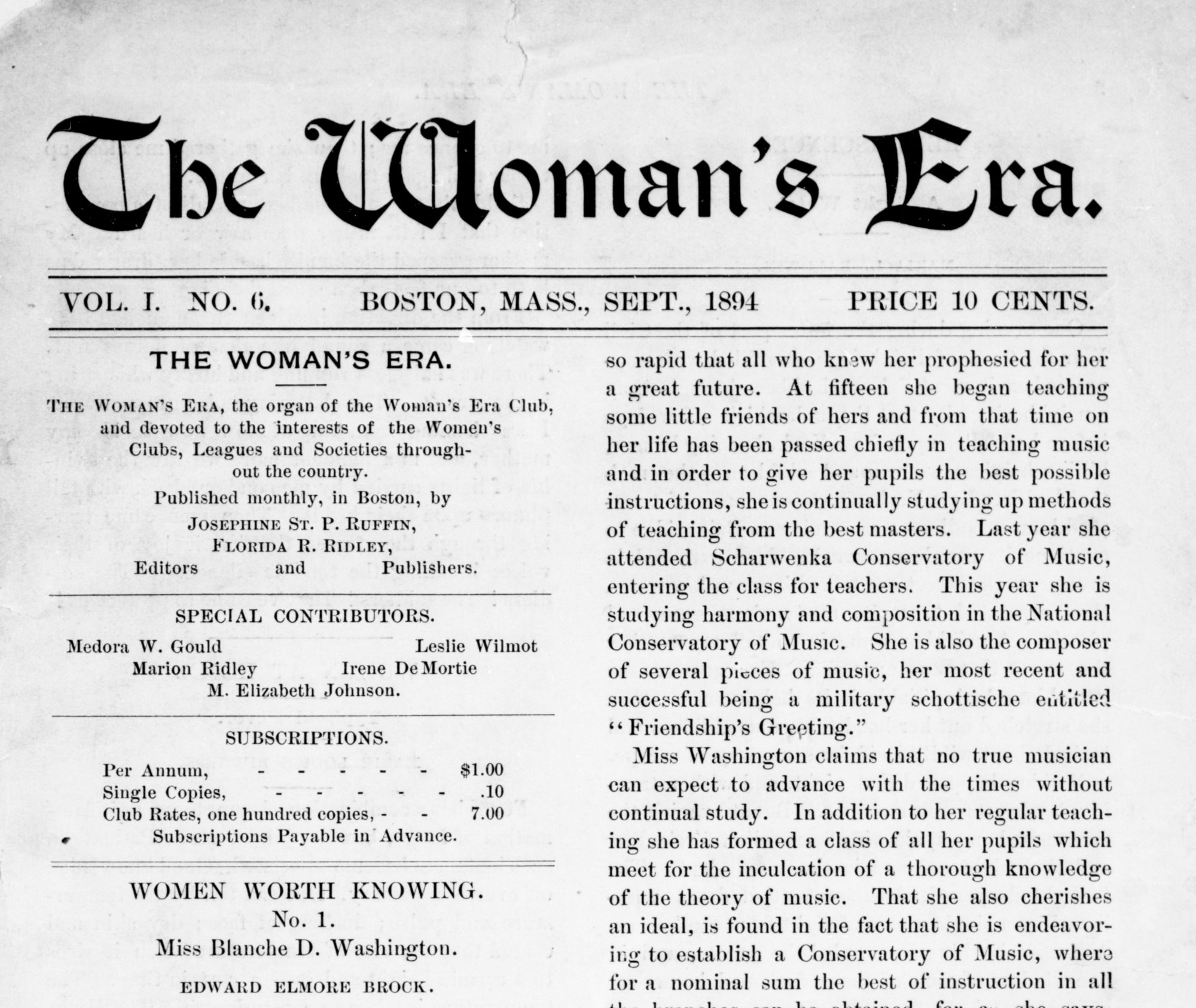
Meet Florida Ruffin Ridley, an important Black Bostonian who worked, studied, played, and created within the landscapes on display in our featured exhibition, Building Blocks: Boston Stories from Urban Atlases.
Read more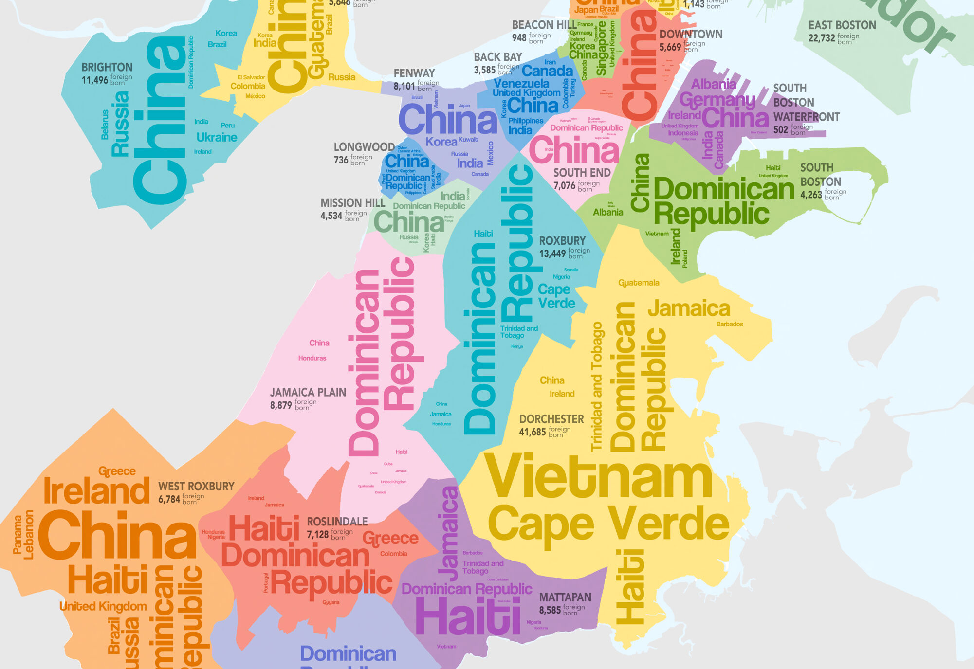
An interview with Sharon Hessney
Read more
For our new rotating exhibition, Building Blocks: Boston Stories from Urban Atlases, the Leventhal Center hired and worked with three high school students from Boston Public Schools as teen curators.
Read more
An interview with Spring 2023 Northeastern co-op, Patricio Pino
Read more
Exhibition Curatorial Fellow Laura Lee Schmidt dives into our ongoing Building Blocks exhibition
Read more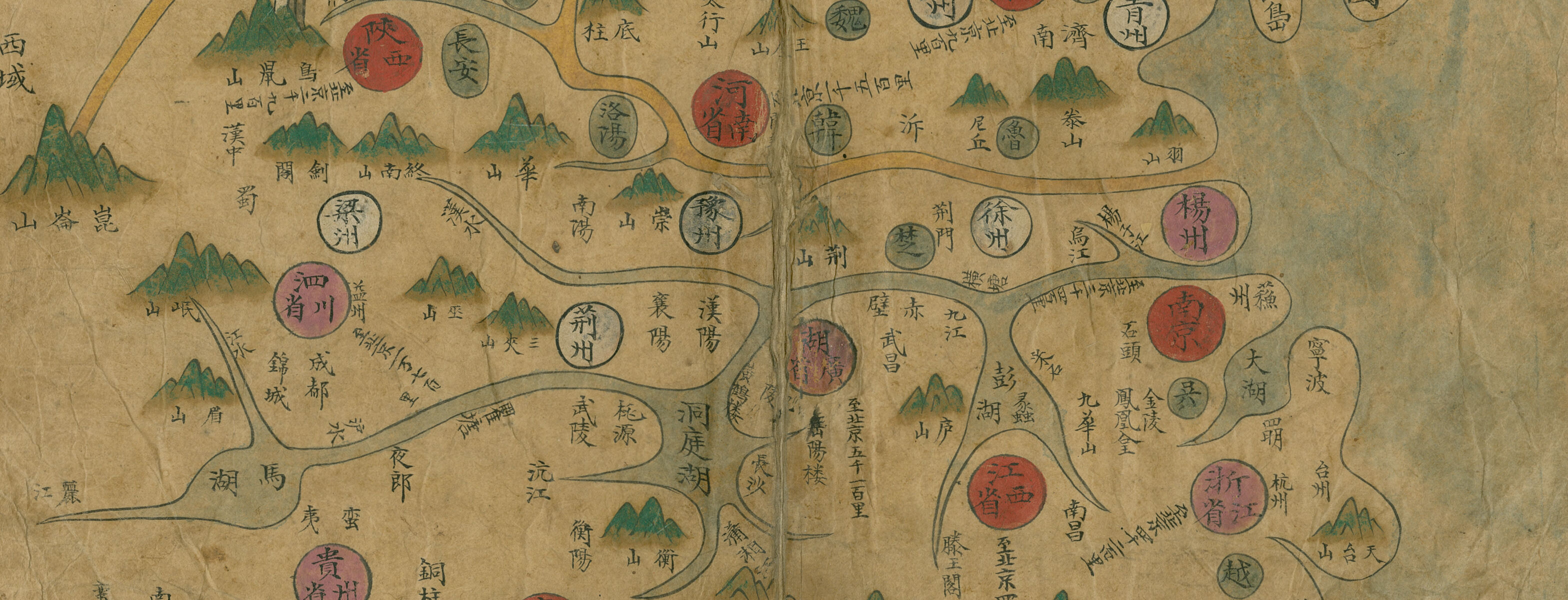
How did Korean cartography evolve in the Joseon period? Explore this interactive Map Chat from the MacLean Collection to learn more about a fascinating collection of atlases.
Read more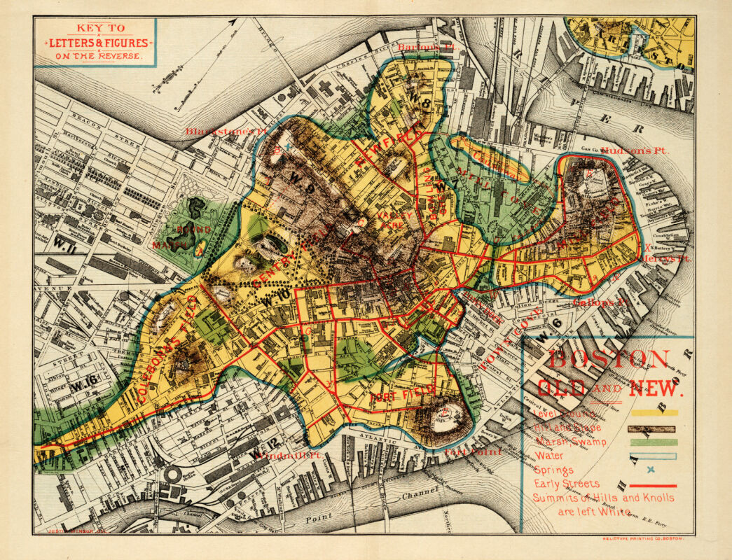
One-sixth of Boston sits on land that was once tidal estuaries, shallow marshes, and mud flats.
Read more