
- June 29, 2026
- Salvatore Martinelli
Two Epistemologies of the Sky
What a Korean star chart in the MacLean Collection tells us about the heavens it was made to govern
Read more What a Korean star chart in the MacLean Collection tells us about the heavens it was made to govern
Read more
Two maps of Beijing from the MacLean Collection
Read more
Explore the cosmos and the world-spaces of the Jain religion
Read more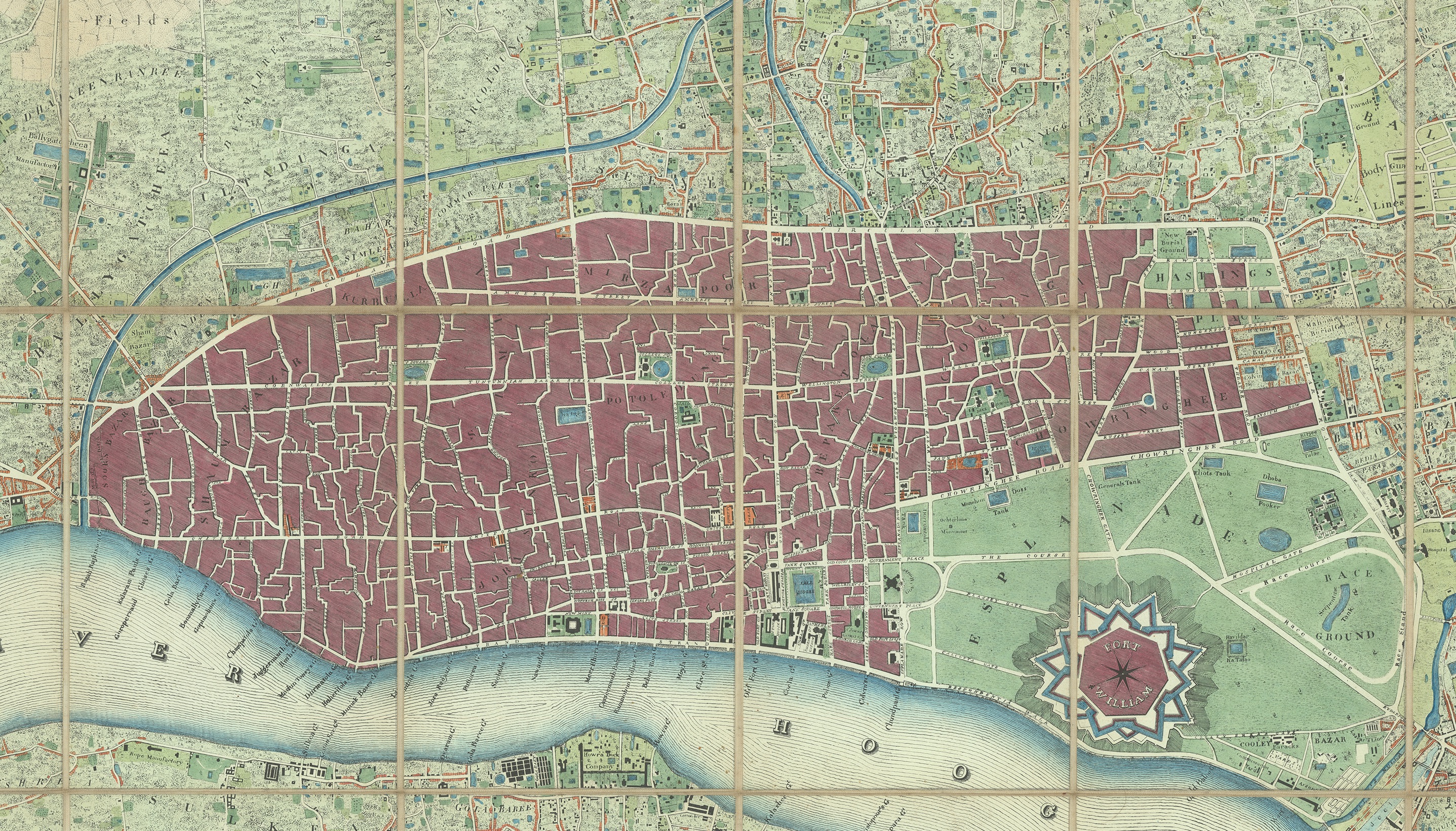
Zoom into the details of Jean-Baptiste Tassin's 1832 city map
Read more
Studying one particular copy of an eighteenth-century map of the Ming Empire opens up a genealogy of printed maps
Read more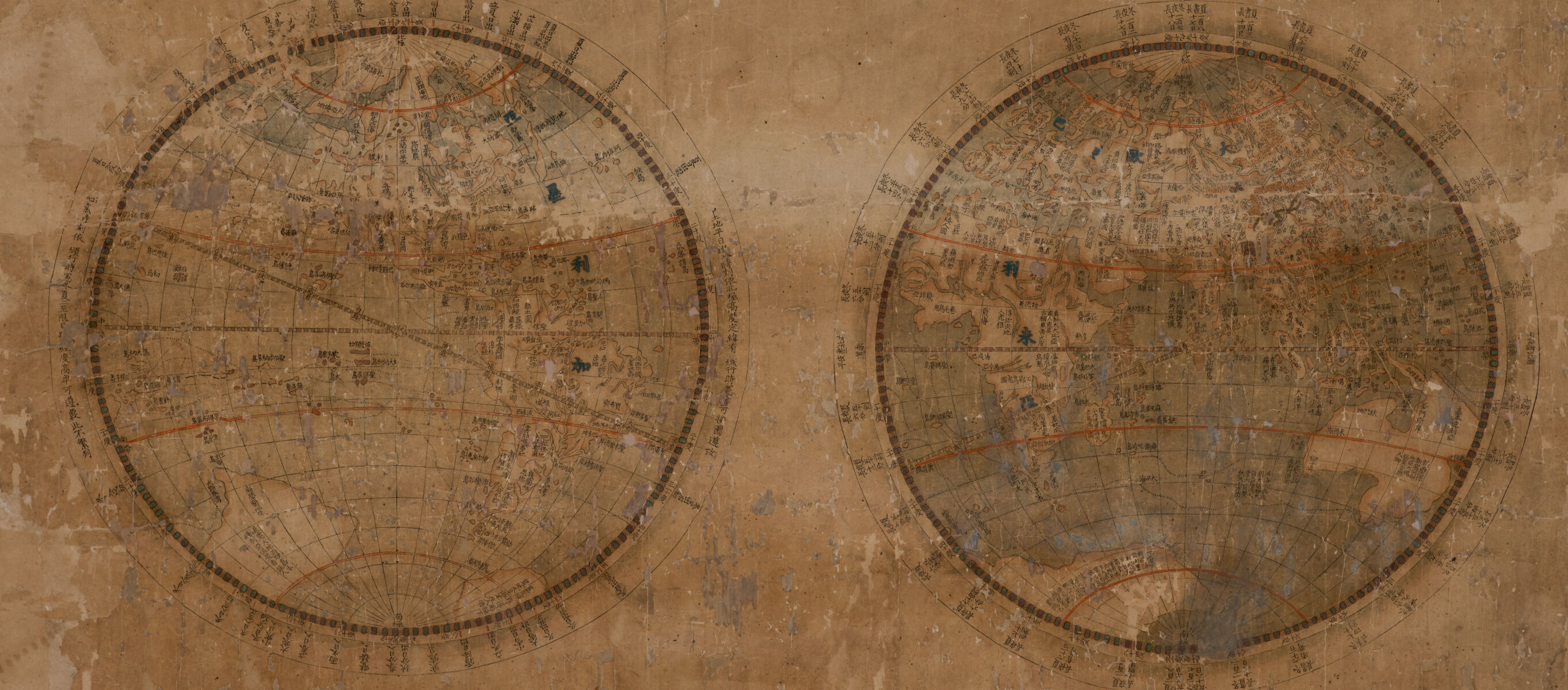
In the late eighteenth century, an encounter between European and Chinese cartography left clues about the diffusion of geographic knowledge
Read more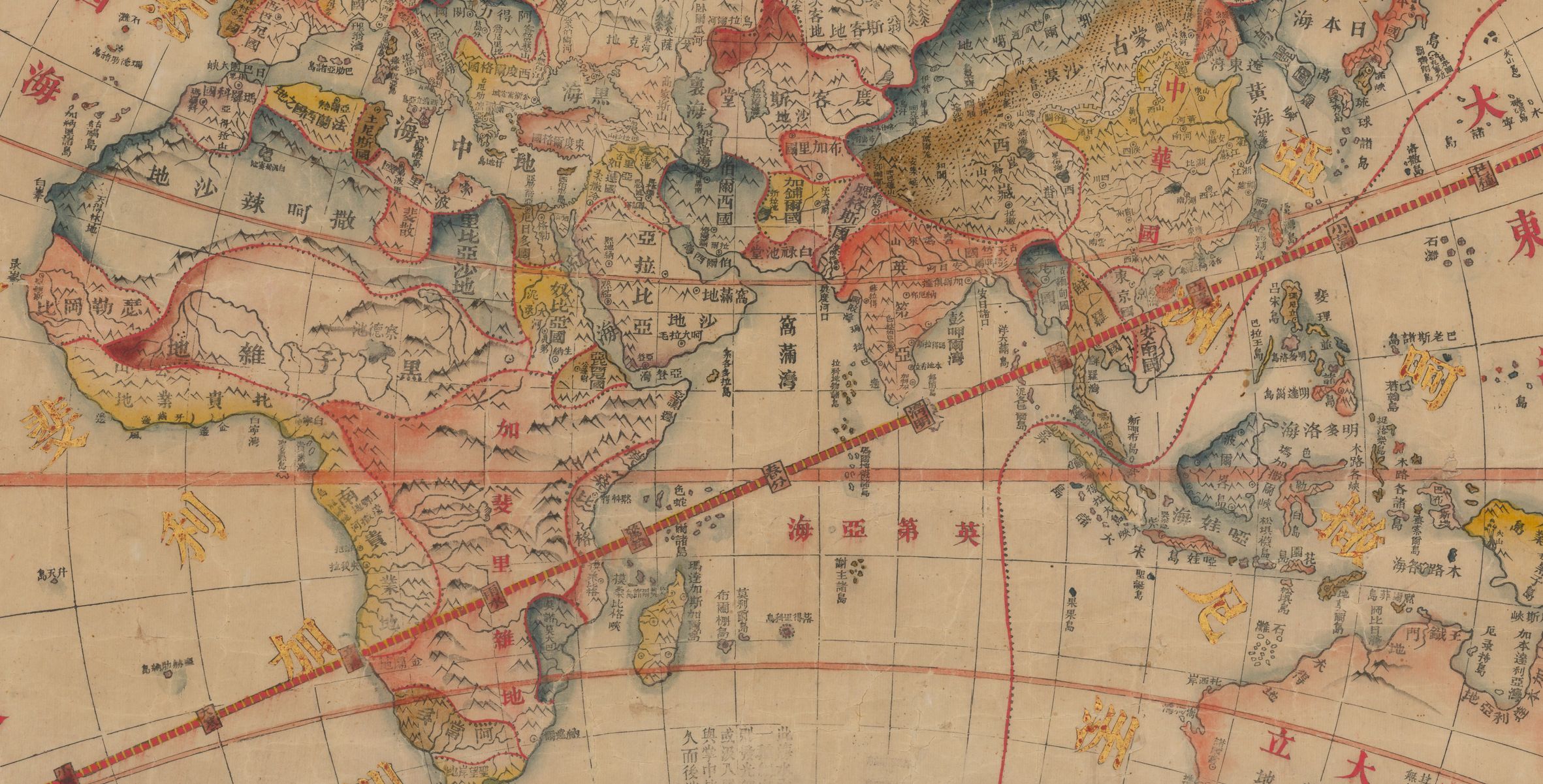
See how the Qing Empire’s mapping of world geography changed during and after the imposition of European power in the Opium Wars
Read more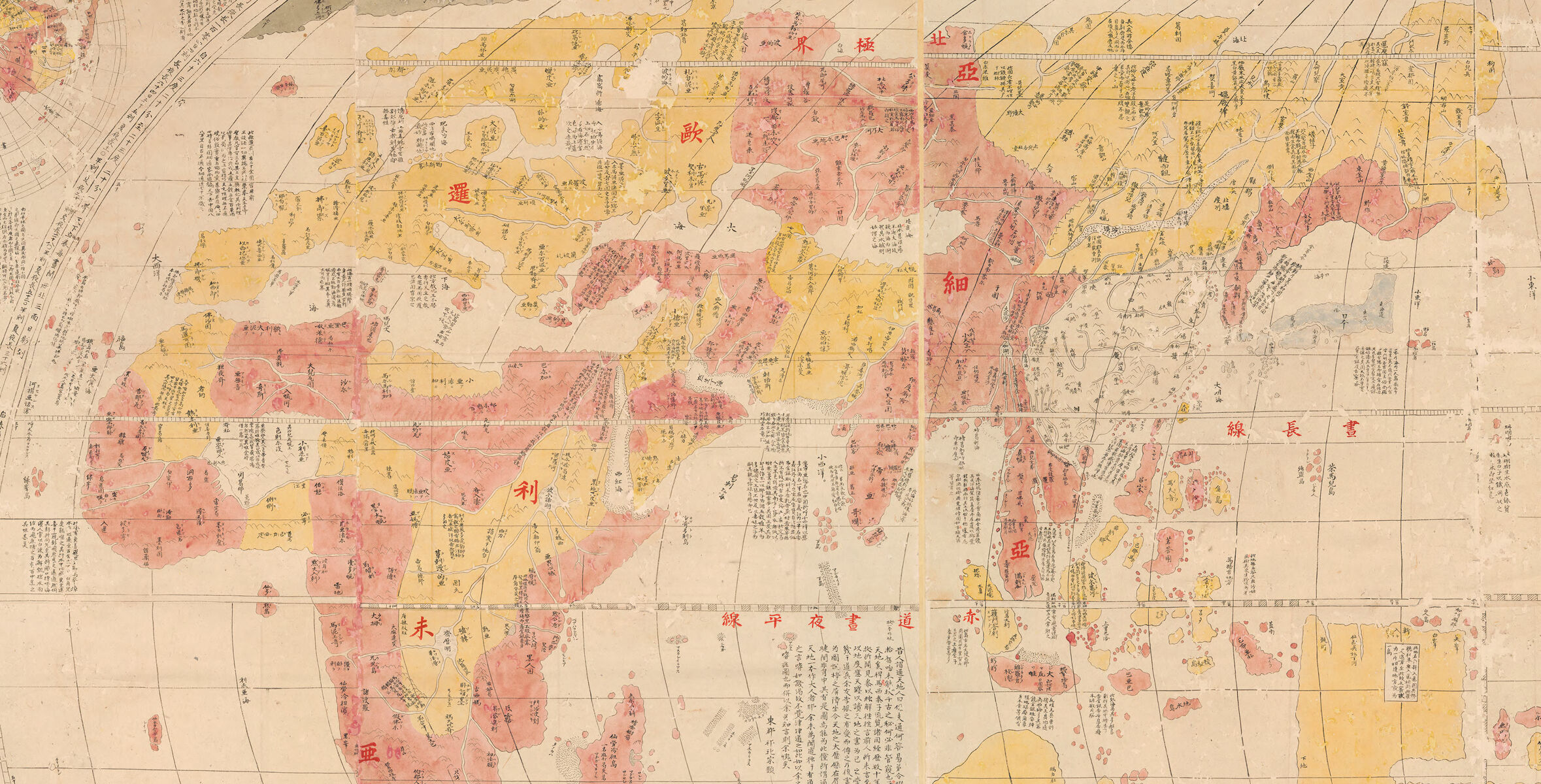
In this interactive Map Chat from the MacLean Collection, learn more about how Japanese mapmakers saw the world in late 18th and early 19th centuries
Read more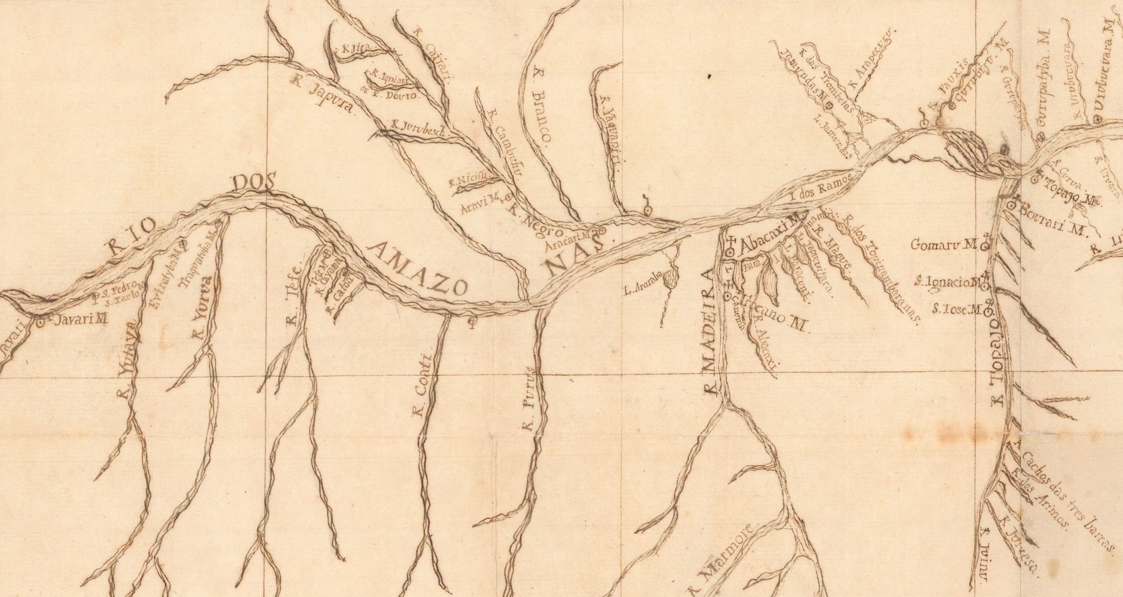
A 1755 map created by a German Jesuit missionary for the Portuguese Empire casts new light on early European efforts to map the Amazon River valley
Read more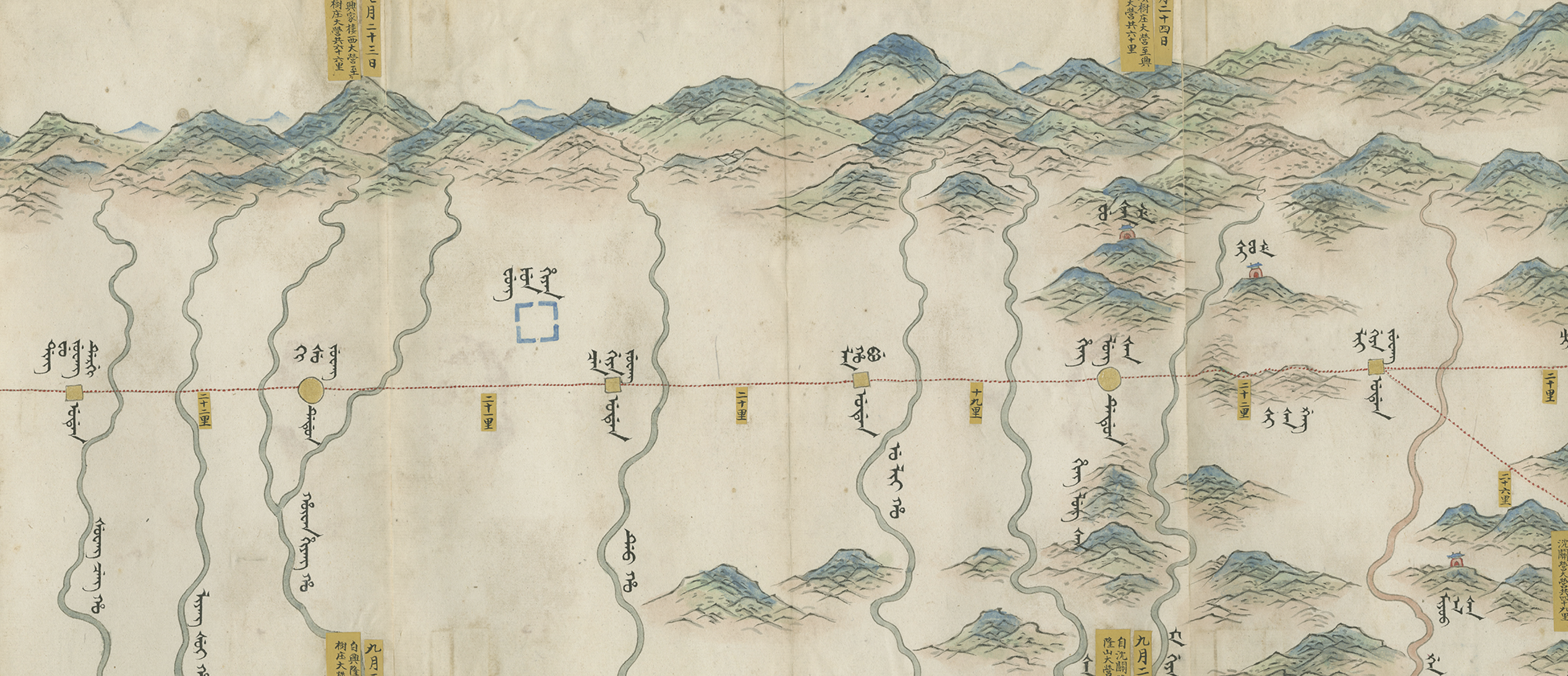
Travel alongside the Qianlong Emperor in this interactive tour of a map nearly twenty feet long
Read more