
April 25, 2022

Now that the marathon runners have made their annual pilgrimage down Boylston Street past the Central Library, we’re celebrating the start of spring in Copley Square. With that comes (hopefully) warmer temperatures and excuses to move our meetings outside to the Library’s courtyard. With the first events of our new exhibition More or Less in Common, we’ve had a number of opportunities to think about how the weather outside isn’t just a question of fair or foul—but of community resilience and social justice. If you’re local, swing by—or, if you’re not, check out the virtual reality tour we’ve just added to the digital exhibition.
Boston Globe: "Mapping environmental justice"
We were thrilled to welcome Boston Globe journalist Renée Loth to our exhibition More or Less in Common. Her thoughtful review highlighted some of the most themes in our show, and her summary on Twitter may have captured the essential message of our work: “Far from dusty relics of a pre-digital age, maps like the ones at the Boston Public Library can help us visualize environmental justice & be tools for civic activism.”
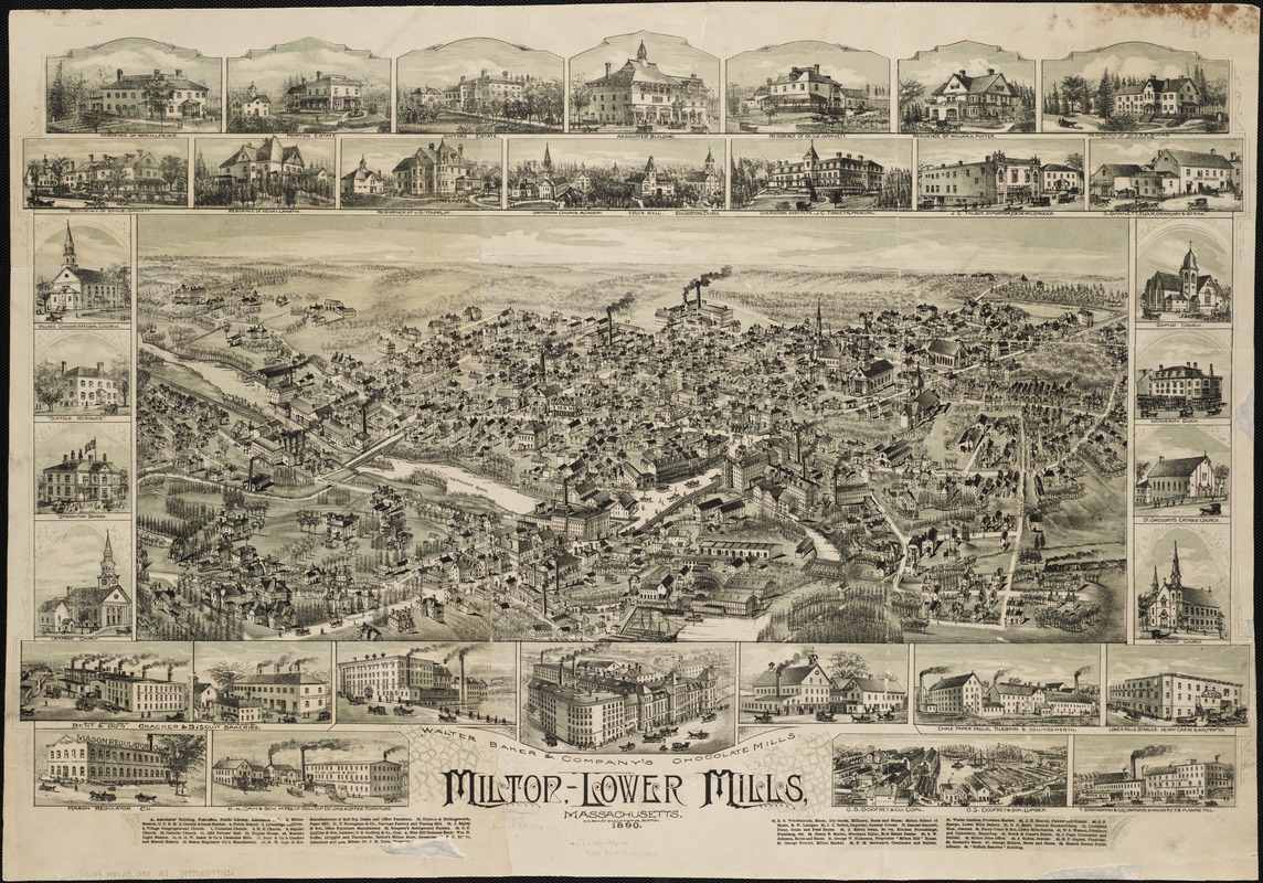
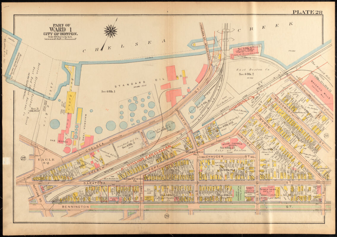
Power, Paper, and PCBs: An Environmental History of the Lower Neponset River
If you lived in Boston in the 1960s, you might remember the Baker Chocolate Works factory and smells of chocolate wafting up from the banks of the Lower Neponset River. But today, the water and soil of the Neponset are dangerously contaminated with chemical waste and and hazardous materials. Megan Nally wrote about the environmental history of the Lower Neponset River, just as the U.S. Environmental Protection Agency (EPA) announced the addition of the river to the Superfund National Priorities List, which will open up federal funds for cleanup and remediation.

Online event: Geographies of contact between soldiers and civilians · April 26, 7pm ET
What impact did the Revolution era military’s presence in American cities have on citizens and civilians? Tune in to hear Professor John McCurdy unpack the geographies of contact between soldiers and civilians—from urban squares to barracks and lodging houses—during the Revolutionary War. McCurdy’s work examines the small-scale spaces where the everyday realities of life during an imperial conflict became personalized. Part of the Richard H. Brown Seminar on the Historical Geography of the American Revolutionary Era.

Public Interests
Ambitious urban planners, like Boston’s Edward J. Logue, once dreamed up massive interventions into American cities. But those plans quickly garnered pushback across the political spectrum. How and why did activists turn against government power and urban planning in the last third of the twentieth century? Garrett Dash Nelson looks at three new books that explore the contentious relationship between activism and the state, and asks what lessons we might draw from this era’s unintended consequence, in this essay for Places Journal.
Online event: Paving Over People · May 3, 6pm ET
What can a neighborhood do when a highway brings increased air pollution and health risks to residents? In Boston’s Chinatown, a partnership between community organizations and local researchers led to the Community Assessment of Freeway Exposure and Health Study (CAFEH) on the health risks of highway pollution. We’ll talk with Lydia Lowe of the Chinatown Community Land Trust, Doug Brugge of the University of Connecticut School of Medicine, and Ellin Reisner of the Somerville Transportation Equity Partnership to discuss their work and lessons from participatory research.

BARI Conference: "Data, A Community Journey" · May 6
Are you interested in learning more about ways that civic data is being used to advance policy and research in greater Boston? The Boston Area Research Initiative at Northeastern University (BARI) is presenting their 2022 conference, “Data, A Community Journey” on Friday, May 6th with options for in-person and virtual attendance. We’re particularly excited to hear the panel “Climate Resilience: How to Center Communities in the Pursuit of Radical Change?”
Request a Repro for Free
Are you part of a cultural, educational, or environmental nonprofit that could use high-quality reproduction of a map in our collection? Are you a teacher who wants a reproduction for your classroom? We’re taking requests for low-cost and free reproductions of digitized maps in our collection for organizations that plan to display the reproductions in a public or classroom setting, such as a trailhead kiosk, neighborhood bulletin board, or classroom table.
The Leventhal Map & Education Center is an independent nonprofit. We rely on the contributions of donors like you to support our mission of preserving the past and advancing the future of maps and geography.
View this email in your browser
Leventhal Map & Education Center at the Boston Public Library
617.859.2387 · info@leventhalmap.org
{{SenderInfoLine}}