Constructing a City
Much of what we take for granted in the daily workings of today’s city took shape during the late nineteenth and early twentieth centuries. From sewers and sanitation to transportation and modern buildings, urban atlases covered these details at a scale we can appreciate.
READING STORIES INTO URBAN ATLASES
A city skyline is a signature of a complex urban organism, built up over decades or even centuries. Of course, many factors go into a skyline, but one key feature is the height of the buildings themselves. Even though they depict top-down views, urban atlases give us a picture of the origins of a vertical cityscape.
In 1861—the year the American Civil War started—Charles E. Pinney published the first insurance map meant to assess fire risk in Boston. With their incredible level of detail, these atlas plates offer a window into what the city looked like just before its buildings started started rapidly growing up and out in the years after the war. This plate in Pinney’s atlas gives a stylish view of downtown at a time when the city’s population hovered just above 177,000.
Plan of the city of Boston, plate 2
C. Pinney
1861
Leventhal Map & Education Center

Using the key , one can see details such as skylights (rectangles and circles with X’s through them), boilers (long black rectangles), risky buildings (denoted by exclamation marks), and number of stories (marked on the centers of each building). All four were important factors in determining fire risk.
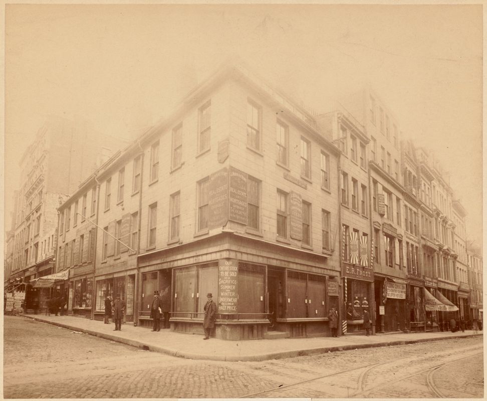
On the corner of Court Street and Washington Street towards the top center of this plate in the Pinney atlas would become the site of Boston’s first tall office building . Looking at this block prior to the time it began growing vertically invites us to imagine what the downtown area was once like. The atlas documents a dense block surrounded by important civic spaces, offices, banks, and a museum. This photograph of the block’s corner shows a cluster of three- and fourstory commercial buildings. Stacking offices on top of stores made for a modern downtown.
Site of Ames Building - 1891
W. G. Shilaber
1891
Boston Public Library Arts Department
LOOKING UP AND LOOKING BACK: TALL BUILDINGS
While it was not unusual to see warehouses or row houses up to six stories tall before the Civil War, developments in transportation, construction, and telecommunications after the war opened the way for a new, ambitious type of building.
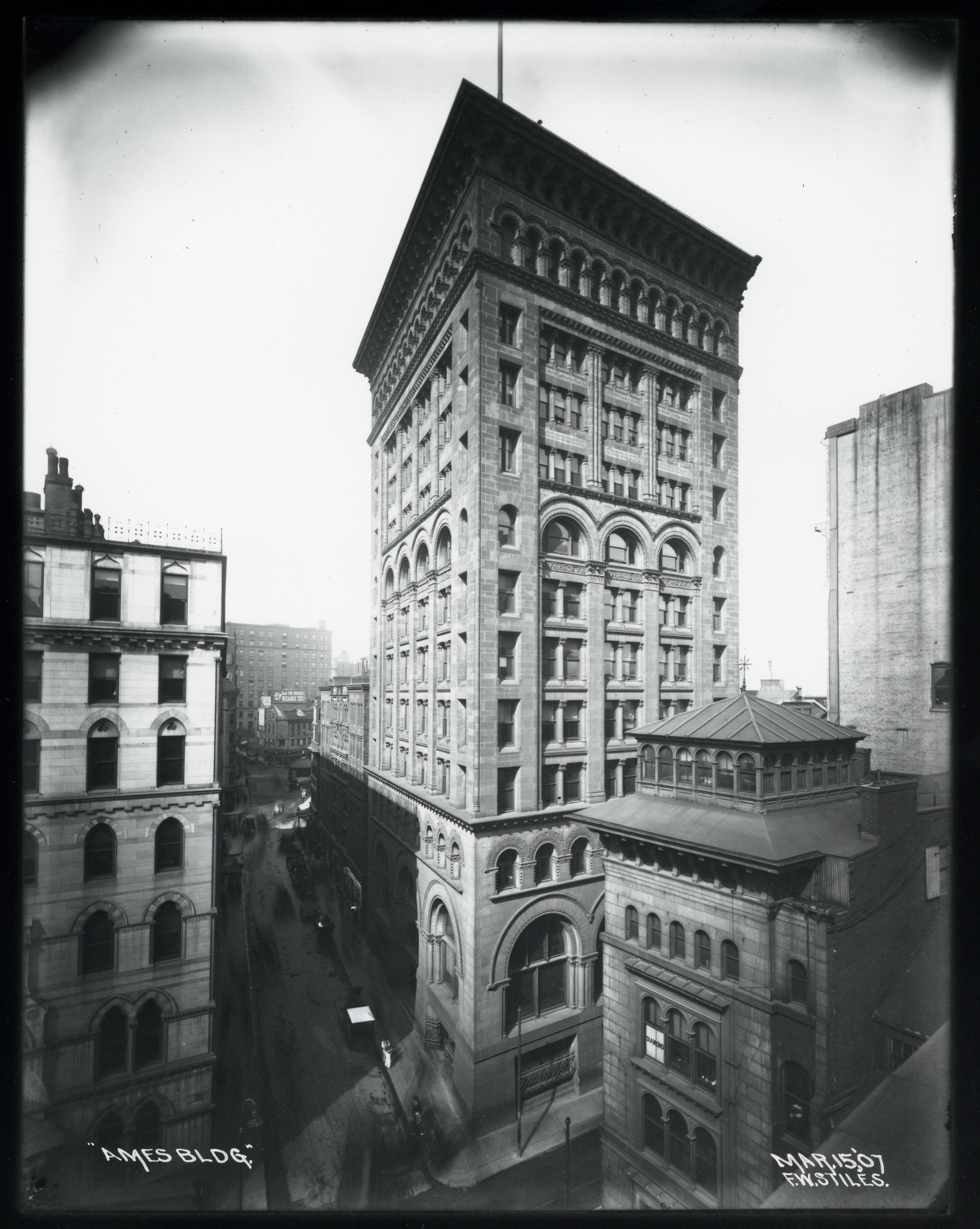
At 14 stories, (15 23 Boston’s first “skyscraper,”) situated on 1 Court Street, was constructed from stone masonry, rather than the steel construction of the classic skyscrapers of the era. Designed by the firm Shepley, Rutan, and Coolidge, the Ames Building’s architecture was in keeping with the Richardsonian Romanesque style that was popular in Boston at the time (another example sits across from the Boston Public Library: Trinity Church).
Ames Building
F. W. Stiles; Boston Transit Commission
1907
Boston City Archives
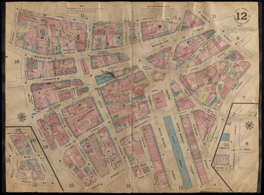
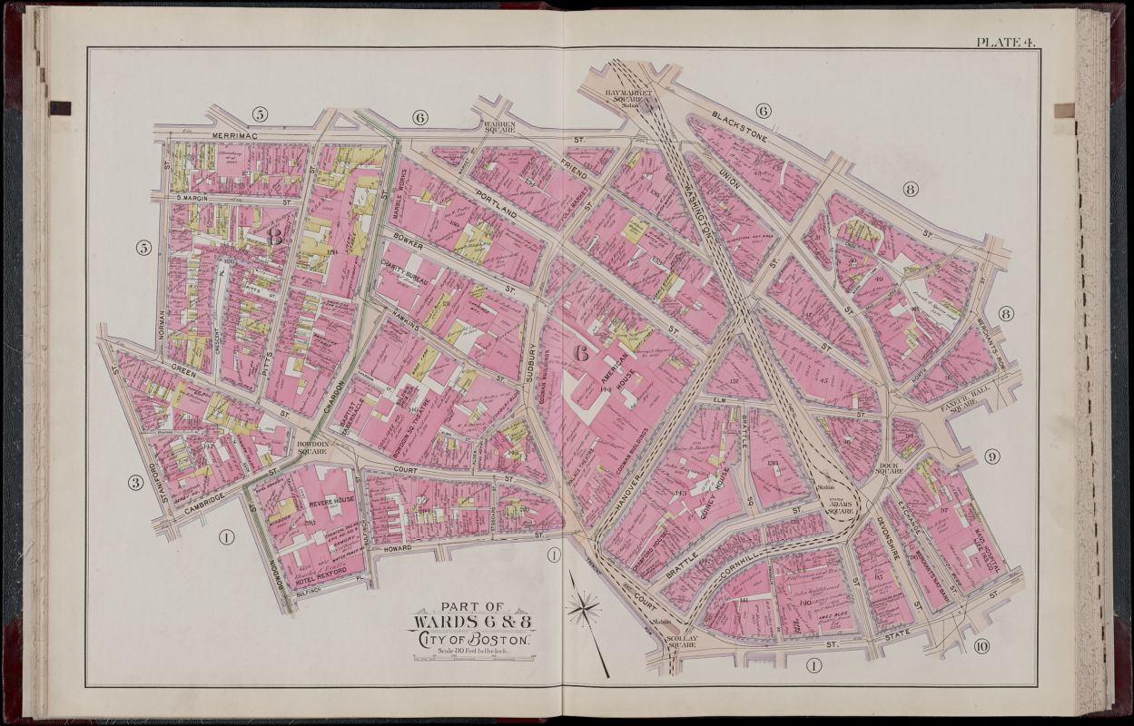
Both the 1882 Sanborn and 1898 Bromley atlases indicate the Ames building’s number of stories. On the Bromley, the number “13” is underlined to show there is an additional basement level.
Detail of Insurance Maps of Boston, Volume One, Plate 12
D. A. Sanborn
1882
Leventhal Map & Education Center
Detail of Atlas of the City of Boston, Boston Proper, Plate 4
G.W. Bromley & Co.
1898
Leventhal Map & Education Center
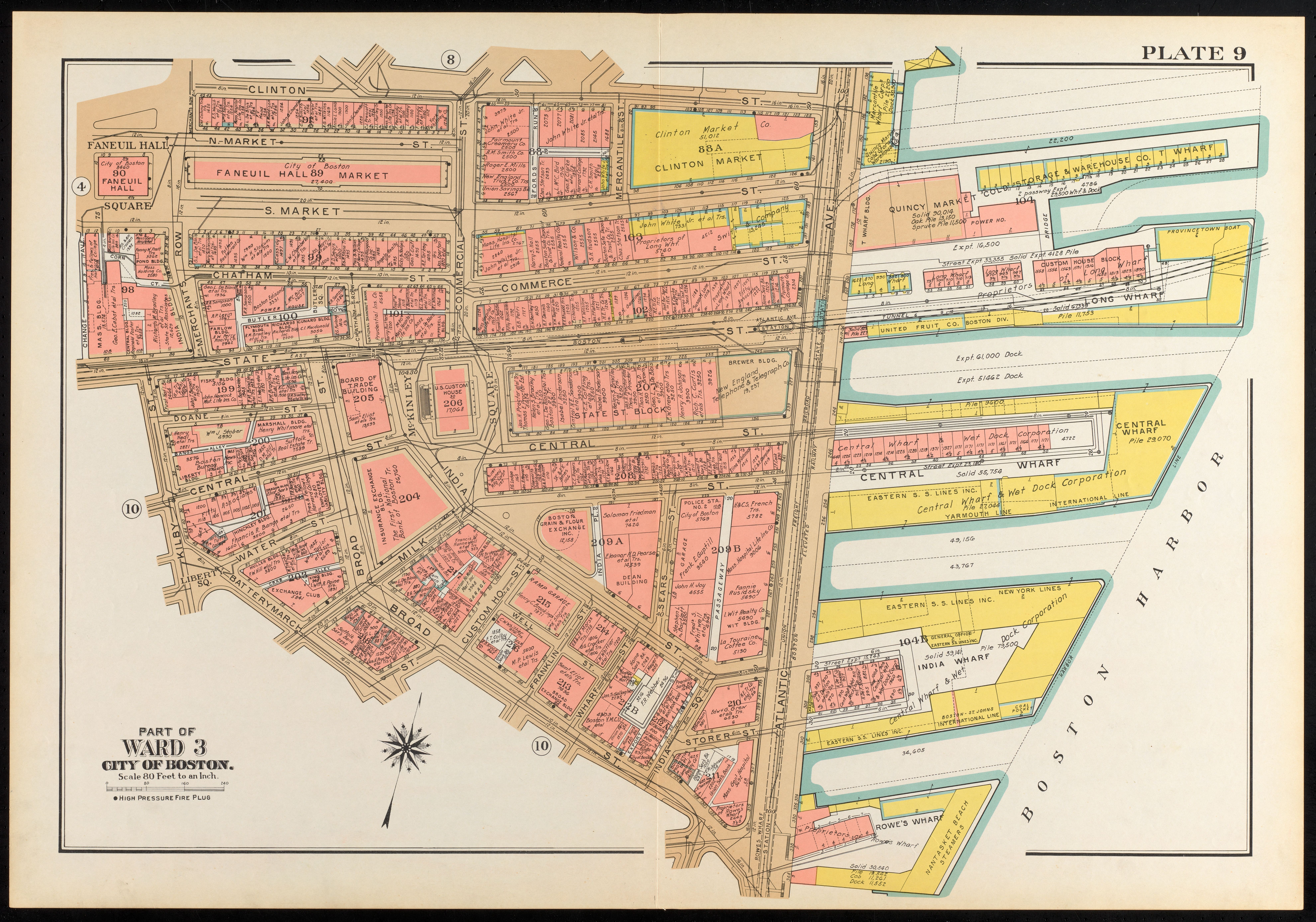
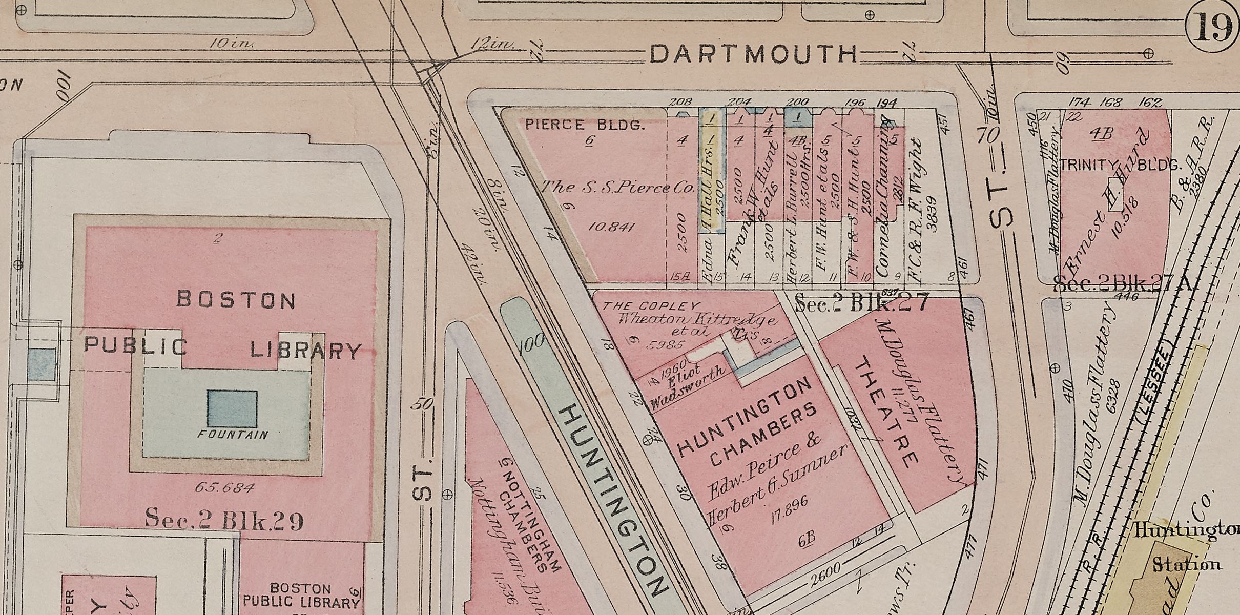
Sometimes a building just needed to be taller. The Custom House Tower is a fine example of this upward pressure. It was originally constructed in the 1840s and resembled a Greek temple with Doric columns on each side, floating between several streets in the present-day Financial District. At the turn of the twentieth century, increasing trade volume necessitated expansion. In 1913, the Custom House gained 27 steel-girded stories and became Boston’s tallest skyscraper until the Prudential Tower was built in 1964. The 1938 Bromley atlas shows how close the building was to the waterfront docks, as well as its grand staircase and columns.
Detail of Atlas of the City of Boston, Boston Proper and Back Bay, Plate 9
G.W. Bromley & Co.
1938
Leventhal Map & Education Center

The Custom House tower in construction
John Albert Seaford
[ca. 1910–1930]
Boston Public Library Arts Department
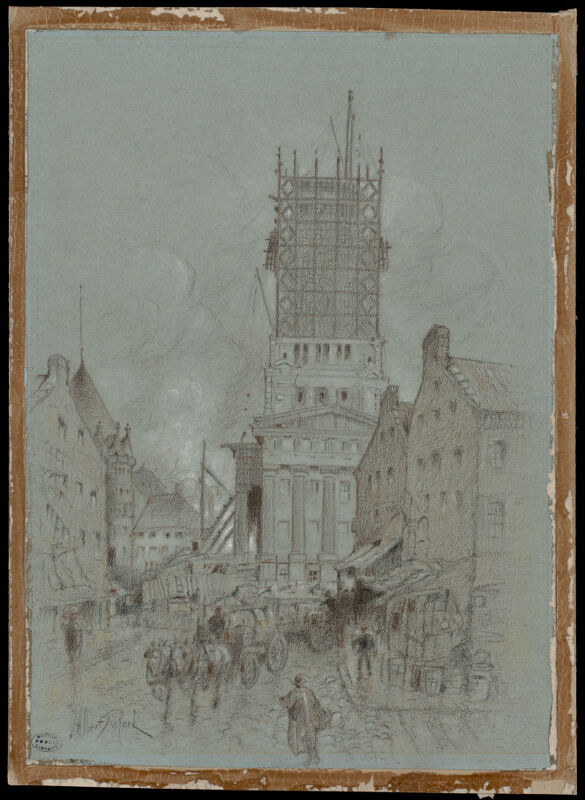
Both tall buildings represented the aspirations of reaching up even while their styles look back in time—perhaps revealing an ambivalence about progress of an age that went full speed ahead.
The “3” in the corner shows the height of the Custom House before the addition.
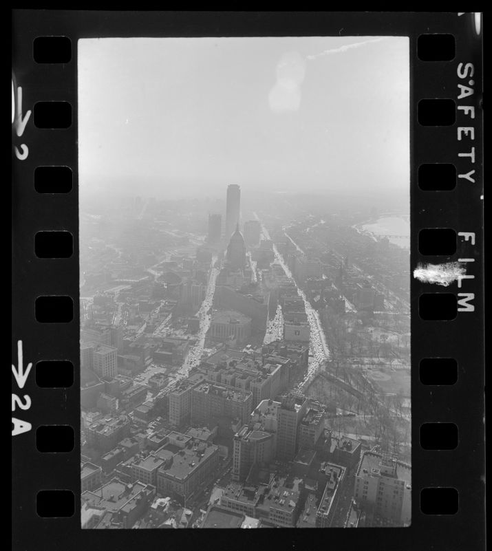
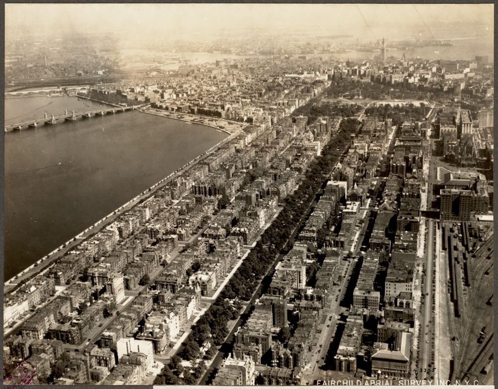
The photograph shows a lone skyscraper standing tall over the harbor. It also offers a view of the site of the Prudential Center in the railyard at the bottom right corner.
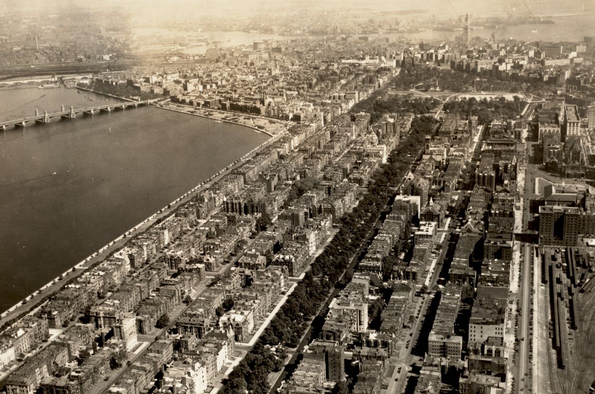
Boston. Back Bay
Fairchild Aerial Surveys, Inc.
1925
Boston Public Library Arts Department
An aerial view of Back Bay looking north and showing the newly constructed Prudential Building.
Back Bay looking east aerial view (note uncompleted Hancock Tower), downtown Boston
Spencer Grant
1969
Boston Public Library Arts Department