Dumont de Montigny was a French colonial officer stationed in Louisiana in the early eighteenth century. He spent nearly 18 years there and wrote an extensive history of the region, published in 1747, which included these beautiful maps of encampments, forts, farmland, and more. These maps are in the physical collection of the Newberry Library and appear in our American Revolutionary War-Era Collection of Distinction.
Fort du Billoxy
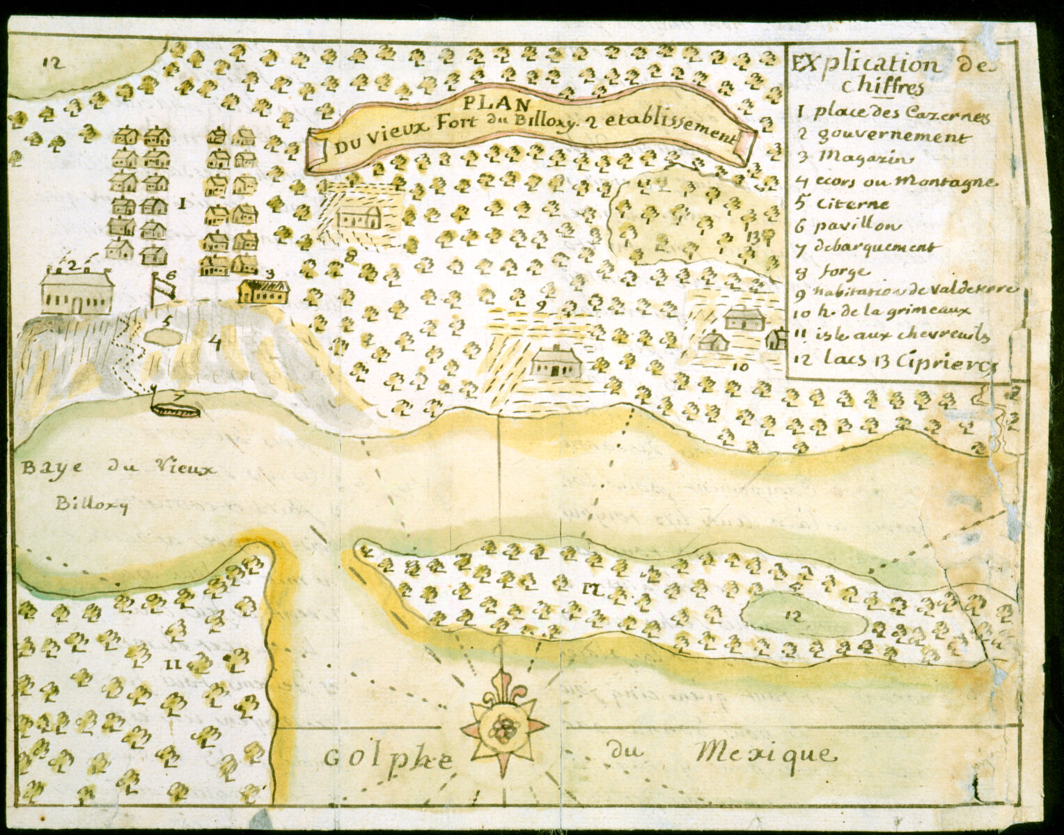
Dumont de Montigny, Plan du vieux Fort du Billoxi, 2 etablissement (1747).
Fort Maurepas, on the Gulf of Mexico, was also known as Fort Biloxi (the exact name was spelled in a variety of ways). In this rather organically laid out map, Dumont has labeled residential barracks, the government building (which may have been the seat of French Louisiana, when Biloxi was the capital), the well, cypress marshes, and more. The time he depicts is 1720; today the fort is within the town of Ocean Springs, Mississippi.
Land “Cessions”
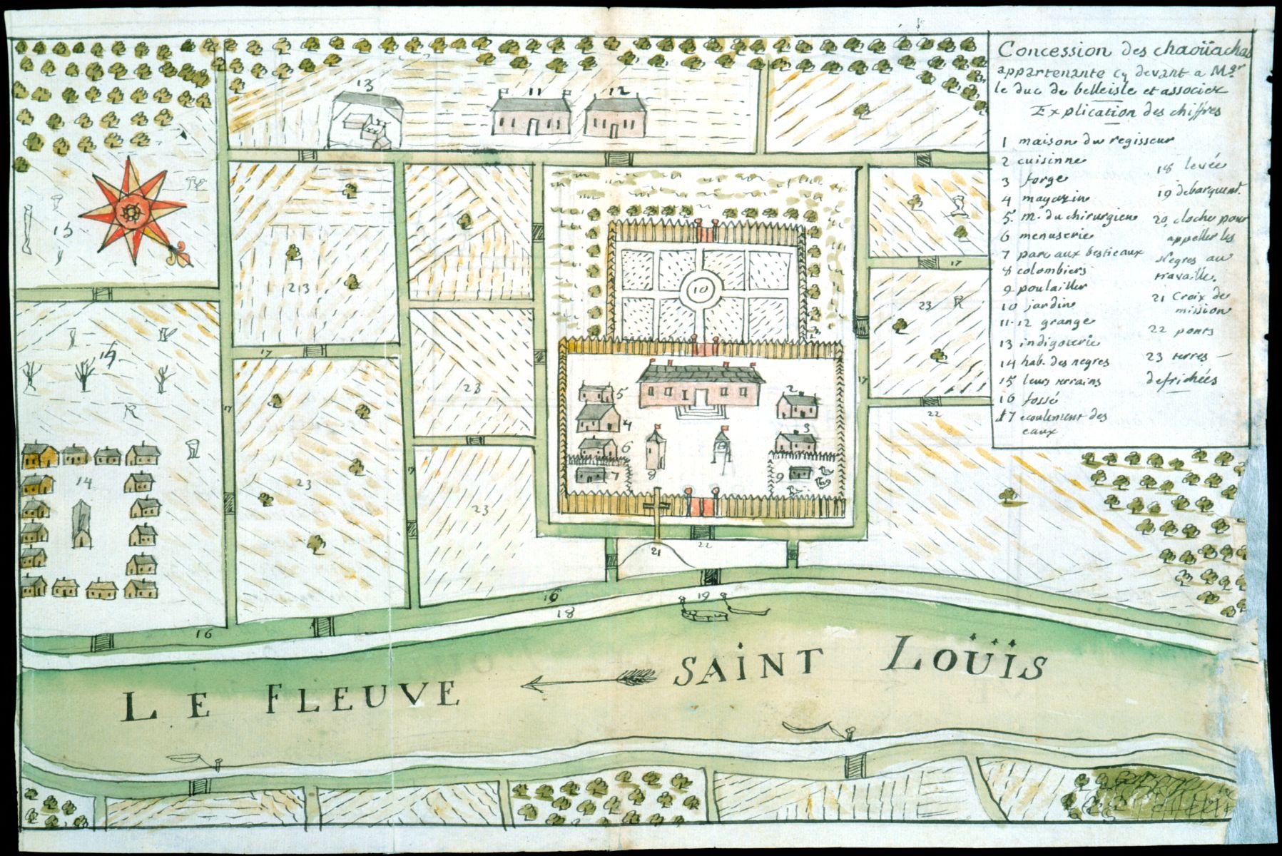
Dumont de Montigny, Concession des Chaoüachas appartenante cy devant a Mgr. le duc de Belleisle et associez (1747).
This map title begins “Concession des Chaoüachas,” which means Chaoüacha land grant or ceded land. It is unlikely that the Chaoüachas saw themselves as willingly ceding land to the French. On the contrary, Alan Gallay describes them as one of the “petite nations” that was raided and attacked, and its inhabitants enslaved, by other native groups on behalf of the English. The map itself is much more geometric than the previous one, with irrigation systems flowing at right angles through square fields. It shows a plantation on Saint Catherine Creek in Natchez, Mississippi. The plantation formed part of Charles Louis Auguste Fouquet, duc de Belle-Isle’s land concessions in provincial Louisiana.
Battle Map
![Dumont de Montigny, [Campement] de l’armée franc̦oise [devant u]n village des ennemis, les Chicachas le 26 [de mais] 1736 (1747).](https://iiif.digitalcommonwealth.org/iiif/2/commonwealth:z603vn65v/full/,1200/0/default.jpg)
Dumont de Montigny, [Campement] de l’armée franc̦oise [devant u]n village des ennemis, les Chicachas le 26 [de mais] 1736 (1747).
Finally, this map makes direct reference to some of the violence that is hidden by the polite term “concession” in the previous map. It depicts the Battle of Ackia, detailing a failed 1736 attack by Choctaw and French allies led by Jean Baptiste Le Moyne, Sieur de Bienville against a Chickasaw village and English allies. This battle was fought about 7 miles northwest of the later site of Tupelo in Lee County, Mississippi.
Our articles are always free
You’ll never hit a paywall or be asked to subscribe to read our free articles. No matter who you are, our articles are free to read—in class, at home, on the train, or wherever you like. In fact, you can even reuse them under a Creative Commons CC BY-ND 2.0 license.