This 1796 postal route map popped up in a tweet from our collections bot on Twitter last week! Our map bot trawls the collections and chooses crops from random maps to tweet out to the world.
Excerpt from "Map of the United States exhibiting the post-roads, the situations, connections & distances of the post-offices, stage roads, counties, ports of entry…" (1796) https://t.co/HCMa3mUVBw
[See something that needs more explanation? Please read https://t.co/aeyHggOzHf] pic.twitter.com/jD8JkciwbU
— A U T O M A P I C 🤖 (@auto_mapic) April 20, 2021
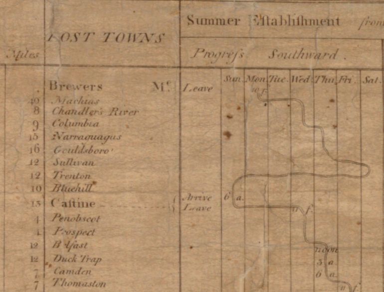
It’s got everything you’d want – post-roads, distances between post offices, and the cutest diagram of “Progress of the Mail on the Main Line.” This chart shows how long it takes to get mail from one town to the next. The cropped section of it on the right starts in Maine and progresses southward; mail leaves Brewers, ME on a Monday and arrives in Thomaston, ME a week and a half later on a Thursday. You can see the line which denotes the days snaking along through the calendar.
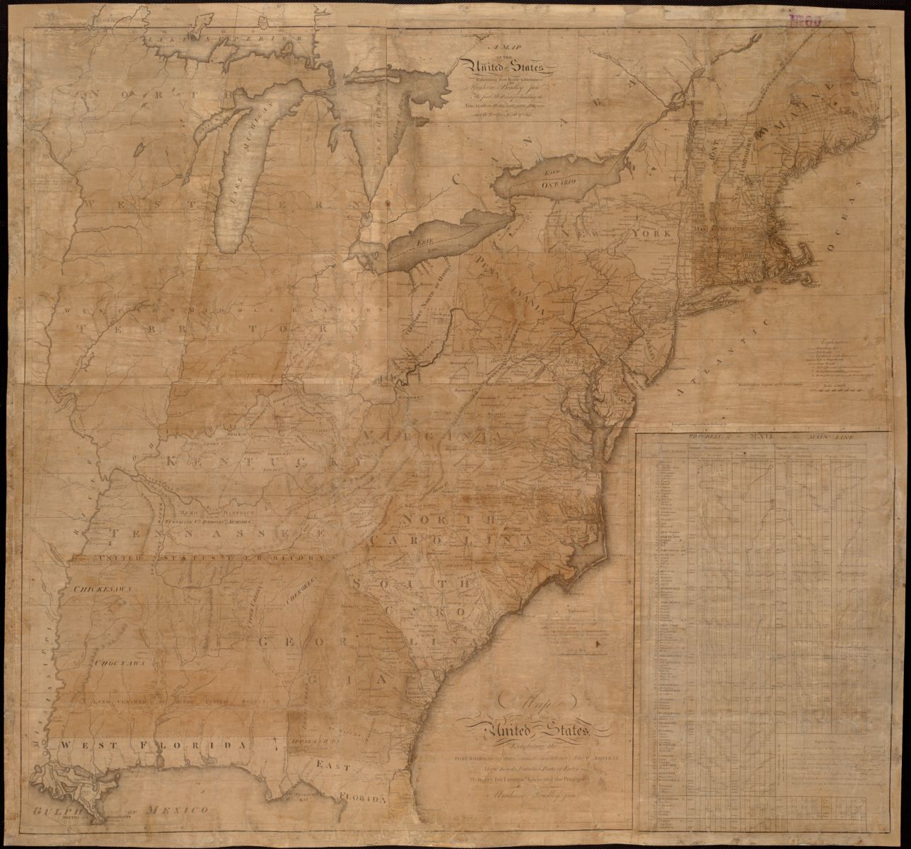
The map is by Abraham Bradley Jr., assistant Postmaster General and a cartographer. With its timetable, it was an incredibly useful piece of technology that was meant to be posted at all large post offices. It also helped people conceptualize the size of their new nation, and provided them a way of measuring its distances through time. It’s the first postal route map of the US, but Bradley published updates over the years and many similar maps came after his 30 year tenure at the Post Office.
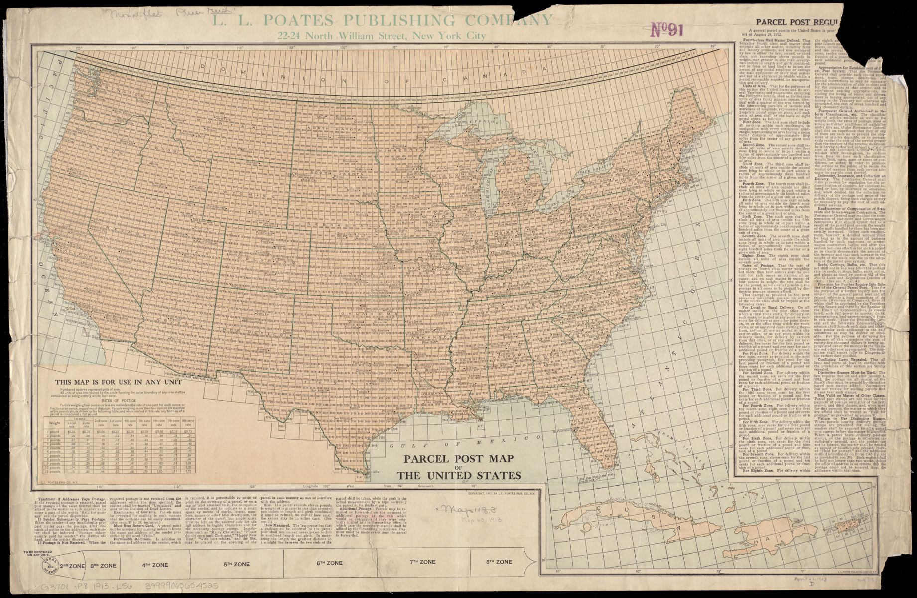
Here’s a 1913 parcel post map of the US from our collection, whose table is about postage rate rather than mail route timing. It also has an “appendage used to determine postal zones,” and includes regulations about parcel post in the margin.
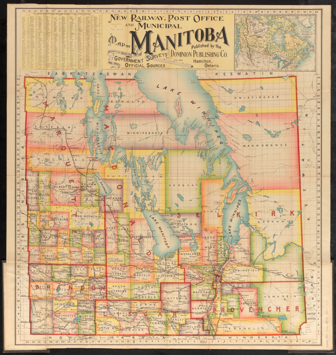
We’ve even got post maps from other countries, including this pretty one from Manitoba! It’s a “railway, post office, and municipal map” with the locations of those places marked and indexed on the map. Talk about typography! Check out these maps and, of course, many more, in our digital collections.
Our articles are always free
You’ll never hit a paywall or be asked to subscribe to read our free articles. No matter who you are, our articles are free to read—in class, at home, on the train, or wherever you like. In fact, you can even reuse them under a Creative Commons CC BY-ND 2.0 license.