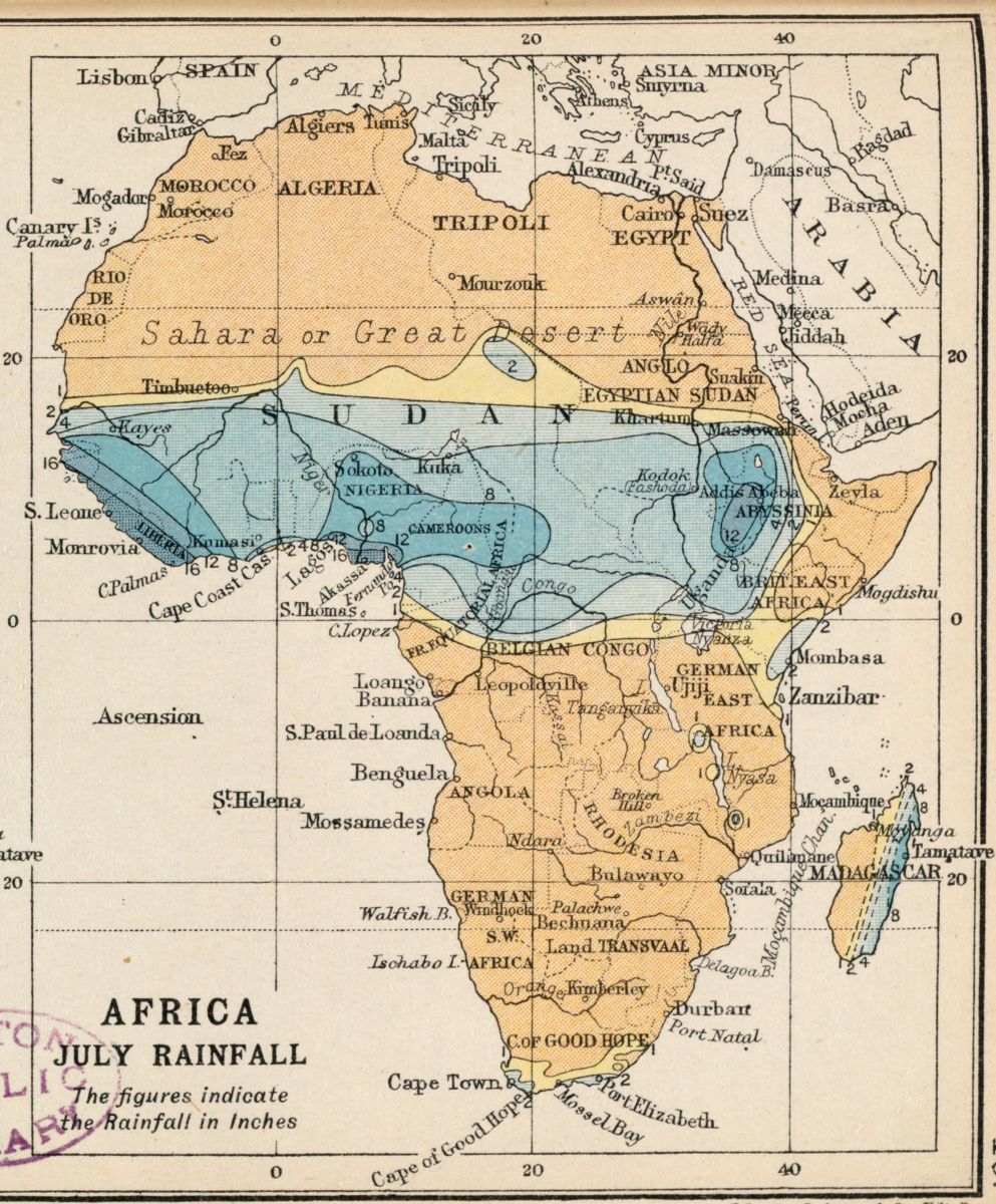
John George Bartholomew, E.P. Dutton, and J.M. Dent & Sons, Africa January rainfall – Africa July rainfall (1913)
This map of Africa is usually juxtaposed with another Africa, to compare rainfall in January to rainfall in July. The July rains, shown here, are centered on the area just south of the Sahara desert, whereas January rains have their centerpoint further south. The place names on this map are from 1913, when many Europeans referred to the areas by their colonial names. Rhodesia, for example, is on this map, but is now Zimbabwe. Mapmakers can have specific biases and agendas with their maps, and it’s important to recognize what those are. These cartographers were representing a colonial territory that they wanted to measure and study, likely for commercial gain.
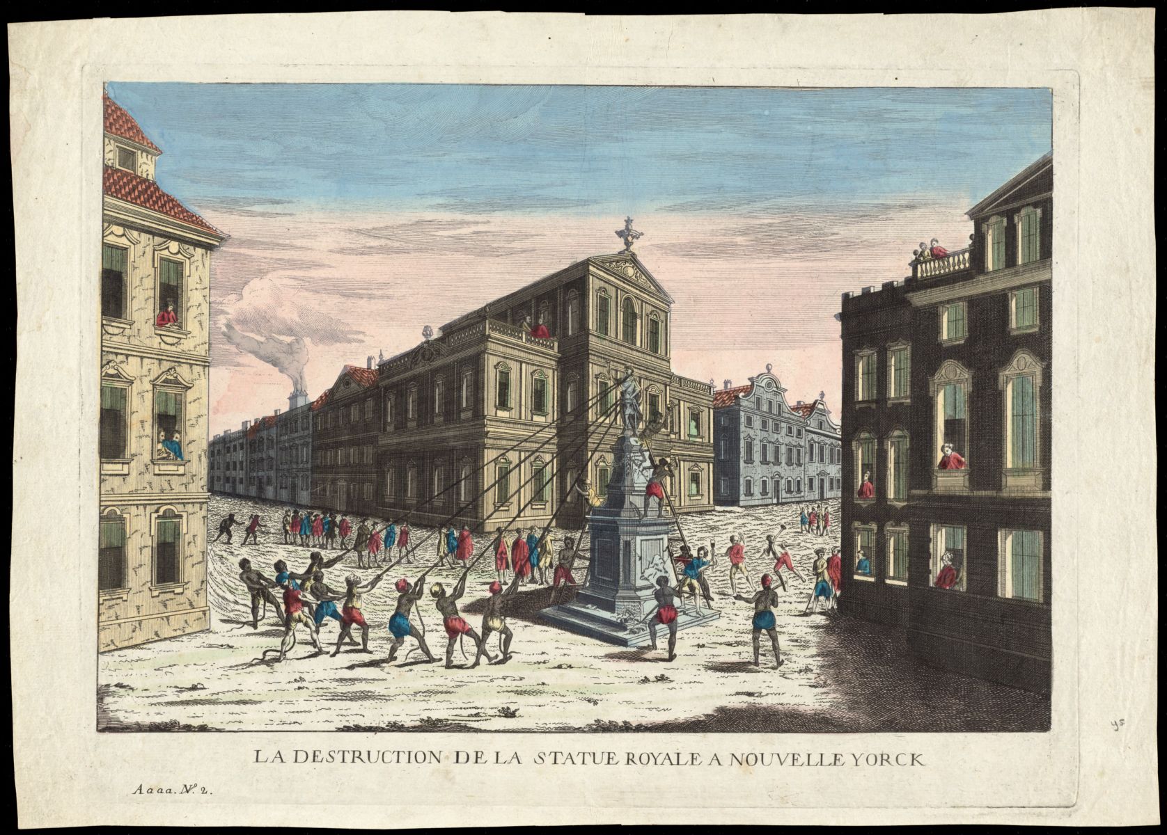
More than a century earlier, the American colonies had gained their independence from Great Britain. This print imagines the scene after George Washington read the Declaration of Independence to his troops on July 9, 1776, and New Yorkers gathered to tear down this statue of King George III. The card is a vue d’optique, a popular mode of 3d art at the time. A viewer would use a magnifying machine called a zograscope to see the image with the illusion of depth. The perspective and saturated colors of this piece are typical of the form, popular in the late 18th and early 19th centuries, although often the words would also have been backwards to be read forwards through the zograscope, which usually flipped an image.
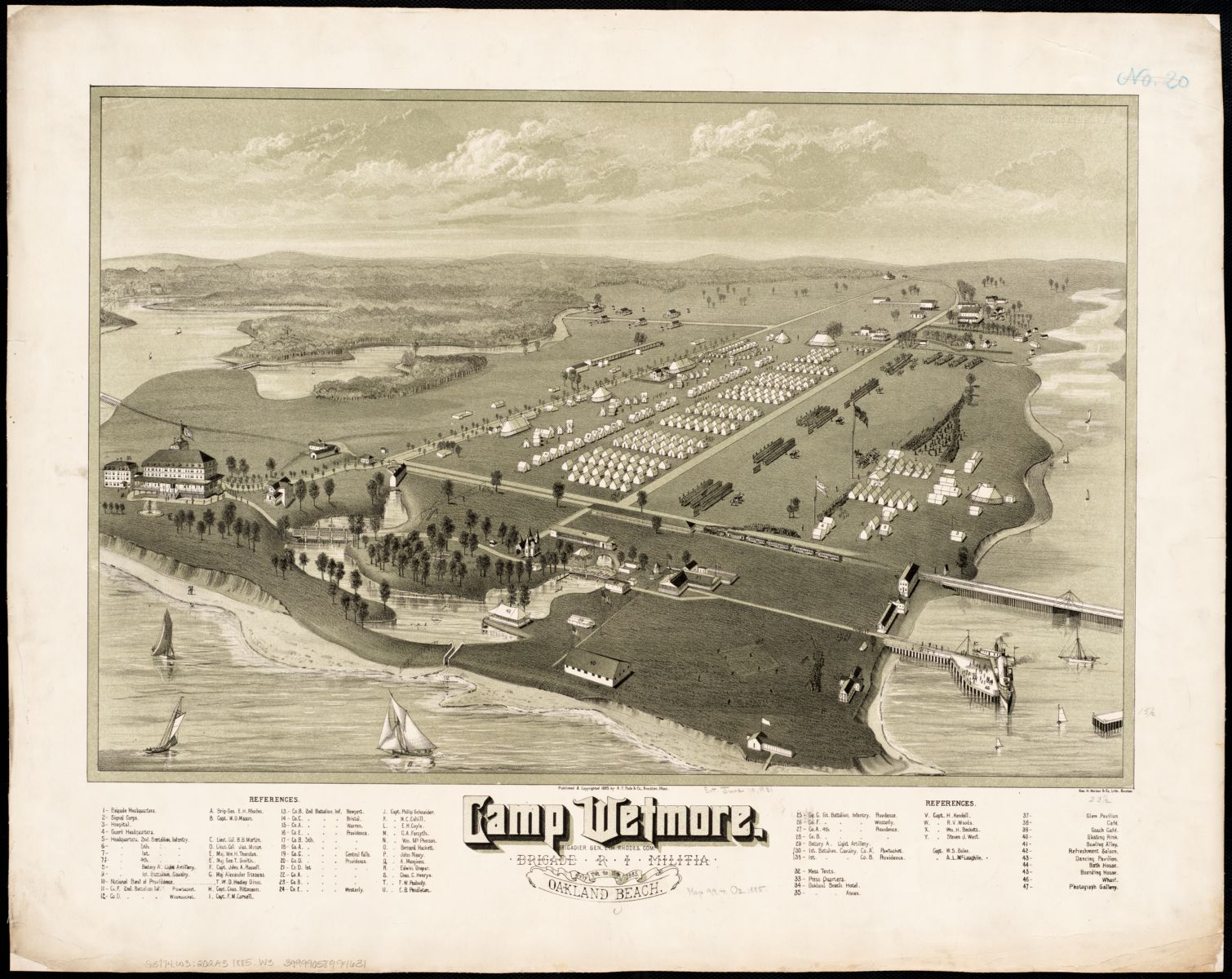
Geo. H. Walker & Co, and A.F. Poole & Co, Camp Wetmore, R.I. brigade militia, July 7th to 11th, 1885, Oakland Beach (1885)
A popular form from the late 19th century is the bird’s-eye view. This type of map looks down at an angle from above a landscape, and often focuses on a specific city. This bird’s-eye view is of Camp Wetmore on Oakland Beach, the camp of the Rhode Island militia July 7-11, 1885. Many states maintained militias after the Revolutionary War, and Rhode Island’s in particular was used several times to quell labor union strikes.
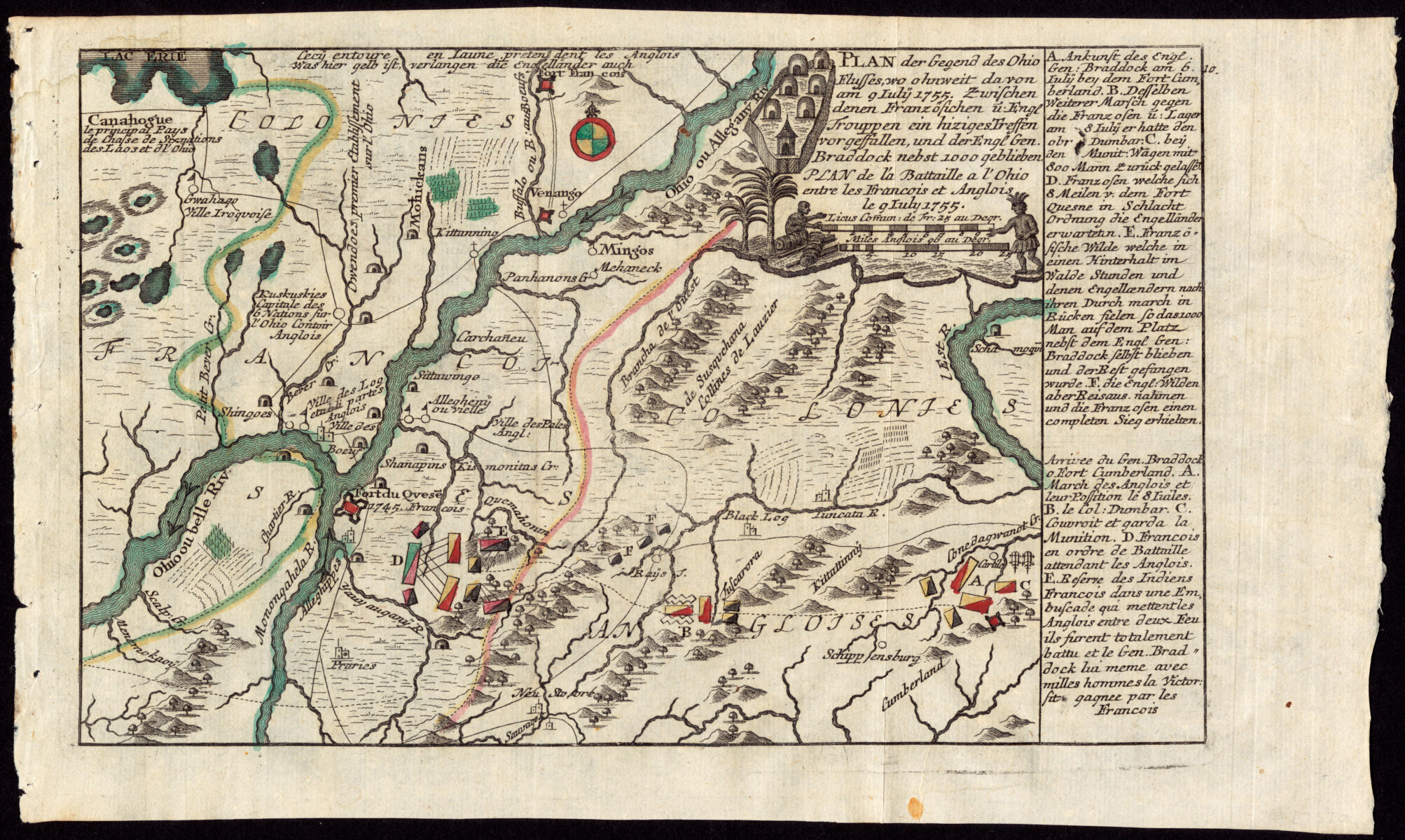
Christian Friedrich von der Heiden, Plan der gegend des Ohio Flusses, wo ohnweit da von am 9 July 1755, zwischen denen Franzofichen u. Engl trouppen ein hiziges treffen vorgeffallen, und der Engl Gen. Braddock nebst 1000 geblieben (1760)
Jumping back to the 18th century is a map from earlier conflict, this beautiful plan of the Battle of the Monongahela on July 9, 1755 during the French and Indian War reveals the failures of English troops to adapt to the new style of warfare in the New World. There were nearly 1000 English casualties, more than two-thirds of the combatants on the English side. George Washington served as a civilian aide-de-camp to General Braddock in the battle. Battle maps were popular in the 18th and 19th centuries – and if you had to guess, what would be the most mapped battle of the Civil War?
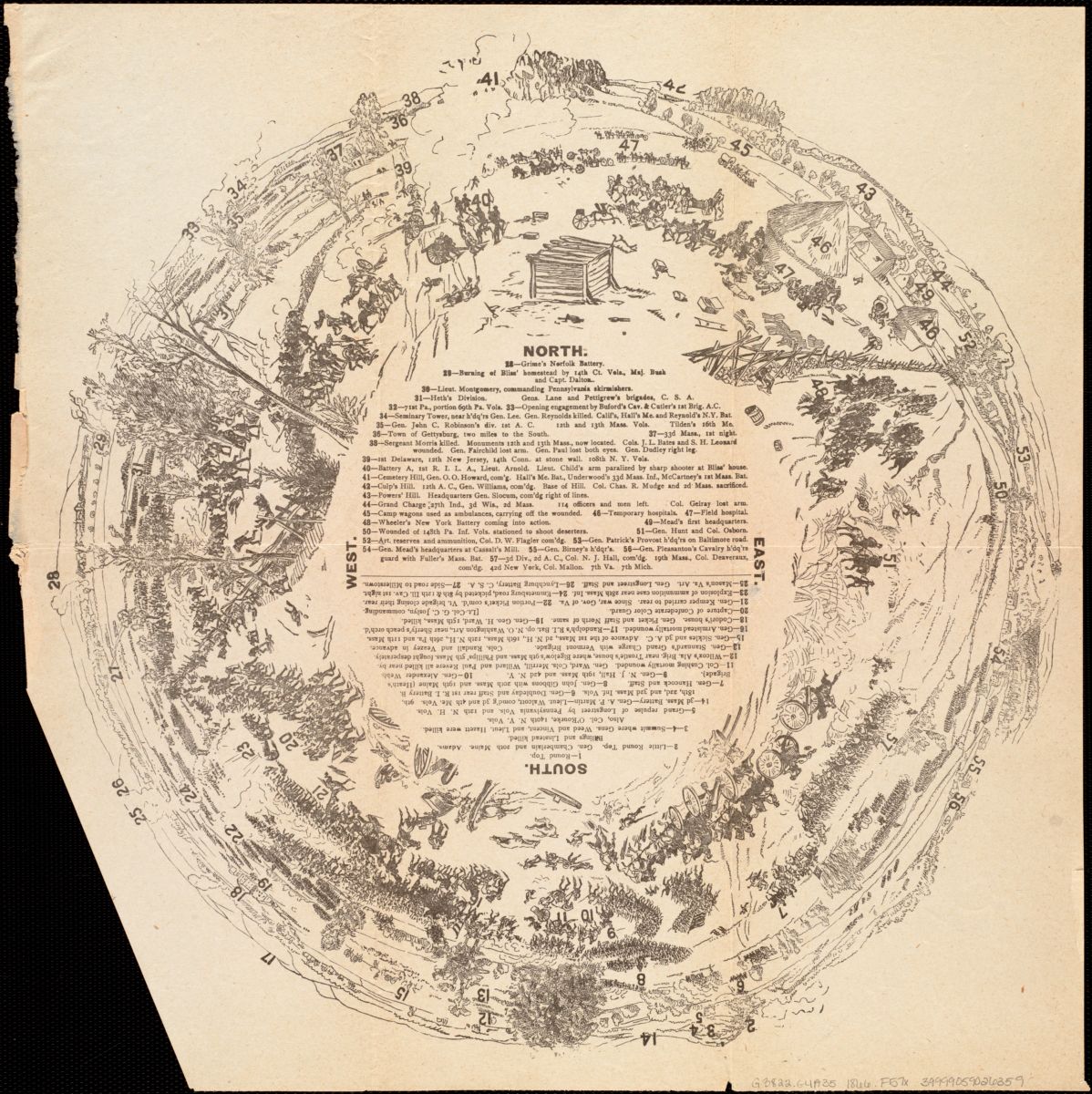
If you bet on Gettysburg, you’d be right! There are approximately 150 different maps of the Battle of Gettysburg, the turning point of the Civil War. This panoramic one maps landmarks, locations of specific regiments, and sites of selected casualties. It shows a 360 degree view of the events of the battle, marked with numbers that correspond to a key in the center. The Battle of Gettysburg was three days, July 1-3, 1863, and was one of the most significant engagements of the war.
Our articles are always free
You’ll never hit a paywall or be asked to subscribe to read our free articles. No matter who you are, our articles are free to read—in class, at home, on the train, or wherever you like. In fact, you can even reuse them under a Creative Commons CC BY-ND 2.0 license.