Alan Leventhal—the son of our founder Norman B. Leventhal, a longtime supporter of our work, and the Chair of our Board of Directors from 2020 to 2022—was recently sworn in as the U.S. Ambassador to Denmark. To celebrate Alan’s new role, let's take a tour of maps and materials about Denmark from the Leventhal Center and BPL collections.
Scandinavia 540 years ago
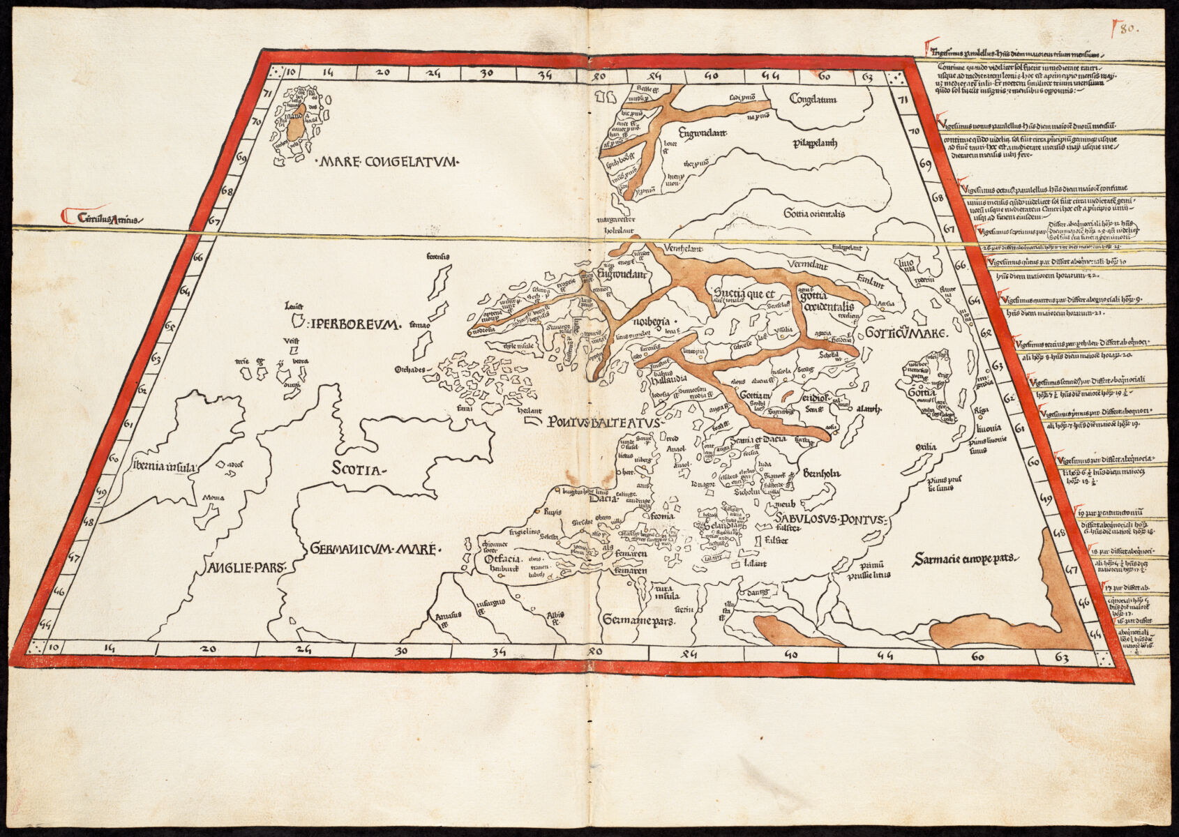
This circa 1482 plate from a Ptolemaic atlas is one of the oldest maps in our collections showing what we now call Denmark. It's labeled here with "Dacia" on the Jutland peninsula—an provincial term to refer to what later became both Denmark and Sweden—and "Selandia" on the island of Zealand, where Copenhagen sits. This map also shows Iceland in the upper left hand corner, which came under Danish rule at the beginning of the sixteenth century and remained a territory of Denmark until the middle twentieth century.
Copenhagen under siege
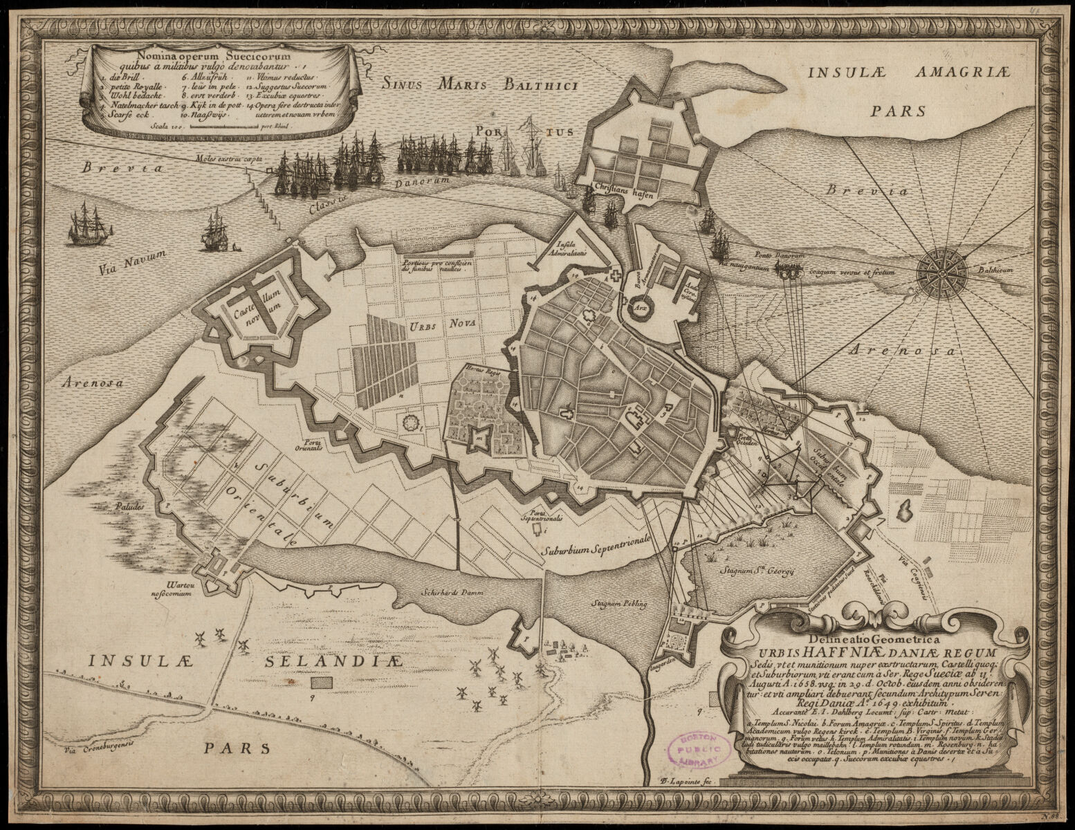
While the foreign relations between Scandinavian countries are now friendly, Denmark and Sweden have a history of conflict—in fact, according to one measure, they have fought each other more often than any other two countries in world history. This map of Copenhagen from the late seventeenth century was produced to illustrate a history of the Swedish Empire by the German political theorist Samuel von Pufendorf. The map shows the Swedes’ 1658 siege of Copenhagen, which was was ultimately unsuccessful, in part due to the city’s strong fortifications. Today’s U.S. embassy is located just outside of the city’s historic bastion wall. This map also appears in Mapping a World of Cities, our collaborative timeline of urban historical cartography.
A pictorial Denmark
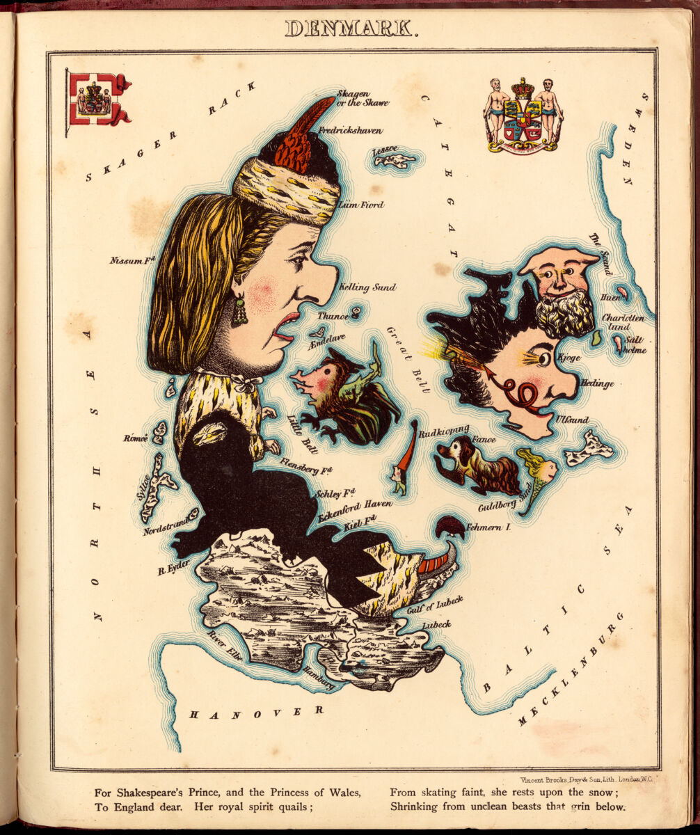
This caricature map of Denmark appeared in Lilian Lancaster and William Harvey’s 1868 book Geographical Fun. Caricature maps like this one often offered lighthearted commentary on serious topics, like the famous octopus map that appeared in our Bending Lines exhibition. In this illustration of Denmark, the “royal spirit” of the nation is “shrinking from unclean beasts that grin below”—almost certainly a reference to Prussia, which in 1864 had annexed the territories of Schleswig-Holstein at the foot of the Jutland peninsula.
A nation poking out into the North Sea
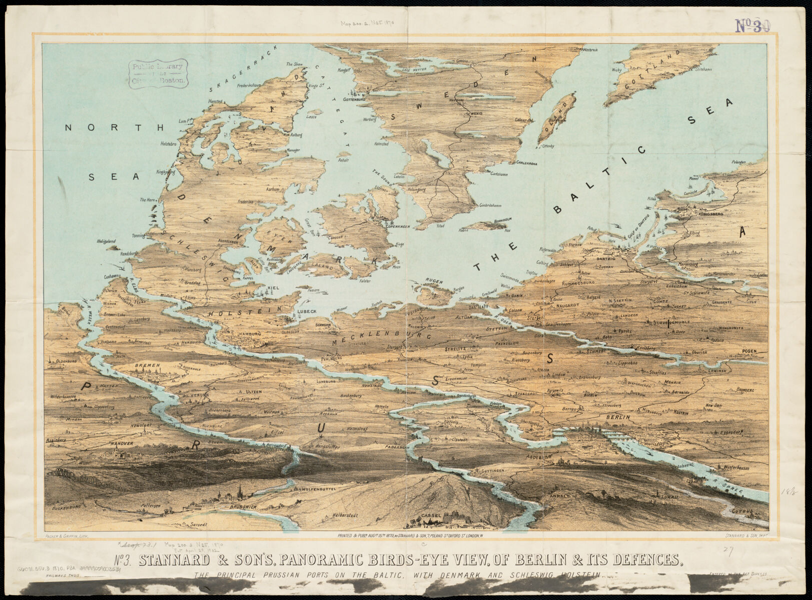
While the titular topic of this 1870 map is “Berlin and its defenses,” this unique bird’s eye perspective gives an excellent window into the geographic relationship between Denmark, Germany, and the Scandinavian countries. With its complicated structure of peninsulas and islands dividing the North Sea from the Baltic Sea, Denmark has always played a key role in the geopolitics of northern Europe. Maritime traffic from important cities like St. Petersburg, Gdańsk, and Lübeck must pass through one of three passages: the Øresund near Copenhagen (labeled here as “The Sound”), the Great Belt separating the island of Zealand from Funen, or the Little Belt separating Funen from the Jutland peninsula. During the climatological period known as the Little Ice Age, the Swedish army was able to cross the Little Belt when it froze in 1658, setting up the siege described in the first map and offering an early example of how the global climate system can impact political conflicts.
The tragedy of a Prince of Denmark
This isn’t a map, of course, but it’s one of the most notable examples of a Danish character playing a role in English literature—Shakespeare’s Hamlet, which is set in medieval Denmark. The BPL’s Rare Books Department, which will reopen to the public later this year after a major renovation, is home to the Thomas Pennant Barton Collection, an important collection of Shakespeare material. This 1611 edition of Hamlet was published just a decade after Shakespeare first wrote this enduringly provocative play.
A cycling map of a green city
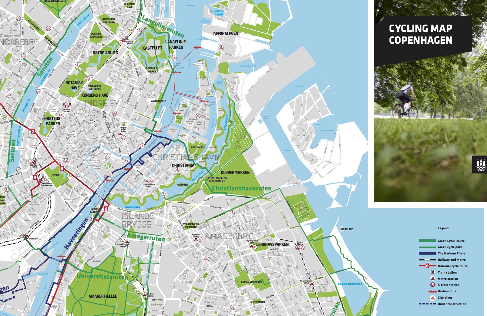
This map isn’t yet in our collections, but it captures one of Denmark’s most impressive modern geographic features: the nation's extensive system of bicycle-friendly streets and paths. Denmark has been at the forefront of efforts to address climate change (a topic that’s also of interest to the new ambassador!), and moving people into more low-carbon methods of transportation is a major goal for the country. This map of Copenhagen shows some of the primary routes for bicycling around the city. One of the most striking features of the city's bicycle infrastructure is the Cykelslangen bridge.
Luckily, when Alan is stationed in Copenhagen, he won’t have to feel too far away from a world-class collection for researching historical geography. The Danish Royal Library has one of Northern Europe’s largest map collections. From all of us at the Leventhal Center, we wish the best to Alan in his new role—and we can foresee many trans-Atlantic cartographic adventures to come.
Our articles are always free
You’ll never hit a paywall or be asked to subscribe to read our free articles. No matter who you are, our articles are free to read—in class, at home, on the train, or wherever you like. In fact, you can even reuse them under a Creative Commons CC BY-ND 2.0 license.