It’s been a hot few days in New England, and what better way to chill out than with some maps? Here’s a selection of cool maps from Junes throughout history!
Bunker Hill
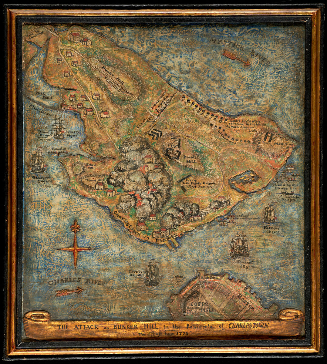
Mildred Giddings Burrage. The attack on Bunker Hill in the peninsula of Charlestown the 17th of June 1775. 1926.
The Battle of Bunker Hill was June 17, 1775. This painting done 151 years later of the battle is by Maine artist Mildred Burrage, who used gesso to create topography in the map. It’s a very beautiful piece with a satisfying texture. We have a lot of battleground maps in our collection, but this is one in particular that rides the line between a piece of art and a map. In fact, we did a whole exhibit on the overlap between art and maps, which you can still see online.
A Swing and a Miss at the Park
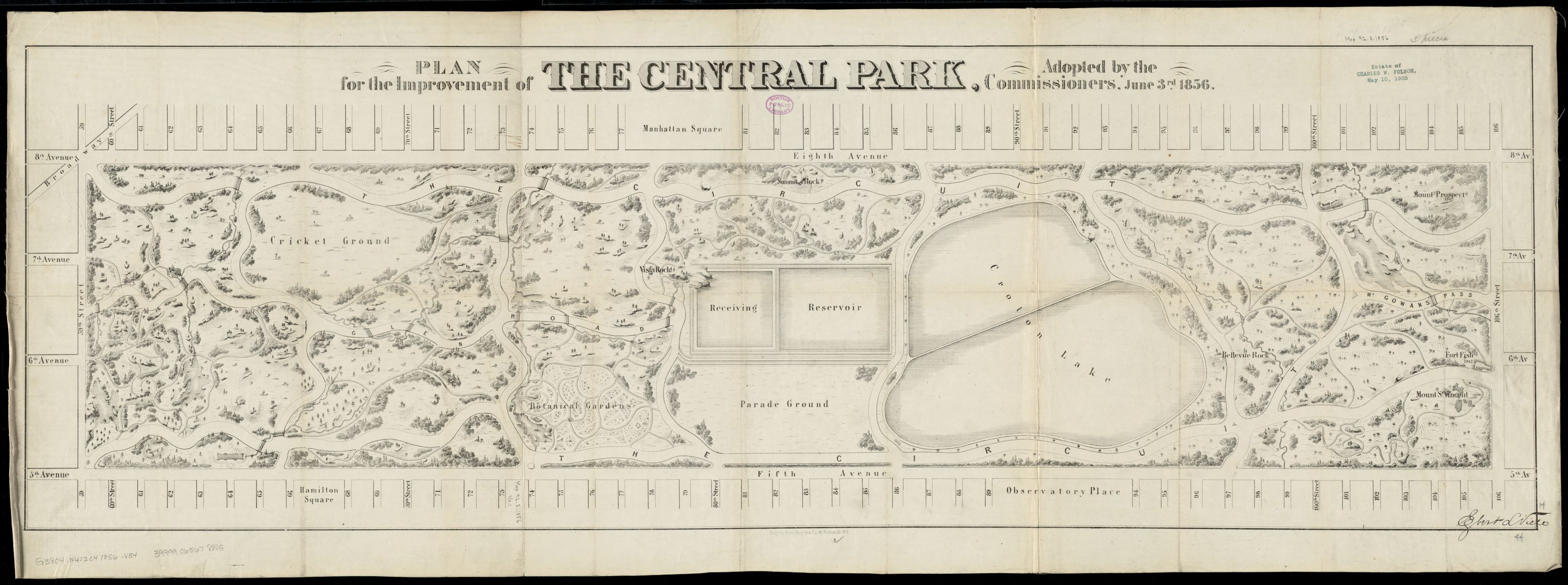
Egbert Ludovicus Viele. Plan for the improvement of the Central Park, adopted by the Commissioners, June 3rd, 1856. 1856.
Here’s a June 3, 1856 proposed map for improving Central Park! It was created by a cartographer named Viele, who you may or may not know did not end up designing the park. In 1857 there was a contest for the design of Central Park, won by Frederick Law Olmsted and Calvert Vaux. Olmsted is famous for designing many parks, including Central Park, Mount Royal Park in Montreal, and the Emerald Necklace in Boston. For more information on Boston green space in particular, check out our exhibition Breathing Room.
20th Century Real Estate
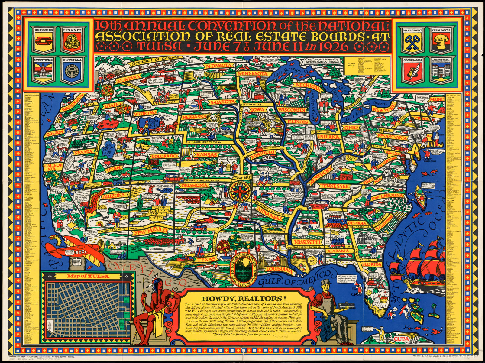
National Association of Real Estate Boards, and R.R. Donnelley and Sons Company. 19th annual convention of the National Association of Real Estate Boards. 1926.
In June 1926 in Tulsa, there was a real estate conference for which this celebratory map was drawn up. It’s a stylistically striking piece in primary colors, memorializing the nineteenth annual convention of the National Association of Real Estate Boards. While this map is gorgeous, and has pictures of realtors with funny geographic quips, it also conveys underlying racial attitudes of the time: the only Black person on the whole map is a caricature picking cotton, and there’s a Native American used as decoration to highlight Tulsa’s western, cowboys-and-Indians charm. Read more about contextualizing maps like this in our collections.
Go Fish
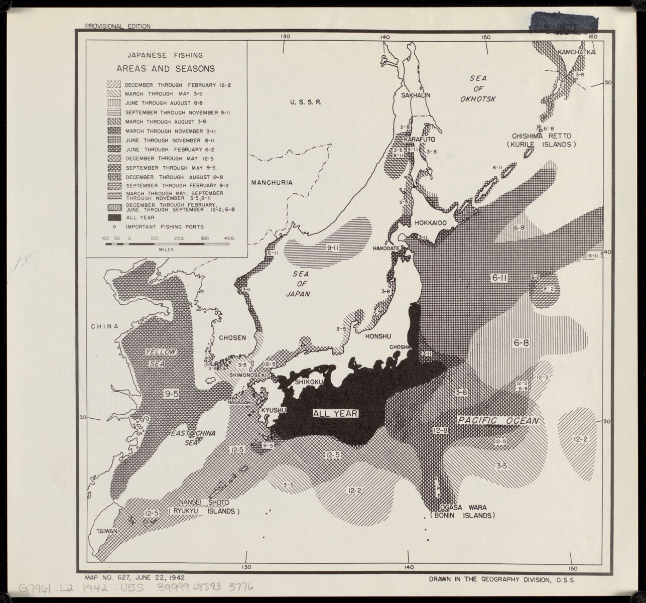
United States. Office of Strategic Services. Geography Division. Japanese fishing, areas and seasons. 1942.
From June 22, 1942 comes this map of seasonal fishing in Japan. It was produced by the Office of Strategic Services, WWII predecessor to the CIA. We have several maps made by the OSS in our collections, including a mineral resource map of Morocco, German freight traffic movement, and land use in Korea. The strategic uses of maps and geographical knowledge is on clear display in this subset of the collection.
Solstice Celebrations
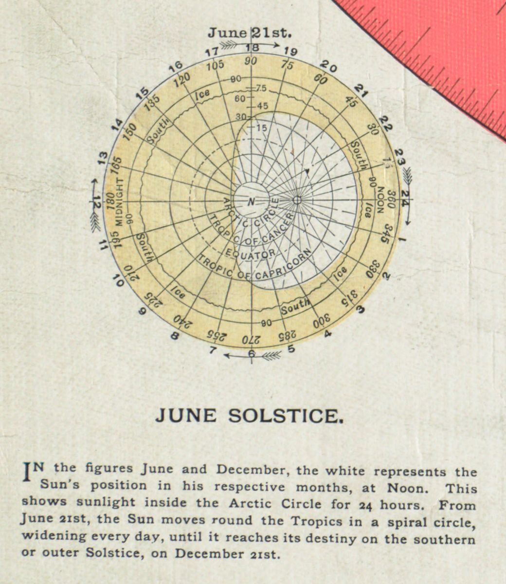
Alexander Gleason and Buffalo Electrotype and Engraving Co. Gleason’s new standard map of the world. 1892.
June is the month of the summer solstice, when days are the longest in the Northern Hemisphere. Here’s a diagram from Gleason’s flattened, top-down map of the world, where you can see “the Sun’s position in his respective months.” On June 21, the Arctic Circle falls entirely within the sun’s range for the entire 24 hour period. There’s another diagram on the other side of the map for the winter solstice in December.
Take a Stroll!
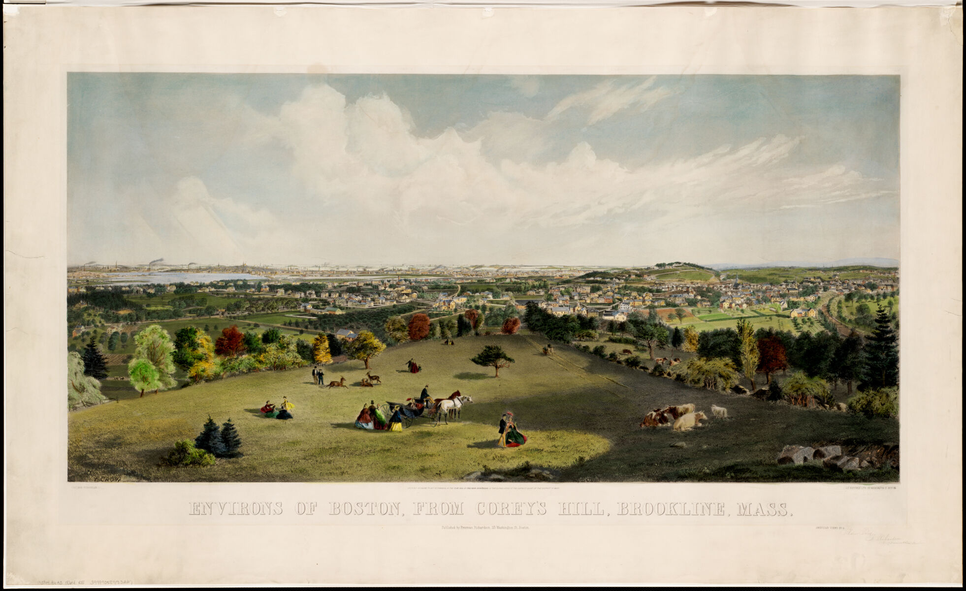
Freeman Richardson. Environs of Boston, from Corey’s Hill, Brookline, Mass. 1864.
With cooler temperatures rolling in over the next few days, the weather will be perfect for checking out this view of Boston from Corey Hill. Bird’s eye view maps like this one were popular in the second half of the 19th century. You can see people hanging out alongside horses and cows in the foreground, enjoying what we hope is balmy weather, while in the background there’s a glimpse of downtown Boston and the unfilled Back Bay. The year after this was drawn, Richardson spent his May and June of 1865 in Virginia rather than Boston, “sketching scenery, military installations, and urban structures following the close of the Civil War.”
Our articles are always free
You’ll never hit a paywall or be asked to subscribe to read our free articles. No matter who you are, our articles are free to read—in class, at home, on the train, or wherever you like. In fact, you can even reuse them under a Creative Commons CC BY-ND 2.0 license.