Our world is awash in data. The widespread availability of computers and Internet access has made it possible to aggregate and share information at scales that even just a few decades ago would have been almost unimaginable. Geospatial information is a major part of this data revolution. Data sets provided by institutions like the City of Boston or the US Census Bureau offer incredible sources of information on topics ranging from poverty to environmental change—ready to be analyzed and mapped by anyone.
But is it really true that anyone can work with this data? In spite of the push to make geospatial data "open" and "public," meaningful access to geospatial resources is too often isolated behind technical systems that are built for experts, and a steep learning curve looms formidably in front of those who might like to take "raw" data and create maps, stories, and arguments from it.
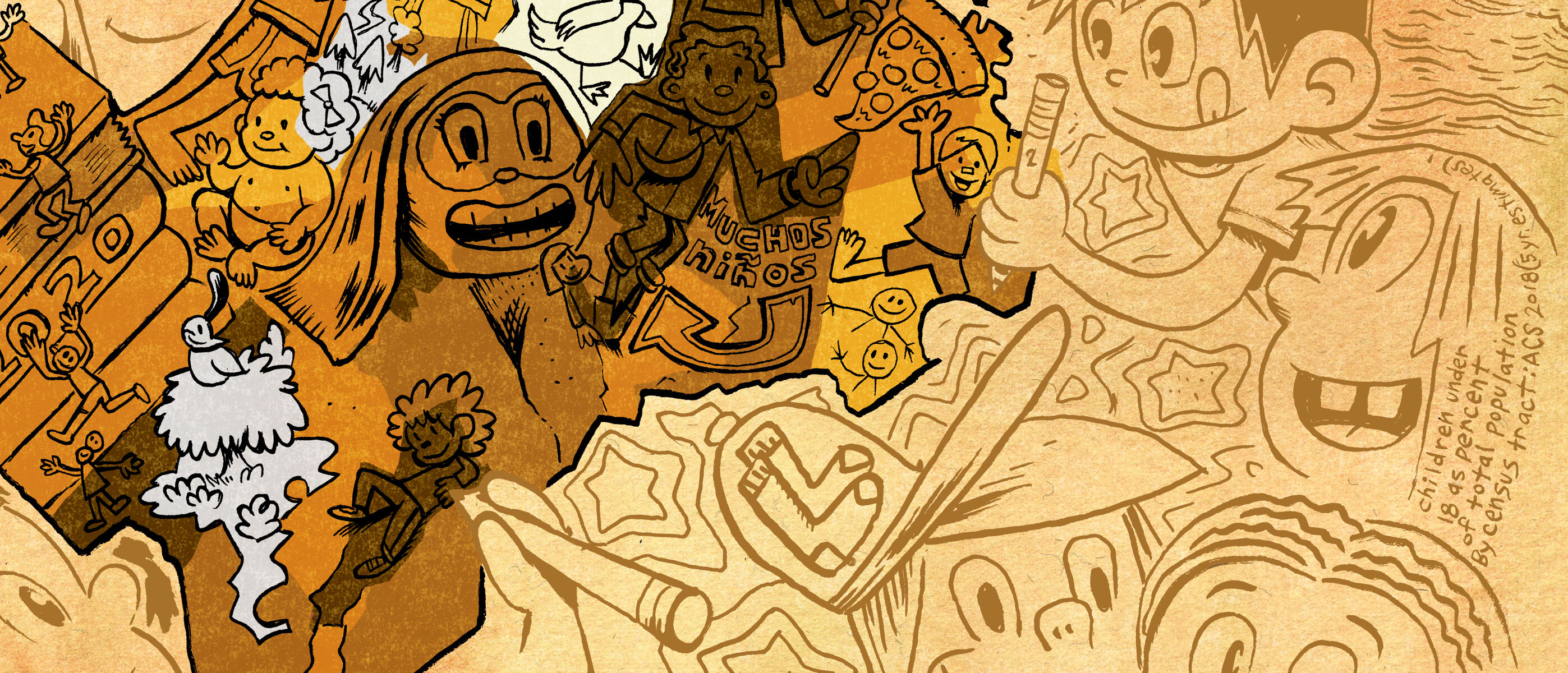
The artists Raúl the Third and Elaine Bay created this caricature map from American Community Survey data for our exhibition Bending Lines
Sixty years ago, if you wanted to access statistical information about your community, you might have visited a research library like the BPL and requested atlases, reports, and government publications. Today, even though that kind of information is available freely online, it can ironically be more difficult to access when it's trapped inside of special file formats and confusing databases.
The Northeast Big Data Innovation Hub is funding this project
We're thrilled to announce that we're embarking on a project that aims at solving some of these challenges. As recipients of a Seed Fund Grant from the Northeast Big Data Innovation Hub, we're going to be working to provide broader—and better—access to digital geographic information.
Our project involves building both "technical infrastructure" and "social infrastructure." On the technical side, we're creating an all-new portal for describing and documenting useful geographic data sets about Boston and the region for nonexpert users, with an emphasis on human readability. Our portal will foreground concerns around how data sets relate to one another. It will also describe data in a way that asks critical questions about who and what is represented—and how.
Technical solutions alone, however, aren't enough for widening access to data. That's why we're also building institutional support for members of the public who want to work with geospatial information. We'll be documenting the new data portal and supporting it with easy-to-use training material aimed at adult library patrons and K-12 teachers. To launch all of this work in its trial phase, we'll be developing a new, free educational program and offering it remotely next spring. Working with our Education team, our goal is to equip participants with the skills, confidence, and critical disposition that's necessary for doing good work with data.
A data story from the Bending Lines exhibition, created by Madison Draper and Alison DeGraff Ollivierre, explores how geographic information requires interpretation and human context
The team
At the LMEC, this project will be managed by Garrett Dash Nelson, Curator of Maps & Director of Geographic Scholarship, and Belle Lipton, Geospatial & Cartographic Information Librarian. We're joined by our Education staff, Michelle LeBlanc and Lynn Brown, who will be heading up efforts to introduce these programs to K-12 teachers.
As advisors to the project, we're collaborating with Catherine D'Ignazio and Eric Robsky Huntley of the Department of Urban Studies & Planning at MIT. They're both leaders in the world of critical data studies; check out D'Ignazio's new book (with Lauren Klein) Data Feminism, and watch Huntley talk about counter-cartographies at the most recent NACIS conference.
Three fantastic MIT students, our first cohort of Public Data Fellows, will be building the portal documentation, training material, and educational program together with us. Tess McCann is a second year Master's in City Planning student with a background in graphic design and project management and a passion for history and maps. Sarah Lohmar is a third-year undergraduate in Urban Planning with Computer Science excited about merging education with data. Missy Hill is an undergraduate in the Department of Urban Studies & Planning interested in the relationships between scientific discoveries and the communities they impact.
Finally, an advisory board of teachers from the Boston Public Schools system will help us shape the project, and ensure that the materials we create are useful and empowering for K-12 teachers.
Get updates
Are you interested in participating in our first offering of our training course next spring? Follow us on social media or join our mailing list. We'll be posting more details in 2021 about our plans.
Our articles are always free
You’ll never hit a paywall or be asked to subscribe to read our free articles. No matter who you are, our articles are free to read—in class, at home, on the train, or wherever you like. In fact, you can even reuse them under a Creative Commons CC BY-ND 2.0 license.