On December 15, we hosted From The Vault: Winter Travel and Tourism! From The Vault is a biweekly event series showing collections objects selected by Map Center staff. For this edition of the series, we looked at objects from our collections that map winter attractions, climate, and methods of travel.
Canada. Department of the Interior, Topographical map of the Rocky Mountains: Banff sheet (1902)
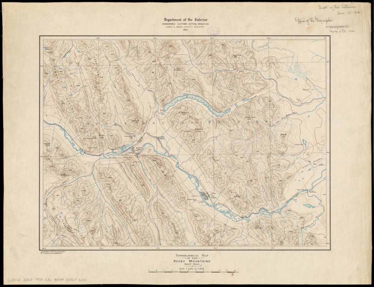
The Canadian Rockies are both a winter wonderland and a summer paradise. This topographic map inspires looking at the winter imagery of snow-capped peaks and frozen lakes through a new lens.
Along the Canadian Pacific Railway, the words ‘Coal Mine’, and ‘Anthracite’ depict an area that hosted a coal mine in the late 19th-early 20th century. The coal mine shut down and the town of Anthracite was eventually deserted; it is now known as a ghost town.
J.H. Bufford & Co, Map of the Vermont Central Rail Road and its connections, forming the Great Northern Route from the Atlantic to Montreal and the Lakes: from Smith’s map of the United States (1848)
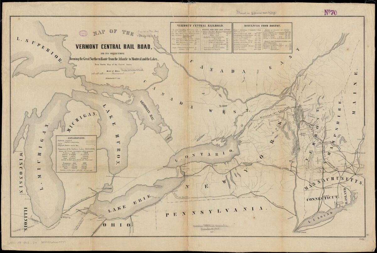
Railroads are not only a great way to get around town, but also a great way to explore more distant places within a larger geographic area. Published in 1848, this map highlights a few rail lines that could carry passengers from one winter scene to another. For example, one could leave the bustling city of Boston and see icy Lake Champlain.
Geological Survey (U.S.), Mean monthly average temperature (1986)
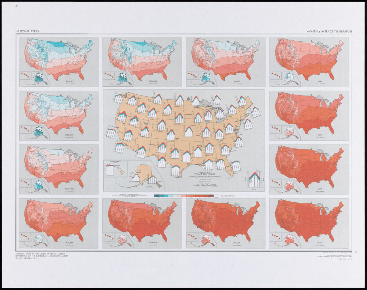
This 1986 geological survey is a visual display of the mean monthly average temperature across the U.S. using data on the time period 1931-1960. While some experiences of seasonal temperature changes and weather patterns have stayed the same since the publishing of this map, much has also changed. In recent years, Bostonians have experienced unseasonably warm weather days in the depths of winter, sometimes back-to-back with aggressive snow storms. Looking at this map in the present day inspires us to ask the question: how have winter travel, tourism, and recreation been experienced as weather factors like temperature have changed in dramatic ways?
Federal Writers' Project of the Works Progress Administration of Massachusetts, Winter sports map of the Berkshire Hills (1936)
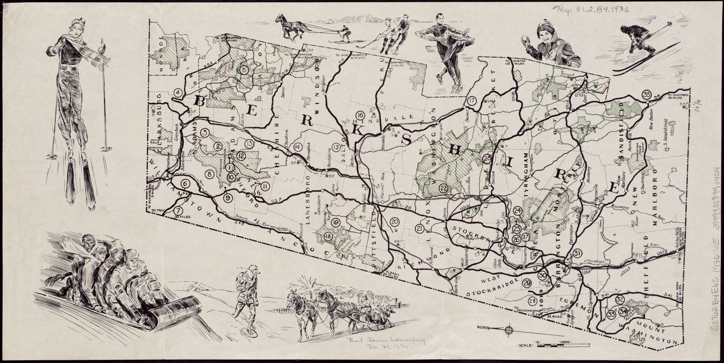
Berkshire County, MA boasts fantastic opportunities for seasonal recreation. Depicted on the margins of this map are illustrations of winter sports differing in difficulty. Some lesser known winter activities are shown, such as skijoring, which is the activity of a person on skis being pulled by a horse, dog(s), or even a motor vehicle.
John H. Renshawe, Panoramic view of the Mount Rainier National Park, Washington (1914)
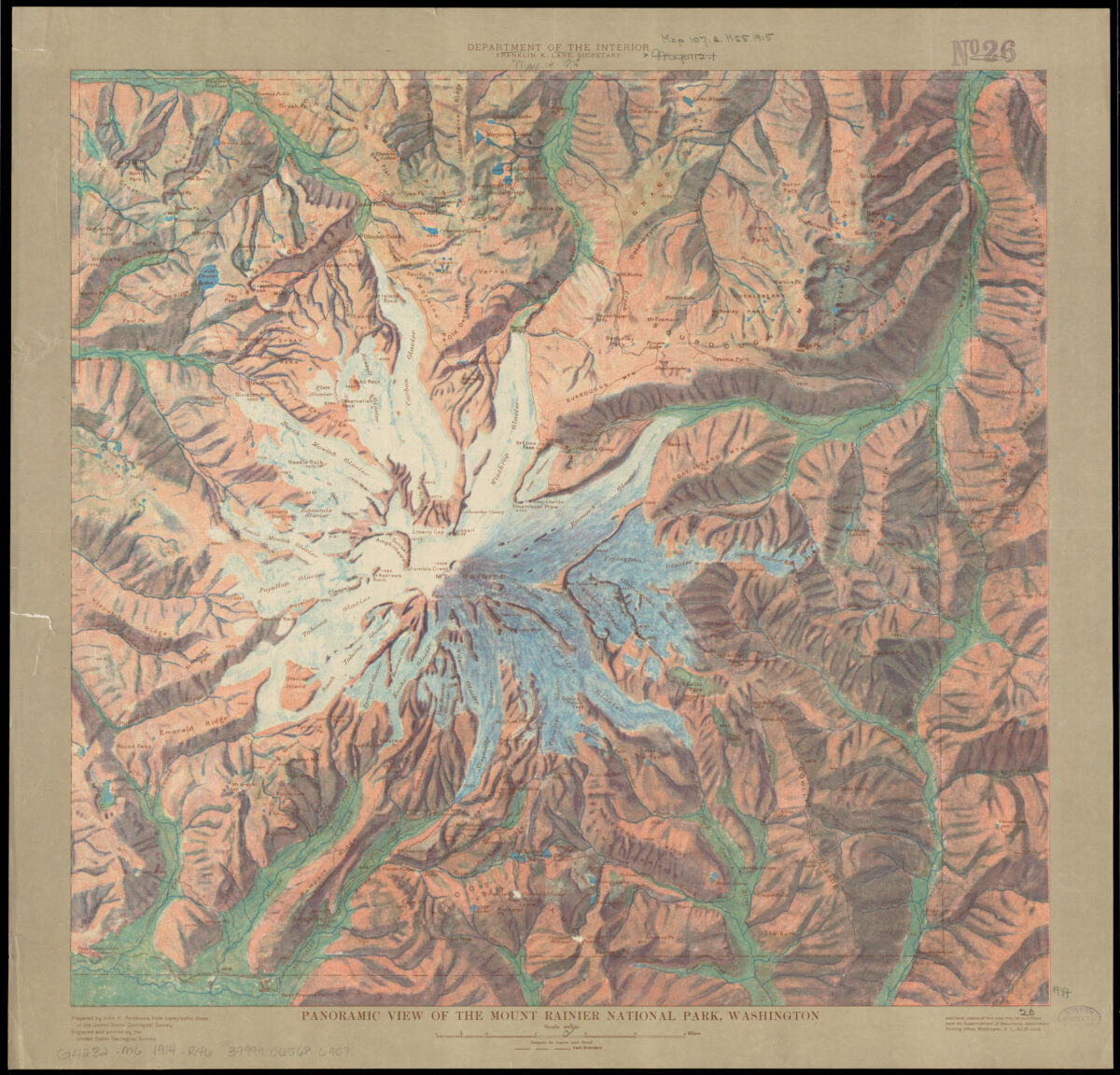
In addition to being a place for people to take on advanced, backcountry winter sports, Mount Rainier is one of many national parks that plays a role of climate resilience in North America. The expansive wilderness consisting of glaciers, forests, meadows, lakes, and other wetlands—that span a wide elevation range—provide many benefits, including a protected wildlife habitat and a place for carbon storage.
J. Schedler, Relief map of the White Mountains, N.H (1879)
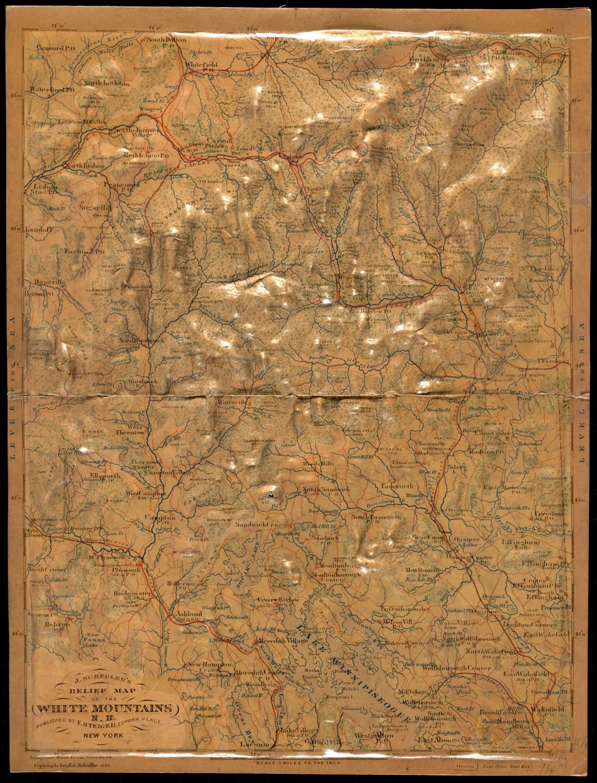
This 1879 relief map invites a close looking of the White Mountains of New Hampshire. Mount Washington stands the tallest of the White Mountains at around 6,300 feet.
Our articles are always free
You’ll never hit a paywall or be asked to subscribe to read our free articles. No matter who you are, our articles are free to read—in class, at home, on the train, or wherever you like. In fact, you can even reuse them under a Creative Commons CC BY-ND 2.0 license.