On July 21, we hosted From The Vault: Marine Landscapes! From The Vault is a biweekly event series showing collections objects selected by Leventhal Center staff. For this edition of the series, we looked at objects from our collections that map marine landscapes and the creatures that inhabit them.
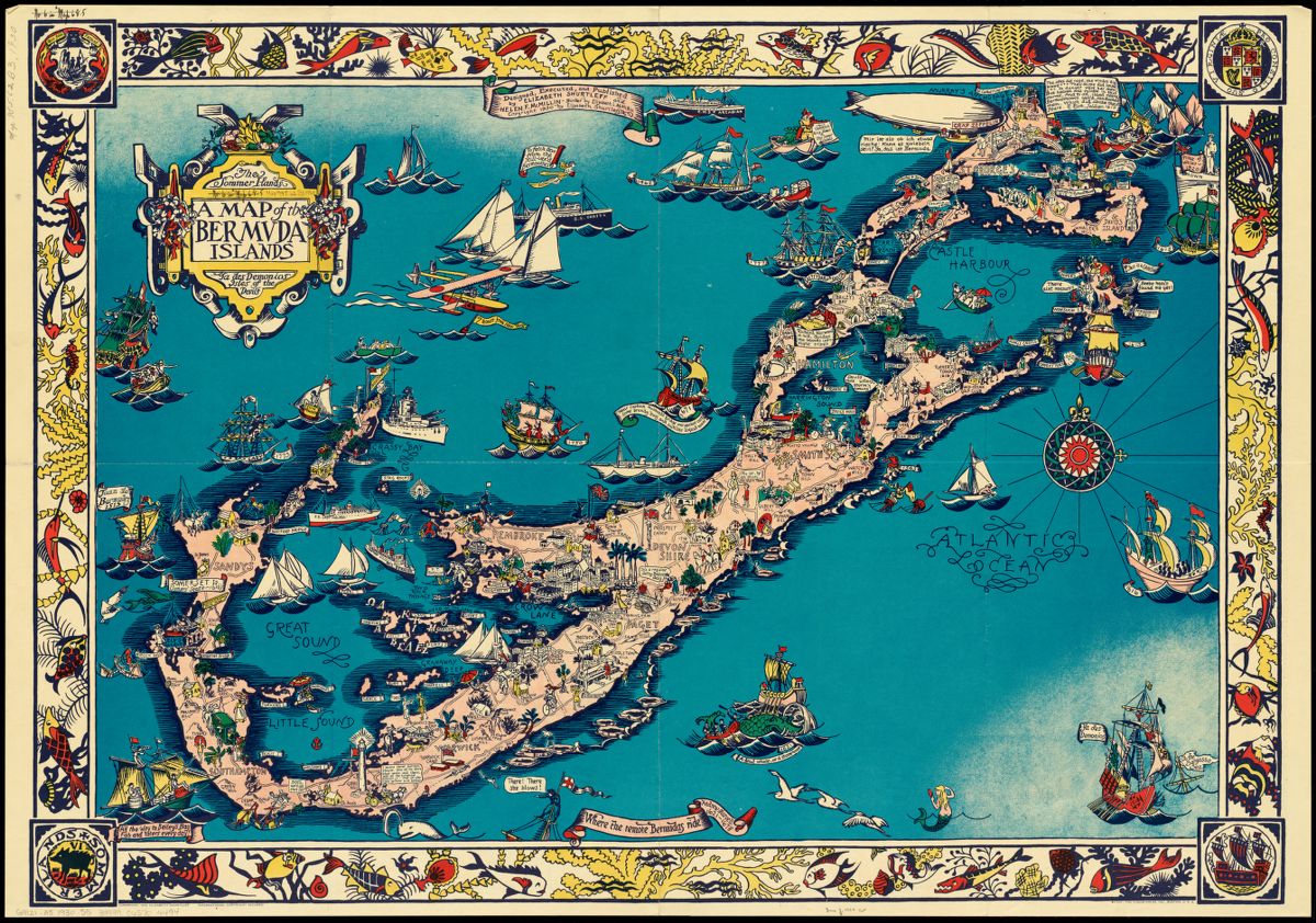
Elizabeth Shurtleff and Helen McMillin, A map of the Bermuda Islands: ya des demonios, isles of the devils (1930)
This pictorial map promotes tourism to the Bermuda Islands by depicting their recreational offerings and rich history. The border of the map depicts realistic marine life in contrast to some of the more fantastical creatures on the map, such as the mermaid in the bottom right, and the green sea monster nearby Elbow Beach.
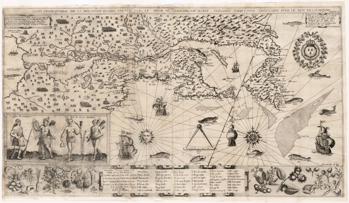
Samuel de Champlain, Carte geographique de la Nouvelle Franse (1613)
This particular map has had an exciting life as one of the maps that was stolen from the Boston Public Library and later recovered by the former curator for the Leventhal Center, Ronald Grim. Originally published in Paris in 1613, this map depicts part of Eastern Canada, specifically the Saint Lawrence River Valley, as well as the northern tip of Maine. The vast region in this map was known to the mapmaker, Samuel de Champlain, as New France or “Nouvelle France”. Champlain is credited with the establishment of New France, the founding of Quebec City, and for several diplomatic dealings in the development of New France. Like many settlements developing in coastal regions, the ocean and other waterways were life-giving and life-maintaining sources. In the ocean and nearby lakes, we can see a combination of ships and water-dwelling figures.
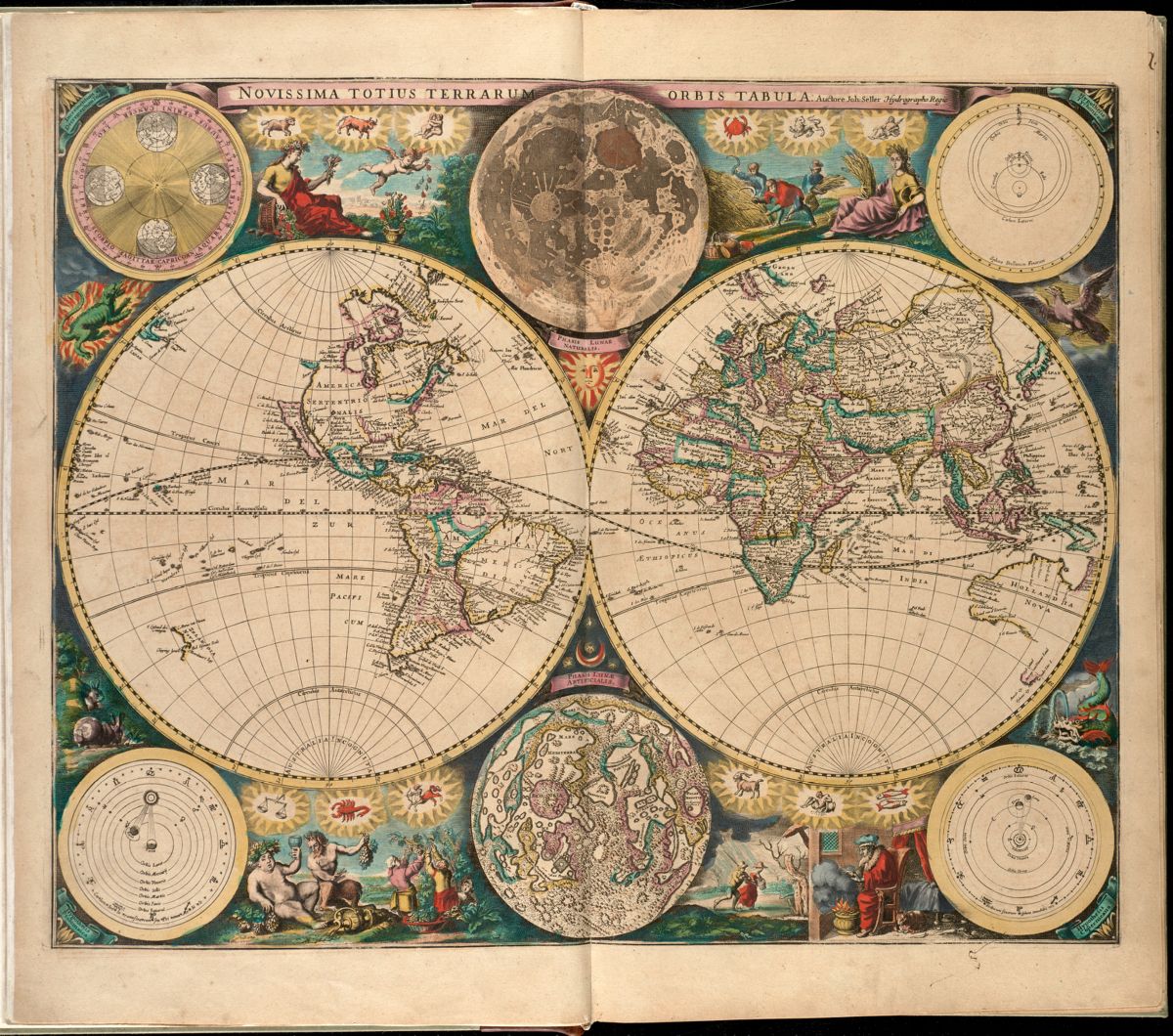
John Seller, Novissima totius terrarum orbis tabula (~1672)
Written in Latin and filled with illustrations, Novissima totius terrarum orbis tabula gives us insight into 17th century conceptualization of the earth’s geography. Notice that a land mass indicating Antarctica is missing from this map. Note also the names of the oceans and seas on this map: which ones are the same today and which have been changed? Surrounding the hemispheres, there are creatures; the fish and crab of the zodiac are familiar to us, but the marine creature on the lower right of the map seems to be unknown.
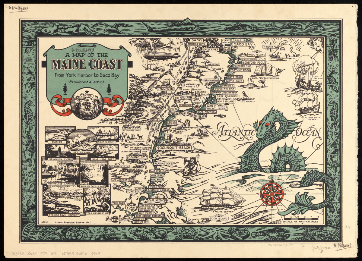
Albert Prentice Button, A map of the Maine coast from York Harbor to Saco Bay: reminiscent & actual (1929)
This 20th century map is anchored by a large title block on the top left, and a mythical sea creature on the lower right. In between those two focal points, plenty of marine creatures both real and fictional exist. The lively border of the map offers a glimpse into the rich marine wildlife of the Maine coast. Despite depictions of creatures that may potentially be dangerous to humans, this map seems to be an aid for tourism, given Button’s decision to highlight Maine’s coastal history, recreational activity offerings, and cultural landmarks.
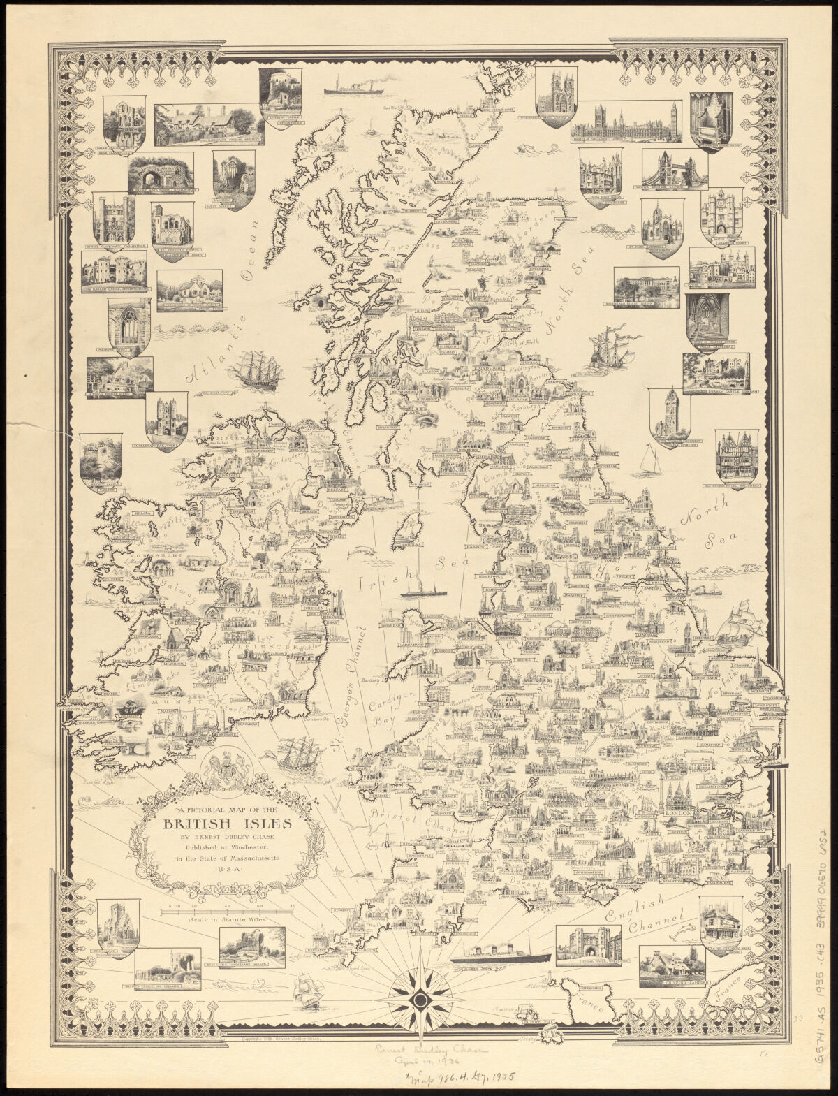
Ernest Dudley Chase, A pictorial map of the British Isles (1935)
Although this map was published here in Massachusetts, it is a detailed pictorial view of the British Isles, highlighting architectural and cultural points of importance. In the seas and oceans on this map, fictional creatures lurk alongside great ships.
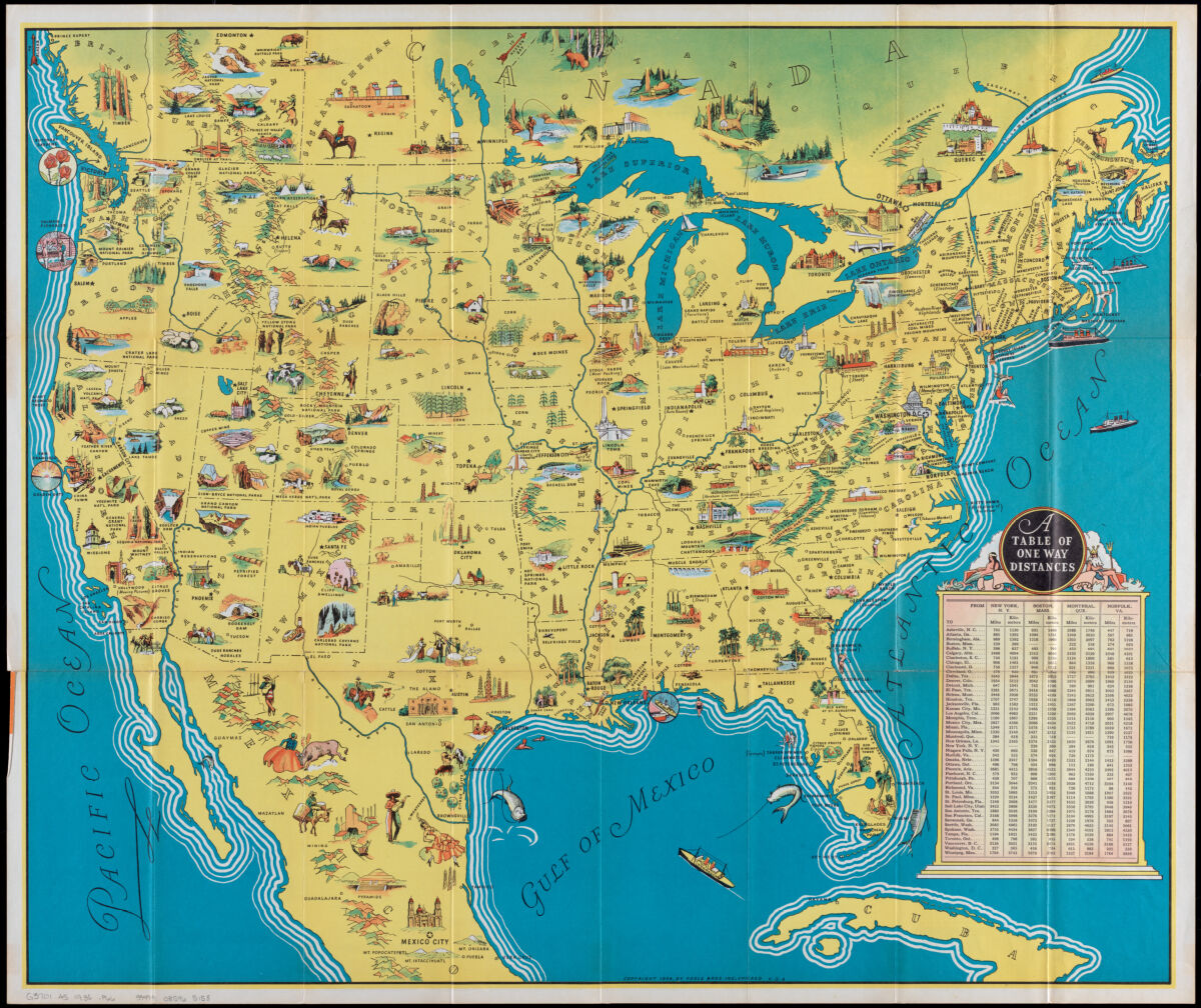
Poole Brothers, America: beauty, wonders, inspiration, progress, without end (1936)
On this map—intended to promote tourism across North America—pictures and vignettes emphasize historical stories (“Pyramids” near Guadalajara, Jalisco, Mexico), sites of industry (“Motor Industry” in Detroit, Michigan, U.S.A), as well as increasingly popular spaces of entertainment and recreation, such as “Hollywood (Moving Pictures)”. A mermaid and a Poseidon-like figure lounge on the title block, providing a playful contrast to the real marine life and human swimmers depicted in the maps' waters.
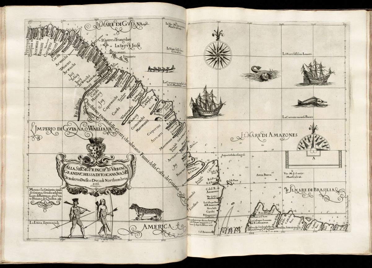
Sir Robert Dudley, Alla serma. sigra. principsa. d’Vrbino Grandvchessa di Toscana sva sigra. d: Roberto Dvdleo Dvca di Northumbria (~1647)
This map covers French Guiana and part of Brazil. It appeared in Dudley’s 1646-1647 Dell’Arcano del Mare atlas (“On the Mystery of the Sea”) and was the first printed maritime atlas to cover the whole world, as well as the first to use the Mercator projection in its cartography. It includes illustrations of formidable naval vessels juxtaposed with sea monsters.
Our articles are always free
You’ll never hit a paywall or be asked to subscribe to read our free articles. No matter who you are, our articles are free to read—in class, at home, on the train, or wherever you like. In fact, you can even reuse them under a Creative Commons CC BY-ND 2.0 license.