On October 13th, we hosted From The Vault: Hispanic Heritage Month! From The Vault is a biweekly event series showing collections objects selected by Leventhal Center staff. For this edition of the series, we looked at a few objects from our collections that explore Hispanic heritage.
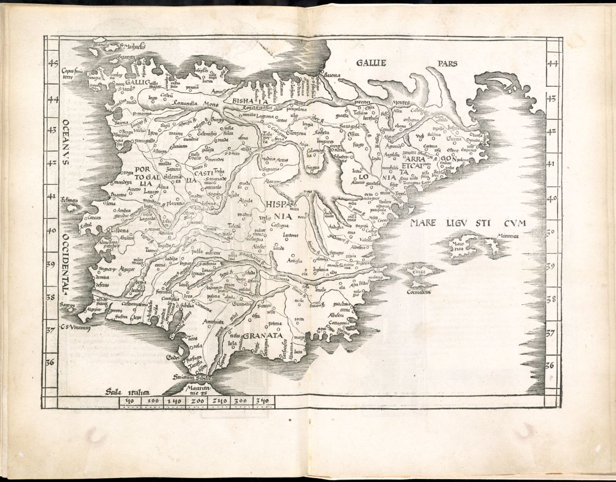
Tabula Moderna Hispaniae (1525)
This 16th century map, originally from Ptolemy’s Geographia, shows Spain and Portugal. Given the black-and-white coloring of this map, the mountainous parts of the Iberian peninsula are shown pictorially through the lightly shaded channels on the map.
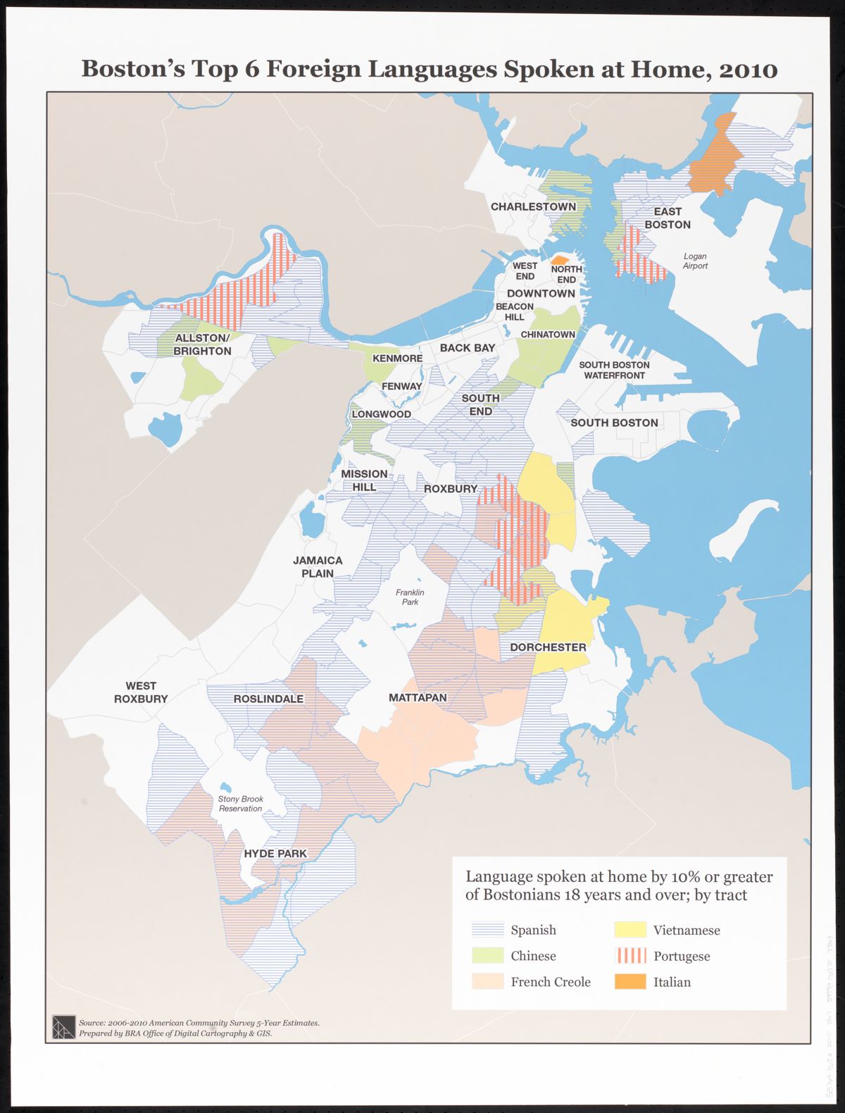
Boston Redevelopment Authority, Boston’s top 6 foreign languages spoken at home (2010)
Based on survey data from 2006-2010, this Boston Redevelopment Authority map estimates Boston’s top 6 foreign languages spoken at home. Spanish appears to be spoken in a majority of the tracts.
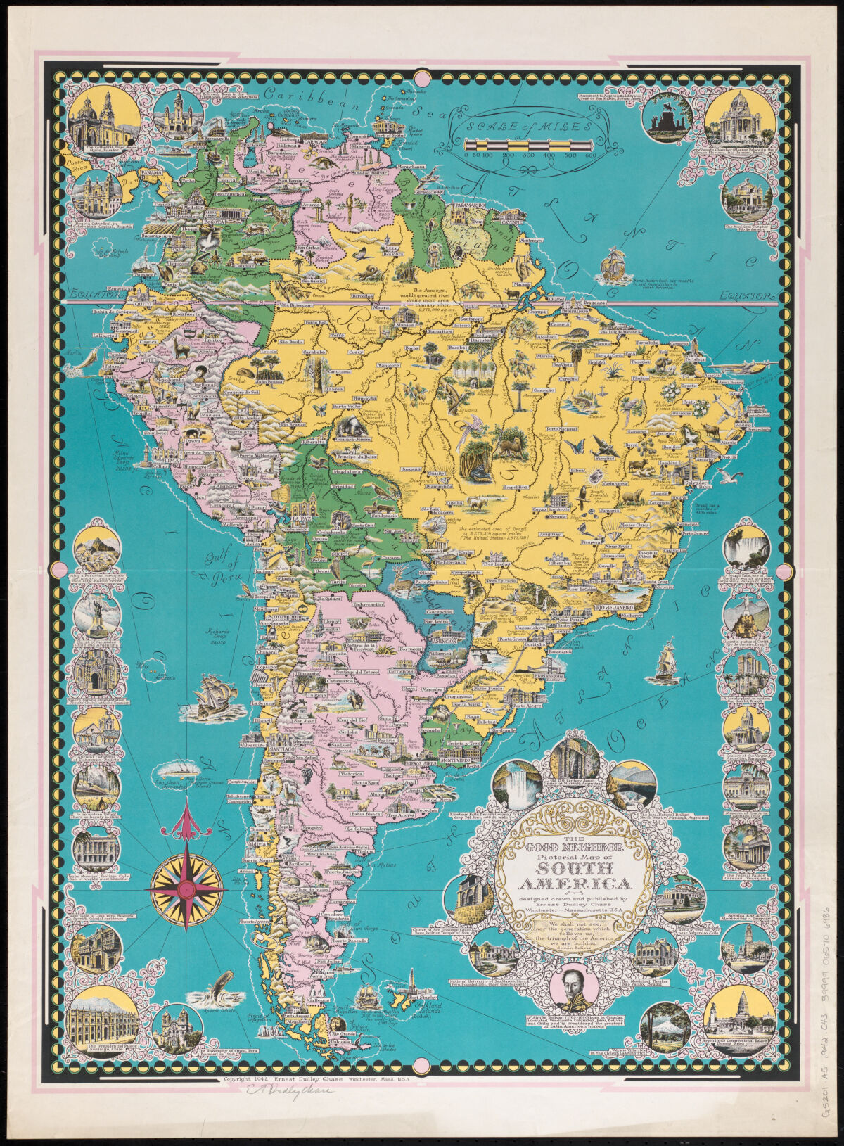
Ernest Dudley Chase, The good neighbor pictorial map of South America (1942)
Ernest Dudley Chase, a 20th-century cartographer and famous Massachusetts resident, drew and published many pictorial maps in his day. In this map, Chase emphasized architectural sites, people important to South America’s history—see Simón Bolívar at the lower right title block of the map—and several other characteristics of South America, including the common flora and fauna within its states and territories.
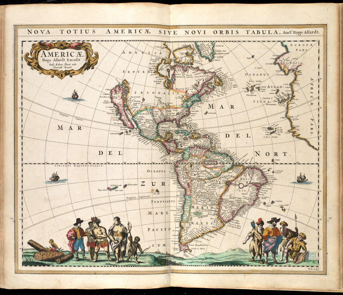
Huych Allard, Americae (1660)
Published in the 17th century, Americae maps North and South America. Among the interesting aspects of this map, one is that it depicts the present-day U.S. state of California as an island separated from the rest of the country, a common myth at the time. A second point of note is that the present-day North American country of Mexico is labeled “Hispania Nova,” or “New Spain”—this map was published about 160 years before Mexico became an independent country.
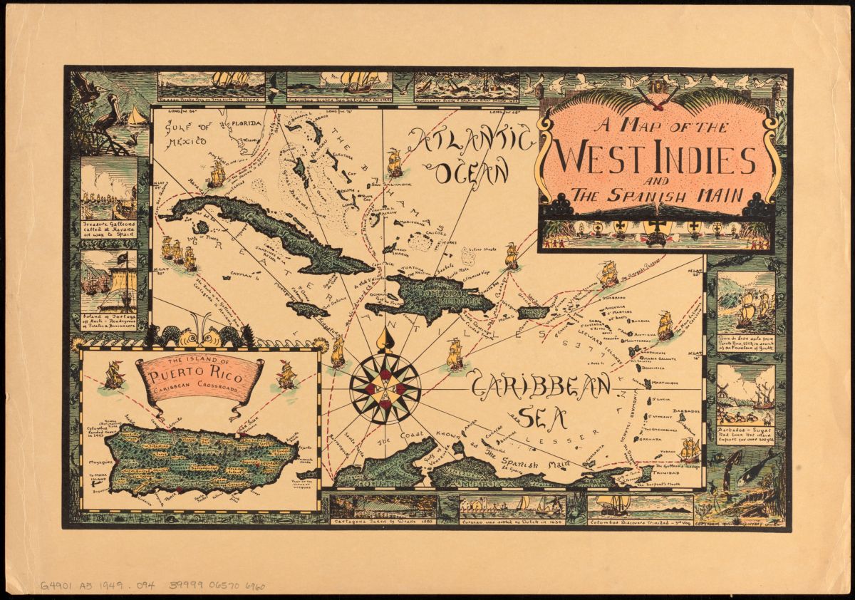
Geoffrey Owen, A map of the West Indies and the Spanish Main (1949)
A map of the West Indies and the Spanish Main provides a view of an area generally referred to today as the Caribbean. This map is rich in small details that only partially explore the Caribbean’s turbulent colonial history. Text such as “Columbus discovers Trinidad,” and the vignette on the title block—which depicts indigenous peoples battling colonizers with large, imposing ships—give a sense of the conflicts that occurred, and perhaps a sense of how such conflicts led to the present-day culture on the islands.
Our articles are always free
You’ll never hit a paywall or be asked to subscribe to read our free articles. No matter who you are, our articles are free to read—in class, at home, on the train, or wherever you like. In fact, you can even reuse them under a Creative Commons CC BY-ND 2.0 license.