On May 12, we hosted From The Vault: Bird's Eye Views! From The Vault is a biweekly event series showing collections objects selected by Leventhal Center staff. For this edition the series, we looked at objects that map spaces and places from above
Bird’s eye views are a unique genre of cartographic materials that were drawn as if the artist viewed a town from an elevated or bird’s eye view perspective. They were compiled and published primarily in North America during the last half of the 19th century and the early decades of the 20th century. Artists did not actually view their subjects from an elevated perspective, but walked the streets sketching individual buildings. Then they prepared a composite drawing depicting the town to its best promotional advantage.
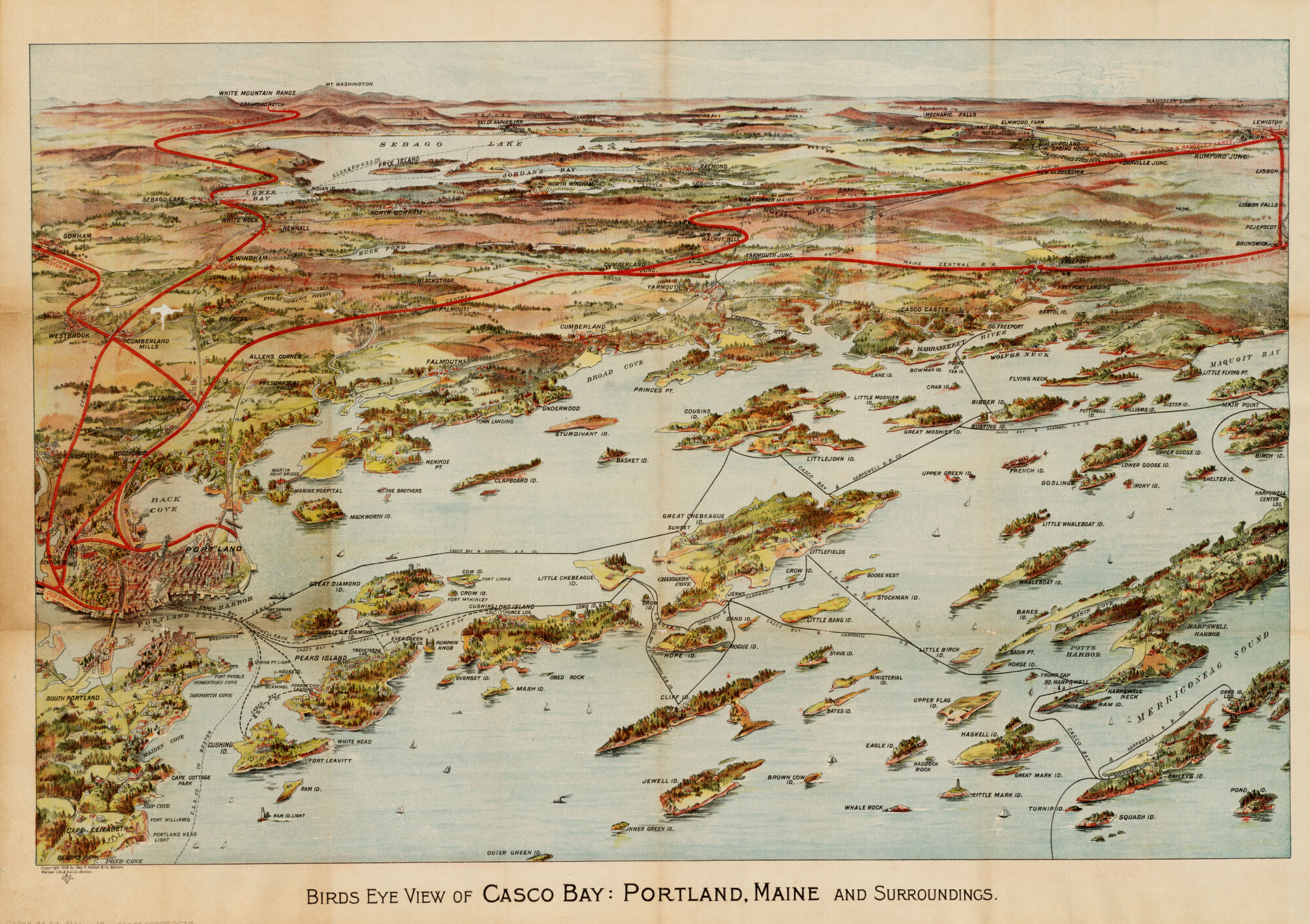
Birds eye view of Casco Bay, Portland, Maine, and surroundings (1906)
Over 100 objects from our collections, including this map of Casco Bay, were produced by a Boston-based firm called the Geo. H. Walker & Co. The lithographic firm operated from 1882 to 1927 and produced things like maps, views, portraits, sheet music, and book illustrations. Some of our favorites include a view of Boston freight terminals, a bicycle map of Massachusetts, and a long, folded map of Commonwealth Avenue.
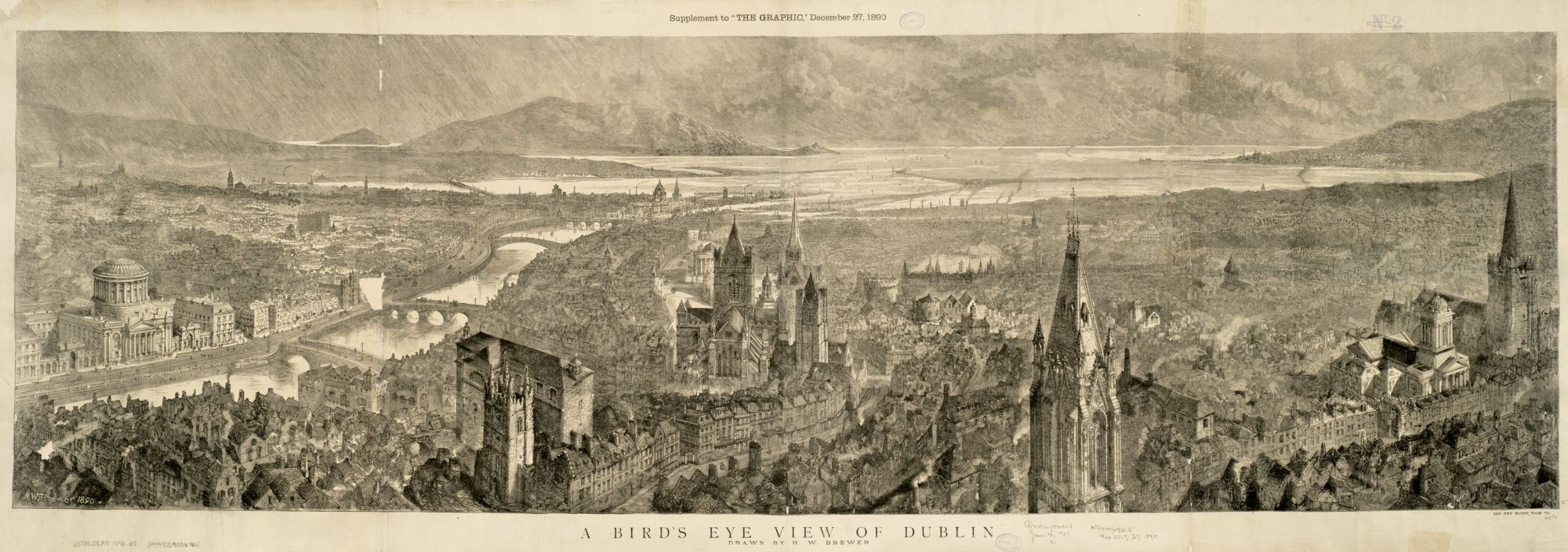
A bird’s eye view of Dublin (1890)
A scene of 1890 Dublin is depicted in great panoramic detail on this map by Henry W. Brewer, a British illustrator who gained fame for his detailed city panoramas in nineteenth century. Brewer was an early contributor to The Graphic, a British weekly illustrated newspaper, where this map was first published as a supplement on December 27, 1890. Do you recognize any of the foregrounded buildings?
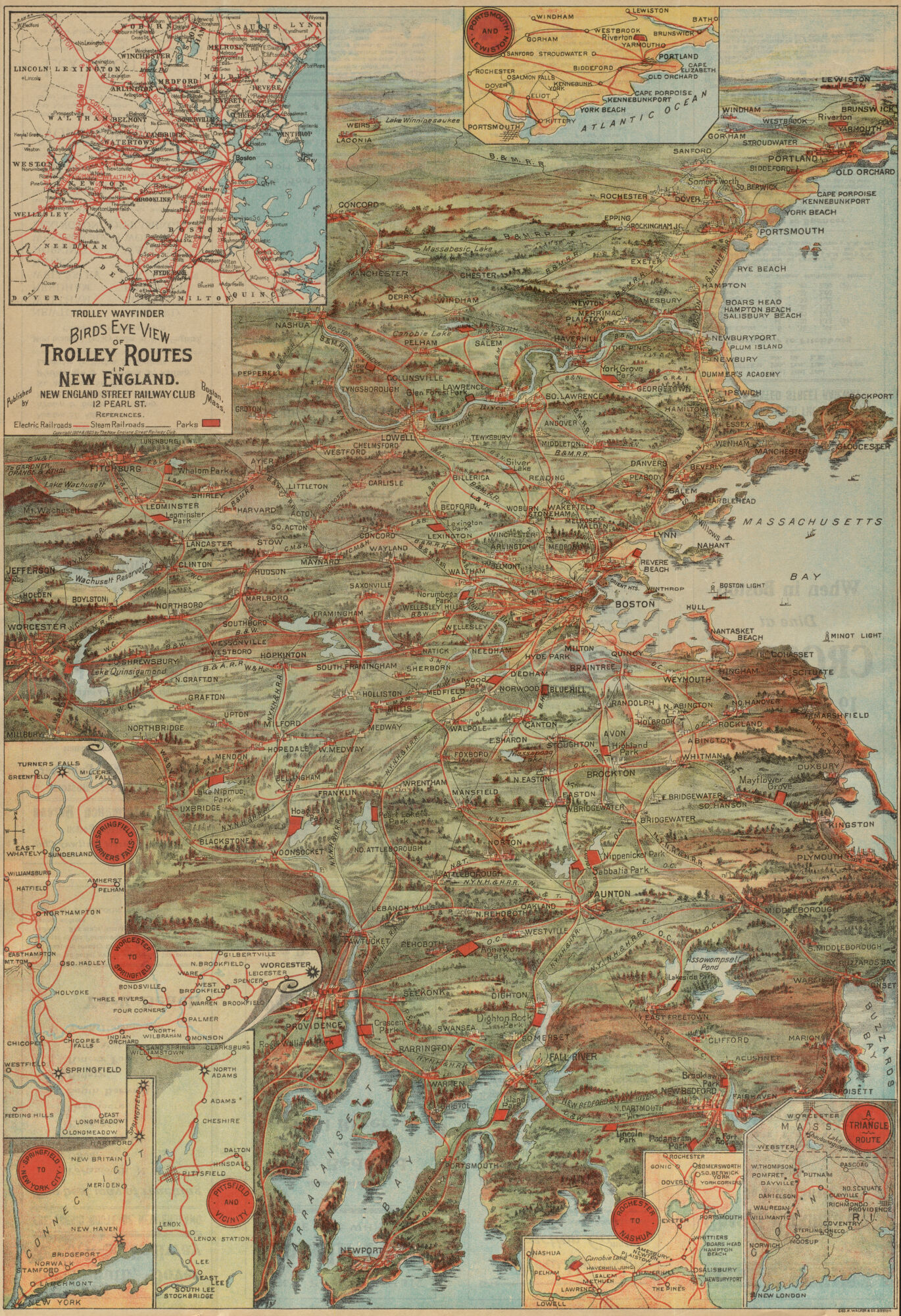
Bird’s eye view of trolley routes in New England (1905)
This map of trolley routes across New England was published in 1905 by the New England Street Railway Club, an early-twentieth century trade association for railway operators and engineers based right here in Boston at 12 Pearl Street. It “contains valuable information for travelers by trolley” like distance, fare, and travel time, and could be purchased for ten cents at “all news stands” or by writing to the Trolley Information Bureau.
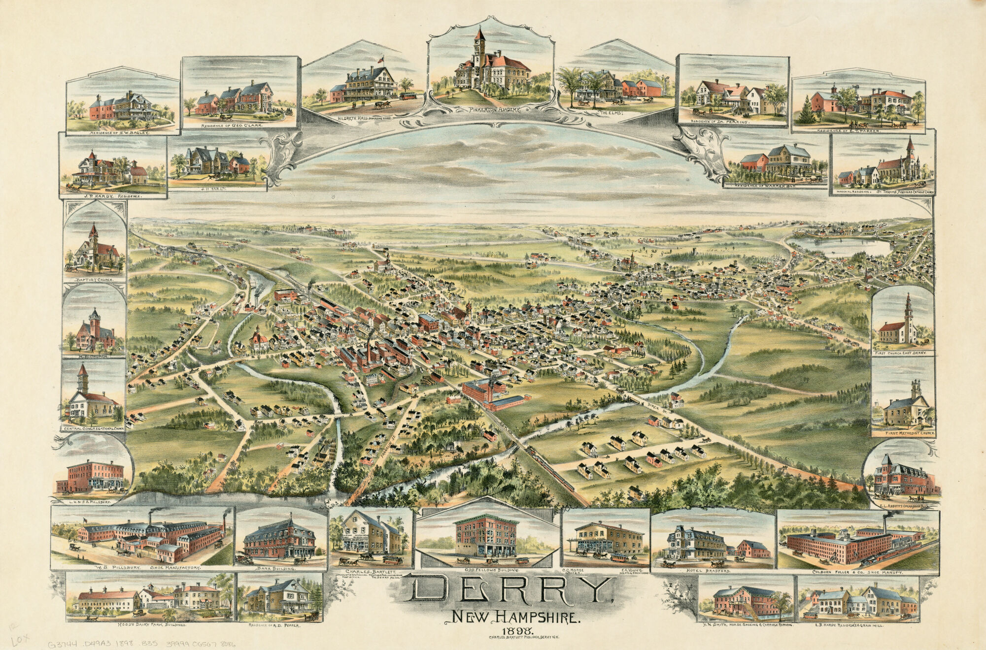
Derry, New Hampshire (1898)
This colorful map of Derry, NH was published by Charles Bartlett, Publisher in 1898. Can you locate the printing and publishing house on the map’s landscape? Also included on the map is the Pinkerton Academy, an independent day and boarding school founded by brothers Major John and Elder James Pinkerton in 1814. The original school building still stands today alongside twenty-two new[er] academic buildings, residences, and athletic fields.
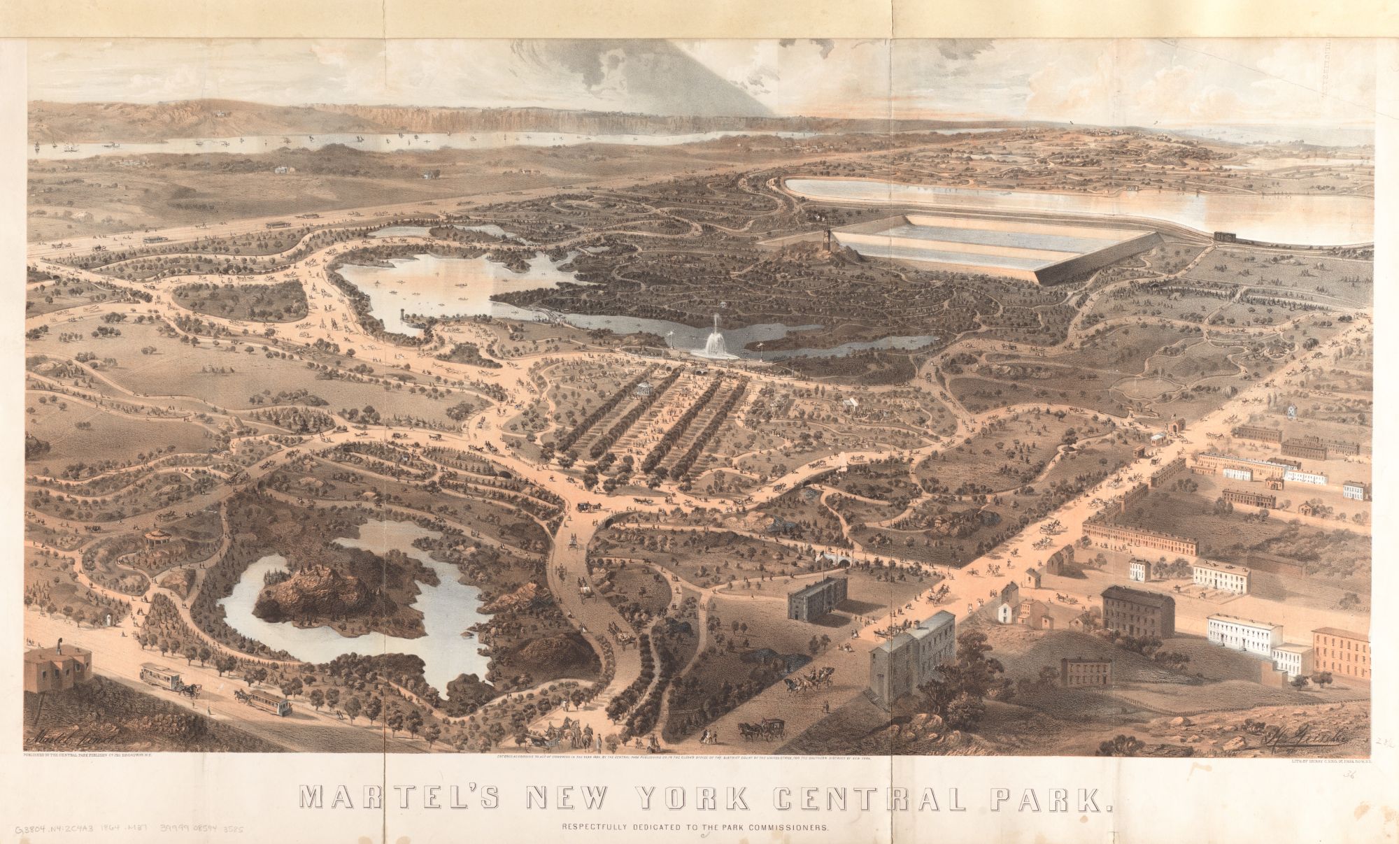
Martel's New York Central Park (1864)
This 1864 bird's eye view depicts a newly-completed Central Park from the perspective above Fifth Avenue and 58th Street. To identify some of the park's attractions, we compared the map with this 1856 improvement plan which includes labels for the Botanical Gardens, Receiving Reservoir, Vista Rock, and Croton Lake.
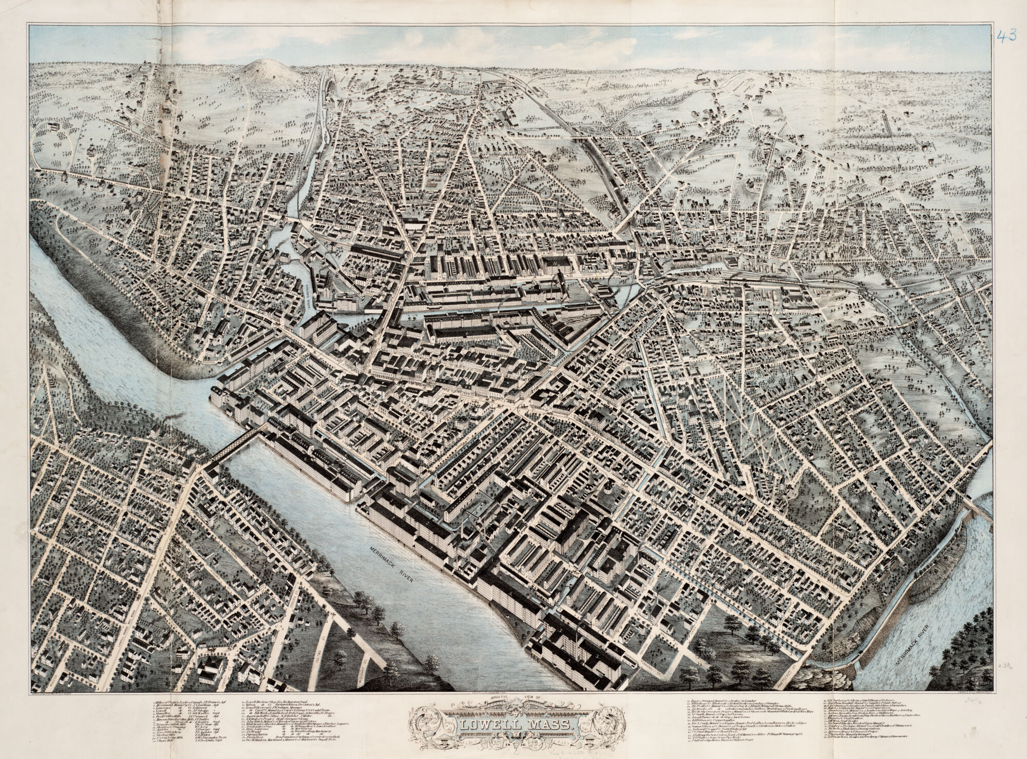
Bird's eye view of the City of Lowell (1987)
Recognized as the first planned company mill town, Lowell was founded in the 1820s when a group of Boston financiers constructed a textile factory on a canal bypassing the Merrimack River’s Pawtucket Falls. This view depicts a densely settled city resulting from fifty years of industrial growth, and served primarily as a business directory with the legend listing sixty industrial and commercial activities.
For more on bird's eye views, take a read through our past exhibition, Boston and Beyond: A Bird’s Eye View of New England, and explore our digital collections.
Our articles are always free
You’ll never hit a paywall or be asked to subscribe to read our free articles. No matter who you are, our articles are free to read—in class, at home, on the train, or wherever you like. In fact, you can even reuse them under a Creative Commons CC BY-ND 2.0 license.