On July 7, we hosted From The Vault: Summer Vacation! From The Vault is a biweekly event series showing collections objects selected by Leventhal Center staff. For this edition the series, we looked at objects from our collections that map places of summer relaxation and recreation.
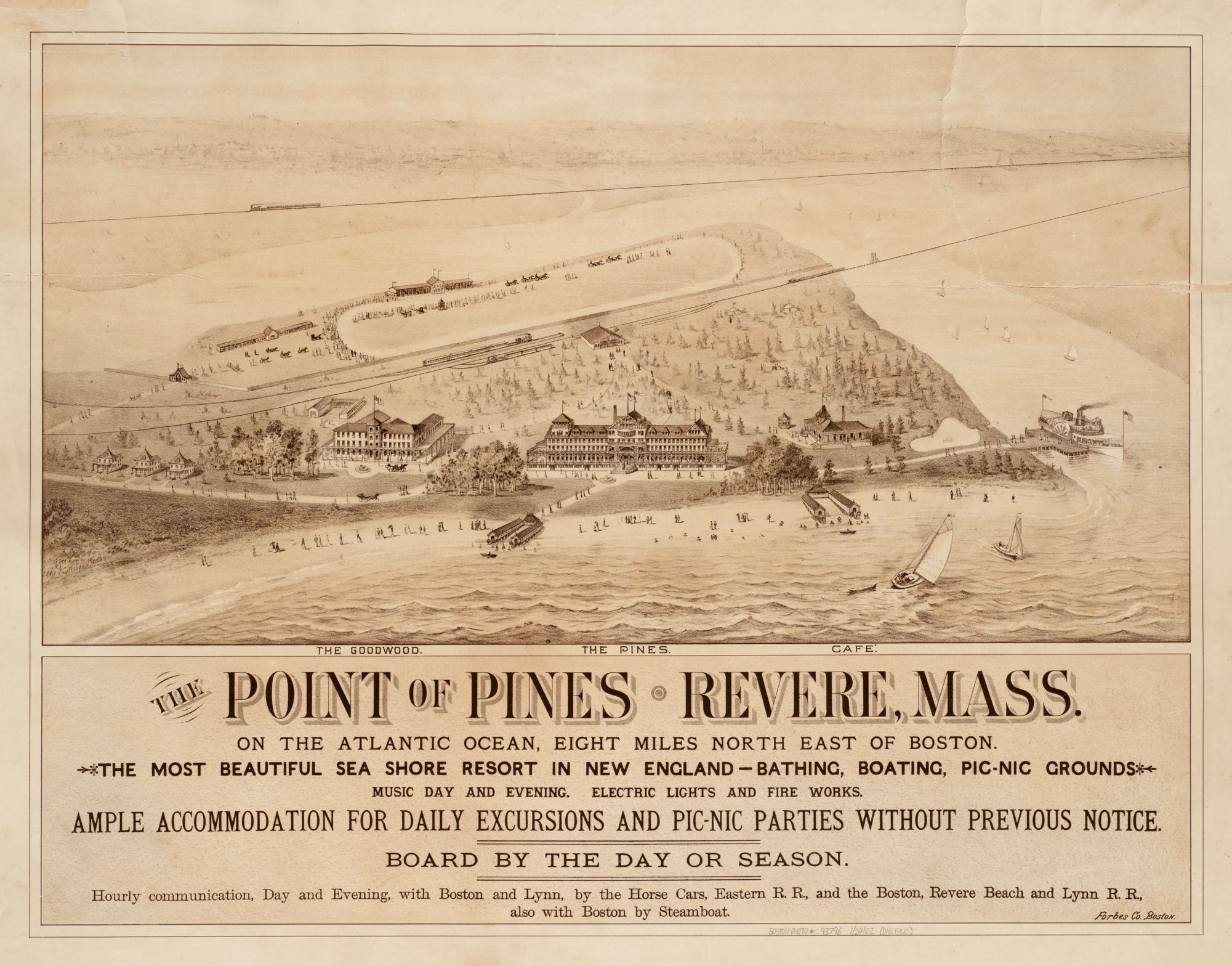
E. R. Howe, The Point of Pines, Revere, Mass (1880)
The Point of Pines, located just north of Boston, opened one year after this map’s publication in 1881. The Pines Hotel is promoted on this bird’s eye map as the “most beautiful sea shore resort in New England” where guests will enjoy “music day and evening,” “electric lights and fire works,” and “daily excursions and picnic parties without previous notice.” In addition to the hotel, developers made plans for a racetrack and amusement park on the property. Sounds like fun, right? Unfortunately, the amusement park never opened. After financial difficulties and lease transfers, work on the park came to a halt just two weeks before the scheduled opening in 1907.
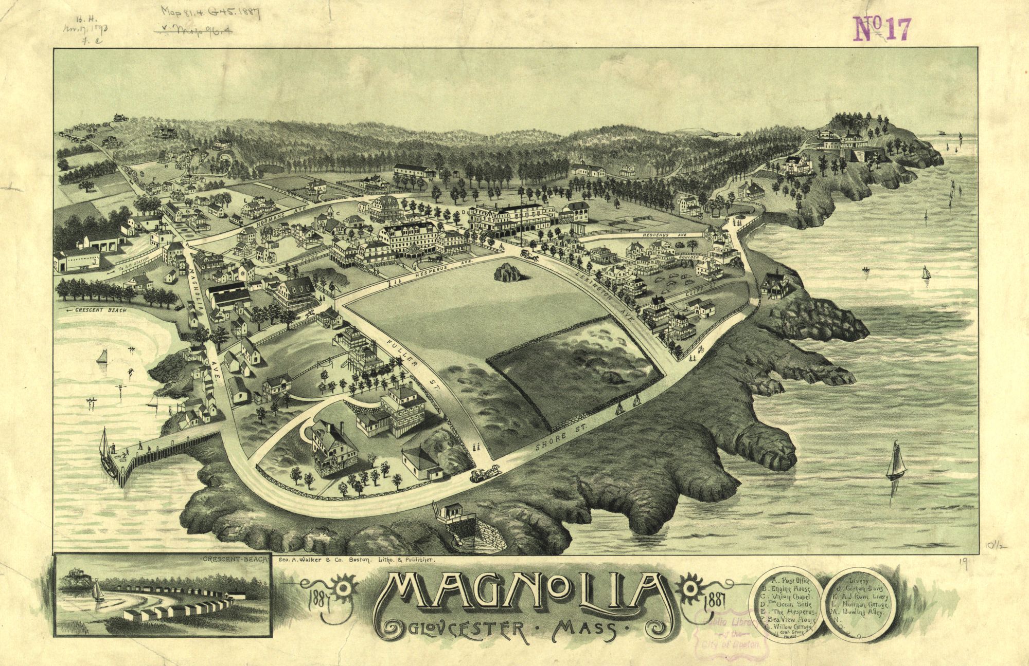
George H. Walker, Magnolia, Gloucester, Mass (1887)
This bird’s eye of the Magnolia, Gloucester details the neighborhood’s piers, beaches, cottages, chapel (C), and bowling alley (M)! In the foreground, Shore Street is lined with people walking and biking along the coast as boats sail nearby. The bicycles pictured are called penny-farthing (or high wheel) bicycles, which were particularly popular during the 1870s and 1880s when this map was first published. The large front wheel provided high speeds (large wheel rotation distance) and comfort (large shock absorption), but soon became obsolete with the development of modern bicycles in the late 1880s.
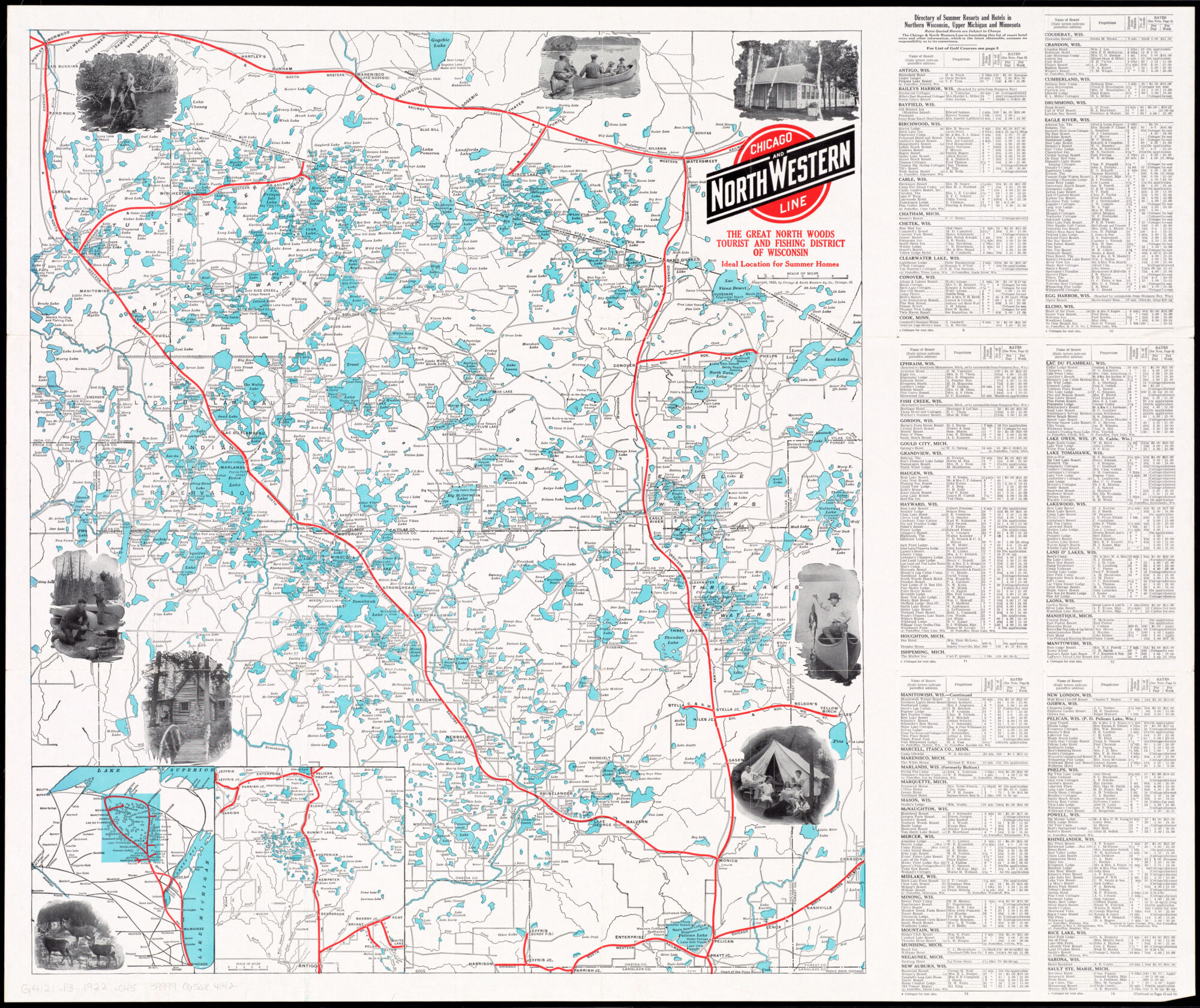
Chicago and North Western Railway Company, The Great North Woods Tourist and Fishing District of Wisconsin: Ideal Location for Summer Homes (1922)
Who’s ready for an afternoon at the lake? This blue-spotted map of the “Great North Woods” of Wisconsin is speckled with hundreds of lakes, rivers, and streams, and also lists nearby resorts, cottages, lodges, and camps. The Chicago and North Western Railroad Line, running across in the map in red, was originally created to carry goods like potatoes, sugar beets, corn, and wheat, but transitioned to passenger service as summer resorts and camps popped up around the region.
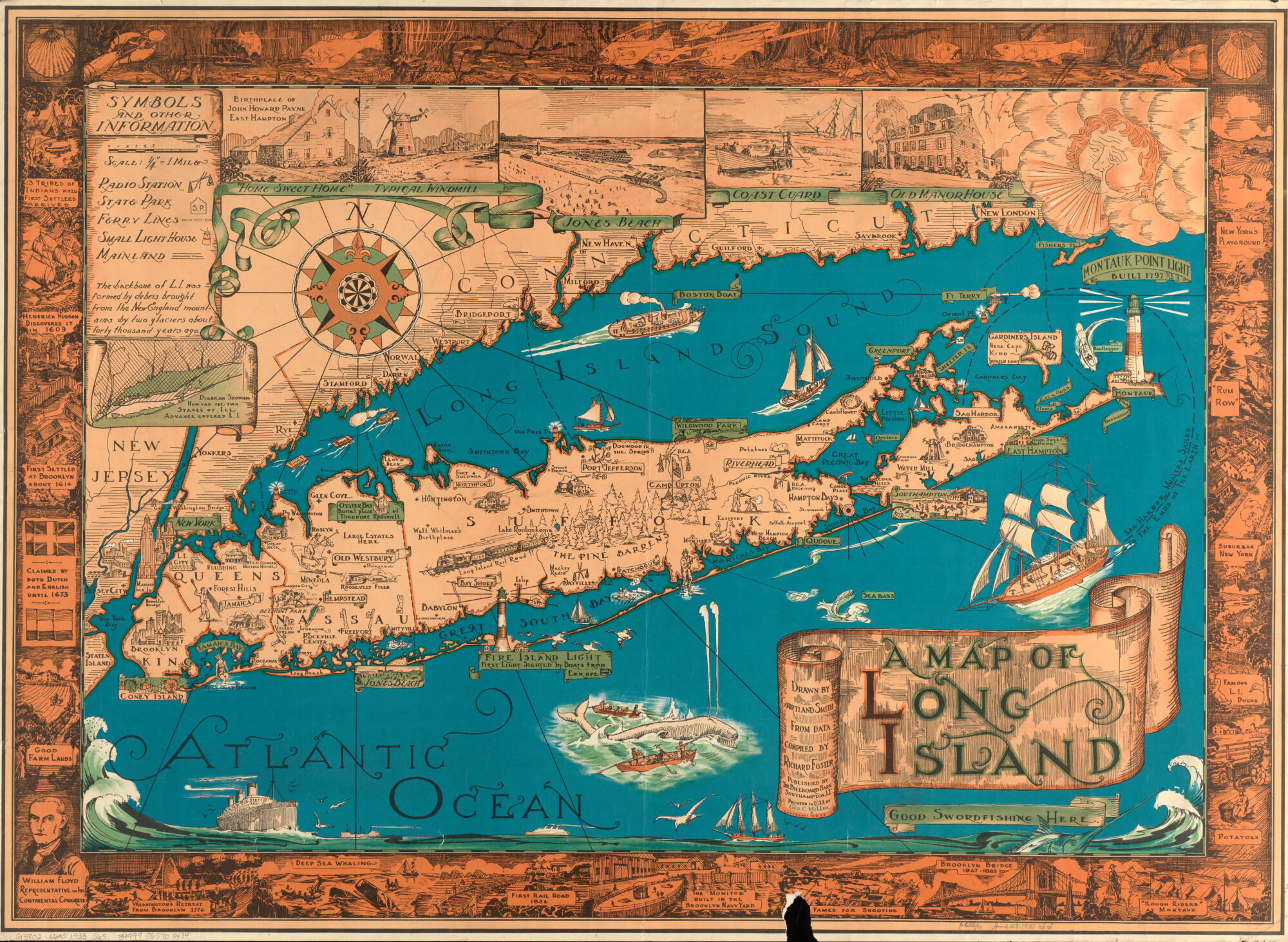
Courtland Smith, A Map of Long Island (1933)
By the late 19th century, Long Island had become a popular summer destination for New York City residents via the Long Island Railroad. With connections to Coney Island, Rockaway, Brighton Beach, and Manhattan Beach, visitors enjoyed not only seaside resorts, beautiful beaches, and delicious food, but roller coasters, racetracks, boxing matches, gambling, dance halls, and more. This 1933 map of Long Island captures the summer spirit with illustrations of beach activities, outdoor games, lighthouses, boats, and wildlife.
Boston Redevelopment Authority, Boston Urban Wilds (1976)
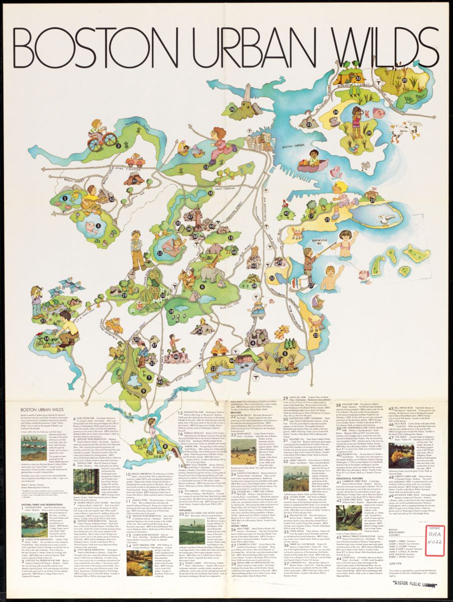
Have you visited any of the urban wilds—natural parks, woodland reservations, beaches, and hilltops—mapped on this guide by the Boston Redevelopment Authority? It was published as part of a larger BRA document called “Boston’s Urban Wilds: A Natural Area Conservation Program,” which inventoried 143 natural areas in the City and made recommendations for the remaining natural areas.
Our articles are always free
You’ll never hit a paywall or be asked to subscribe to read our free articles. No matter who you are, our articles are free to read—in class, at home, on the train, or wherever you like. In fact, you can even reuse them under a Creative Commons CC BY-ND 2.0 license.