On April 28, we hosted From The Vault: The Great Outdoors! From The Vault is a biweekly event series showing collections objects selected by Leventhal Center staff. For this edition the series, we looked at objects that map national parks, green space around Boston, and the natural world beyond.
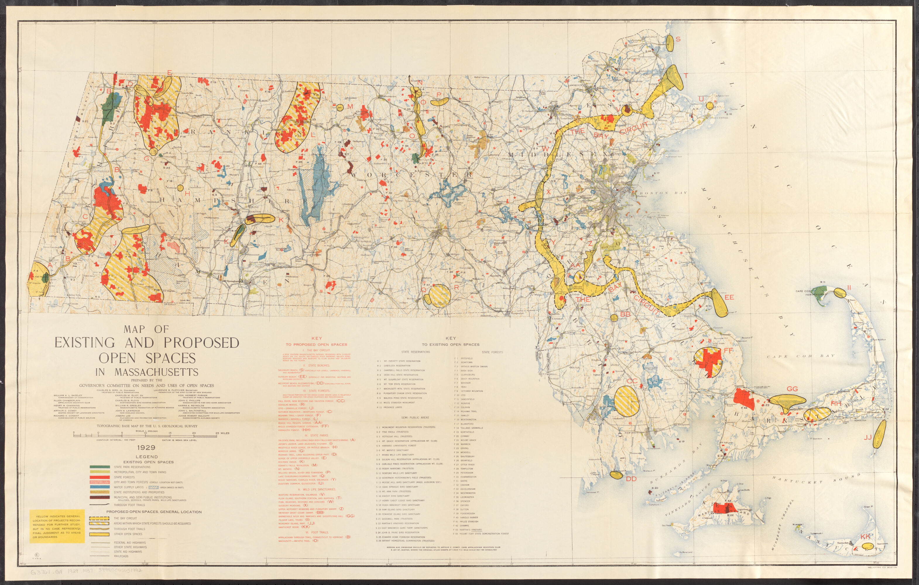
A Map of Existing and Proposed Open Spaces in Massachusetts (1929)
In 1927, the Trustees of Public Reservations reported: “To determine the areas which should be included in the future system of State Parks, Forests and Reservations, a comprehensive survey of the present uses of land, accessibility and potential values of sites for different purposes should be made.” The map shown here was the net of that survey, as requested by “His Excellency Governor Fuller.”
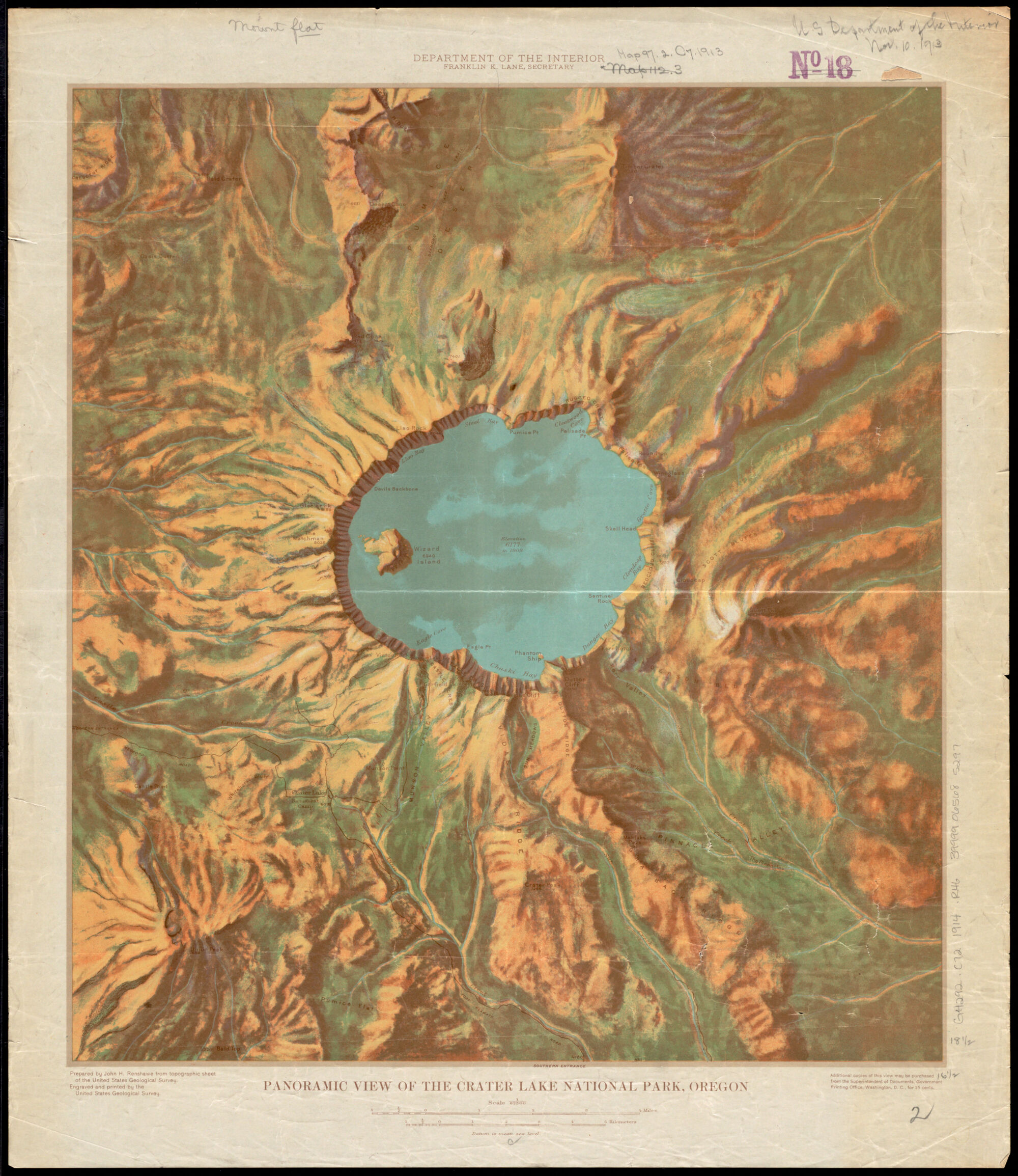
A Panoramic View of the Crater Lake National Park, Oregon (1914)
Approximately 7,700 years ago, Mount Mazama, a 12,000-foot-tall volcano in today’s Oregon, erupted, collapsed, and formed Crater Lake. Legend of the native Makalak people explains that the collapse was caused by a battle between the spirit of the sky and the spirit of the mountain. Today, the lake measures 1,943 feet deep and is known for its bright blue color, as featured on this map from 1914.
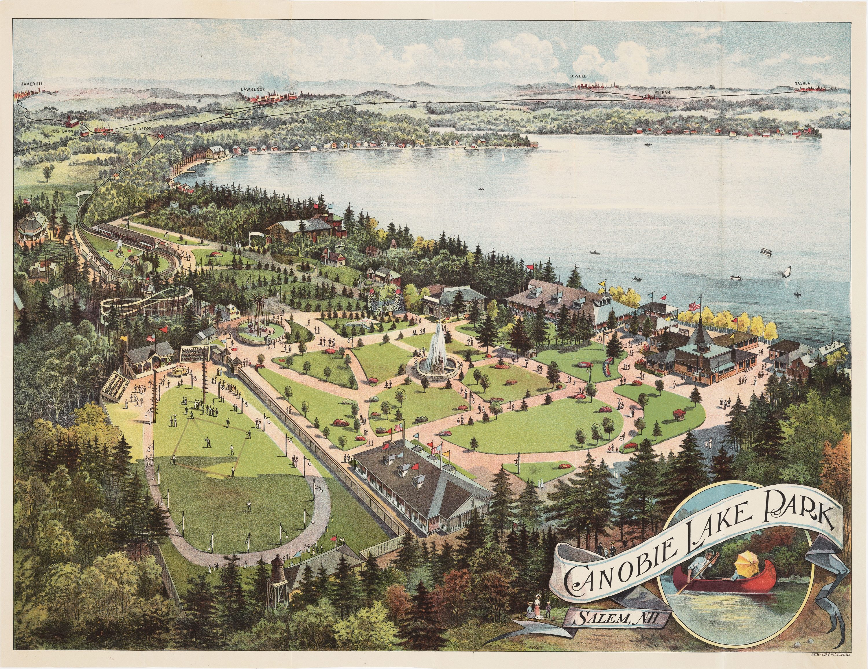
Canobie Lake Park, Salem N.H. (1912)
In 1902, the Hudson, Pelham & Salem Railways (HP&S) opened Canobie Lake Park as a means of generating additional business for its new trolley line to Salem, New Hampshire. In its early years, the park was known for its flower gardens, promenades and attractions like canoeing, sporting events, the Circle Swing, picnics, and the Penny Arcade.
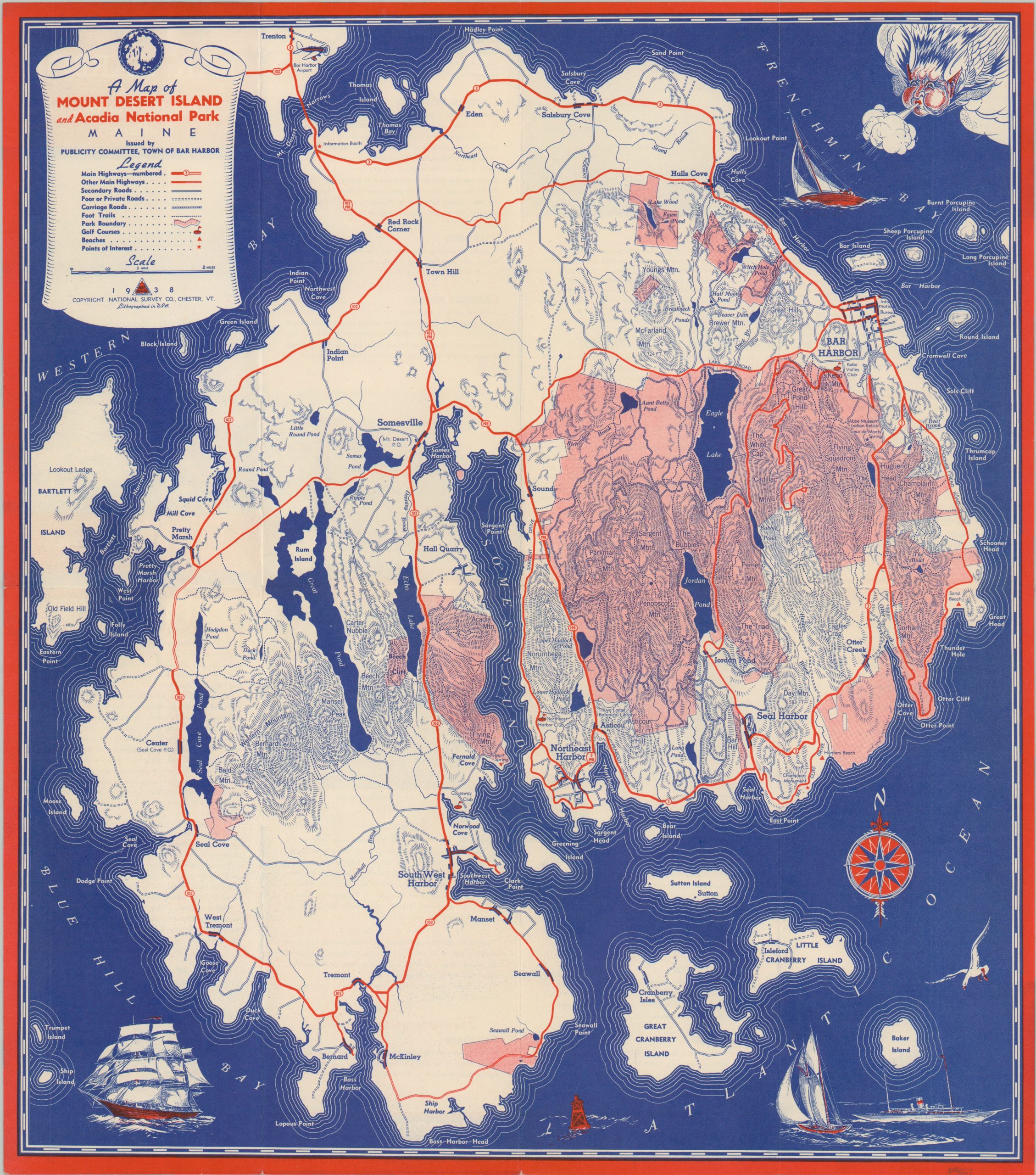
A Map of Mount Desert Island and Acadia National Park (1928)
This map of Mount Desert Island was published in 1938 as part of a promotional brochure by the Publicity Committee of Bar Harbor. A publication from the same time also promotes the island, claiming: “Nowhere in the world is there such a wonderful land of sea, cliff, lake and forest as nature has lavished on this great Maine Coast Resort. No vacation trip to Maine can be complete without a visit to Bar Harbor, America’s most distinguished resort.”
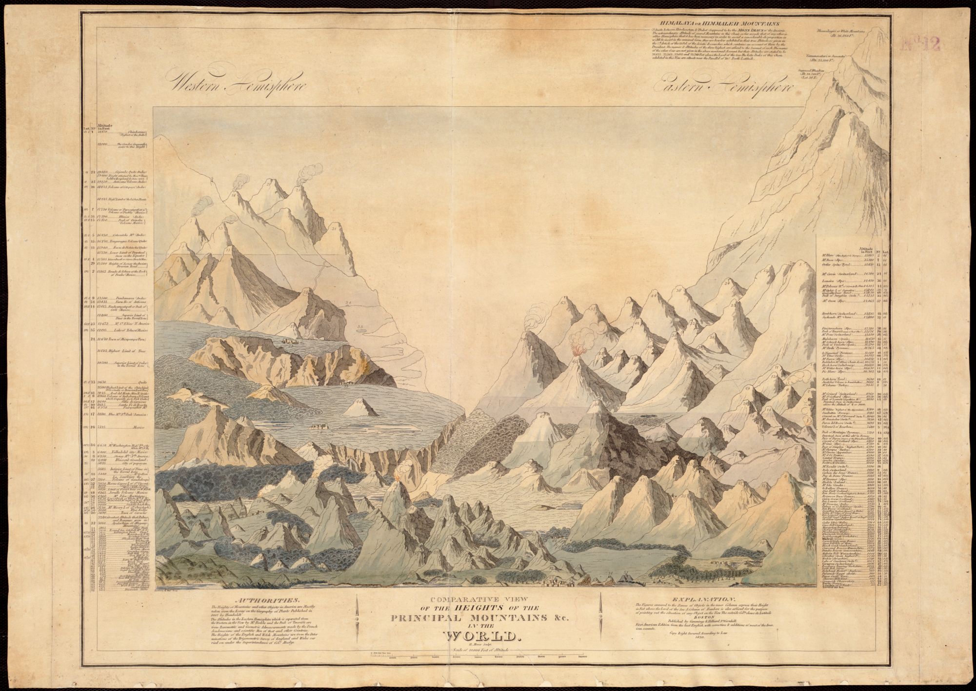
A Comparative View of the Heights of the Principal Mountains in the World (1820)
This 1820 map of the principal mountains of the world was made using data from Alexander von Humboldt’s 1807 Essay on the Geography of Plants, an early-nineteenth century Trigonometric Survey of England and Wales conducted under William Mudge, and various “Barometric and Geometric Admeasurements made by the French Academicians and scientific Men of that and other countries.”
Our articles are always free
You’ll never hit a paywall or be asked to subscribe to read our free articles. No matter who you are, our articles are free to read—in class, at home, on the train, or wherever you like. In fact, you can even reuse them under a Creative Commons CC BY-ND 2.0 license.