alert("You do not have JavaScript enabled on this browser. You can still use the website, but some functionality will not work. You will have a better experience if you enable JavaScript");

A World(view) Transformed by War

Introduction

The two mid-nineteenth century Opium Wars (1840-42, 1856-60) were significant moments in early modern Chinese history. The failure of the Qing empire to properly manage the British-led opium trade and resulting military interventions heralded a period for the Qing court of unequal treaties and forced concessions of territorial and sovereignty rights to primarily European powers. The declining Qing court was pushed to accept this new world order and new maps were made to reflect this change.

A comparison of two maps within the MacLean Collection help illustrate some of the resulting cartographic revisions implemented. Both maps have been discussed in an earlier MacLean Collection Map Chat. This Map Chat examines other considerations between these two maps in particular — including each mapmaker’s geopolitical vision. It is important to note that both maps were produced in and for the imperial court and thus represented an official and public perspective.
China, Qing dynasty, woodblock sheet map
Zhuang Tingfu, 大清統職貢萬國經緯地球式方輿古今圖 [Great Qing world map of tribute bearing countries with spherical coordinates, past and present] (ca. 1800). China, Qing dynasty, woodblock sheet map, ink and color on paper, 60 x 93 cm. (map), 211 x 104 cm (overall), MacLean Collection MC33486

Map A

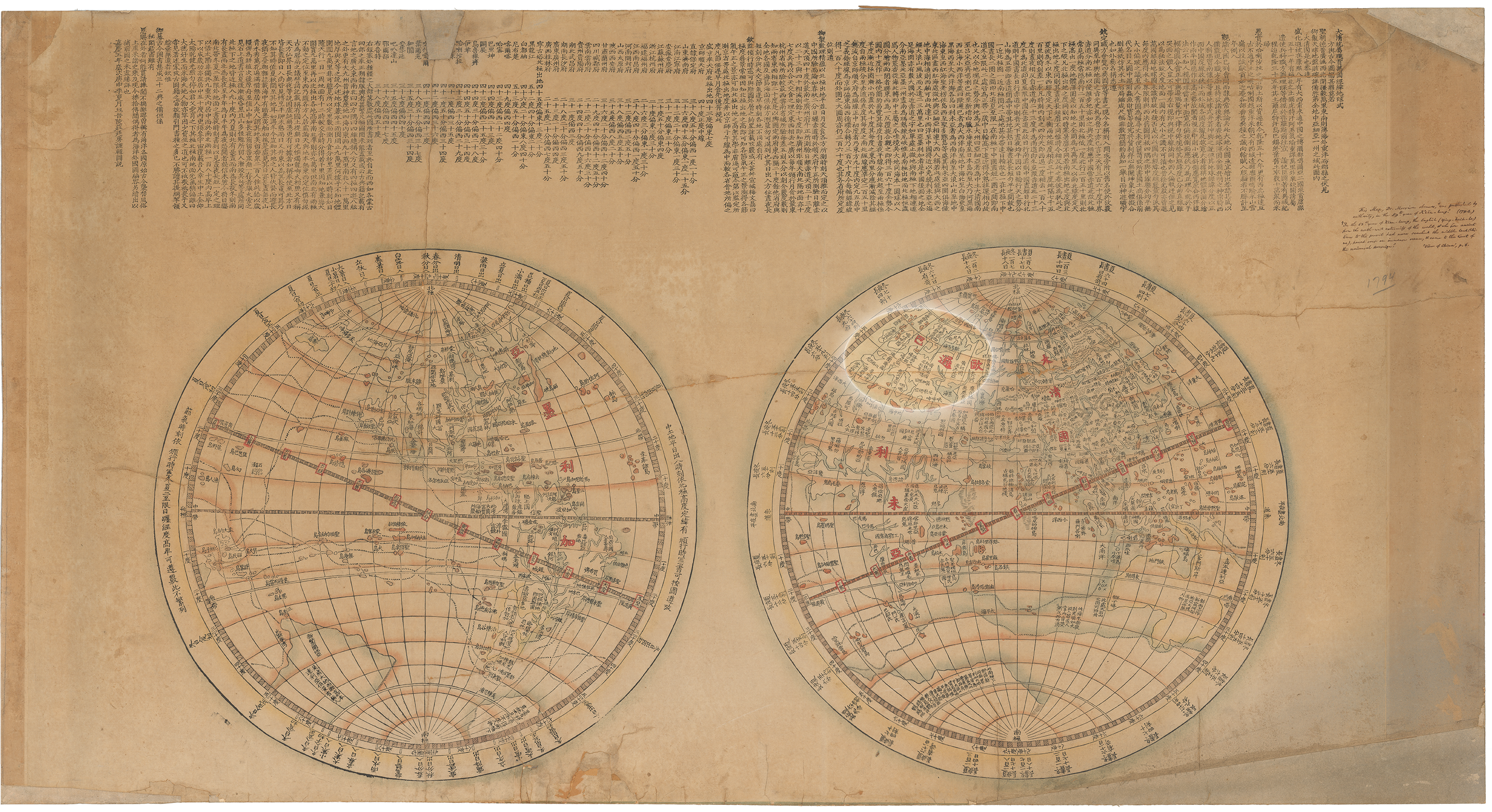
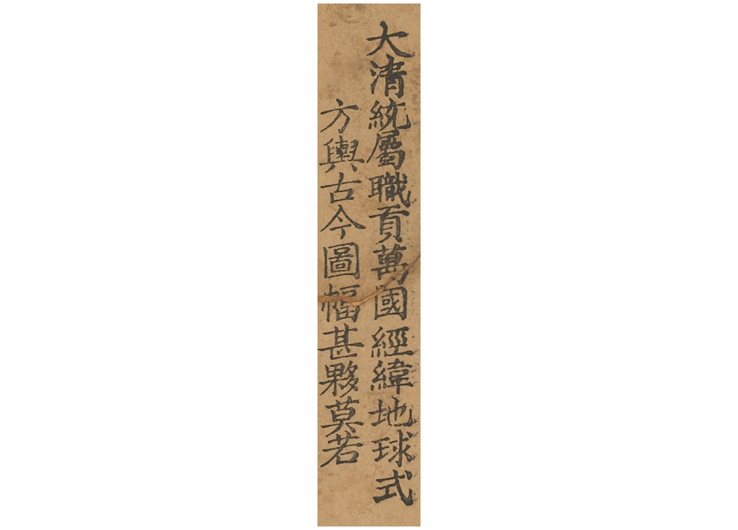
Daqing tongshu zhigong wanguo jingwei diqiu shi fangyu gujin tu 大清統屬職貢萬國經緯地球式方輿古今圖 (1800) by Zhuang Tingfu 莊廷尃.

Scholar mapmaker Zhuang Tingfu’s 1800 map was produced at the end of the height of Qing power. After a long string of successful military conquests under the reign of the Qianlong Emperor (r. 1735-1796), the greater Qing empire had expanded to an unprecedented size.

China, Qing dynasty, woodblock printed sheet maps
萬國與圖 [Map of the world] (1858). China, Qing dynasty, woodblock printed sheet maps, ink, color and gold on paper, 127 × 75 cm (each sheet), MacLean Collection MC31582.

Map B

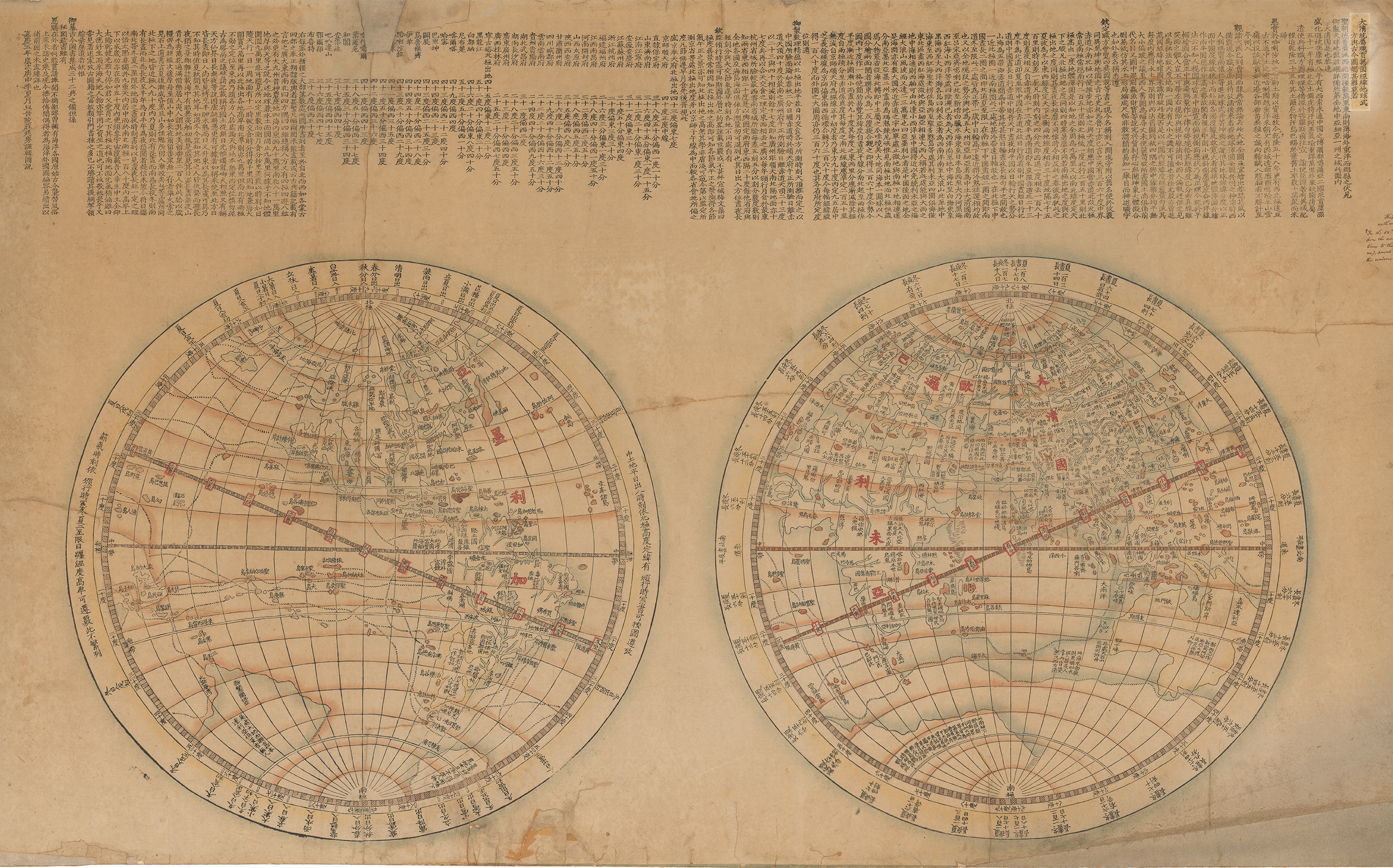
Wanguo yutu 萬國輿圖 (1858) by an unknown maker.

The 1858 Wanguo yutu was produced anonymously during the Second Opium War (1856-60). It was based on Zhuang’s earlier 1800 map, visually and textually reproducing many elements like much of the lengthy inscription and generally the double hemisphere projection of the world.

Comparisons

As you compare the two hemispheres, notice how much more detail the 1858 map gives about foreign nation-states as opposed to the 1800 one.

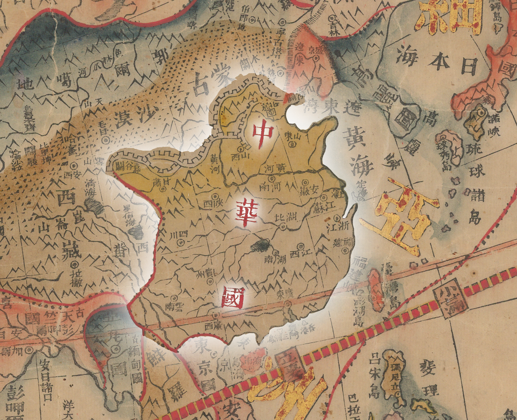
In Zhuang Tingfu’s map, only the coordinates of major cities within the greater Qing empire were listed in the preface and named within the map (Fig. 1). Graticule (longitude and latitude) coordinates for the capitals and provincial cities of Qing China.
Fig. 1 | Graticule (longitude and latitude) coordinates for the capitals and provincial cities of Qing China.
No non-Qing capitals or cities were listed or named. Toponyms of foreign places were written out over their general areas with no territorial borders indicated (Fig. 2). Detail of Italy (意大里亞) is a named amorphous peninsula amongst many in Europe.
Fig. 2 | Italy (意大里亞) is a named amorphous peninsula amongst many in Europe. Outside bands provide latitude and named relative positions of the sun through the four seasons.
Zhuang Tingfu seemed chiefly interested in implementing a European geographic coordinate system and presentation style, using graticules to locate places in Qing China and situate its empire within a larger world order.

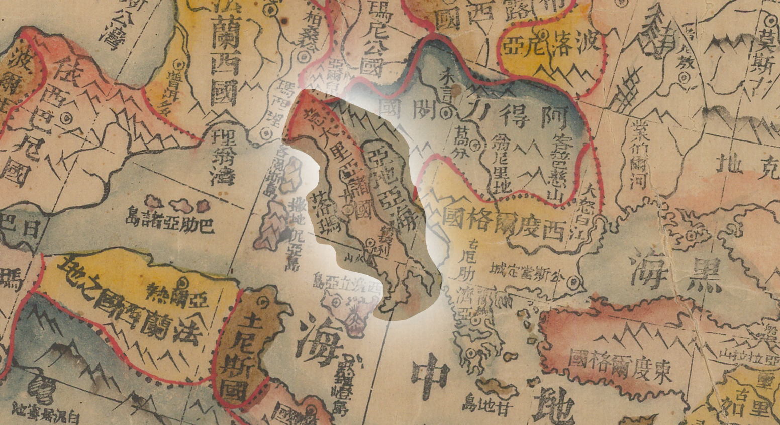
Conversely, the anonymous court mapmaker of the 1858 map indicated greater interest in the larger world, that beyond Qing China. Within the preface, only the coordinates of major cities in Saiwai 塞外 (beyond the Great Wall) and Xinjiang 新疆 (the “New Territories”) were listed, omitting all the Qing capital and provincial capital coordinates. Major cities and geographical landmarks around the world were named and marked. Political boundaries between nation-states and continents were drawn using dotted black lines and highlighted in red (Fig. 3). The Italian Peninsula (意大里亞諸國), with its distinctive boot shape, has its geopolitical borders demarcated using black dots and red lines.
Fig. 3 | The Italian Peninsula (意大里亞諸國), with its distinctive boot shape, has its geopolitical borders demarcated using black dots and red lines. Rome 落瑪 and Naples 納波利 are named, with Mount Vesuvius located (火山).
All provincial and country names including Qing China’s 中華囯國 (Fig. 4) were written in either red or black characters within the confines of their territorial borders. Detail of Qing China named on map
Fig. 4 | Qing China is named zhonghua guo.

It’s a New World

What triggered the introduction of these additional place names between 1800 and 1858? What changed politically in Qing China? Was it the two mid-nineteenth century Opium Wars? The 1858 map was produced in the midst of the second opium war. Geopolitical considerations and Qing China’s relationship with other world powers were likely in the court mapmaker’s mind.
The worldview presented through the 1858 map brought its mapmaker into alignment with early Qing reformers like the scholar-official Wei Yuan 魏源 (1794-1857), who soon after the first opium war published his famed geographical atlas, the Haiguo tuzhi 海國圖志, in three editions between 1844-52. Published for widespread distribution, this book popularized the image of a world of distinct competing nations, with China being one of many. It was to be understood that each nation state had a unique evolution in its habits, societies, and technologies. Within such a world, nation states were expected to uphold the principle of Westphalian or national sovereignty, whereby each state holds exclusive sovereignty over its territory. The Haiguo tuzhi was the first indigenous Chinese work to assert that China had to participate in such a system.
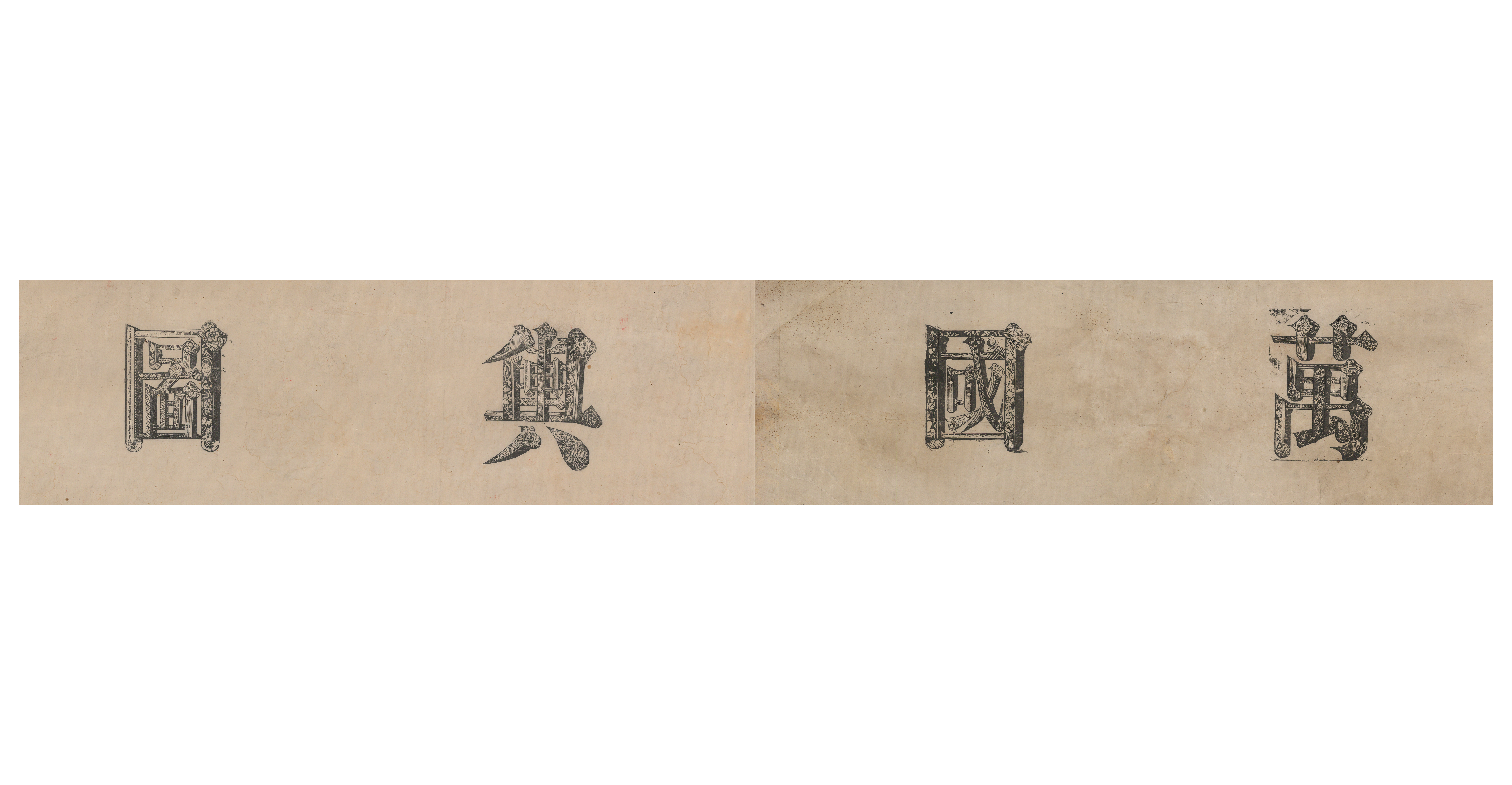
This new worldview meant a conceptual shift away from the Sino-centric tribute system which had framed Ming and Qing China’s foreign relations. The so-called tribute system defined the official relations and affiliations between the Ming/Qing empire and non-Ming/Qing regions. The 1800 map uses the term “tribute bearing” in the title with examples provided in the first paragraph of the preface. (Fig. 5) Detail of 1800 map title
Fig. 5 | “Tribute-bearing” (zhigong 職貢) is in the map title (fifth and sixth characters in top right). Various historical tribute missions are listed starting at line five from the right.
The tribute system was a multi-lateral matrix that existed between the various state entities that was ultimately mutually beneficial. However, discourse around this system typically used a bias and vocabulary centered around the Ming/Qing state. Like Wei Yuan, our 1858 mapmaker was highly conscious of a shift to a worldview oriented around the balance of power between all states. The term “tribute-bearing” was dropped from the title and the introductory paragraph of the preface. In fact, the entire phrase “Great Qing and its Myriad Tributary States (大清統屬職工萬國)” that was in the title of the 1800 map was shortened to simply the term “Myriad States (萬國)” in the 1858 map, a term which had been introduced as early as the seventeenth century to mean simply “world.” (Fig. 6)
Detail of 1858 map title
Fig. 6 | “World Map” title
This implied that rather than regard the world map as a map of the Qing empire and its many tributary states, the 1858 mapmaker regarded it as a map of a world comprising a multitude of well-defined polities for whom the Qing was not the political or cultural center.

A World(view) Transformed by War

Conclusion

Zhuang Tingfu’s 1800 map might be said to represent the results of late eighteenth century Qing court mapmaking’s newest encounters with European mapmaking traditions, including double hemisphere projections and coordinate grids, but with a Qing empire-centric worldview. The 1858 Wanguo yutu shifted the narrative, both visually and textually, to reflect a new Westphalian worldview. By the mid-nineteenth century, the scholar officials and mapmakers of the Qing court were becoming familiar with international law and its new geopolitical meanings, as Qing China, as did many other parts of the world, began shaping their image of a modern nation state.

Amberly Yeo | Author

Dr. Richard A. Pegg | Editor & Project Manager

Katie E. Osborne | Development & Design