
November 24, 2025
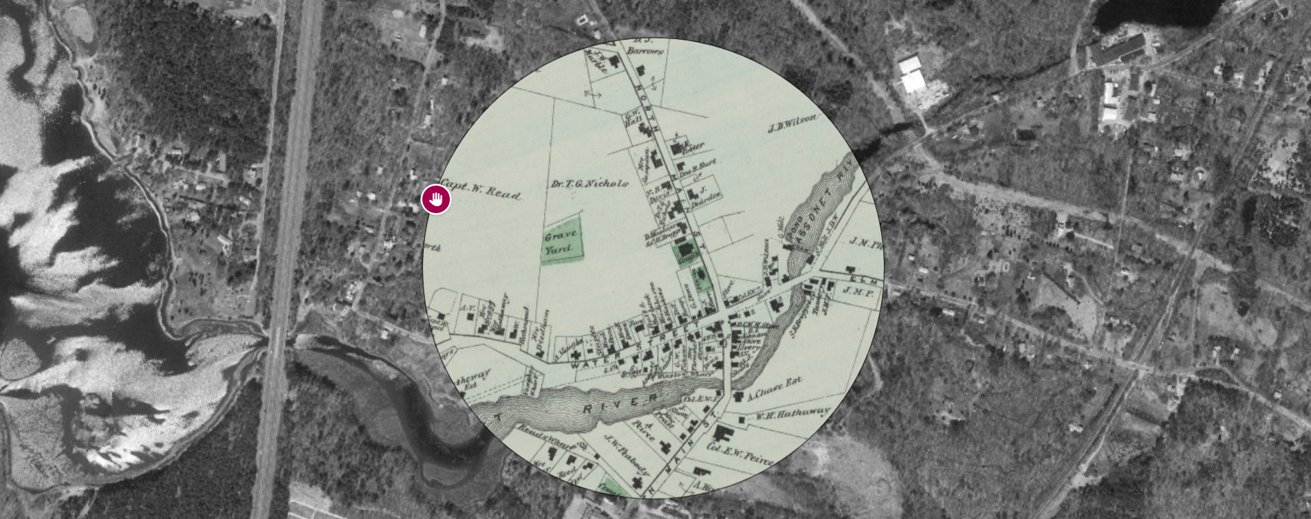
F.W. Beers, Atlas of Bristol Co., Massachusetts (1871), shown in Atlascope view
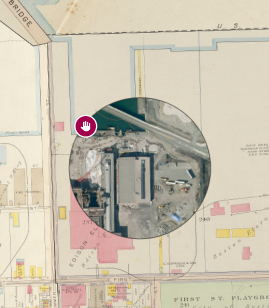
New Article: Making Power, Making Land: The Spatial Legacy of Boston’s Energy Production
The creation of new land and the development of power infrastructure have a shared history along Boston's waterfront—one that still impacts our environment today. In this essay, Genna Kane examines how energy corporations reshaped the waterfront to make it more useful and valuable, and how this history can help us better understand the current strategies and the contemporary challenges for planning Boston's waterfront today. This work was supported by the Leventhal Center’s Small Grants for Early Career Digital Publications program.
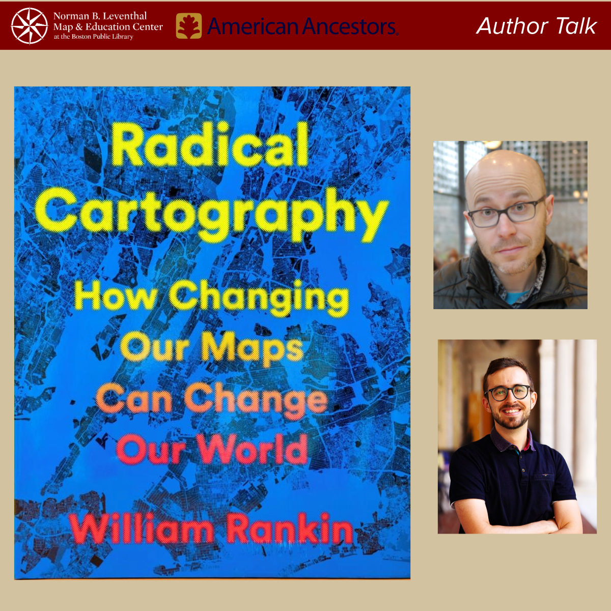
Virtual: "Radical Cartography: How Changing Our Maps Can Change Our World" with William Rankin · Dec 3, 6 pm ET
Brimming with vibrant maps, including many created by the author, Radical Cartography investigates the cartographic representation of boundaries, layers, people, projections, color, scale, and time. In this virtual author talk co-hosted by American Ancestors, cartographer and historian William Rankin argues that it’s time to reimagine what a map can be, and how it can be used. Rankin will be in conversation with the Leventhal Center's Associate Curator of Digital & Participatory Geography, Ian Spangler.
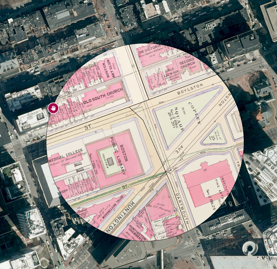
In Person: Atlascope Workshop for Educators · Dec 3, 5:30 pm ET
Our experience is that students—from third grade to high school—light up when we dig into the rich neighborhood histories in Atlascope. What was here before? Why did our school have a different name? What remains the same?
In this hands-on session, Leventhal Center educators will introduce Atlascope, our interactive urban atlas tool, and show you how to bring Atlascope lessons into your classroom. You’ll also get a sneak peek at our new classroom kits, designed to help students explore local history through maps. Space is limited. Priority will be given to teachers currently working in the classroom.
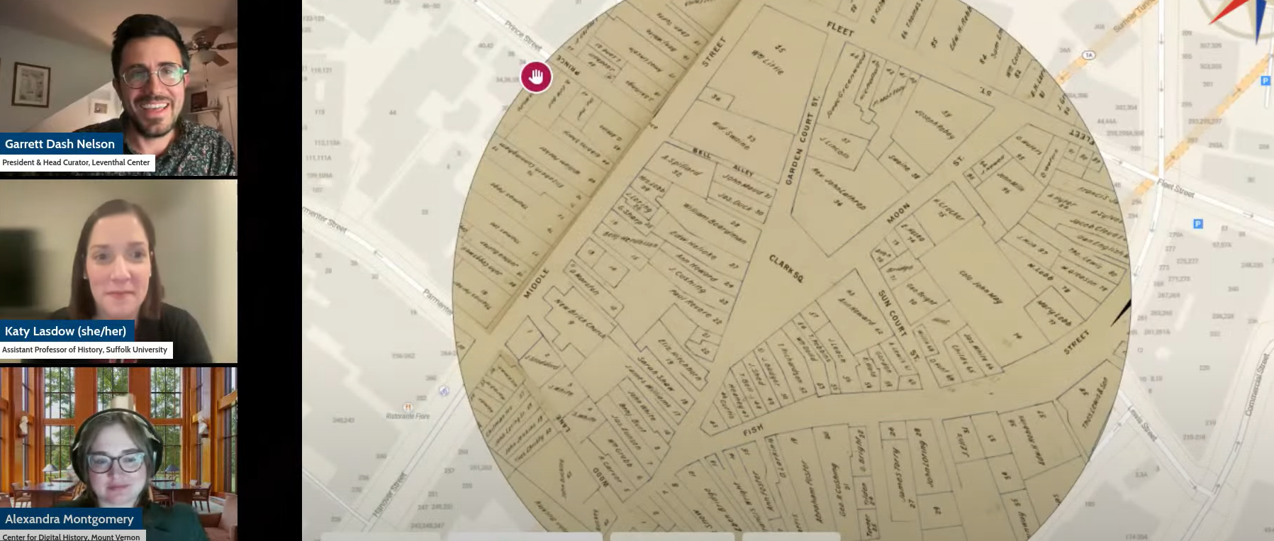
ICYMI: Katy Lasdow on Women Property Holders of Boston’s Waterfront in the Late 1700s
Earlier this month, we hosted a virtual conversation with Dr. Katy Lasdow, co-curator of our current exhibition Terrains of Independence. In this program, Dr. Lasdow explored how maps and deeds documenting women property holders on Boston’s waterfront in the late 1700s illuminate women’s persistence in these neighborhoods, in the face of challenges which changed real estate and land use in the early Republic. This program was part of Richard H. Brown Seminar on the Historical Geography of the American Revolutionary War Era.
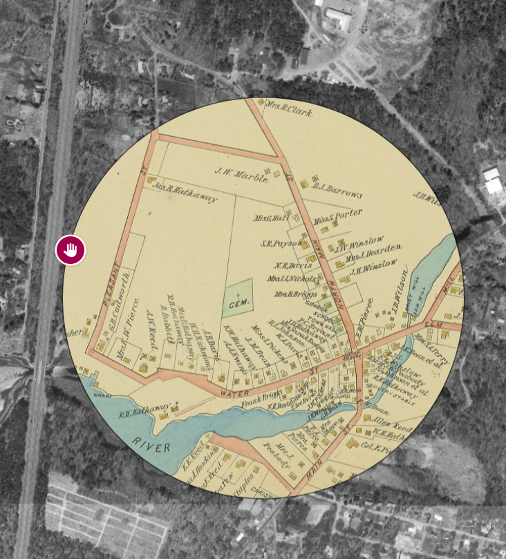
New Atlascope Layer: Freetown
Two new layers have just been added to Atlascope, covering Freetown in Bristol County, Massachusetts. The work to bring these layers into Atlascope was funded by the Town of Freetown. If you would like to help support the development of Atlascope to expand its coverage area across Massachusetts, learn more about Atlascope sponsorship.
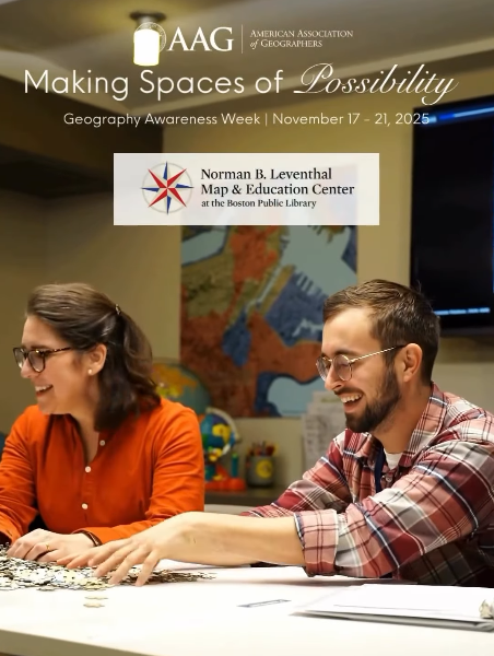
ICYMI: Geography Awareness Week
This past week, the Leventhal Center partnered with the American Association of Geographers to celebrate Geography Awareness Week with this year’s theme “Exploring Spaces of Possibility.” As one of the few museum and education spaces in the United States dedicated to the public study of geography, the Leventhal Center opens up many pathways into hands-on discovery on topics related to space and place.
Osher Map Library Collections Now in ARGO
Collections from the Osher Map Library (OML) are now available in American Revolutionary Geographies Online (ARGO). The Osher collections depict geographies across North America in the eighteenth century, with a particularly unique focus on what is today the st Maine and surrounding areas of New England. The Osher collections are the 20th partner collection to join the ARGO portal, alongside large and small map-holding institutions from across North America and Europe.

Newsletter Trivia: Scale Model of Boston
Boston’s Planning Department houses a model room in City Hall with a 1:40 inch basswood model of Boston's downtown and portions of adjacent neighborhoods. Which of the following neighborhoods is not represented in the model?
Hyde Park
Beacon Hill
Seaport
North End
The answer to last newsletter’s question about which modern district of Boston the historic “Newspaper Row” area is now located is the Financial District. Correct answers will be included in a random drawing—the winner will receive the next three Map of the Month club postcards for free. Congratulations to our last winner, Kayla! In order to enter, make sure you follow us on Bluesky, Instagram or Facebook and direct message or email us the answer to the question. We’ll accept answers until December 1 at 9 am ET.
The Leventhal Map & Education Center is an independent nonprofit. We rely on the contributions of donors like you to support our mission of preserving the past and advancing the future of maps and geography.
View this email in your browser
Leventhal Map & Education Center at the Boston Public Library
617.859.2387 · info@leventhalmap.org
{{SenderInfoLine}}