
Sacrifice Zones
Modern life is full of consumption habits that have environmental consequences. But oftentimes one group of people’s desires and demands leads to a degraded environment for an entirely different group of people. This geographic mismatch between one group of people’s needs and another group’s exposure is a key element of environmental injustice. For instance, hundreds of thousands of New Englanders from all walks of life heat their homes with fuel oil, and millions travel each year in and out of Boston through Logan Airport and its surrounding roads. The toxic landscapes required to store and distribute oil, or to service an international airport, however, are not borne equally on all these users. Geographers use the term “sacrifice zones” to describe places that have been severely impaired by these kinds of land uses.
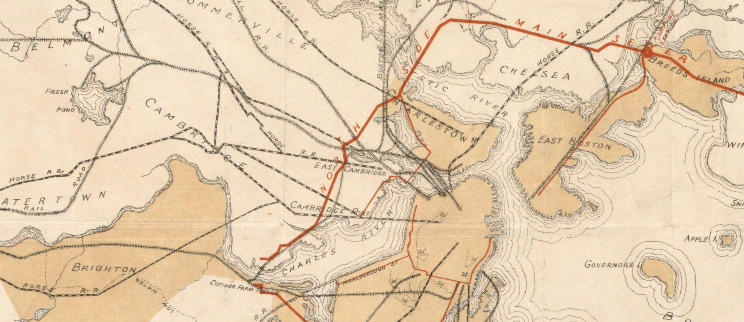
Plate 28 from Atlas of the City of Boston: Charlestown and East Boston
G. W. Bromley & Co.
1922
Leventhal Map & Education Center
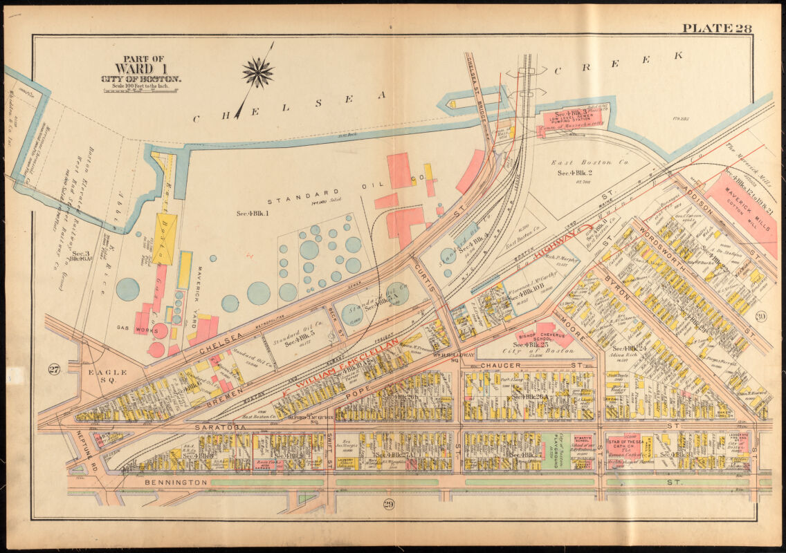
This 1922 fire insurance atlas shows the East Boston side of Chelsea Creek, with the Standard Oil Company’s circular tanks prominently displayed in the center. A hundred years later, it is still an important site for New England’s oil industry, storing jet fuel for nearby Logan Airport and heating oil for homes across the region. The small yellow squares show the modest wood-framed houses that were built right up to the oil facility’s front door, while the red annotation hints at a future environmental scar: land that would be seized to make way for the McClellan Highway, later Route 1A.
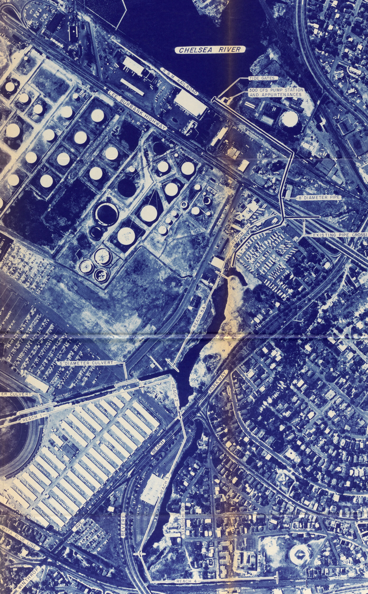
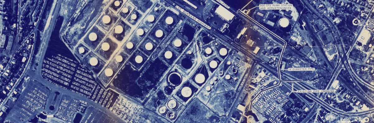
Plate A Chelsea River Alternative from Revere, Sales Creek - Flood Control Study
Massachusetts Department of Environmental Quality Engineering
1976
Boston Public Library
Here, a state environmental regulation plan from 1976 shows interventions to mitigate flooding in Sales Creek, on the border between East Boston and Revere. The aerial photograph shows the petrochemical tanks and parking lots following the creek’s highly engineered route, as well as a manufactured home community. Although this document comes from the era of modern environmentalism, it’s possible to use it to trace out the legacy of centuries of environmental marginalization, from the tidal flats that were seized by white settlers in the seventeenth century to the industrial infill of the nineteenth century. Efforts to protect the environment cannot help but involve social questions about whose interests are being protected today—and whose were in the past as well.
Boston. East Boston
Fairchild Aerial Surveys, Inc.
1925
Boston Public Library
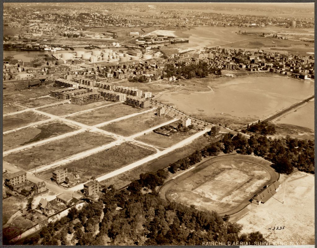
This 1925 aerial photograph shows East Boston around the same time portrayed in the fire insurance atlas. At the center are the recently-filled flats being laid out for residential development, with three-decker homes for working class occupants beginning to appear. Just beyond are the oil facilities along Chelsea Creek, with the eastern part of Chelsea in the background. In the foreground is Wood Island Park, with its gymnastic grounds and track. The park was designed by the Olmsted firm but later destroyed in the 1960s for Logan Airport.