Towards Public Control
Buses for Boston
In 1922, the Boston Elevated Railway Company (BERy) introduced a novel form of transportation for Bostonians: three motor buses, replacing streetcars along a route in Brighton. Buses, with their go-anywhere capability, were cheaper to purchase and operate than streetcars.
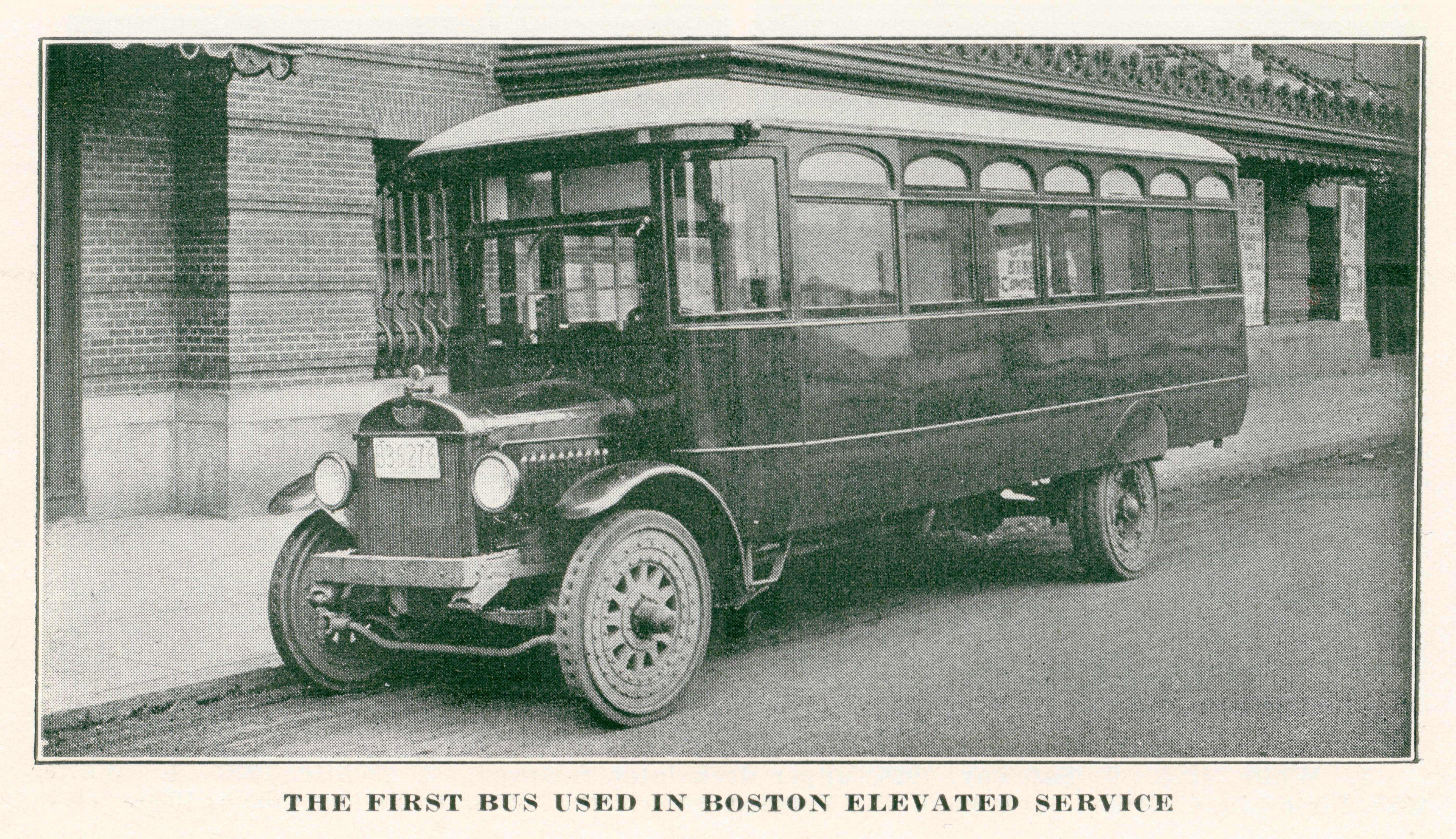
The BERy’s self-described “first bus used in Boston Elevated service” was essentially a large omnibus cab tacked onto a basic truck frame. 4.1B The vehicle provided a rough ride, due to its solid tires and lack of cushioned seats or power steering.
4.1B
“The First Bus in Boston Elevated Service” from “Co-operation,” v. 12 no. 2
Boston Elevated Railway Company
1933
WardMaps LLC
A 1925 map of the BERy’s nascent bus network 4.1A documents a series of seemingly disconnected routes; scores of streetcar lines that connected the early bus routes were omitted. By this point, the BERy was operating thirty-five motor buses. The local fare for a trip on a BERy bus was six cents, or ten cents with a transfer.
With a colorful folding map, 4.1C published in 1930 for Boston’s tercentenary, the BERy celebrated public transit in the central part of the city at a moment when rapid transit stations, streetcar lines, and bus routes all served downtown.
4.1C
The Central Part of Boston, Massachusetts, Showing Transportation Lines of the Boston Elevated Railway
Boston Elevated Railway Company
1930
WardMaps LLC
System Route Map #1 (1936)
While we now enjoy instant access to the latest transit system data on digital devices in our pockets, the Boston Elevated Railway Company’s System Route Map #1, published in 1936, remains a masterfully formatted pocket-sized analog navigation device.
One side 4.2A is dominated by a map of the entire BERy network. The reverse side 4.2B features a comprehensive list of the system’s lines and routes. By referencing both sides, one could locate a desired route, track operating frequencies, plot connections, and navigate all modes of the BERy’s network.
4.2B
System Map (verso)
Boston Elevated Railway Company
1936
WardMaps LLC
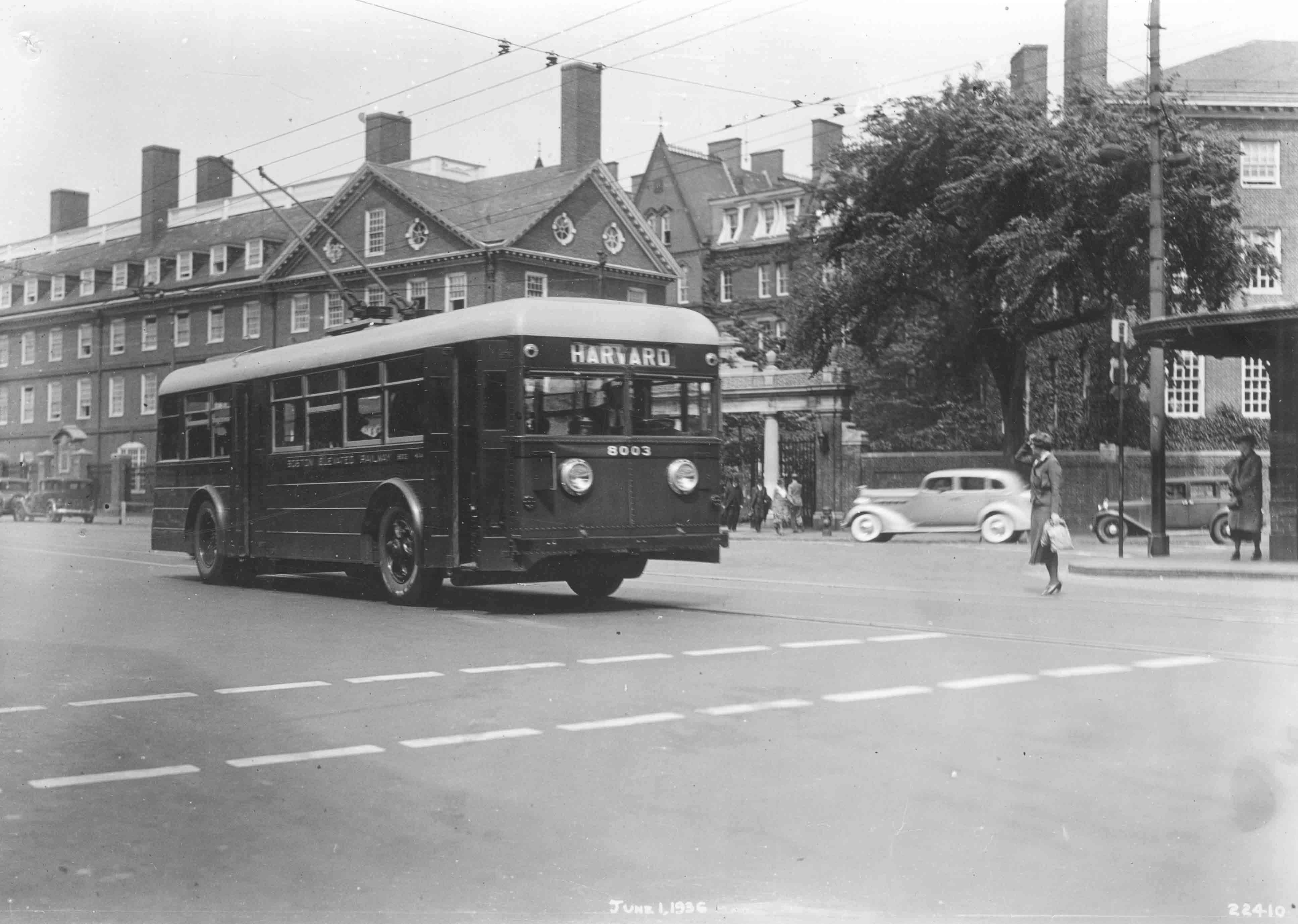
In the center of System Route Map #1, 4.2A anchored at its termini by black triangles enclosing a white number 66, is the BERy’s first trackless trolley route. A photograph 4.2C captures a Route 66 trackless trolley entering Harvard Square in 1936. Trackless trolleys rode smoother and quieter than streetcars. Their interiors were more spacious and motors more reliable than those of early buses. The size of Boston’s trackless trolley network peaked just before the middle of the 1950s, when forty-three trolley bus routes were serviced by a fleet that was the third largest in the nation.
The orientation, scale, proportion, and general language of representation of the map, a design attributed to Boston commercial cartographer Richard F. Lufkin, was a refinement of earlier transit maps for Boston, including Chase’s 1865 regional map 2.1A and the West End’s 1891 system map. 2.2D As a testament to its usefulness, the “Lufkin Format” system map was reissued, with revisions made only for content, first by the BERy, then the MTA, and eventually a young MBTA.
Public Control, Round 1
The Metropolitan Transit Authority (MTA), established by the Commonwealth to take over a financially floundering Boston Elevated Railway Co. (BERy), was the first public entity with wholesale ownership and control over public transportation in Boston.
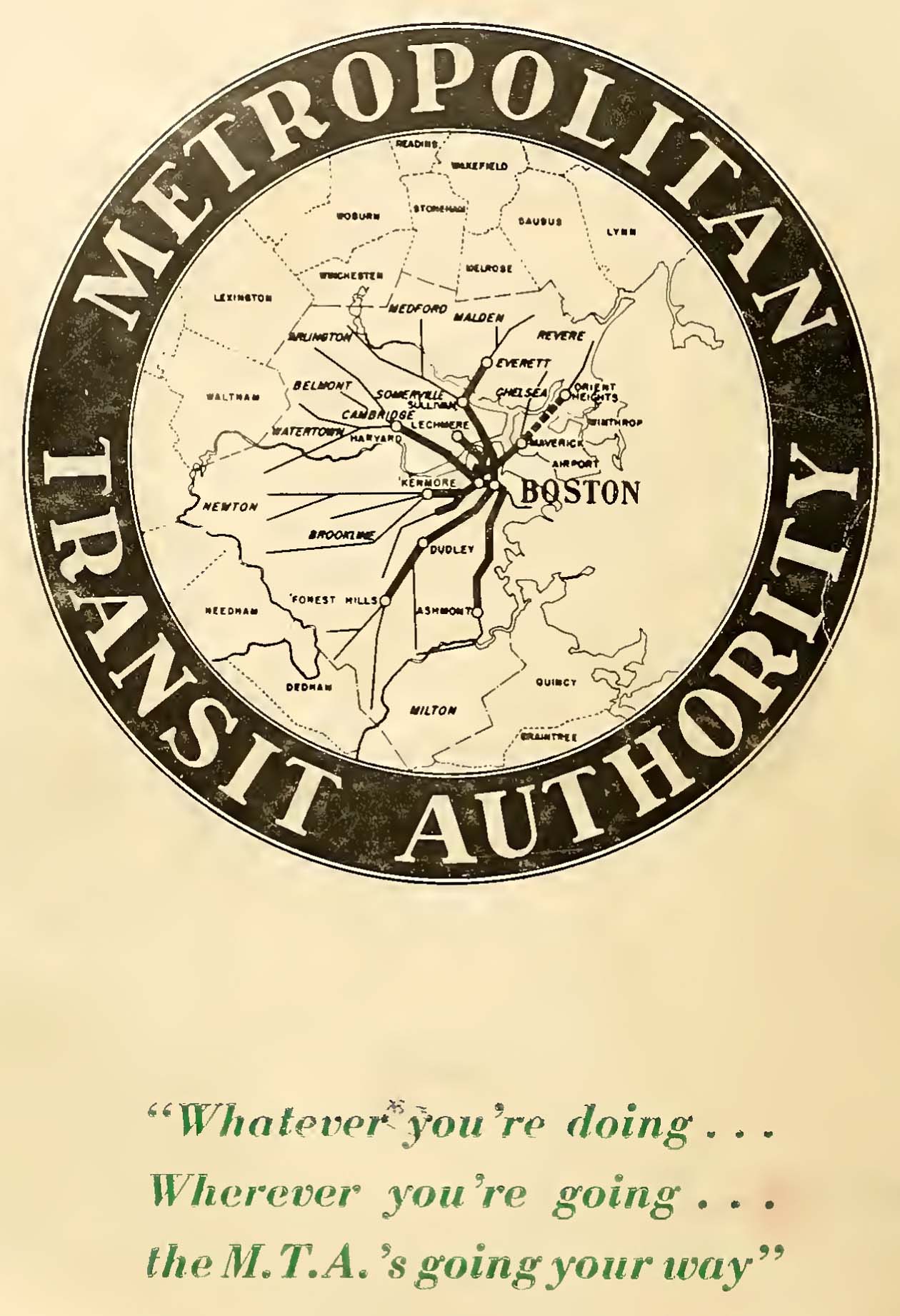
The MTA announced its arrival with a map logo, 4.3A representing the MTA’s fourteen-town service area tied together by transit lines radiating from downtown Boston.
4.3A
MTA Logo from “Second Annual Report of the Board of Public Trustees of the MTA”
Metropolitan Transit Authority
1949
WardMaps LLC
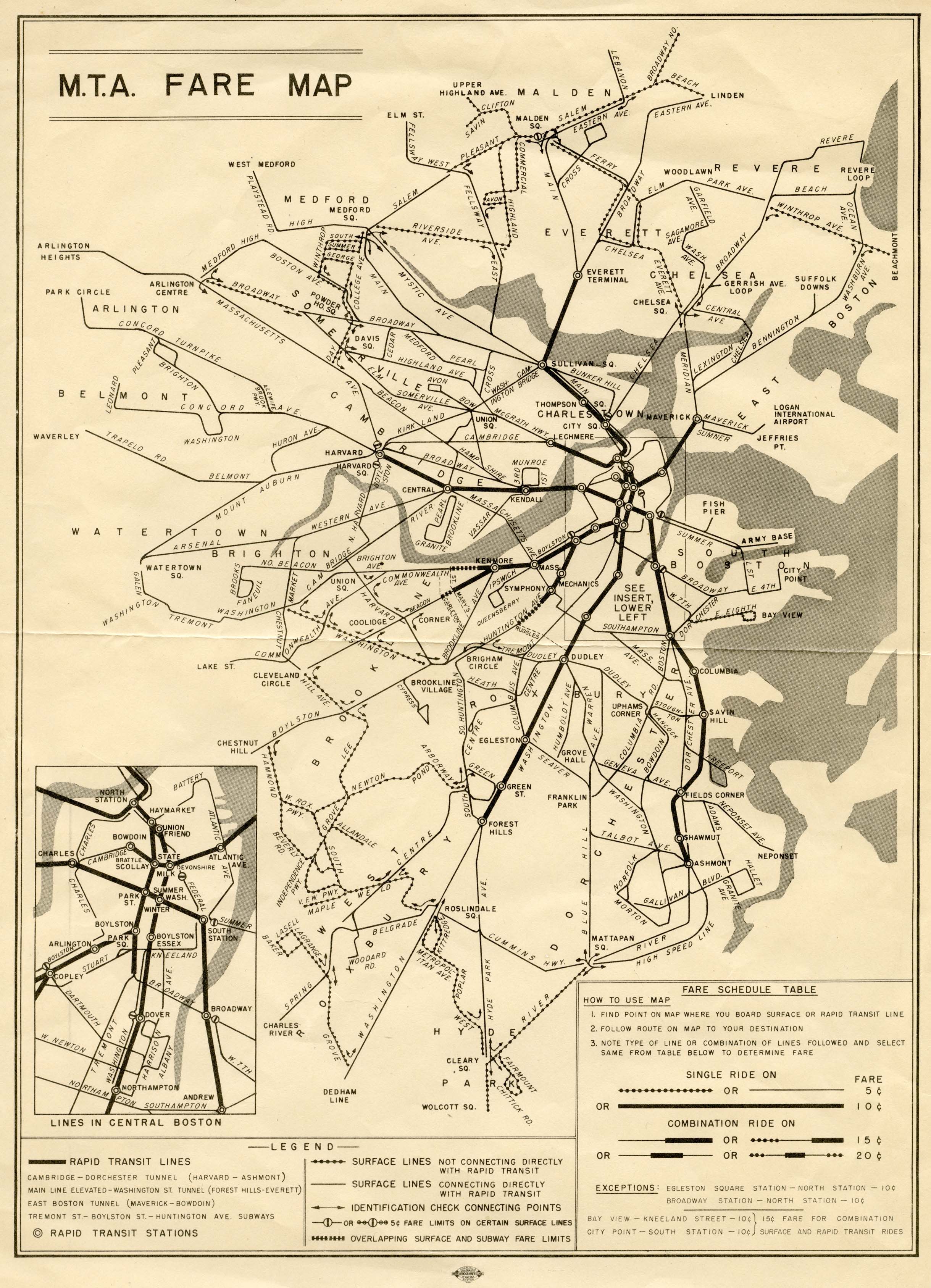
In 1947, the MTA kicked off its tenure by increasing service on existing lines, launching new bus routes, and establishing a long-term plan to upgrade existing transit stations. However, its 1949 fare structure was so complicated it required an explanatory map 4.3B accompanied by a multiple page pamphlet.
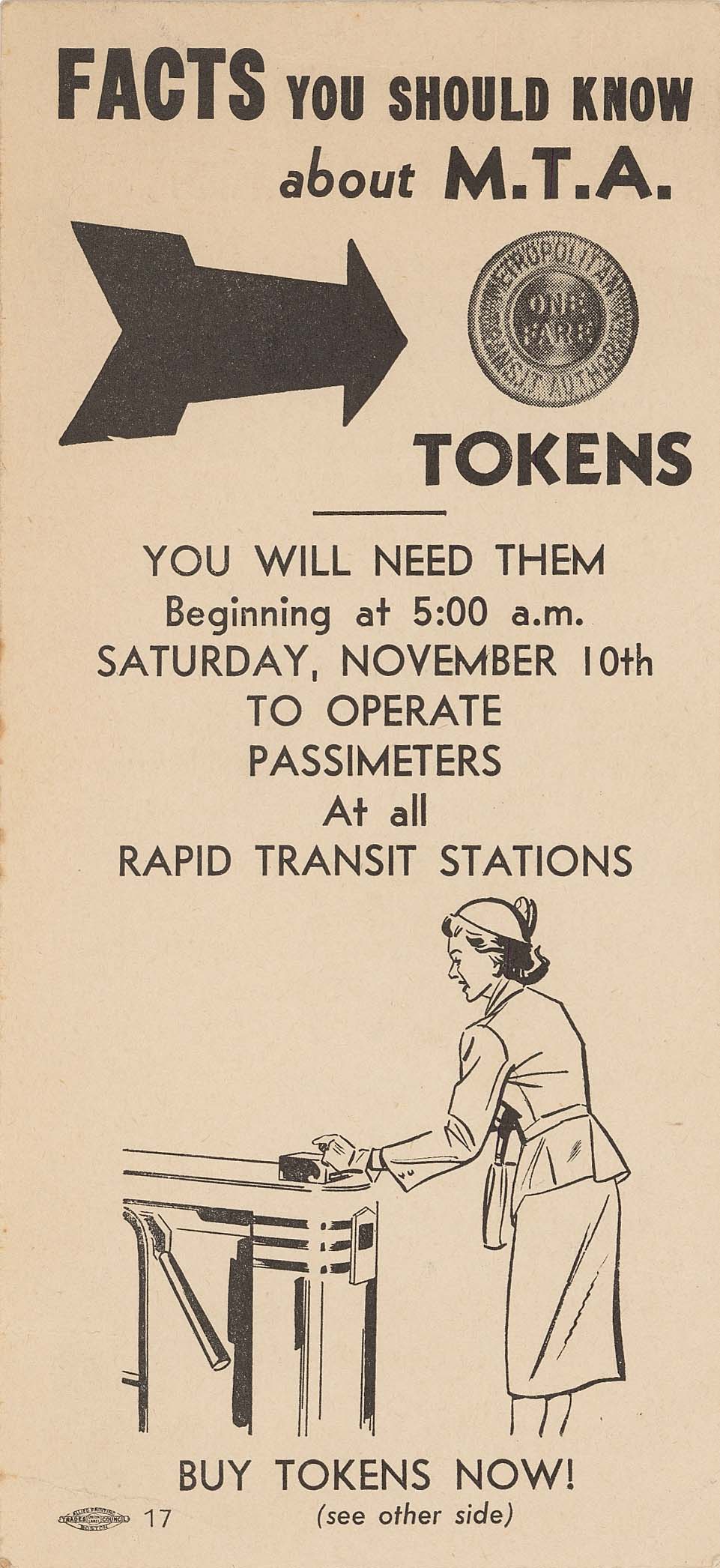
Major projects completed by the MTA included extending the East Boston Tunnel line (now MBTA Blue Line) to Revere in 1952-54, introducing tokens for fare payment in 1951, 4.3C converting the Highland Branch (now MBTA Green Line D Branch Riverside) from railroad to streetcar service in 1959, 4.3D establishing an unprecedented number of park and ride lots to woo automobile commuters, and purchasing new buses for the streets and rapid transit cars for the Cambridge-Dorchester Line (now MBTA Red Line) 4.3E .
4.3C
Facts You Should Know About M.T.A. Tokens
Metropolitan Transit Authority
1951
WardMaps LLC
4.3D
Announcing the Big New MTA Line: Highland Branch
Metropolitan Transit Authority
1959
WardMaps LLC
4.3E
The M.T.A.: 16th Annual Report
Metropolitan Transit Authority
1962
WardMaps LLC
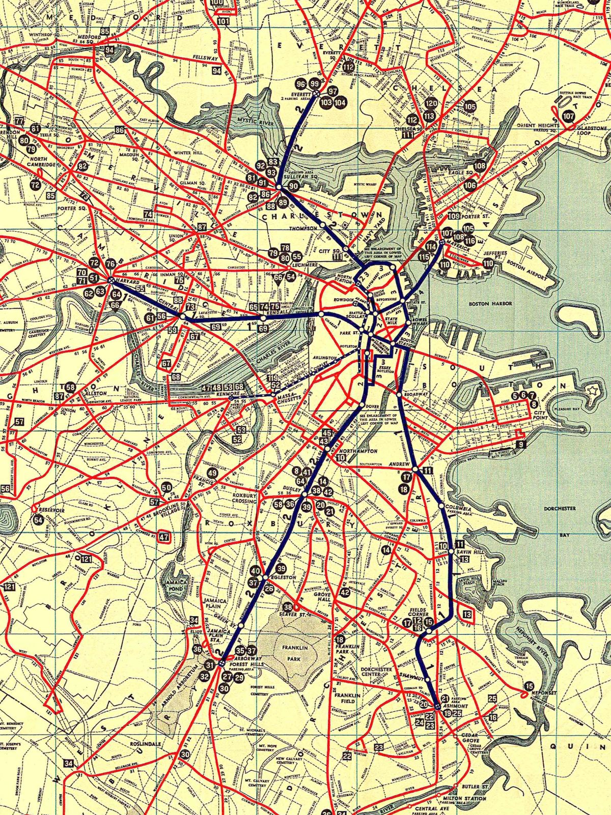
The MTA’s 1957 Rapid Transit Brochure map 4.3F shows MTA lines reaching to Revere and Everett in the North, and Forest Hills and Mattapan in the South. Despite efforts to improve service and economize operations, the MTA was unable to overcome ridership and revenue declines, mostly due to a massive shift of commuters towards private automobiles. Meanwhile, railroads connecting Boston with its expanding suburbs were seeking permission to discontinue money-losing passenger services.
4.3F
Rapid Transt [sic] Lines of the Metropolitan Transit Authority
Metropolitan Transit Authority
1957
WardMaps LLC
![Image of Rapid Transt [sic] Lines of the Metropolitan Transit Authority](https://s3.us-east-2.wasabisys.com/lmec-public-files/exhibitions/getting-around-town/cw-4/4.3F-RTL%20brochure%20-%20mta%201957%20-%20map.jpg)
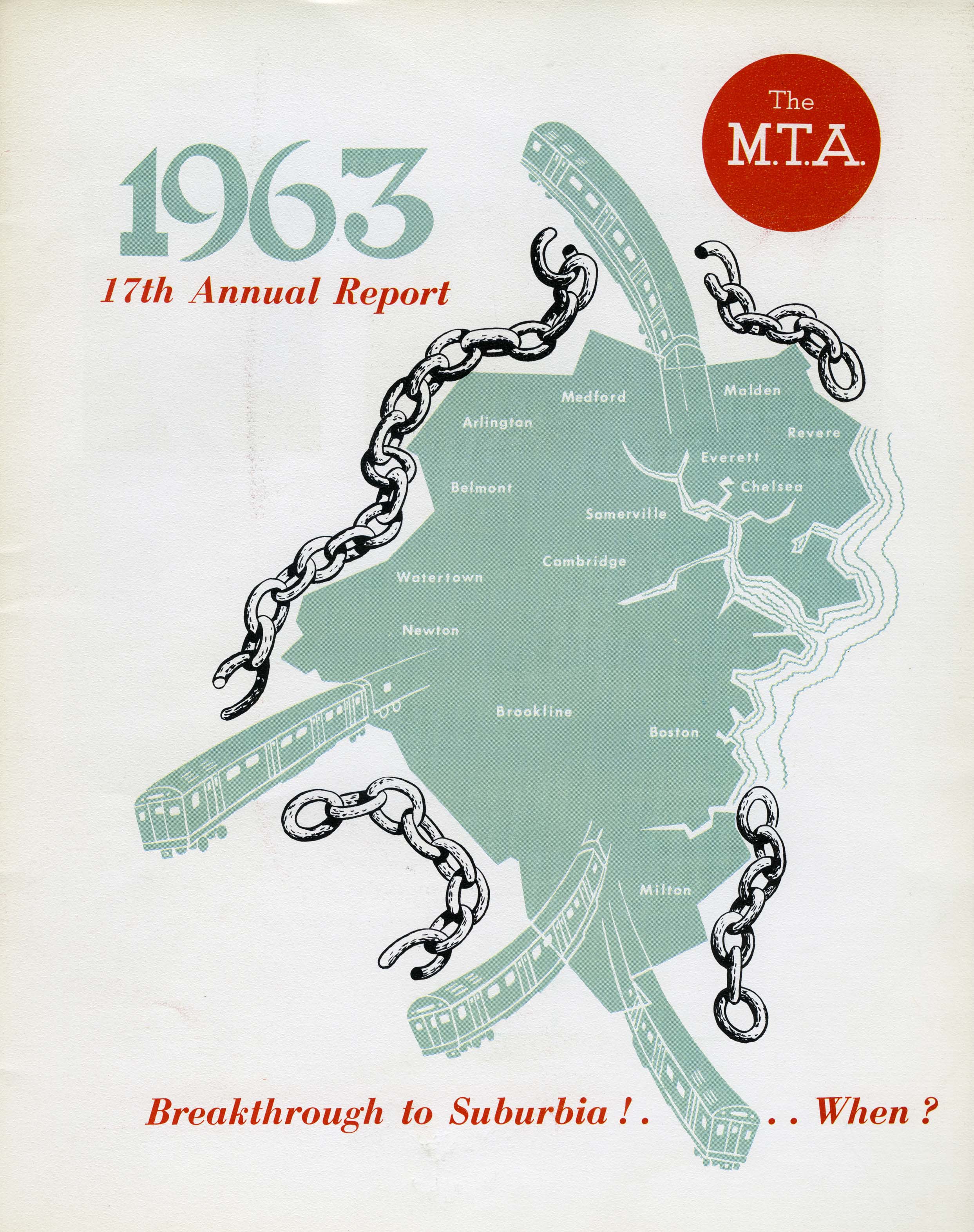
The cover of the MTA’s final annual report in 1963 4.3G features rapid transit trains forcefully breaking through chains surrounding the MTA’s service area map. Within a year of the report’s issuance, the chains were indeed broken as the state reconstituted the MTA as a new regional entity, the MBTA.
4.3G
The M.T.A.: 17th Annual Report
Metropolitan Transit Authority
1963
WardMaps LLC