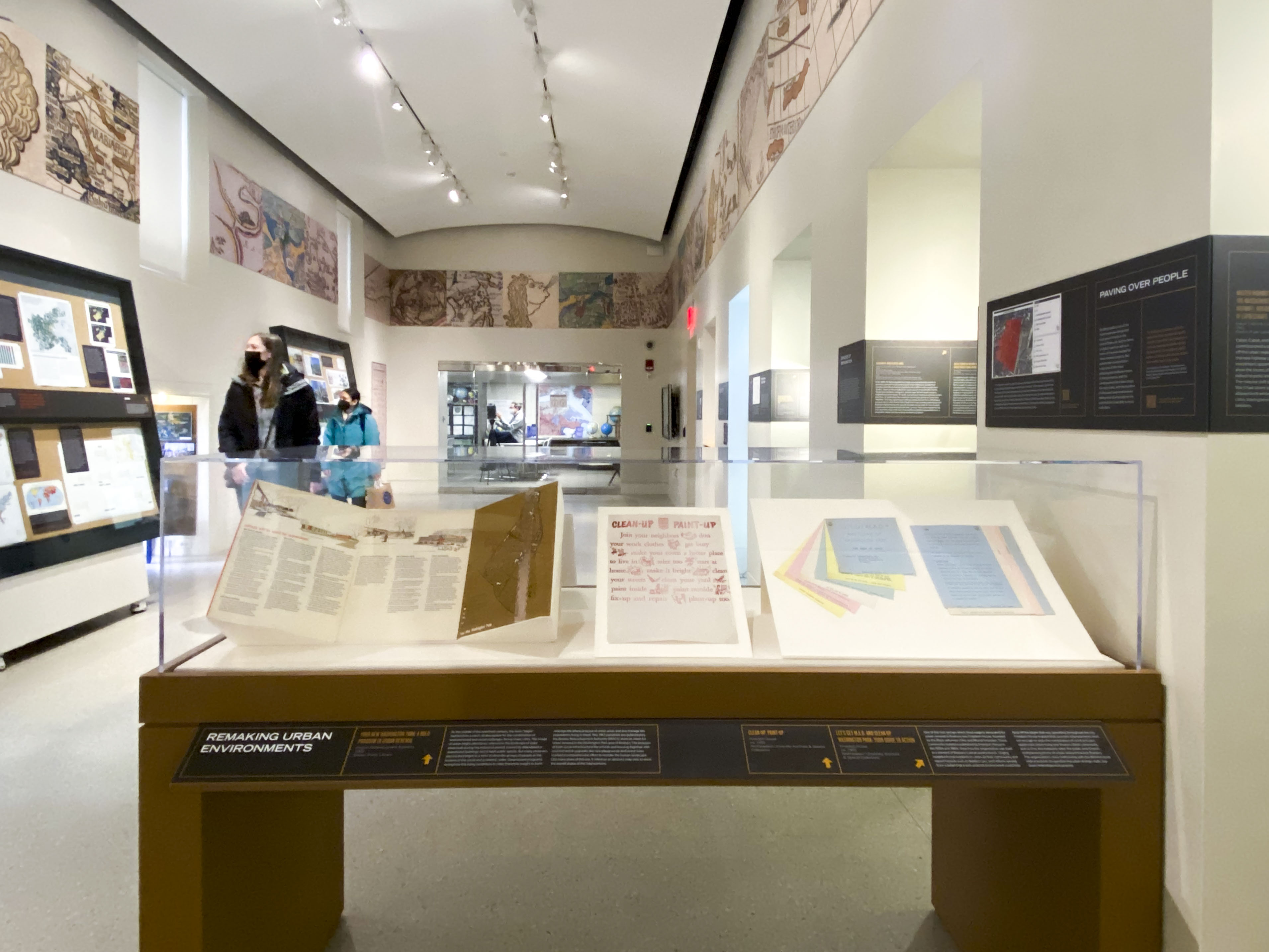
A Period of Newness
The MBTA’s First Decades
In 1964, the Massachusetts Bay Transportation Authority (MBTA)—now popularly known as the “T”—arrived hot on the scene with a mandate from the Commonwealth to reimagine public transit in Eastern Massachusetts and address the crises which had undermined the MTA and regional rail service.
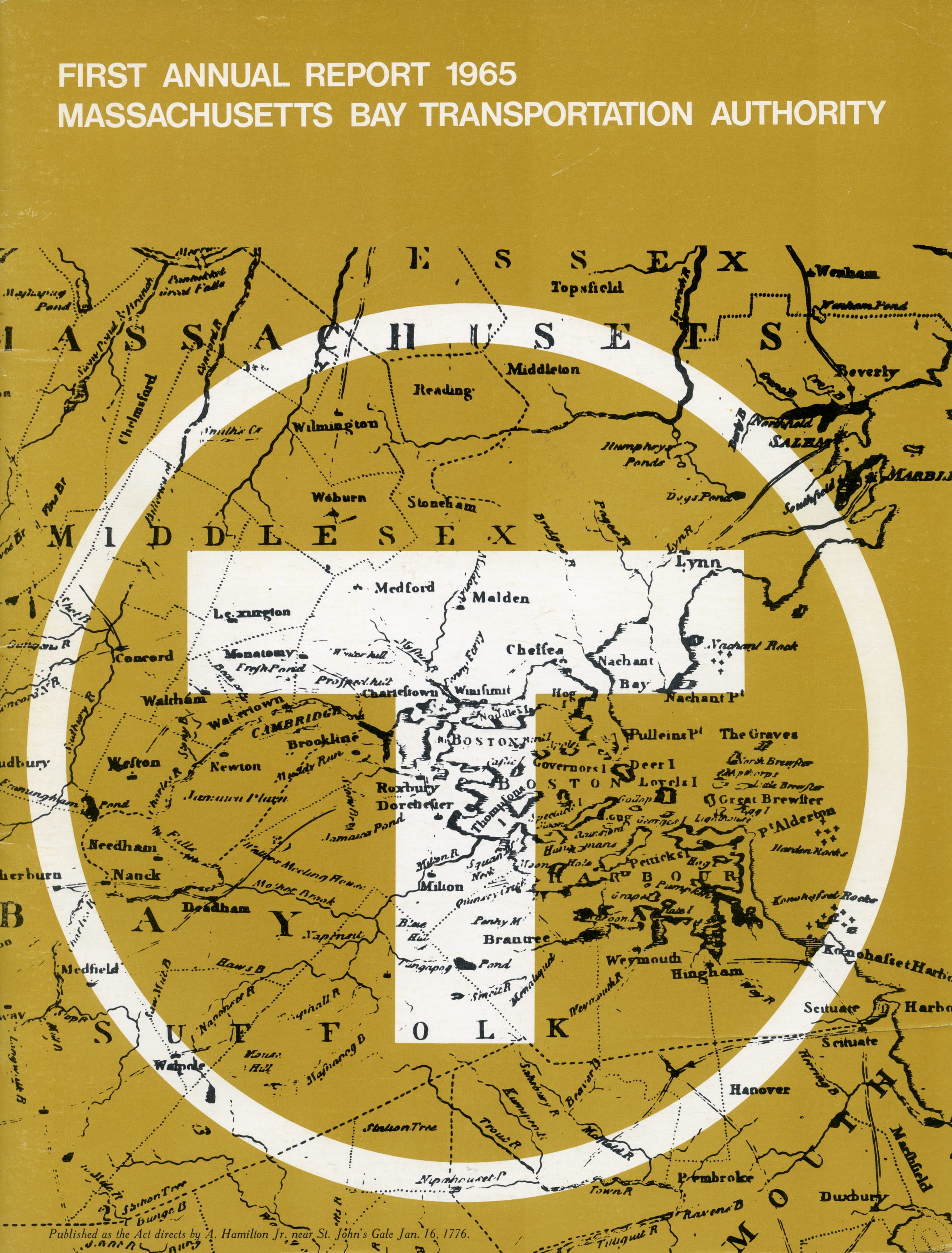
On the cover of its first annual report, the MBTA overlays its logo upon a 1776 map of Greater Boston. 5.1A
5.1A
Cover of “First Annual Report”
Massachusetts Bay Transportation Authority
1965
WardMaps LLC
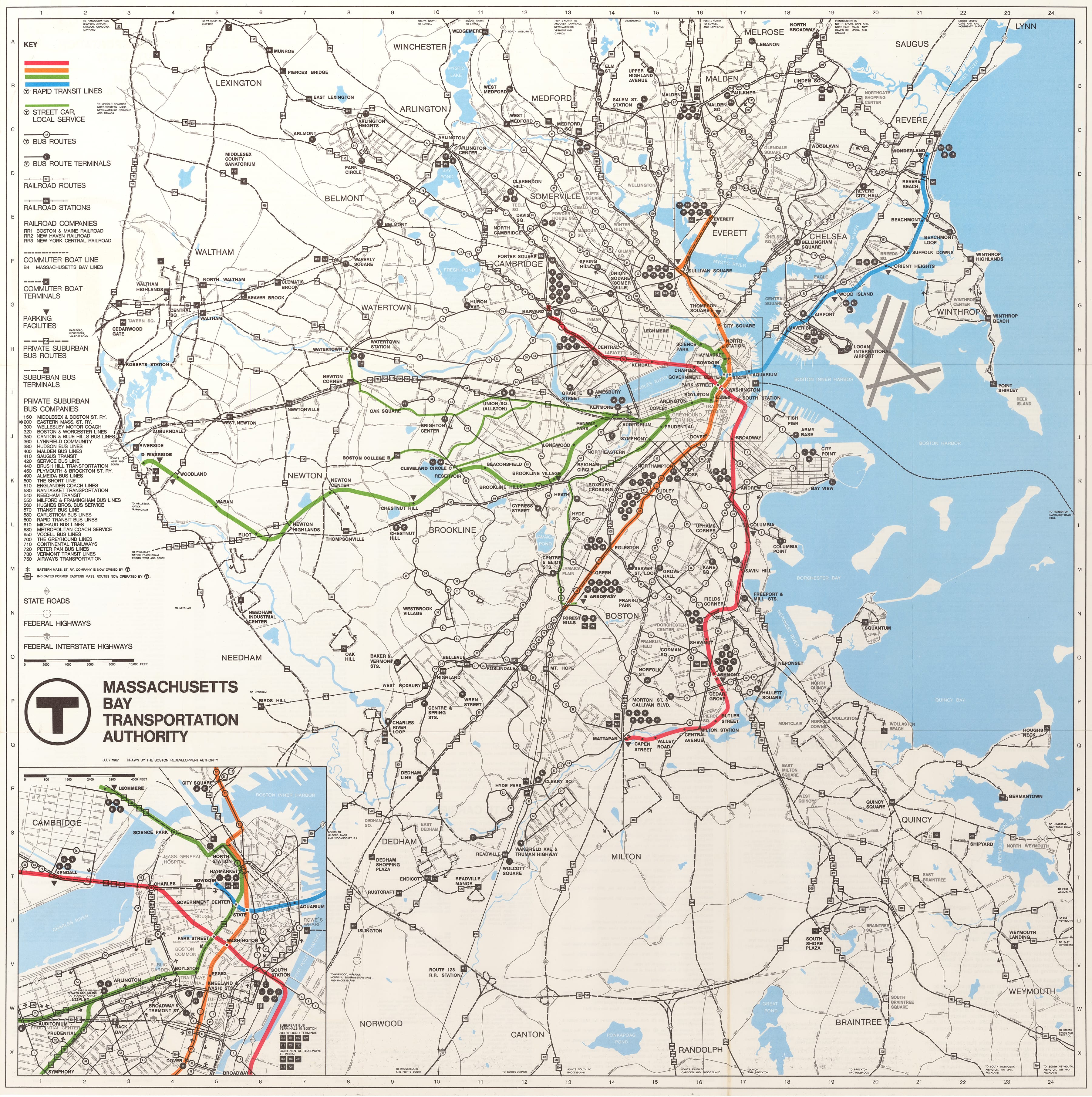
The 1967 MBTA System Map 5.1B provides a snapshot of the T in the middle of its first decade. Colored lines, only finalized in 1966, trace rapid transit and streetcar routes. The abstract rapid transit “spider” map 5.3B had yet to become ubiquitous, so the new colors are applied to a geographically accurate base map. Commuter rail lines, which had not yet come under MBTA ownership, are labeled for private railroad operators. Thirty different operators are keyed to bus routes.
5.1B
MBTA System Map
Massachusetts Bay Transportation Authority; Boston Redevelopment Authority
1967
WardMaps LLC
Reaching Out
The MBTA hit the ground running in 1964. The aesthetics, operations, and extents of public transit service for Greater Boston were reset, rebuilt, and expanded like never before. Over the next two decades, the T rebuilt stations, extended lines, purchased new vehicles, and protected legacy transit infrastructure for the public good. Optimistically, the T described its first eighteen months as a “period of newness.”
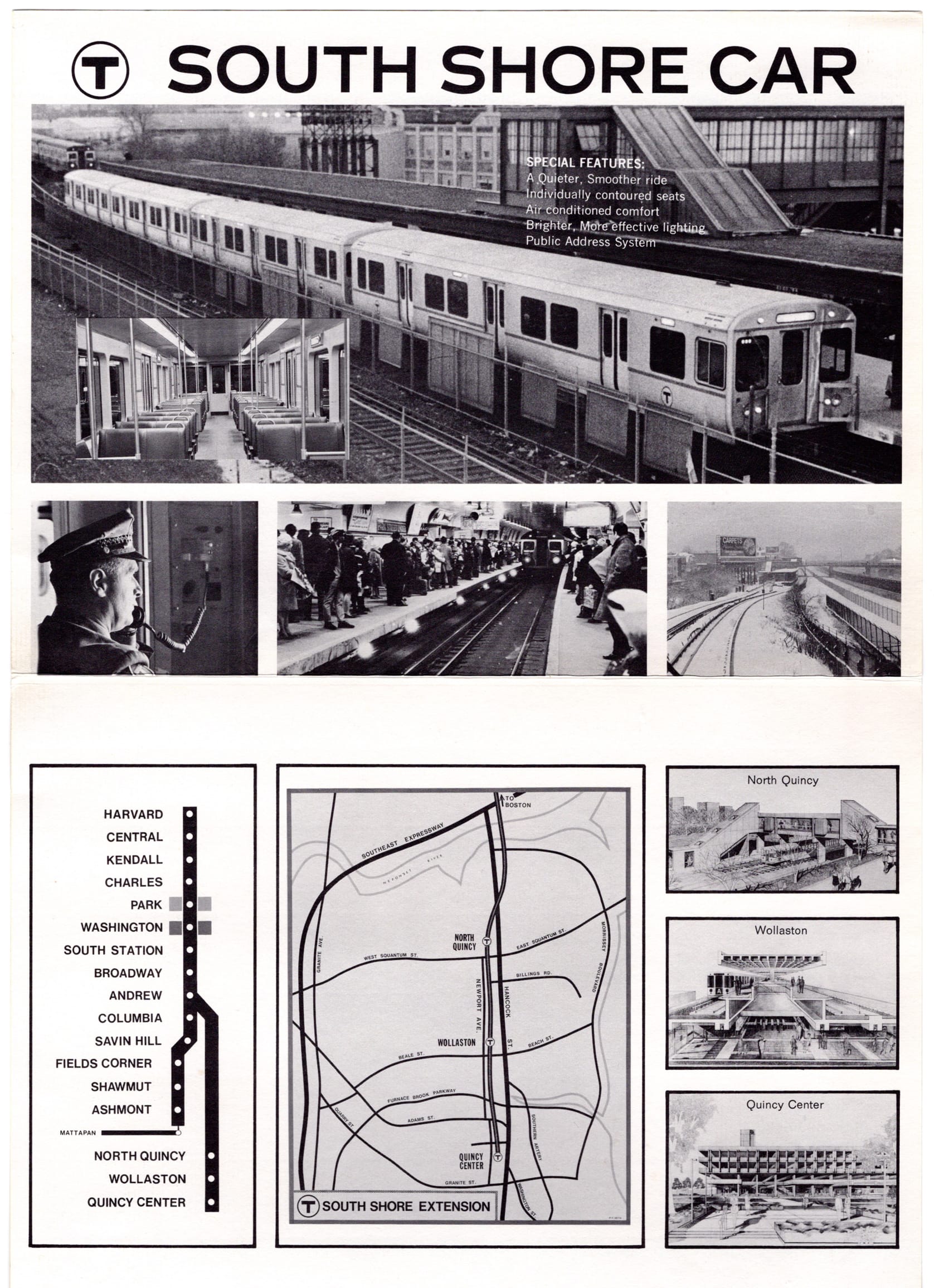
A young MBTA tapped unprecedented federal mass transit funding. As it applied the money to projects like new Red Line cars, 5.2B the Haymarket North Extension of the Orange Line, 5.2D or the Northwest Extension of the Red Line, 5.2E the T produced a myriad of publications to keep the public updated and engaged.
5.2B
Transit: South Shore Car
Boston Redevelopment Authority; Massachusetts Bay Transportation Authority
1973
WardMaps LLC
5.2D
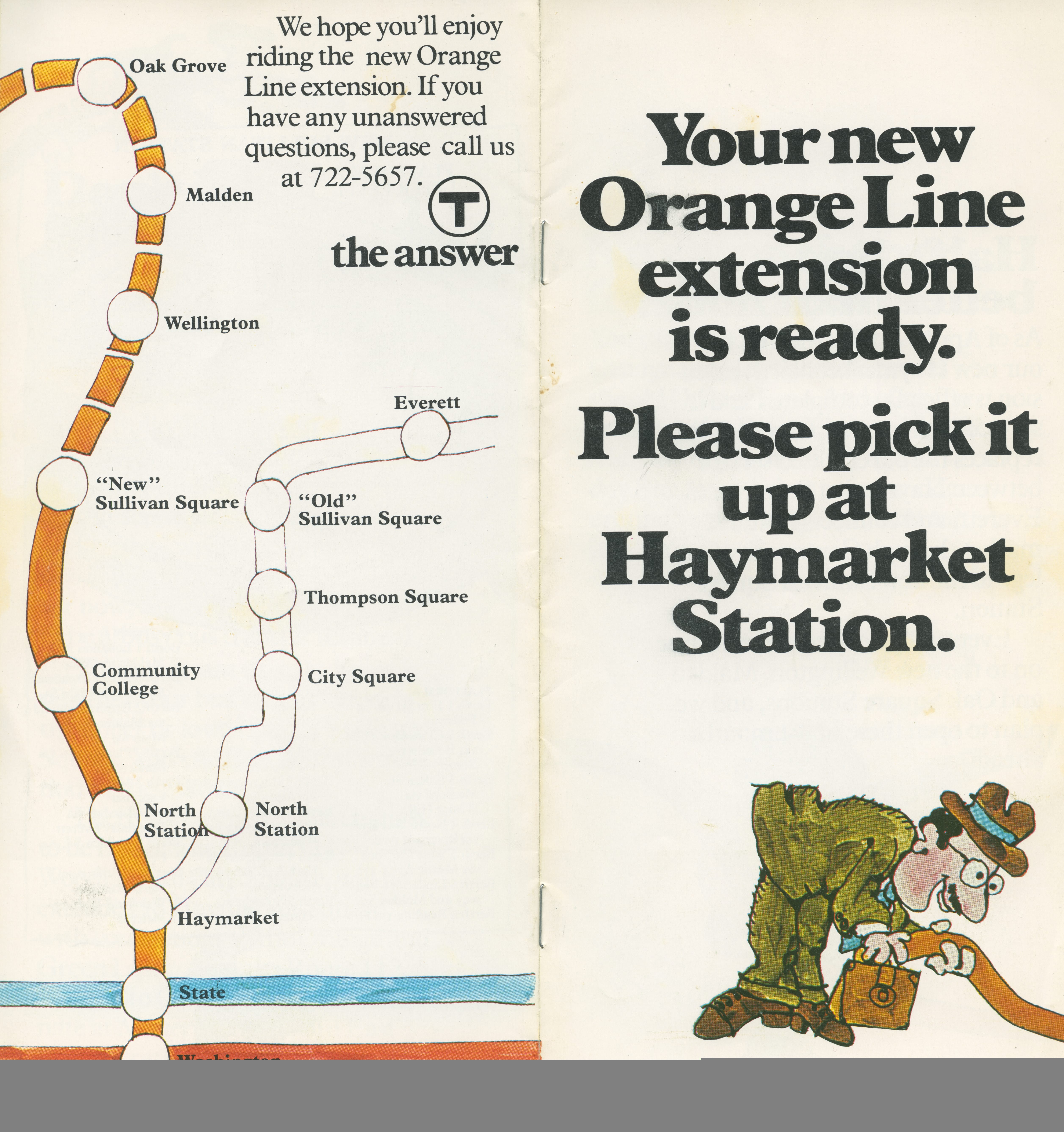
Your New Orange Line Extension Is Ready
Massachusetts Bay Transportation Authority
1975
WardMaps LLC
5.2E
“Proposed Stations of the Northwest Extension” from “Red Line News,” no. 1
Massachusetts Bay Transportation Authority
1976
WardMaps LLC
Markings on a brochure map 5.2A indicate station modernizations complete at Arlington, Bowdoin, Government Center, Aquarium, and Airport Stations; modernizations were still underway at eleven other stations. Dashed lines on the map indicate the then under construction Haymarket Extension of the Orange Line and South Shore Extension of the Red Line.
5.1A
Cover of “First Annual Report”
Massachusetts Bay Transportation Authority
1965
WardMaps LLC
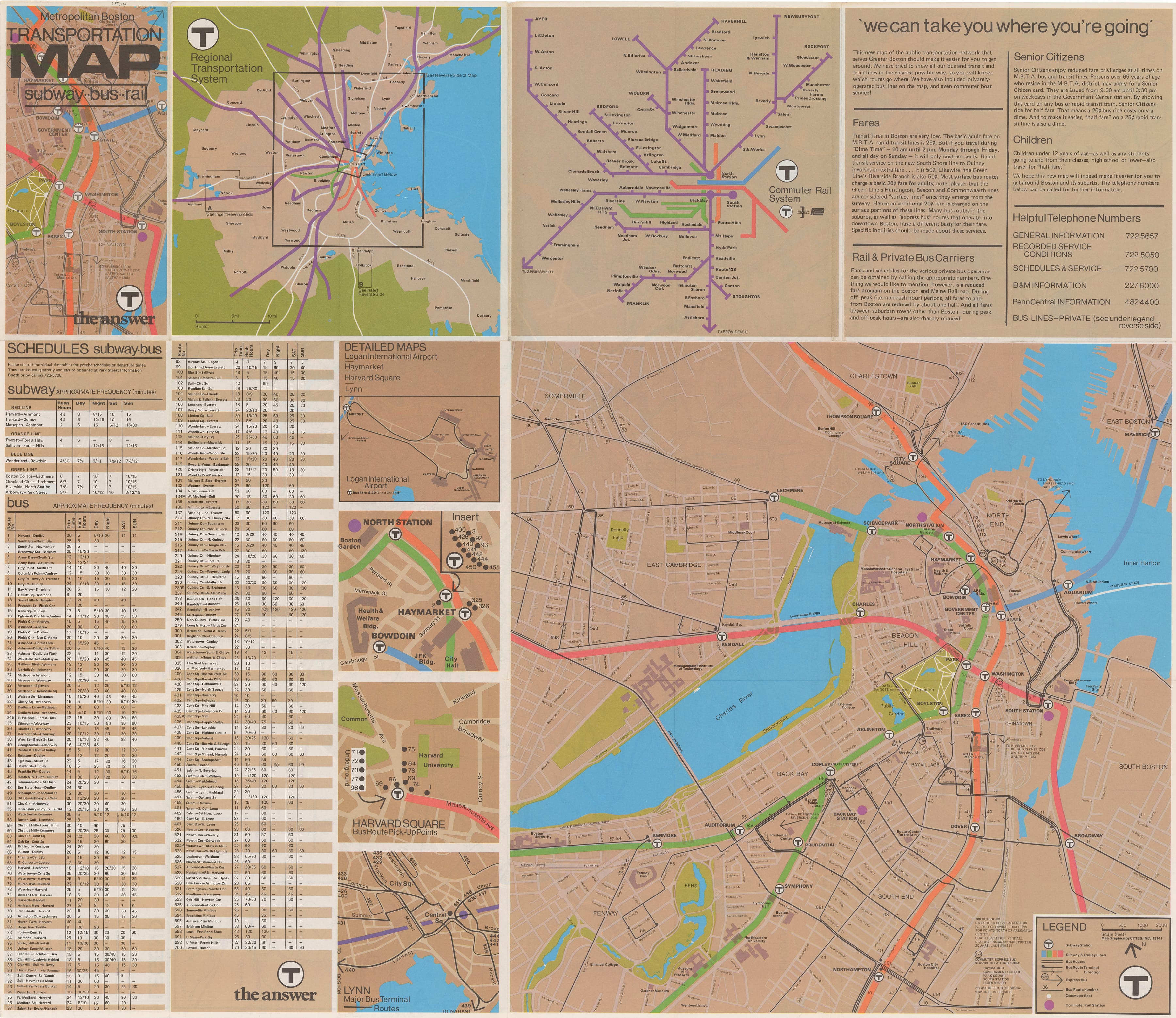
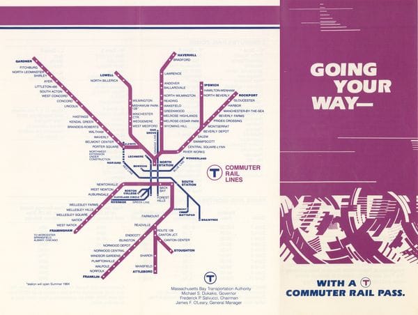
The 1974 MBTA folding system map 5.2C included commuter rail lines in purple for the first time. The cover of the map displayed the T’s logo with the assertive subtext “The Answer,” an appeal to the public’s concerns about fuel prices and congestion. A 1983 version of the commuter rail map 5.2F predates the MBTA’s reopening of commuter rail service to Newburyport, Worcester, Rhode Island, and on the Old Colony Lines to the South Shore.
5.2C
Metropolitan Boston Transportation Map: Subway-Bus-Rail
Cities, Inc.; Massachusetts Bay Transportation Authority
1974
WardMaps LLC
5.2F
Going Your Way With a T Commuter Rail Pass
Massachusetts Bay Transportation Authority
1983
WardMaps LLC
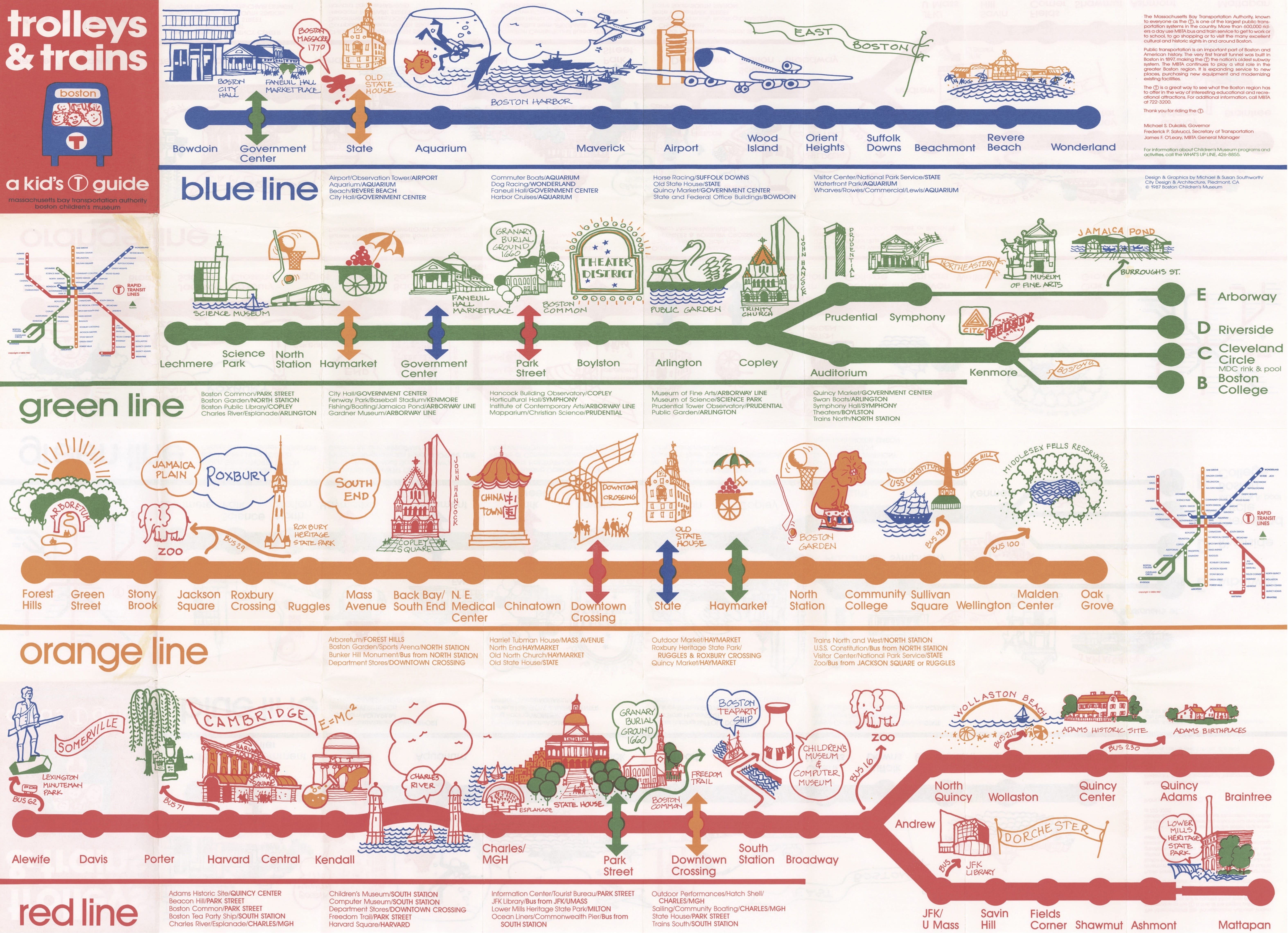
Children and students are also important users of public transit systems. The 1987 folding “trolleys & trains” map 5.2G presents the colored rapid transit and light rail lines in a condensed format. Along each line, and adjacent to nearby stations, are cartoons of landmarks and sights with a child’s eye in mind.
5.2G
Trolleys & Trains: A Kid’s T Guide
Massachusetts Bay Transportation Authority
1987
WardMaps LLC
Designing The T
Within its fist few years, the MBTA pursued a wholesale rebranding and rethinking of how to navigate public transit. Hired by the MBTA, design firm CambridgeSeven codified a redefined look and feel of public transit in Boston into a ten-part set of documents, the Manual of Guidelines and Standards.
One master sheet within the Manual 5.3A specified the installation of informative wall panels at key points within each station. Major wall panel types, each tailored to a particular station and capped by a station sign and information ribbons, included a list of outbound stations, a list of inbound stations, a map of rapid transit lines, a geographically accurate system map, and a neighborhood map.
5.3A
Manual of Guidelines and Standards
Massachusetts Bay Transportation Authority
1966
CambridgeSeven
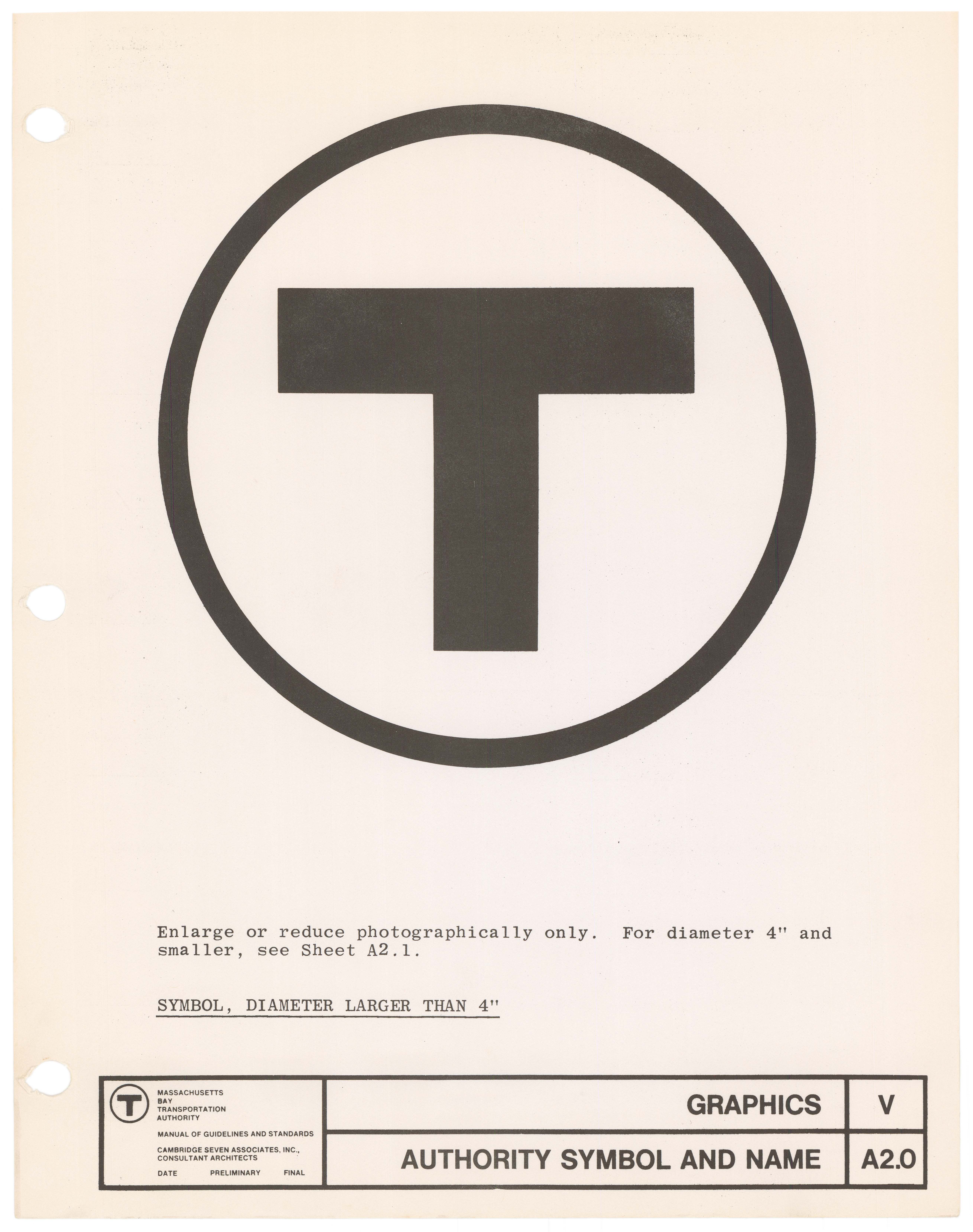
The Manual contained master sheets for each of the MBTA’s first set of official colors as well as maps to be installed within vehicles. The T’s symbol, designed by Cambridge Seven and codified in the Manual, was a black circle enclosing a truncated and capitalized Helvetica “T”. It was an identifying mark of supreme clarity with which the MBTA continues to brand itself.
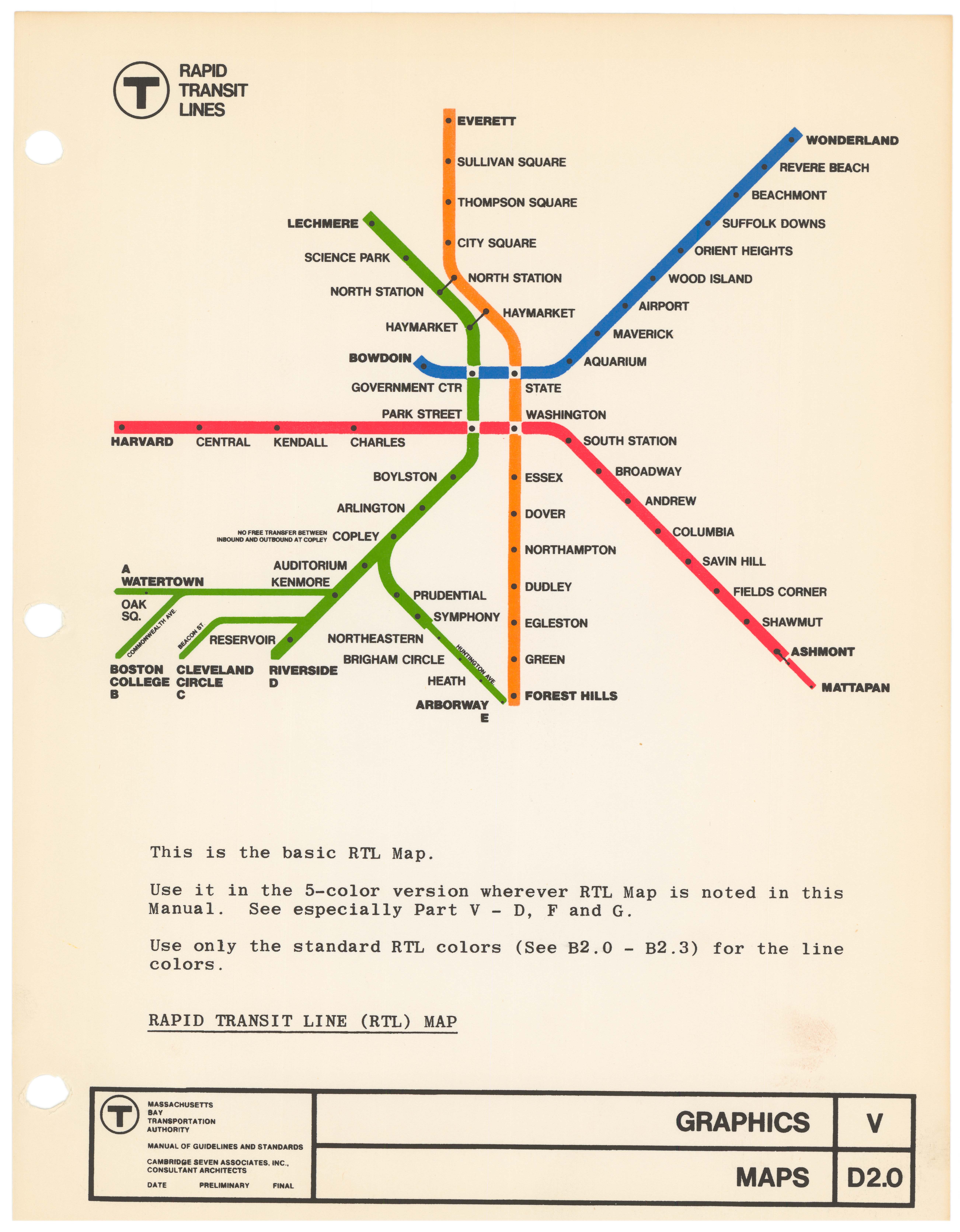
Section V of the Manual included another iconic graphic for the MBTA, a diagrammatic rapid transit line map. 5.3B With its clean lines, each drawn in one of four vibrant colors, uncluttered capitalized Helvetica text, and a stark white background, the map epitomized mid-twentieth century modernist graphic design. It quickly gained the nickname “the spider map,” as it loosely resembled a spider’s construction, with four stations in downtown Boston holding the center of a web of transit lines radiating out to invisible points of attachment. An early version was featured on the MBTA’s first wallet map shown in the flat table in the center of the gallery.
5.3B
“Rapid Transit Line (RTL) Map” from “Manual of Guidelines and Standards”
Massachusetts Bay Transportation Authority
1966
WardMaps LLC