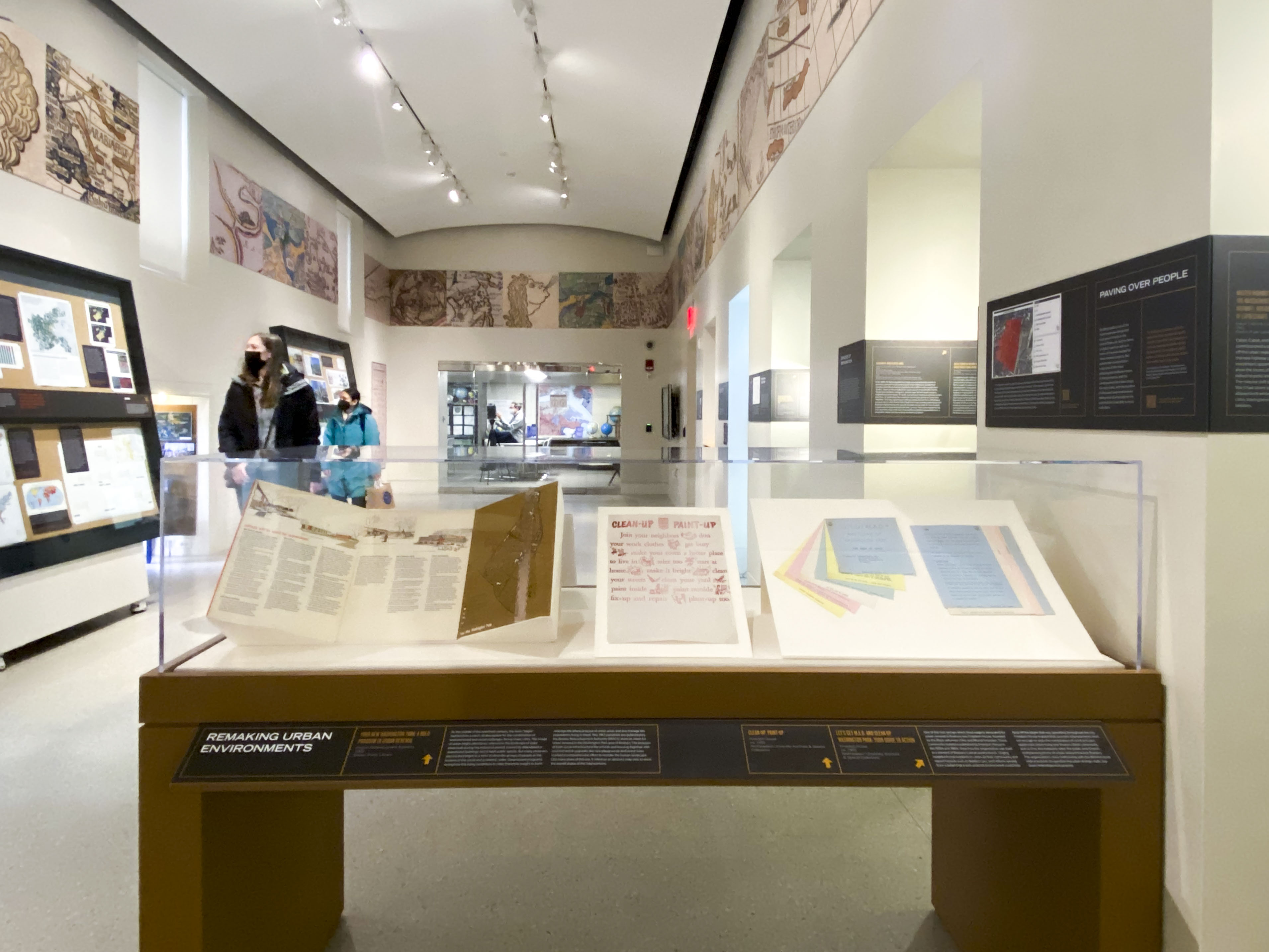
Personal Navigation Devices: 1820s-1970s
From the point of view of the traveling public, portable schedules, maps, and other navigation tools have been vital to getting around on public transportation. Centuries of analog paper tools have given way to digital devices constantly updated with the latest data. Produced across the span of 150 years, the personal navigation devices featured in this case, while only a minuscule selection of what was produced, were once relied upon as heavily as our mobile devices are today.
Navigation Evolves in the Nineteenth Century
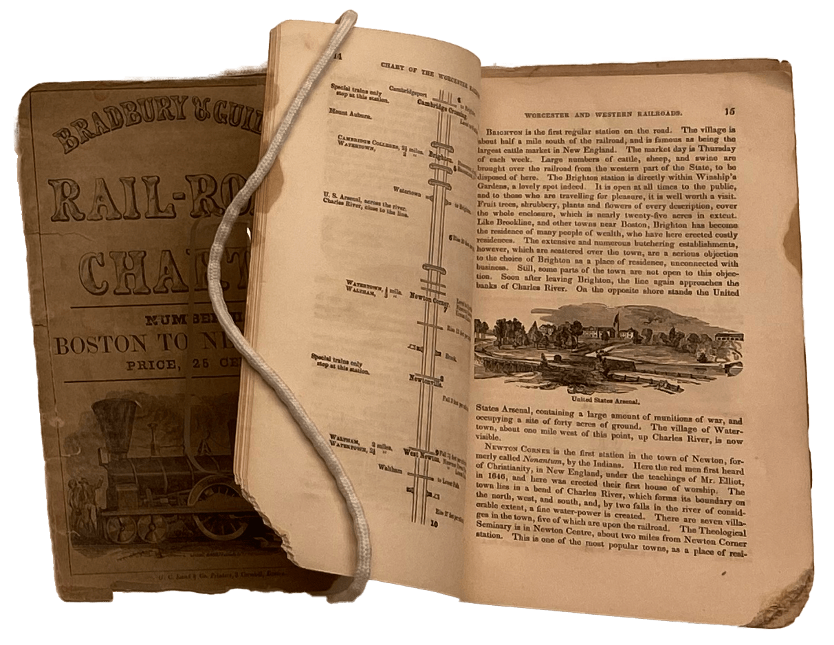
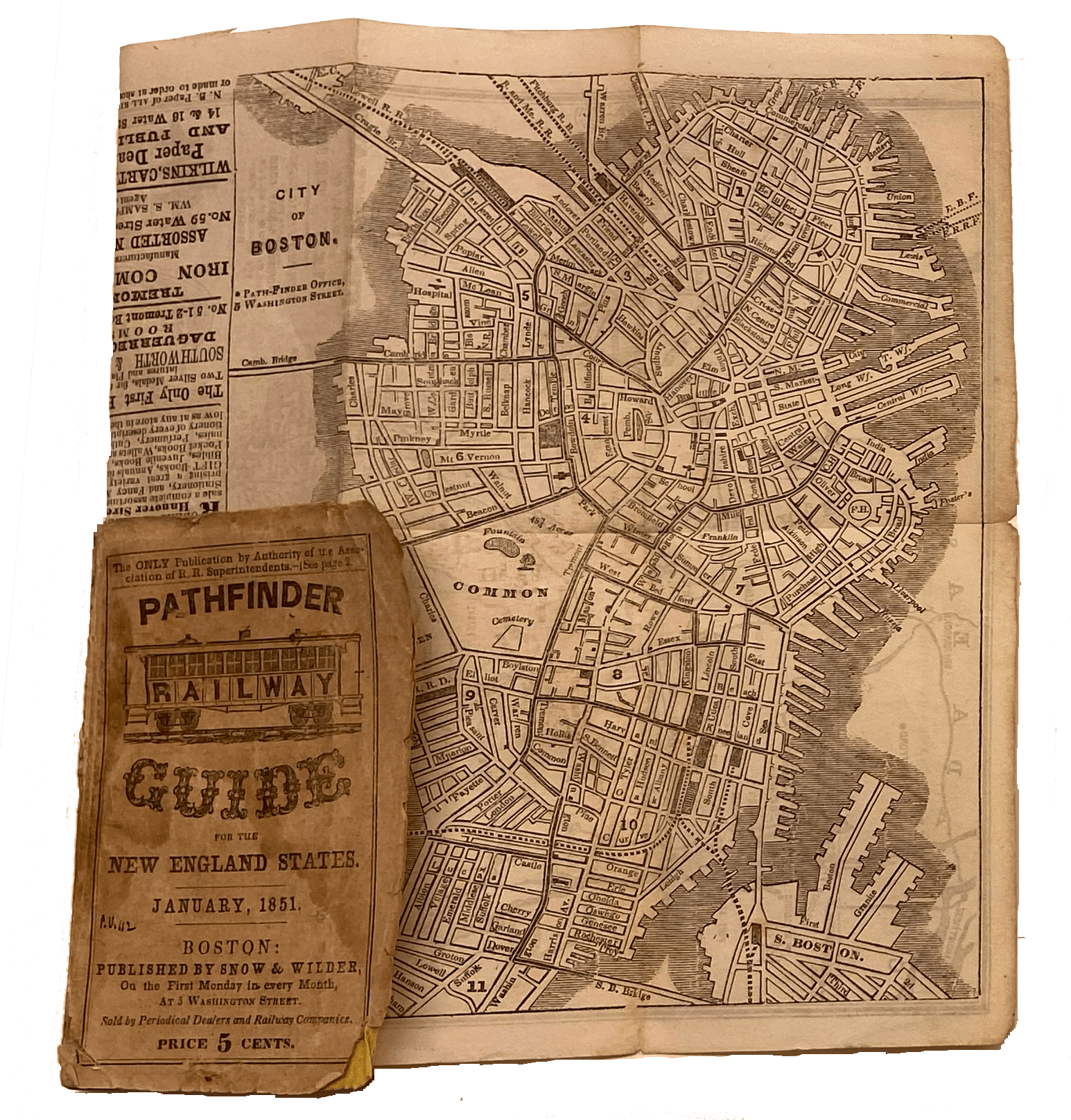
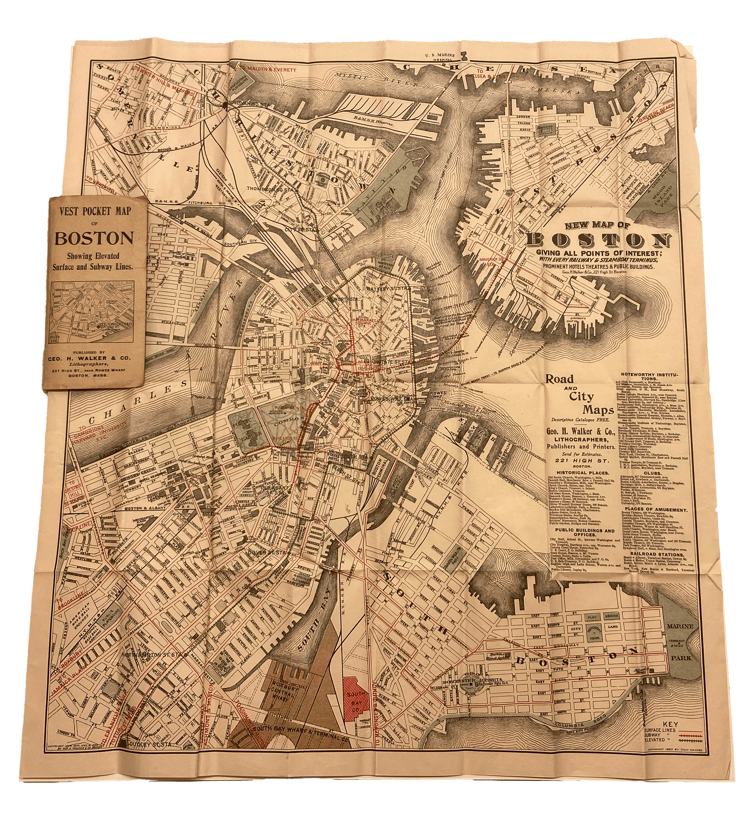
When navigating public transit in Boston in the early and mid-nineteenth century, travelers referenced, among other print publications, portable almanacs and guides featuring simple lists of stagecoach services, FT1.1 omnibus routes, FT1.2 or line maps of steam railroad services. FT1.3 FT1.4 In the later half of the century, pocket guides with detailed maps, some for whole networks FT1.5 and others for single operations FT1.8 became the norm. A supreme transit map for late nineteenth century Boston, was Walker’s Vest Pocket Map. FT-CENTER Available at newsstands and train stations, it was regularly updated and reissued as transit lines evolved.


FT1.4
Bradbury & Guild’s Rail-Road Charts: Number II. Boston to New York
Bradbury & Guild
1850
WardMaps LLC
FT1.6
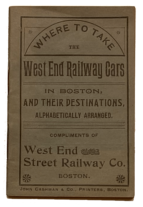
Where to Take the West End Railway Cars in Boston, and Their Destinations
West End Street Railway Company
1895
WardMaps LLC
FT1.7
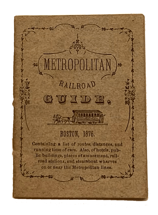
Metropolitan Railroad Guide
Metropolitan Railroad Co. (Boston, Mass.)
1876
WardMaps LLC
FT1.8
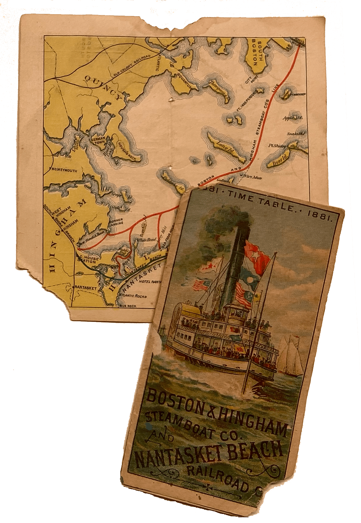
Boston & Hingham Steamboat Co. and Nantasket Beach Railroad Co. 1881 Time Table
Boston & Hingham Steamboat Co.; Nantasket Beach Railroad Co.
1881
WardMaps LLC
Portable Network Maps
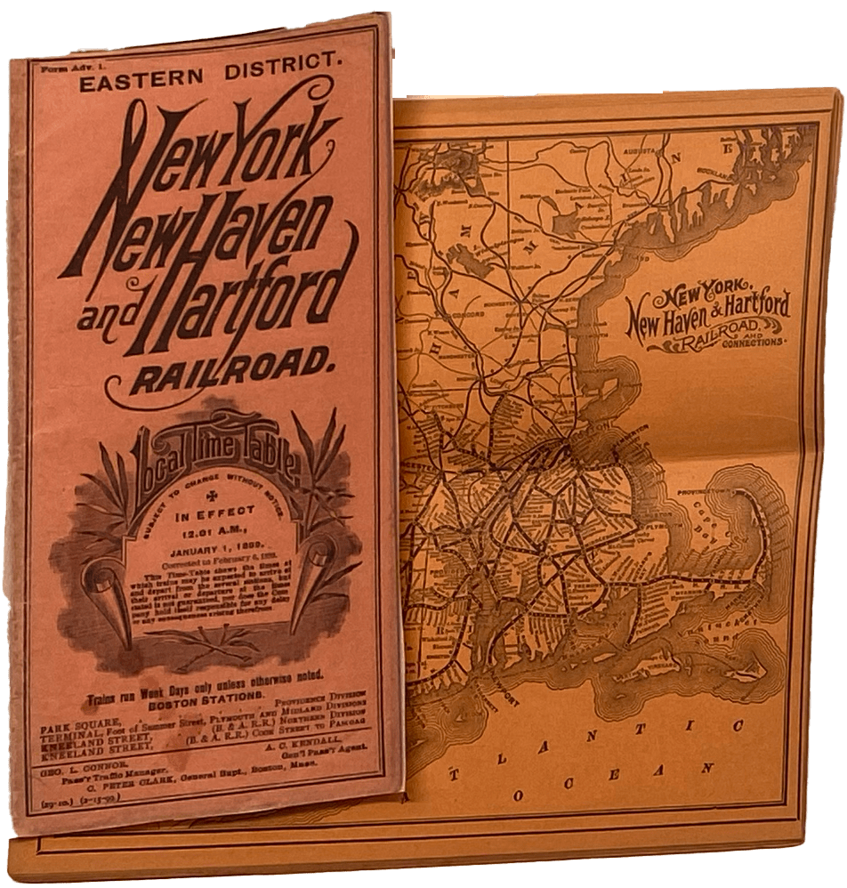
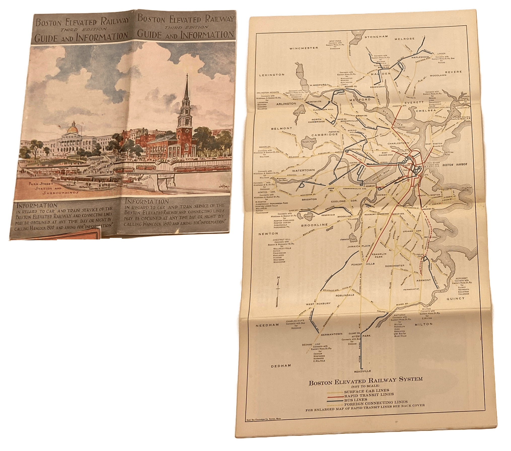
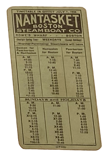
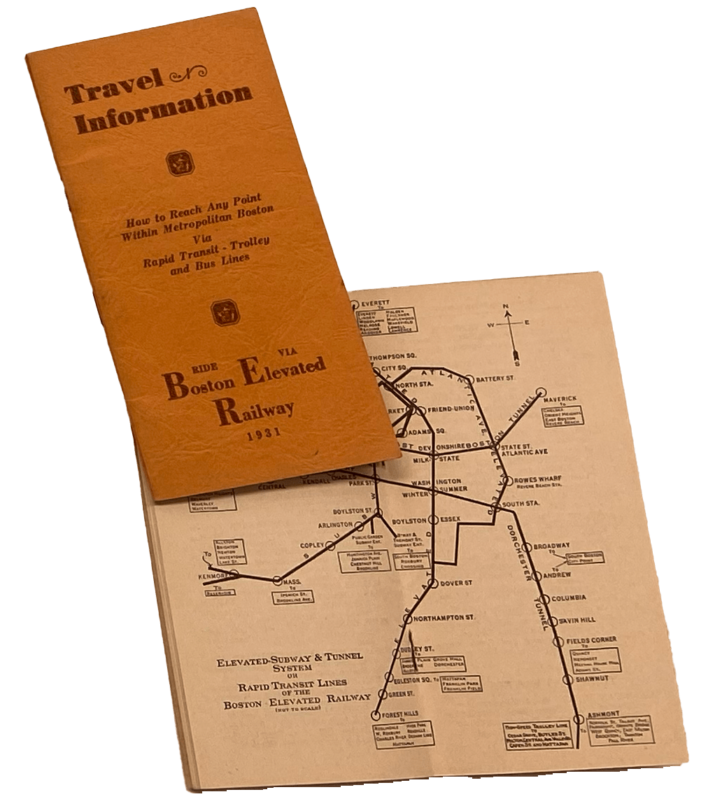
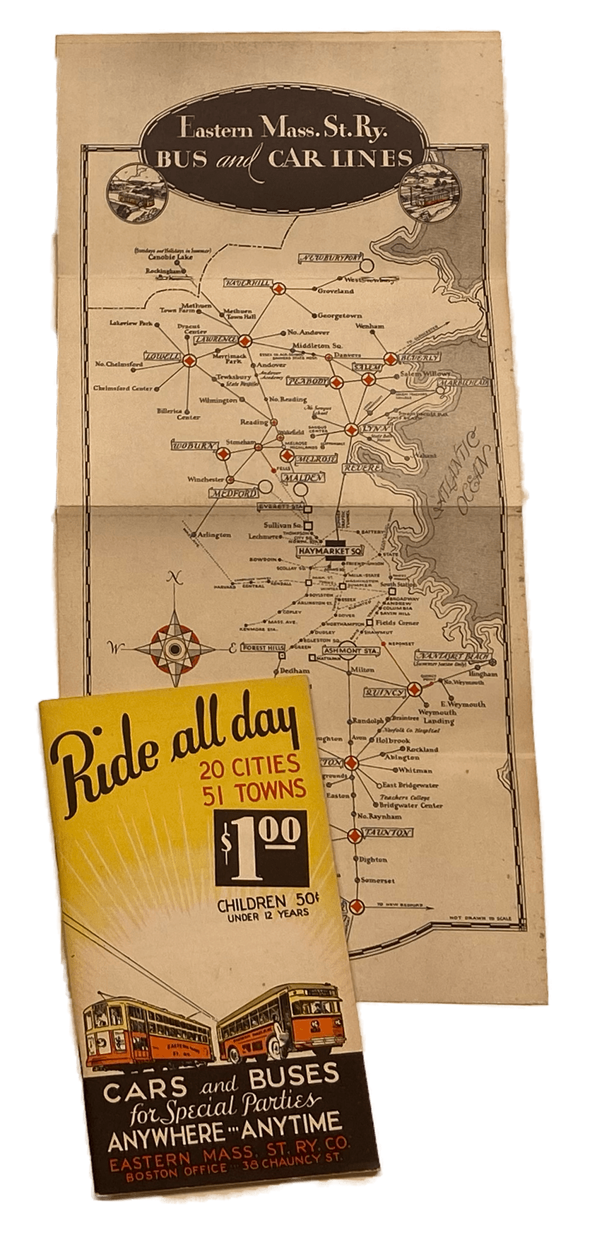
In the last decades of the nineteenth century, consolidation of the street railway and steam railroad companies contributed to a profusion of printed network maps and guides, each published by a single transit operator. The New Haven Railroad’s first timetable and map for service to South Station FT2.1 , the Boston Elevated Railway Company’s (BERy) Guide and Information map, FT2.2 the BERy’s Travel Information map, FT2.4 and the Eastern Massachusetts Street Railway Company’s Ride All Day for $1.00 map FT2.5 each reveal a large network requiring a detailed but highly edited system map.
FT2.1
Eastern District, New York, New Haven & Hartford Railroad Local Time Table
New York, New Haven, and Hartford Railroad Company
1899
WardMaps LLC
FT2.2
Boston Elevated Railway Guide and Information
Boston Elevated Railway Company
1927, 1928
WardMaps LLC
FT2.3
Nantasket Steamboat Co. Timetable in Effect July 7, 1934
Nantasket Steamboat Co.
1934
WardMaps LLC
FT2.4
Guide to the Boston Elevated Railway
Boston Elevated Railway Company
1931, 1933
WardMaps LLC
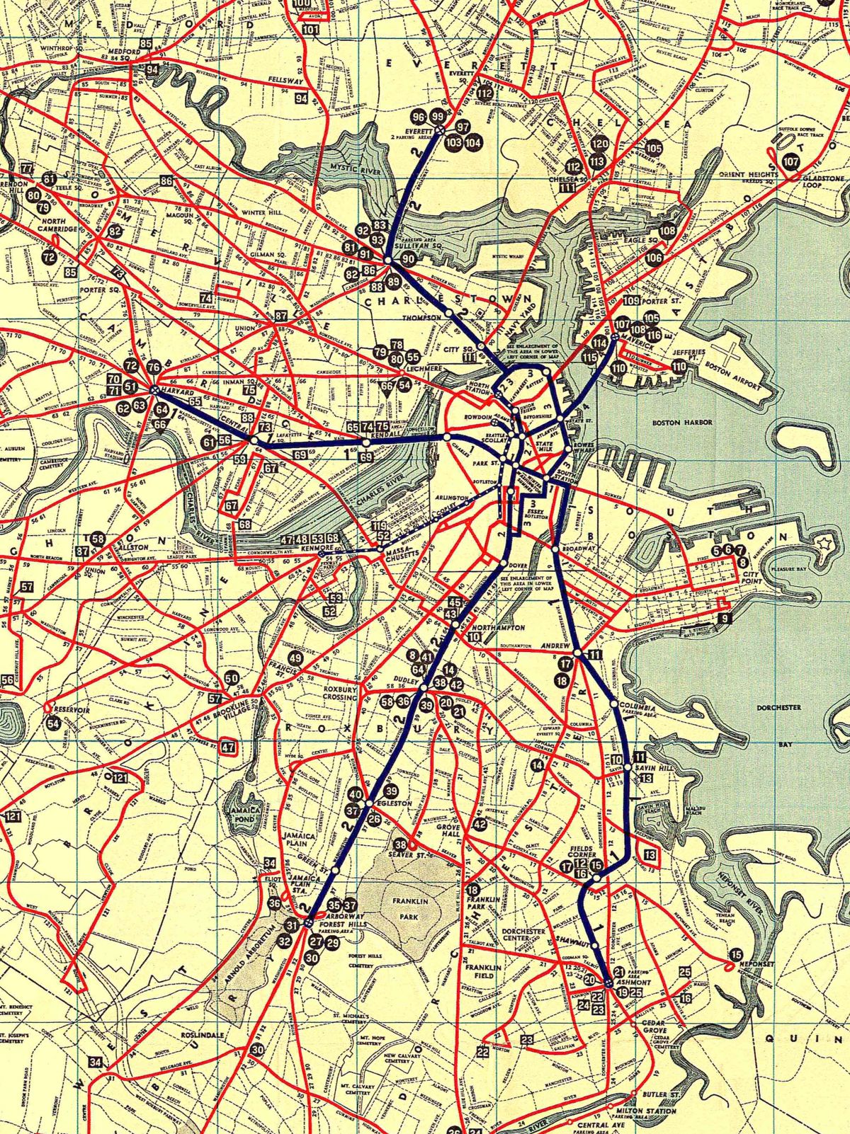
Unfolding Railed Transit, Local and Regional
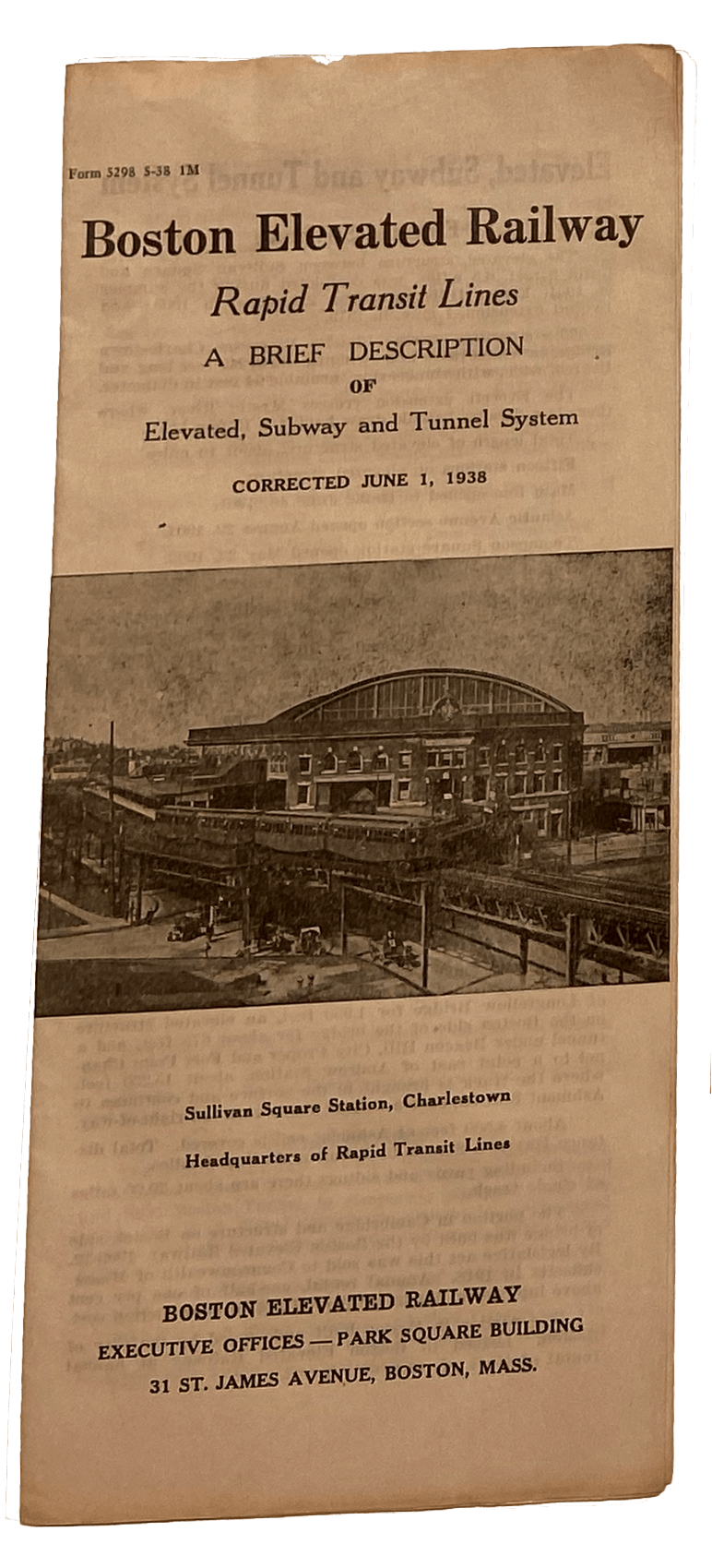
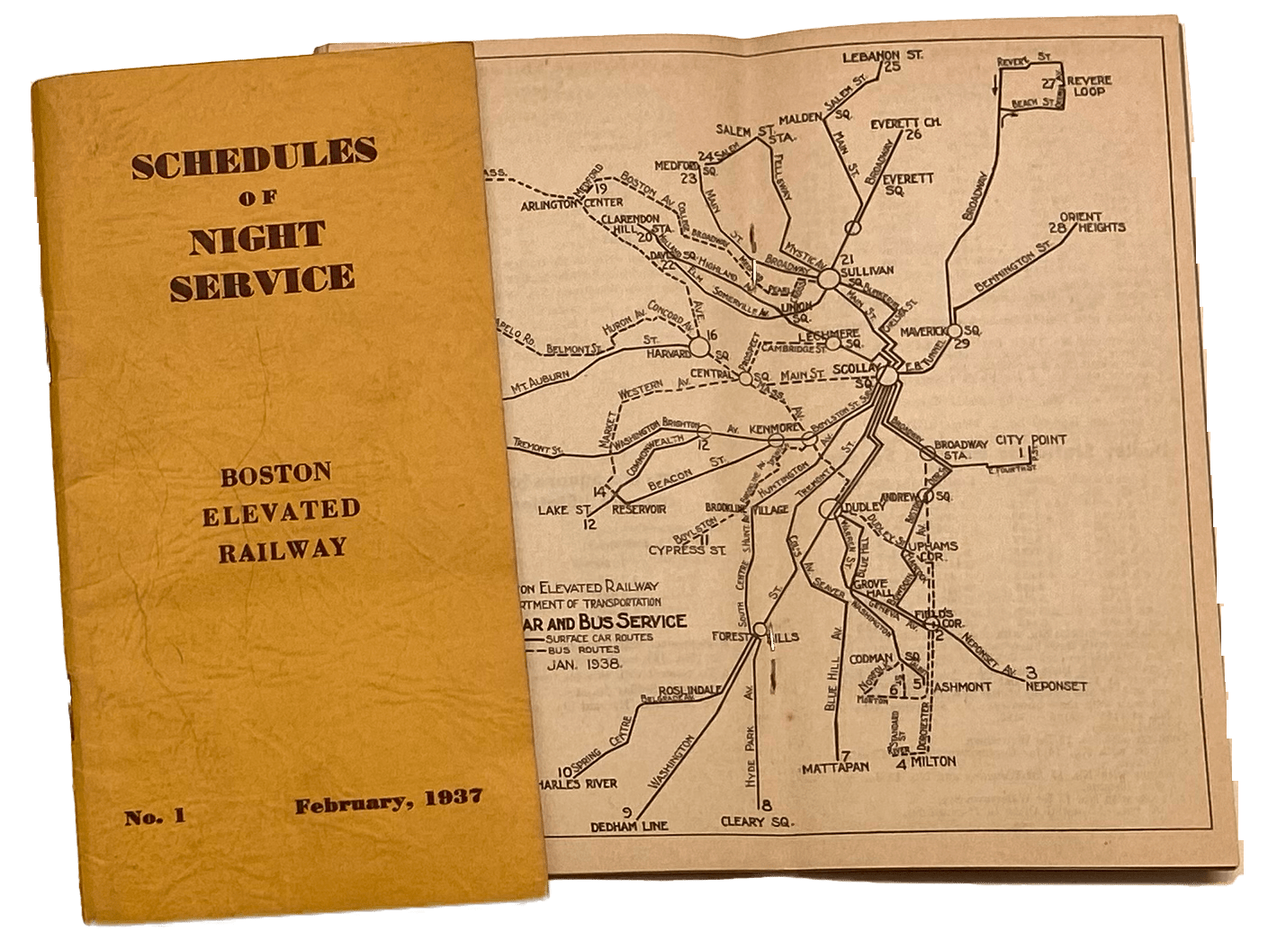
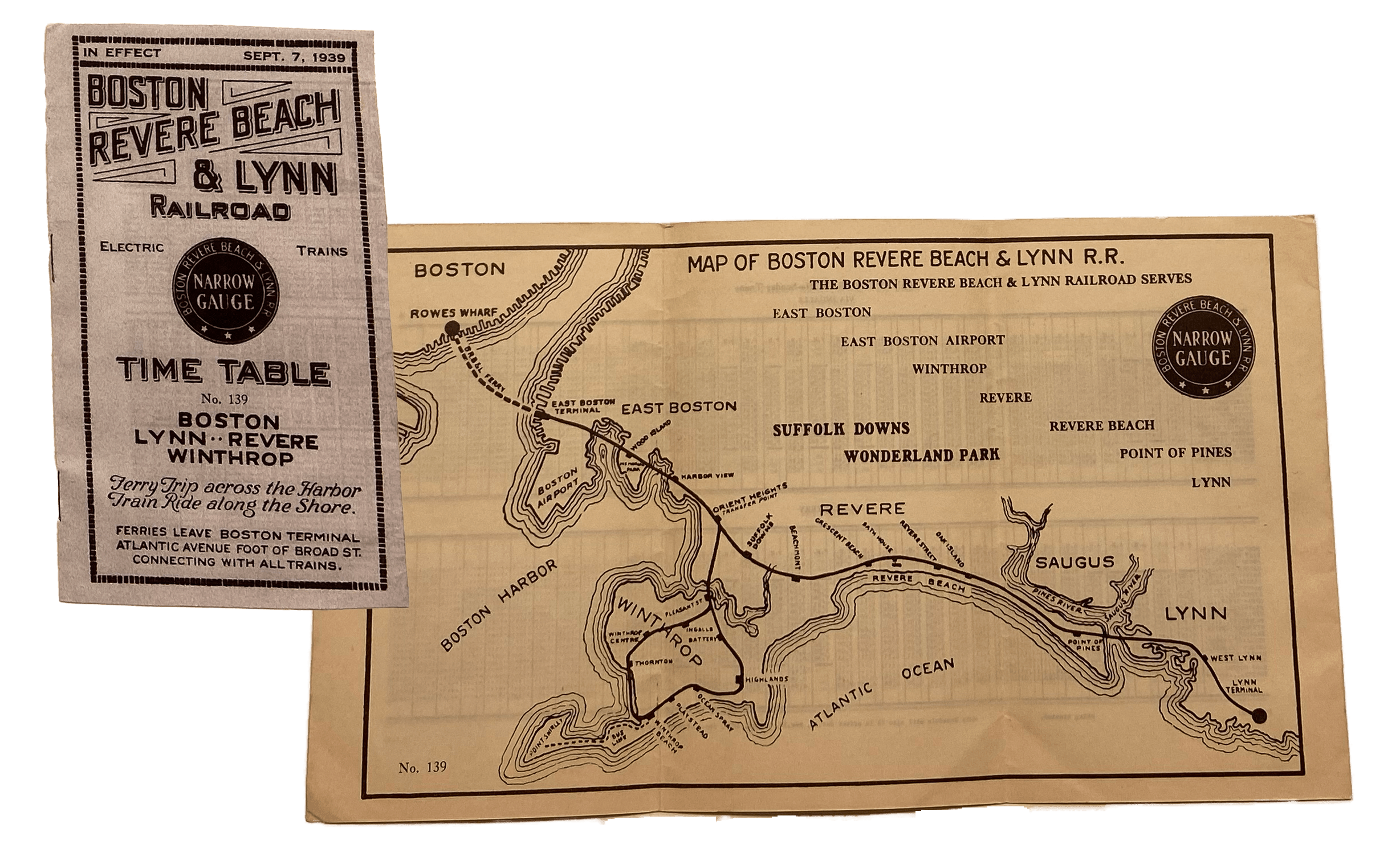
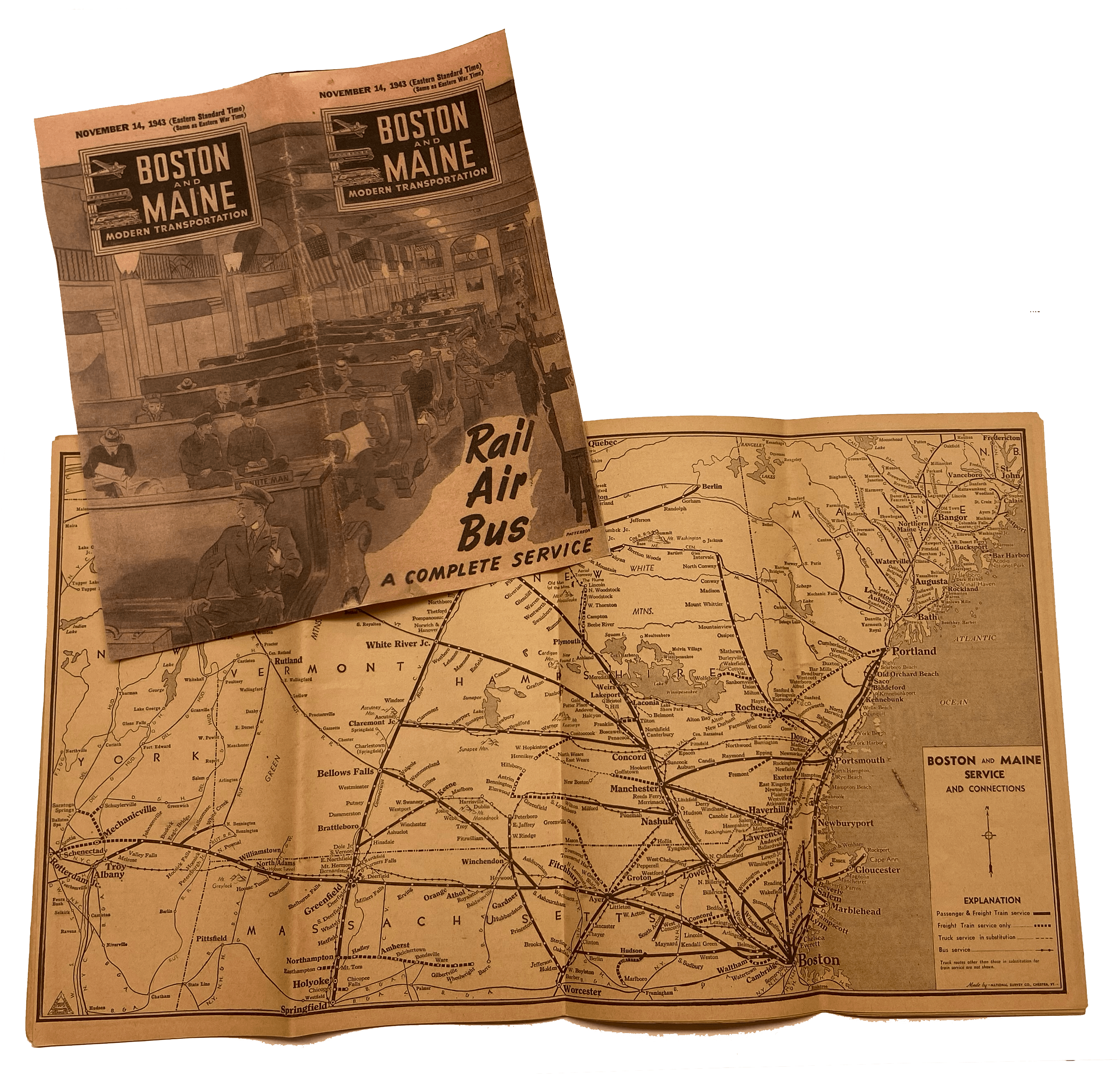
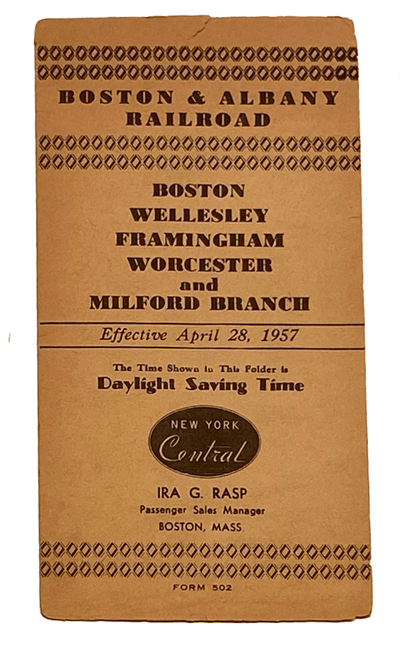
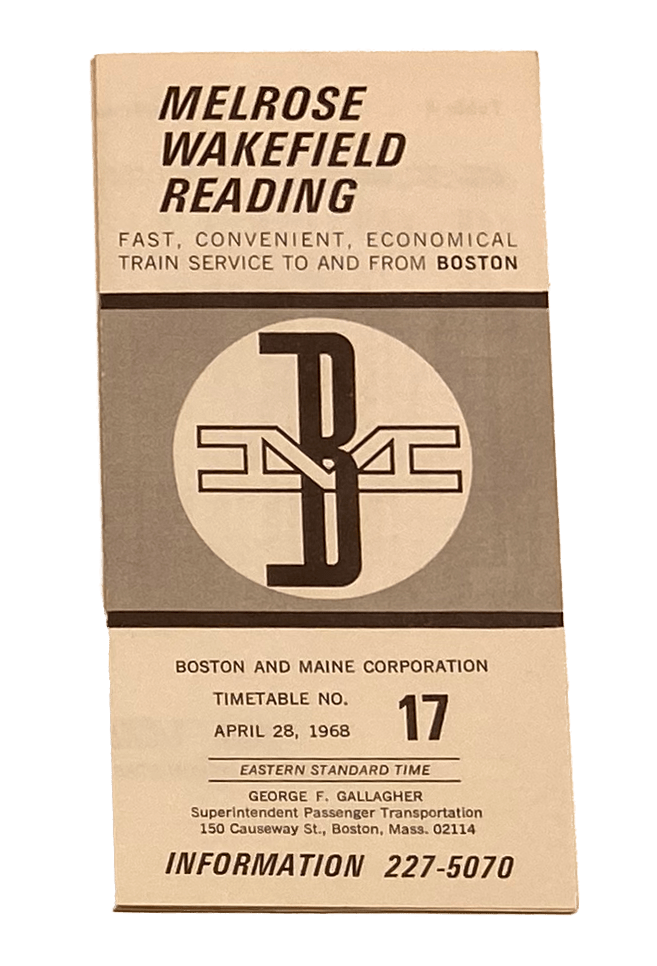
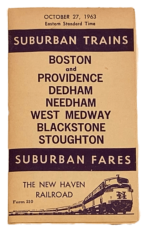
For much of the twentieth century, Boston was served by robust, complementary transit networks, each navigable using portable paper guides, schedules, and maps. The rapid transit elevated and tunnel lines of the Boston Elevated Railway Company (BERy) FT3.1 whisked riders through town in speeds faster than typically achieved today. The BERy’s night service lines FT3.2 kept people moving all night. Trains and ferries of the Boston, Revere Beach & Lynn Railroad FT3.3 transported commuters and beachgoers between Boston’s Atlantic Avenue, Revere Beach, and Lynn. Other railroads, including the Boston & Maine, FT3.4 FT3.6 Boston & Albany, FT3.5 and New Haven FT3.7 , provided both commuter and long-distance rail services from Boston.
FT3.1
Boston Elevated Railway Rapid Transit Lines: A Brief Description of Elevated, Subway and Tunnel System: Corrected June 1, 1938
Boston Elevated Railway Company
1938
WardMaps LLC
FT3.2
Boston Elevated Railway Schedules of Night Service
Boston Elevated Railway Company
1937, 1938
WardMaps LLC
FT3.3
Boston, Revere Beach & Lynn Railroad Time Table
Boston, Revere Beach & Lynn Railroad Company
1939
WardMaps LLC
FT3.4
Boston and Maine Modern Transportation: November 14, 1943
Boston and Maine Railroad
1943
WardMaps LLC
FT3.5
Boston & Albany Railroad: Boston, Wellesley, Framingham, Worcester and Milford Branch
Boston and Albany Railroad Co.
1957
WardMaps LLC
FT3.6
Boston and Maine Corporation: Melrose Wakefield Reading Timetable
Boston and Maine Corporation
1968
WardMaps LLC
FT3.7
New Haven Railroad Suburban Trains October 27, 1963
New Haven Railroad Co.
1963
WardMaps LLC
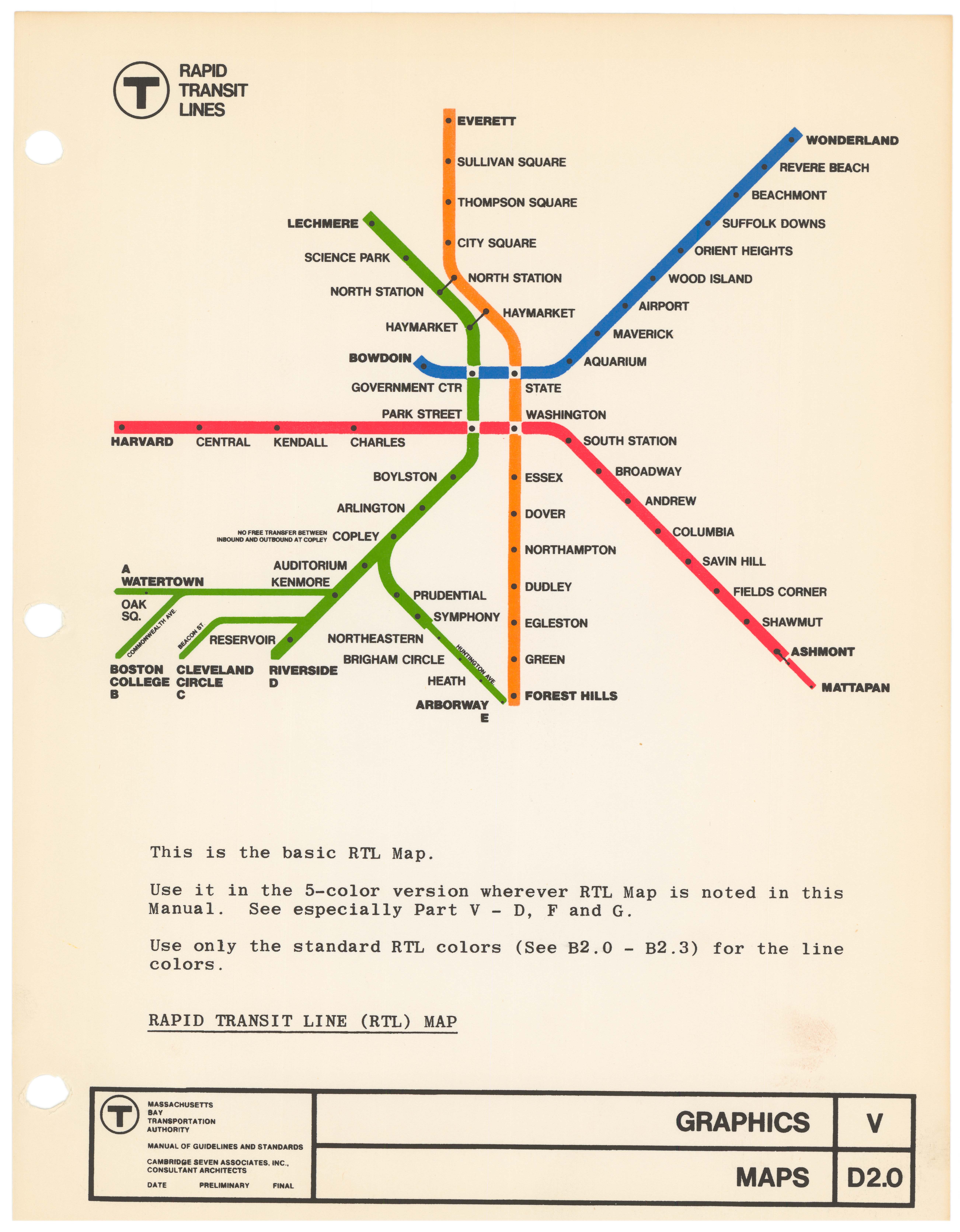
Navigating The Early Public Control Era
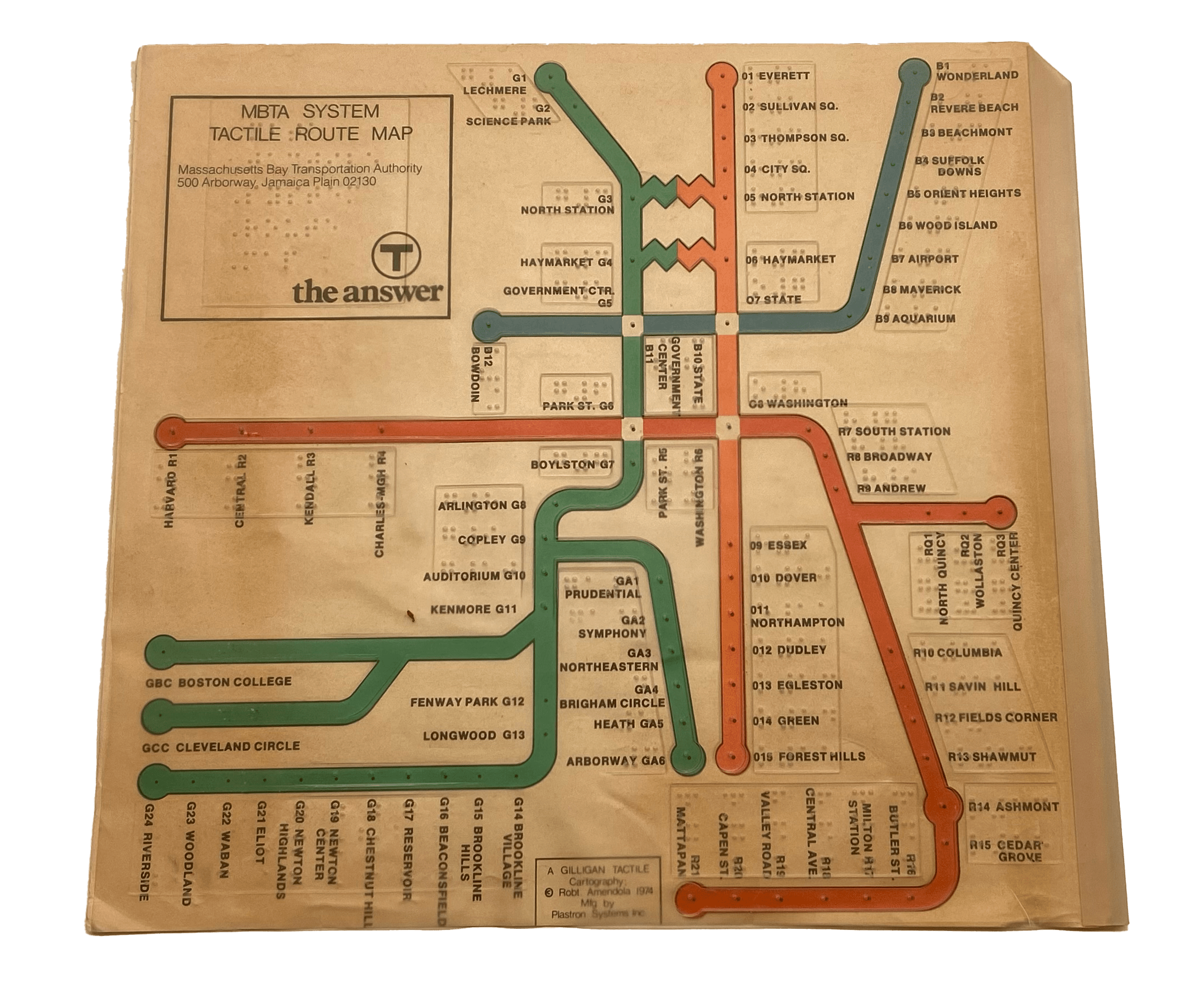
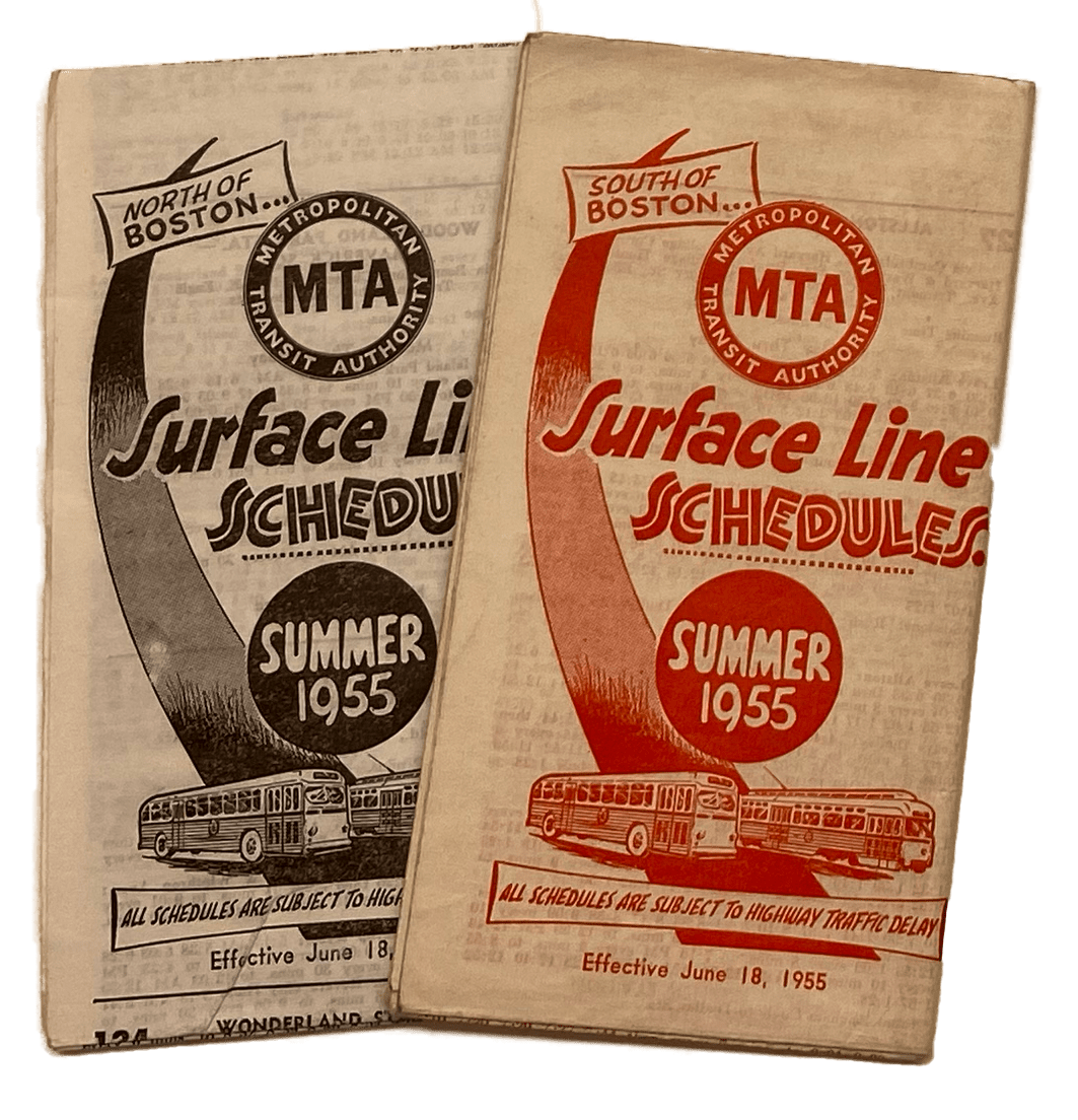
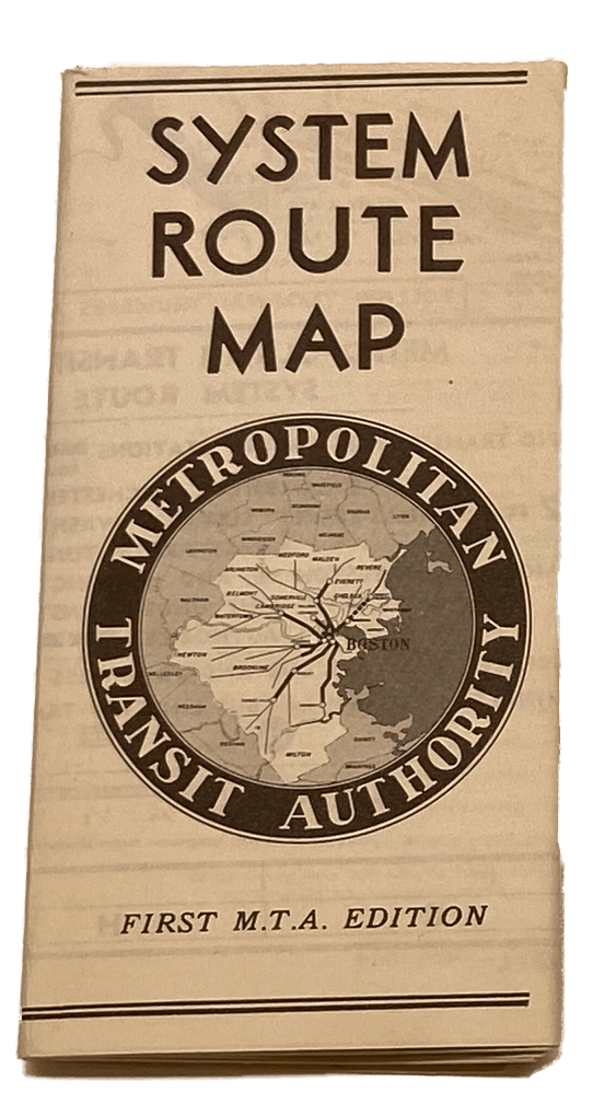
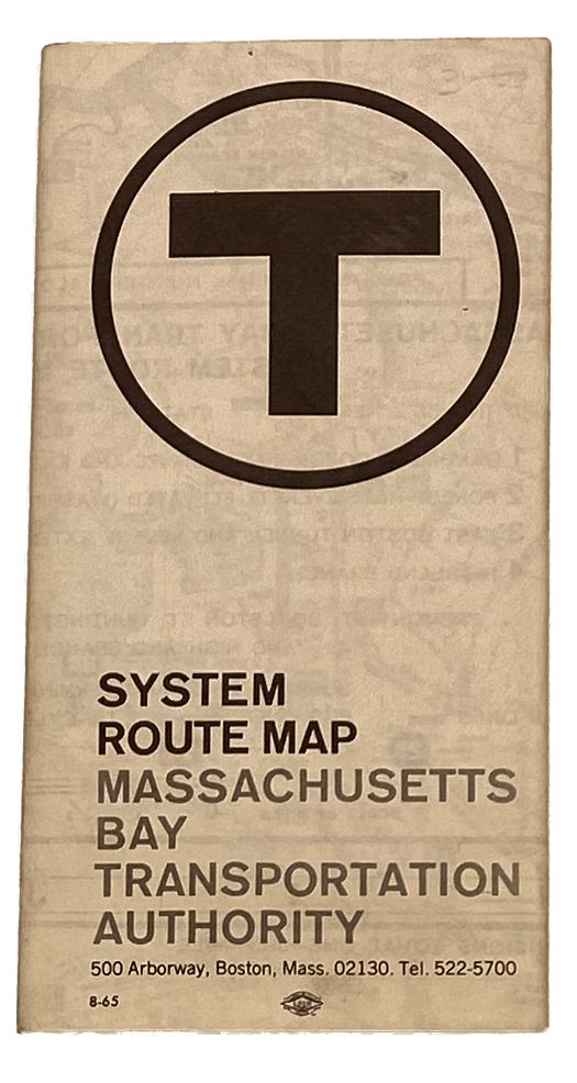
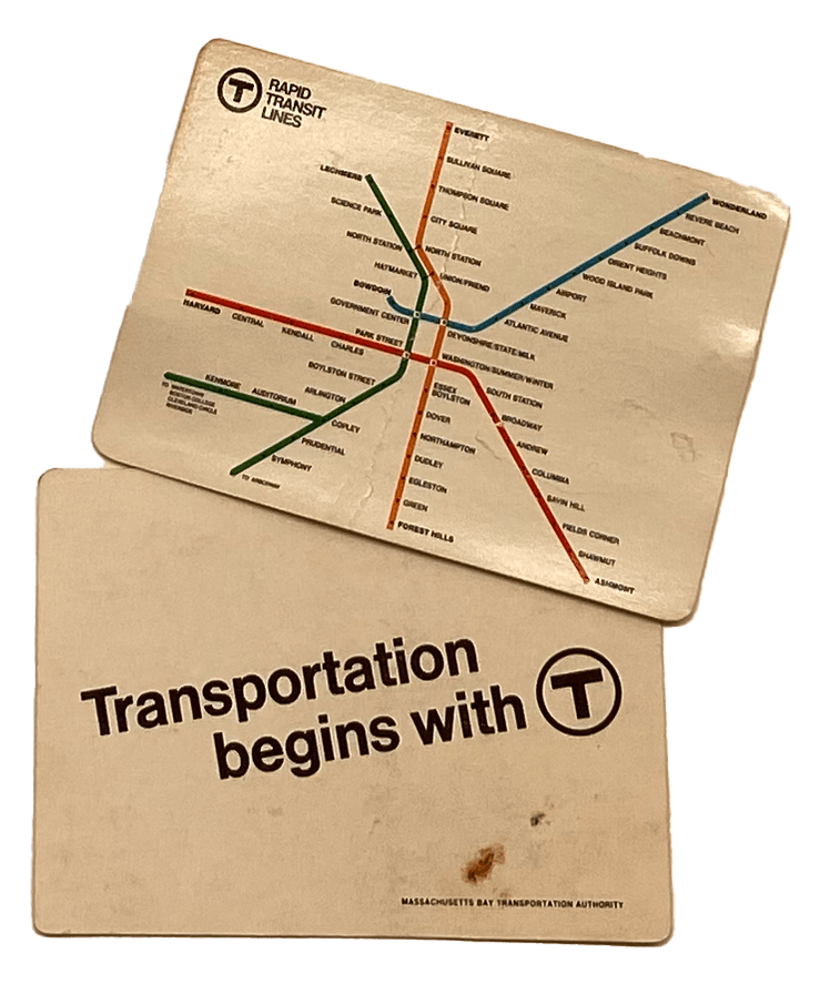
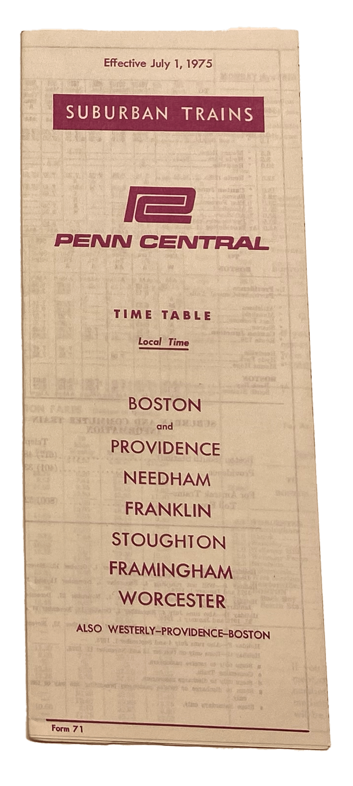
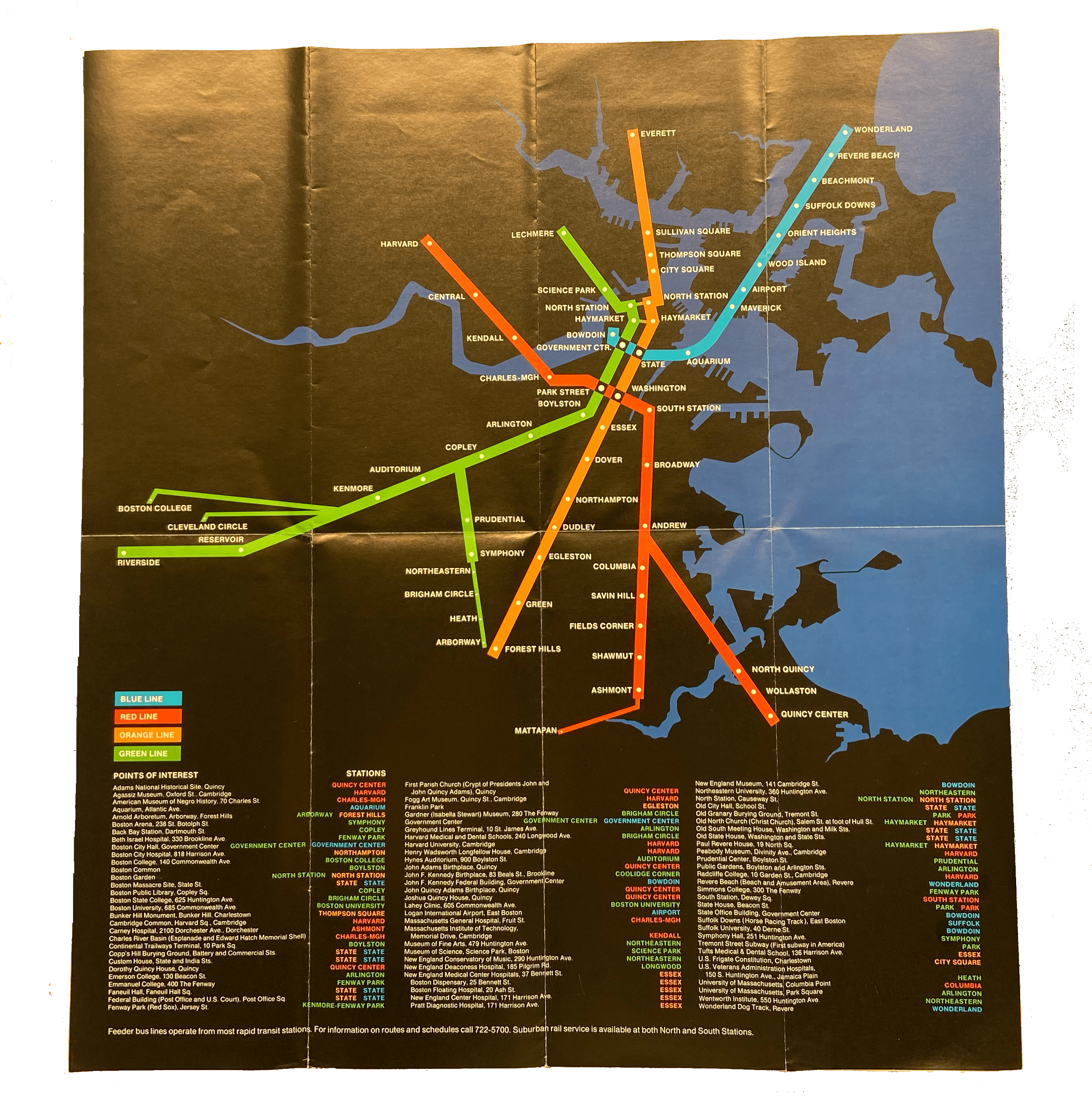
The Metropolitan Transit Authority (MTA) and its replacement, the MBTA, issued many kinds of portable paper schedules and maps. The MTA produced seasonally-issued and encyclopedic Surface Line Schedules as well as folding system route maps that later became the basis for the MBTA’s first folding maps. FT4.1-4.3 The MBTA introduced itself to Boston with wallet-sized cards sporting its new rapid transit “spider” map. FT4.4 Commuter rail services were always accompanied by paper timetables, as shown by this schedule from the period of Penn Central operation. FT4.5 Over the years, the MBTA has experimented with various map designs, including a striking 1974–76 black-background rapid transit map FT4.6 and an early attempt to make transit maps more accessible by using a tactile overlay with braille FT4.7
FT4.1
MTA Surface Line Schedules South of Boston, Summer 1955
Metropolitan Transit Authority (Boston, Mass.)
1955
WardMaps LLC
FT4.4
Transportation Begins With T
Massachusetts Bay Transportation Authority
[1954-1967]
WardMaps LLC
FT4.6
T the Answer
Massachusetts Bay Transportation Authority
1974
WardMaps LLC
FT4.7
MBTA System Tactile Route Map
Gilligan Tactiles; Massachusetts Bay Transportation Authority
1974
Leventhal Map & Education Center